Articles by Geoff

Geoff is a principal developer at Visier Solutions as well as an executive member of the BC mountaineering club, and is based in Vancouver, BC

Date: August 27, 2017

Participants: Nancy Zenger, Jeff Wallace, Geoff Zenger

Difficulty: 1

Report:  Hector Ferguson Lake is certainly the most notorious of the 103 hikes, not least because its published roundtrip distance of 28km is a gross misunderestimation by any measure and also because of its crossing of Gold Creek.  Nonetheless, as an aspiring completionist, it was finally time to head to the infamous lake.

I posted a trip on the BCMC schedule and failed to find any takers, but managed to convince Nancy and Jeff to come along with the promise that they would make a 7pm dinner in town.  This seemed overly ambitious given that we weren’t going to be able to have a very early start and I managed to dig up a trip report alleging a 13.5 hour round trip time, but nonetheless decided to take advantage of the opportunity and have a go at the lake.  To my surprise, aside from a couple km of nearly destroyed trail on either side of the Gold Creek crossing, it’s quite a pleasant trip!

I was picked up in the morning just past 7, and this meant that we were able to be parked at the East Canyon lot in Golden Ears Park and on the trail at a few minutes past 8.  We brought our bikes and aside from being a bit grunty in short sections, had no difficulty making good time up the East Canyon trail.  We passed Viewpoint beach and at about 5.75km stashed our bikes in the bush beside the trail, a couple hundred metres past where the trail ceased to be reasonable for biking.  Total biking time was a bit over an hour, perhaps around 1:10-1:15.

From where we hid the bikes in the bush, the trail is in great shape (with minor exceptions) until past the 10km marker.  However, there is a certain point around 10.5km where the trail rapidly deteriorates.  Soon after becoming bushy, the trail is just above the creek and there is some flagging leading down to it as well as flagging leading straight ahead.  We tried following the trail above the creek, but it’s terrible and quickly backtracked and went down to the creek, following it to a sandbar where the river makes a hard turn to hiker’s left.  This is the only point where the route was not obvious.  You’ll see the trail above the creek descending down to you on your right, but continue straight ahead into the bush to find flagging and a continuation of the trail to the crossing over Gold Creek.

This is where the trail is simply destroyed.  It is only a few hundred metres, but trees have fallen over left, right, and centre.  With a bit of creativity though it was possible to stay on top of many of the trees and make our way across the mess, through a few minutes of badly overgrown trail, and pop out onto the beach just 50m downstream of where you need to cross Gold Creek.  Look for the obvious flagging on the far side of the creek.  I crossed the creek on some logs about 50m downstream of the flagging, and Nancy and Jeff simply took off their shoes and waded through the slightly-above-ankle deep water to the far side.  Total time from car to Gold Creek crossing: 2 hours, 15 minutes.

From the far side of Gold Creek, the trail heads through the bush for a few minutes to the easy crossing over Hector Ferguson Creek, and continues through blow down and berry bushes as it starts its ascent towards Hector Ferguson Lake.  At first the trail is in quite bad shape, but after a short while becomes much better.  The trail is extremely well flagged, and while not too quick due to all of the branch dodging and occasional bushy section, was easy enough to follow all the way up to Hector Ferguson Lake.  Total time to lake: 4 hours, 15 minutes.

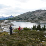
I was so happy to be there!  At last, Hector Ferguson Lake!  The lake itself isn’t anything special, just any other lake in the mountain, but it’s pleasant enough and we had a good lunch before starting our descent.

Our descent from Hector Ferguson Lake to Gold Creek was as slow as our ascent.  I attributed this to a remarkable drop in our enthusiasm, but after a refreshing foot and leg dip in Gold Creek we felt rejuvenated enough to head back down the East Canyon Trail to the parking lot.  It took us almost an hour and a half back to our bikes, but other than the initial hill climb just past the East/West Canyon trails connector bridge, the trail is entirely downhill to the cars and we made it back to our car at a quarter to 5.  Total time from lake to parking lot: 4 hours, 9 minutes.

In the end, I enjoyed the trip a lot more than I expected I would.  It’s close to town, features a lot of pleasant and varied terrain, and was a rather nice way to spend a hot day near the city.  The bikes helped a lot, and allowed us to do the round trip in less than 9 hours, moving quickly but never racing (speed at getting over small logs a big plus).  The only real problem with the trail is the amount of bush that is encroaching on it.  The good news is that it’s 99% minor bush, and if a couple parties were to do the round trip with shears in their hands, just clipping away as they travelled up and down, the trail would quickly be in pretty good shape again.  If you’re thinking of heading in, maybe bring some with you and help out your fellow hikers!

Note: For comfort, recommended to bring a GPS track of the trail with you.  The GPS track on open street map of the east canyon trail is complete and appeared to be accurate.

Tags: , ,

Date: July 28-31, 2017

Participants: Eira Zenger, Brittany Zenger, Geoff Zenger, Ed Zenger, Leslie Zenger, Peter Zenger, Nancy Zenger, Jeff Wallace

Difficulty: 1-3

Report: Ever since Brittany and I climbed the Matriach-Macabre-Grimface traverse from Wall Creek back in 2013 I had the idea in my head to book a cabin at Cathedral Lakes Lodge for the whole extended family and explore the core part of Cathedral Park.  Earlier this year, Brittany and I finally got our act together and pulled the trigger to organize a 4 day trip into the park.

We all met on the night of the 27th at a Keremeos campground so that we wouldn’t have to drive too far the next morning to meet our 10am ride from Cathedral Lakes base camp up to the lodge compound at Quiniscoe Lake, and after a poor night’s sleep due to the sun waking Eira at 4:45am, we drove down Ashnola Creek road to meet our ride in.  Lucky for us, as we were going to be staying in Tom’s cabin, which is a few minutes walk above the lodge we all got to ride in a comfortable Suburban rather than the dusty Unimog with the other campers that morning.  The ride in takes about an hour and was made enjoyable by our driver, Ernie, and by noon we had all our belongings in the cabin and sat down for lunch.

Now, this is my largely my fault for not doing research beforehand, but I had no idea how nice the cabin was going to be.  We had a 4 bedroom cabin with sheets and sleeping room for 8 people, running hot water, as well as a stove and fridge!  True luxury!

As we ate lunch the valley filled with smoke from a fire burning south of the border in the Paysayten Wilderness, and Peter developed a fever that would stay with him for the next 4 days.  However, I was motivated to make it up all the remaining scrambles in the park and convinced my dad, Nancy, and Jeff to head out with me in the smoke to climb the east ridge of Pyramid Mountain.  This is a fun and easy half-day scramble from Quiniscoe Lake.  There is no exposure on the route and we made it to the summit in roughly 2 hours from the lake.  By the time we reached the summit, the smoke had started to subside, and from the summit we rambled along the ridge to Devil’s Woodpile, and down to the col to the south of Quiniscoe Peak.  From here, Jeff and I decided to take the long way back via Quiniscoe Mountain and Red Mountain while the others descended directly to Quiniscoe Lake.  Total round trip time for Jeff and I was about 4.5 hours.

The following day, all of us except Peter headed up to Lakeview Mountain via the Centennial Trail (note: this is not the route indicated in Gunn’s book.  We used that route for the descent).  The smoke had cleared completely by morning, and although it’s very heavy to carry an 18 month old baby all day, we shared the load around and ascended through wonderful meadows on the long gentle climb to Lakeview Mountain.  All day we could see the thick smoke to our south but it never quite encroached on us or severely diminished our views.  From the summit, everyone except for Nancy, Jeff, and I decided to head back down the way we ascended, but the 3 of us descended the south ridge of Lakeview on a good trail and made a quick jaunt up to the summit of Boxcar mountain.  From here we faced a decision of whether to return to the Lakeview-Boxcar col and follow the trail from there down to Goat Lake, or whether to continue to the south and head up Denture Ridge before descending to Goat Lake.  In the end, the decision was simple to head directly down as the smoke was starting to close in, and I found myself as able to justify not going up Denture Ridge because of how close to its high point I’d been on aforementioned trip to Matriarch.  The descent to Goat Lake was quick, and we caught up to the rest of the group not far past the Goat Lake – Centennial Trail junction, at which point I resumed my baby carrying duties.

On the Sunday, Peter was feeling well enough in the morning to join us for the beginning of our hike.  The goal was to make a circle, heading to Glacier Lake, then to Stone City, Smokey the Bear, the Giant Cleft, and then down via the Ladyslipper Lake trail and back to the cabin.  Peter and Leslie only made it as far as Glacier Lake before returning to the cabin on account of illness, but the rest of us continued upwards and made the full loop as described.  Smokey the Bear was worth checking out, but I wouldn’t really recommend people go check out the Giant Cleft.  It’s a neat formation, but if you’ve spent time in the mountains you’ve seen similar features before and visiting it requires significant elevation loss from Smokey the Bear.  In all, the loop took us nearly 7 hours.

For our final day, a few of us hiked around the lakes near the cabin, and spent the midday rowing boats around Quiniscoe Lake, although both my mom and dad chose to hike the Diamond Loop trail, which apparently has the best flower meadows of any trail in the core park.  After this, we packed up and caught our scheduled ride back down to our cars.  On the way out we stopped as usual at Benji Thai in Keremeos, and then had a terribly long drive home because a logging truck had dumped logs all over highway 3 near Manning Park and we were detoured from Princeton to Merritt in order to drive the Coquihalla to get back home to the Lower Mainland.  Oh well.

In all, this was a terrific trip, and I am very grateful that my whole family was able to join our experience.  The cabin exceeded all my expectations and the staff of the lodge were friendly and very helpful.  Highly recommended for everyone!

Tags: , ,

Date: July 24, 2017

Participants: Ed Zenger, Geoff Zenger

Difficulty: 2

Report: Mt. Lindeman is the tallest peak immediately west of Chilliwack Lake, taller than Mt. Webb and Macdonald Peak, and until recently access involved either a long “class 5” bushwack up to Hanging Lake from the south end of Chilliwack Lake or a nearly 3000m day to go via Radium Lake and head up and over Macdonald Peak.  Lucky for us mortals, Harry and the Chilliwack Outdoors Club built a wonderful new trail to Mt. Lindeman last year!

The crux of the trip was finding the right place to park.  This isn’t because it’s not obvious, but rather that the directions to the trailhead that I found online and was following were simply wrong, and we wasted half an hour in the morning dinging up my car and exploring the wrong logging roads.  However, finding the trailhead is in fact easy.  Turn off the Chilliwack Lake Road at the signed turnoff for the Slesse Memorial Trail and cross the two small bridges over the Chilliwack River.  Reset your odometer as your turn off of Chilliwack Lake Road, and once over the bridges, turn left at the first junction (right heads up Nesakwatch Creek to the Slesse Memorial Trail trailhead).  The road parallels the river for close to 5km before turning right and heading up Centre Creek.  While driving up Centre Creek FSR, follow the most travelled road, staying low in the valley (i.e. to the right) and avoiding all roads turning off to the left.  Park at 10.2km from Chilliwack Lake Road, at a fork in the road.  At this point the east ridge of Rexford will be looming large above you.  The right hand fork is overgrown and not drivable, and this is the road you will be hiking up to start your hike.   The road to the left is the wrong way, and after switching back, goes up past many large waterbars to a recent clearcut.  Do not drive up this road.  Note that the road to the trailhead is in good shape, with only some minor ditches and could be reached in any 4wd vehicle, such as any little Subaru.

The first few kilometres of the route to Mt. Lindeman follow the overgrown road (the right-hand fork from the 10.2km parking) as it gently ascends beside Centre Creek until about 40 minutes later it reaches the creek coming down from the valley below Mt. Lindeman.  At this point you make a hard turn to the left, going past a metal sign reading “Mt. Lindeman trail”, and proceed to hike straight up the mountain for a few hundred metres.  This trail is well flagged and in great shape, and after easing up a bit, heads into the valley to the northwest of Mt. Lindeman, reaching some meadows.  We had started hiking just past 9:30am, and reached the meadows at around 11:10.  At the far end of the meadow the trail disappears when it reaches some large boulders, and we made the mistake of bushwacking through the boggy meadow to our left.  As we learned later, it is better to simply go through the large boulders en route to the main boulder gully that can be seen ahead.

Here we took a break and began our route up the main boulder gully (the right hand one) at around 11:30, and reached the main valley above about 40 minutes later.  From here the route is obvious to the col between the ascent valley and Upper Hanging Lake, which we reached just before 1 pm and here we sat down to eat lunch.  From this point, the goal is to make an ascending traverse across the basin to the steep grassy slopes heading up towards the summit.  We shortcutted across the snow to hit the grass and boulders on the far side of the basin, and while the slopes on the other side are steep, it is no problem to ascend them without getting into any 3rd class terrain.  The summit was reached at a bit past 2:15pm, for a total ascent time of a bit over 4.5 hours.

Mt. Lindeman might have the best views of any mountain near Vancouver.  From the summit there are clear views of Rexford, Slesse, Baker, Shuksan, Williams, Bear, Redoubt, the whole Cheam range, as well as the Pickets, Silvertip group, and usual peaks north of the Fraser Valley.

We hung out on the peak for quite a while to take it all in, and finally departed at around 3.  The descent was made very quick by glissading down snowslopes in the upper basins, followed by the excellent trail down to the valley.  The final few km down the overgrown road back to the car were sloggy and annoying, but nonetheless we made it to the car at 5:40pm, for a total descent time of a bit over 2.5 hours and a round trip time of 8 hours.  Note that we were moving pretty quick due to the late start and I would recommend allowing more than 8 hours for most parties.

I highly recommend Mt. Lindeman.  With the trail in its current shape it belongs in the list of top 10 SW BC hikes.  A must do!

Tags: , ,

Date: July 8, 2017

Participants: Brittany Zenger, Geoff Zenger

Difficulty: 2

Report: Brittany, Eira, and I arrived home a day earlier than expected from Hornby Island, and with great looking weather coming the following day, we decided to have a go at Deeks peak.  I had a failed attempt of Deeks on skis back in December and I was eager for the opportunity to deal with unfinished business.

Much like last year when heading to Mt. Hanover, we drove up the Deeks road for ~3.2km to just before the final steep rise on the road and parked here so as to not destroy the XTerra on the final stretch of road.  The road seemed to be in even worse shape than last year and it’s getting to the point where I might just give in and park by the highway the next time I head up towards Deeks Lake.

We left the car at 8:25 and started our march up towards Deeks.  About half an hour up the Deeks lake trail there is a marker on a tree pointing towards the “Bypass trail”, and this is the route we chose for our ascent.  The “bypass trail” (aka “Deeks direct”, aka “Deeks W Ridge direct”) is the most direct trail up to the summit of Deeks but is in need of some love and care.  There are a few places on the trail where we were left hunting around wondering where the next ribbon was, but for the most part it is obvious enough to follow.  The only point with real confusion was where the trail popped out onto a boulder field and it wasn’t obvious that the trail continued to directly up and to the right without ever crossing the boulders.  That said, with a bit of work, I could see this trail becoming very popular as it really is a fantastic route.

As the trail nears treeline it became increasingly steep, overgrown and buggy, but by noon we were clear from the trees, and although we lost the trail markers we headed up straight for the summit without any difficulties, and were on top by 12:45.  The air was clear and the views were great, so we stopped for a lunch and to ponder our way down, eventually deciding to descend towards the Deeks-Windsor col to find the regular trail down to Deeks Lake.

We started our descent at 1:30 and quickly discovered that the route down the east side of Deeks (towards the Deeks-Windsor) col is steep, not travelled very often, and hard to follow with occasional snow patches obscuring the footbed.  Nonetheless, we managed to follow the route all the way to the final bump above the col, where we lost it.  Unfortunately we turned off the ridge too early and instead of going up and over the final minor bump we turned to our right and worked our way down a very steep, unpleasant, and precarious bushy slope until we found the flagging from the proper trail from Deeks joining us from the left.  From here it was just a couple minutes walk to meet the main trail heading up to Windsor.  Unlike the Deeks trail, this trail was in fine condition and we were able to make our way down to Deeks Lake, where we arrived at 3:45 and stopped for our final snack of the day.

From Deeks Lake it was the familiar old slog down to the car, which we reached at 5:15 for a total round trip time of just under 9 hours.  As it stands now, I wouldn’t recommend Deeks over the other peaks in the area like Brunswick or Harvey, but with a bit of work on the bypass trail, Deeks could once again be a north shore classic.


Tags: , ,

Date: June 17, 2017

Participants: Bill, Ilze, Ove, Miranda, Joseph, Oudi, Nancy Zenger, Geoff Zenger

Difficulty: 2/3 (steep snow)

Report: A couple weeks ago I found out that my scheduled BCMC trip to Ben Lomond wouldn’t be possible due to bush overgrowth on the Wind Lake trail from Furry Creek, and I needed to quickly select another destination for my trip.  A flip-through of Gunn’s Scrambles book suggested that Macdonald Peak and Mt. Webb in the Chilliwack Valley would make for a good trip destination at this time of year with the long days.  I haven’t been out on many long hikes lately, and I wasn’t sure how well I’d do on a 2000m day, but the forecast was good enough and decided to go for it.

Most of our carpool arrived at the Chilliwack Lake day-use area just before 8am, although one of our drivers missed the turn and drove part way around the lake before heading back to the proper parking area.  This delayed us somewhat, but we were able to start hiking at around 8:30, down the beach trail towards the bridge and over the Chilliwack River.  From the river crossing, it’s about a 2.5km walk downriver to the no longer existent bridge crossing mentioned in Gunn’s book, and another 500m up to the (well-signed) start of the Radium Lake trail.

The trail up to Radium Lake is long and quite uninteresting aside from the 3 creek crossings: one on a remarkable suspension bridge that would have been a huge effort to construct, one on a flattened log, and the other on a plain old footbridge.  We hustled up the trail without any significant breaks and reached the lake at 11:30 (parking to lake: 3 hours).  Miranda’s flight the previous evening had been significantly delayed and landed at 2:30am, so she elected to sleep on the tent platform by the lake while the rest of us went up to the peaks above.

The flagging indicating the trail up to the Macdonald-Webb col was not obvious to us from the tent platform, and so for the first 10 minutes above the lake we found ourselves bushwacking up the hill before stumbling across a perfectly good trail that we should have been on all along.  We hit snow just before the trail leaves the trees, and with good snow conditions were able to quickly kick steps up to the Macdonald-Webb col where we stopped for lunch and to put on our crampons (lake to col: just under 1 hour).

From the col, we could see that our route up Macdonald would be almost entirely on snow, whereas the south ridge of Webb was 99% snow free.  Macdonald being the larger peak, we decided to head there first, and quickly made our way up to the false summit on snow.  From here, Gunn’s book suggests scrambling up the north ridge, but there was a snow face just to the right of it that appeared to go nearly to the summit, so with our ice axes and crampons we kicked steps up the steep snow slope (~40-45 degrees at steepest point) until we hit rock just below the summit block.  Here we removed our crampons and it was a quick 5 minute scramble on to the summit, which we reached at about 2:05 (col to Macdonald summit: 1 hour, 20 minutes).  We relaxed on the summit for a while, taking in the views of Rexford as the clouds permitted, before starting our way down to the col, departing at around 2:30.

The initial descent was slow as we kicked steps back down the steep snow, but soon sped up and we headed back down to the col, stopping for another bite to eat.  It was getting late by the time we were ready to start our ascent of Webb and so we left our packs in the col, and hustled up the obvious south ridge of Webb as quickly as we could.  Joseph and I made it to the summit in 21 minutes from the col, and the last of us made it up in 30 minutes.  The views were much better from the summit of Webb than they were from Macdonald, so we stopped to take photos and enjoy the day, but eventually noticed it was 4:30 and that we’d need to hustle to make it back down.  The descent off of Webb was quick and easy, and snow made the descent down to Radium lake quick as well, and we reached the lake at 5:30 for our final major rest of the day.

Like so many other hikes in BC, the final stretch of this trip was a real slog and really not fun at all.  With tired legs the descent from Radium Lake to the Chilliwack River and then the ascent back to Chilliwack Lake and the parking lot seemed to go on forever, but we eventually reached our cars at about 8:20 (lake to parking: 2 hours, 35 minutes).

We were really lucky with the weather as it was great for efficient movement: high overcast all day, never raining and never hot.  As a final note, I would not recommend that anyone ever choose to hike just to Radium Lake.  It’s not a particularly nice lake, and you can’t see much of anything above it.  If you want to go to Radium Lake, I would strongly recommend that you follow the trail up to the Macdonald-Webb col, where the great views start, or even ascent all the way up to Mt. Webb.  Thanks to everyone for coming out with me.  I got to summit two new peaks, and had a great day!

Tags: , , ,

Flora Peak

Date: Feb 25, 2017

Participants: Nancy Zenger, Jeff Wallace, Nathan, Geoff Zenger

Difficulty: 2

Report: A friend of mine skiied Flora peak in the Chilliwack valley a few years ago and said that it was a great ski trip, with easy access, nice fall line skiing, great views, and low avalanche hazard, and it’s been on my to do list ever since.  We all met at my house Saturday morning and set off down Highway 1, heading east, but with no particular destination in mind.  By the time we passed through Chilliwack, the sun in Coquitlam had given way to dense cloud, and we seemed to have settled on heading for a mellow day in the Coquihalla, perhaps skiing Zupjok and Iago when Nancy finally made the executive decision that we would try going somewhere new.  The drive BC webcam near Chilliwack Lake showed snow next to the road, and as we were still in the final outskirts of Chilliwack, we made a brief backtrack and headed down Chilliwack valley to the Post creek trailhead.

Indeed, there was snow next to the road at the Post creek trailhead, and the parking lot was also covered in snow.  However, despite being at 630m, the trees appeared to only have a bit of snow in them so we strapped our skis to our packs and at 9:30 began our hike up the Flora Lake trail.  The trail is in good shape, and we quickly ascended.  Little did we know that it would be a long hike up to find snow.  The trail ascends the southern slopes of Flora peak, reaching a camp/viewpoint at around 1200m that overlooks Chilliwack Lake.  Here we saw our first snow, and if it was a good snow year, from here you could skin directly up the mountain, but we elected to continue on foot, eventually reaching an open bench around 1600m.  This is where the winter route diverges from the summer route, with the summer route continuing ahead up the basin ahead to the col to the east of Flora Peak.  The winter route ascends the ridge above directly towards the summit.

We continued for about another 100m before finally electing to put our skis on around 1700m.  Finally!  From here the route is generally straightforward except for one point about 3/4 of the way up the ridge where the ridge steepens.  We kept on the ridge for as long as we could, and just below the rocks, skirted right onto the steep and mildly sketchy snow slope before reaching the comforting safety of the mellow slopes above.  From here it is easy to ascend directly to the summit.

We reached the summit at 1:30, and within a minute or two, so had a large cloud.  Engulfed in fog, the temperature plummeted and after a quick snack we started our descent in a thorough whiteout just before 2 o’clock.  The fog was dense enough that it was challenging to make out the skin track and we descended very slowly.  Only a minute or two down from the summit, Jeff called out from the back for us to wait up.  One of his skis had snapped!  Despite descending through the whiteout at a snails pace, apparently a gentle dip in the slope was all that it took to cause his new G3’s to snap about 8 inches ahead of the front binding.

Nancy volunteered to carry the broken ski, and Jeff soldiered on, skiing and side slipping down the mountain on just one ski.  Nate and I had a surprisingly good run down to the flat spot at the bottom of the basin, and amazingly, the others were only slightly behind us.  From here, rather than follow the trail we skiied straight down the mountain, and managed to hit the trail just a couple minutes walk from the 1200m viewpoint.  The trees on the descent to this point are quite open and in a good snow year would make for fantastic gladed skiing.  For us, they weren’t great, but had just enough snow to allow us to make it down to this point without significant difficulty.  From the viewpoint, the skis were put back on our packs and we hustled down the trail, reaching the car just before 4, for a total round trip of 7.5 hours.

In the right conditions, Flora Peak could be a great ski trip, but in present conditions it would have been more suitable for snowshoes.  Nonetheless, it was great to get out with good company and ski in an area I hadn’t visited before in winter.

Tags: , ,

Tonic Peak

Date: Jan 28, 2017

Participants: Geoff Zenger + a large BCMC party led by Bill Maurer

Difficulty: 2 (mostly easy slopes, short steep section between 21 mile creek trail and valley)

Report: Four years ago I posted a trip on the BCMC trip list for a “mid-winter two-fer”, to go up Mt. Sproatt, traverse over to Tonic Peak, and ski down the hanging valley to the Rainbow Lake trail.  Unfortunately, I was very sick the week before the trip and Bill Maurer volunteered to lead the trip in my stead.  Since then, he has organized a repeat of the same trip each year, trying a slightly different route every time, but never managing to make it to Tonic from Sproatt without running out of time.  This year, I managed to have the date free and decided to join in, and Bill decided that the route would be attempted in reverse: first ascending Tonic, then heading to Sproatt, and skiing back down to Whistler.

A couple logistical mishaps resulted in the party leaving West Van more than 30 minutes late, and so it was about 9am when we finally left the parking lot at the Whistler Cemetery and started our way up the 21-mile creek trail.  The trail towards Rainbow Lake had seen traffic since the previous snowfall, and the going was easy and quick.  Approximately 400m past the outhouses, we found some flagging to the left to the trail and started our way up towards hanging valley.

At this point we were on the left side of a gully, and we learned later from our descent that it would have been easier to ascend to the right side of this gully (but important: still to the left of the main creek flowing out of hanging valley).  Not far up this slope we encountered a cliff band and we were able to work around it to the left, but this necessitated a brief bootpack up a steep snow slope.  On top of this slope, we worked our way to the right, into broad open bottom of hanging valley.  At this point the weather started to warm up towards 0 degrees as the sun came out.  Beautiful!  This is also where we had our only real scare of the day, when we noticed that 2 members of our party had disappeared and we began to worry that they had followed some older tracks up the ridge heading directly to Mt. Sproatt.  A lengthy discussion ensued, and just as we had decided to press on and hope to be able to see them on top of Mt. Sproatt, they caught up to us as it turned out that one of them had had to stop to fasten his bindings more tightly to his skis.

The touring up hanging valley was both easy and very pleasant, and at its head we turned slightly to the left to head up towards the col between Mt. Sproatt and Tonic Peak.  In retrospect, we would have had a more direct route had we ascended through the trees at the head of the valley.  From near the col we turned right and pressed onwards to a little knob in the distance.  Many of us wondered why we were heading there rather than to the taller peak to the right, but our dear leader insisted that it was indeed Tonic Peak.  On reaching “Maurer Knob” however, the GPS was checked and sure enough we were on a minor knob and had to backtrack to begin our ascent to the real Tonic Peak, which we reached at about 1:40, for a total ascent time of 4:40.

The day was clear and beautiful, and from the summit we had great views of the Spearhead Range, Rainbow Mountain, and all of the peaks south of Callaghan Valley.  A quick glance at the time combined with some participants expressing concern about the difficulty of skiing on the descent led to an easy decision to not try to summit Sproatt as well and so we could relax a while on top.  We left the summit after 30 minutes, quickly skinned across the summit plateau, and had a fantastic run straight down into the head of hanging valley on wonderful powder.  Here we decided to stick just to skiier’s right of the main creek, and soon found ourselves at the end of the valley.  Here things got dicey for some of our less experienced skiiers, as descending to the Rainbow Lake trail was essentially a side-slipping clinic.  Nonetheless, everyone made it down to the trail without mishap.  The trail itself resembled a luge track, with many ups and downs, causing headaches for our splitboarder and our newer skiiers, but we persevered, and by 4:30 we were back at the cars.

Many thanks to Bill for organizing, and thank you to everyone else for a great day out in the mountains!  Since having a baby my days out are limited, and it’s wonderful to have days like this with great company and great skiing on those days I do manage to get out.  The route is certainly not a classic, but it is close to home, had great snow, and got us all to a summit that we hadn’t visited before!

Tags: , , , ,

2015/2016 Books Read

Well, it’s been a while since I posted about books I’ve read recently, and so I made an effort this morning to try and remember what I’ve read since my last post.  I’m sure I’ve missed a good handful of books and this is a huge list so I won’t be writing much about most of them, but here goes…

Rise To Greatness: A History of Canada from the Vikings to the Present, by Conrad Black: What a tome!  One of Conrad Black’s many book projects since his ignominious exit from the media business is this magisterial history of white people in Canada.  A history as told from the perspective of the great men who have governed and shaped Canada, it is meticulously researched, well written, filled with colourful language, and loaded with a wealth of anecdotes from his personal communications and experience.  Although it is almost comically lacking in its exclusion of the history and treatment of the First Nations, it is well worth reading.

Better, by Atul Gawande: Wonderfully named, “Better” is both about healing and making patients better as well as about the personal ambition to always improve and better oneself.  Gawande’s stories from around the world of doctors and surgeons going above and beyond to do the best for their patients are engaging and interesting and although I’m not in the same profession, I take much the same attitude towards my career as he does and love his call to arms midway through the book to take your life’s work seriously.  Although I am perfectly happy to accept being mediocre in most aspects of my life (for example, I’m a thoroughly middling soccer player), when it comes to my career I have always and continue to strive to be the best and to always go a step beyond what was previously believed to be possible.  A great quick read.

Being Mortal, by Atul Gawande: I read this book, another by Gawande just a few weeks after reading “Better”, and although I wouldn’t say it’s quite as good, it’s still an excellent read.  “Being Mortal” is an in-depth discussion of geriatric care in America, it’s often sorry state, and is a powerful call to action to improve our treatment and care of people in their last stages of life.

Gray Mountain, by John Grisham:  Grisham has been on a roll lately, and Gray Mountain continues his trend of great easy to read fiction that is as entertaining as it is powerful.  Gray Mountain takes place in the coal country of Virginia where Big Coal is turning ever greater profits at the expense of the health and lives of the workers that it leaves in its wake.  This is the kind of novel I only read on flights, but for what it is, it’s very good.

Rogue Lawyer, by John Grisham: A recent read for a short flight home from Calgary a few weeks ago, Rogue Lawyer is the weakest Grisham book I’ve read in a long time.  Essentially three short stories that tie together at the end, the characters are built up expertly, but the climax fizzles and the book ends just as its getting started.  Grisham is at his best when he’s driven by a moral calling and that is lacking here.

My Idea of Fun, by Will Self: Reading this book was not my idea of fun.  Sure, Will Self uses plenty of interesting language, but the story and ideas simply didn’t grab me at all.  Not recommended at all.

The Girl on the Train, by Paula Hawkins:  Yet another unreliable narrator novel, The Girl on the Train was recommended to me by a bookstore operator in Toronto Pearson airport.  It was enjoyable enough, but the whole way through I felt like I was just reading Gillian Flynn Lite.  Nothing bad, okay, so-so, whatever you want to call it, it’s fine but nothing special.

The Girl in the Spider’s Web, by David Lagercrantz: The three novels in Stieg Larsson’s posthumously published “Millennium” trilogy were both a global phenomenon as well as a lot of fun to read, with the first and the third particularly excellent.  A decade later, David Lagercrantz was authorized to continue the series with a work of his own and well, it’s simply not as good.  Whereas Larsson’s novels were a fun mix of intrigue, hacking, sex, and some truly dark and disturbing material, this book is simply bland.  The initial set up is good enough, but it feels like Lagercrantz doesn’t know what to do with Salander once she finally appears.  I’m sure this will be popular given its pedigree, but I’d just stick with the original trilogy.

Sharp Objects, by Gillian Flynn: I knew of Gillian Flynn already from “Gone Girl”, and in a short span of just a few weeks I read both this book as well as Dark Places on consecutive flights out of Vancouver on business.  Sharp Objects it the story of a young journalist with a history of cutting herself who returns to her hometown to investigate a series of murders.  Although Flynn’s debut work, it already showcases her trademark style, and while not fantastic, it is dark, sarcastic, and gripping right to the end.

Dark Places, by Gillian Flynn:  I read this only a few weeks after reading Sharp Objects, and although dealing with a completely different subject, stylistically it is unmistakably Flynn.  It’s a dark, twister, gripping tale touching on the hysteria over the 1980s supposed heavy metal Satanic cults that lead youth astray, wrong convictions, and unreliable memories.

Alan Turing: The Enigma, by Andrew Hodges: A gift from a few of my aunts for Christmas 2014, this is a wonderful biography.  Turing was an undeniably brilliant man who lived with a complicated yet brief life.  His contribution to the theory of computability will live on forever, and although you may have become familiar with his story through the Hollywood movie, The Imitation Game, I highly recommend reading Hodges’ book as the true story is arguably even more fascinating than the Hollywood revision.

Team of Teams: New Rules of Enagement for a Complex World, by Gen. Stanley McChrystal:  Team of teams was a pleasant surprise.  I started reading it expecting that it would be another book where the whole book was the title, but McChrystal has interesting insights about what a team is (the largest group of people that together thinks that everyone else sucks), and the importance of building an organization of teams where every member of each team has a friend (someone who they could call in the middle of the night if needed) on each other team.  This book has surprisingly relevant insights for the software industry.

The 21 Irrefutable Laws of Leadership, by John C. Maxwell:  One of the more boring business books I’ve read.  Apparently this is a classic, but I found the advice to be largely obvious.  It’s not that it’s awful, just bland.  Go read something by Robert Greene for better anecdotes, or Jo Owen for better leadership advice.

The Sixth Extinction: An Unnatural History, by Elizabeth Kolbert:  This is a fantastic pop science book that I’ve since been able to loan to a number of man-made climate change deniers and convince them to change their minds.  Kolbert walks the reader through dozens of examples of anthropocenic extinctions from recent memory that are indubitably man made.  Engaging and well written.

The Lost Elements: The Periodic Table’s Shadow Side, by Marco Fontani and Mariagrazia Costa: This book is marketed as a pop science book, but really is not at all.  The historical details that led scientists down the wrong paths to imagine elements that were not in fact elements is interesting, but this book is written more like a research paper.  It is thorough, detailed, and unfortunately dry.

The Third Reich in History and Memory, by Richard J. Evans: I love this kind of historical analysis because I think that books like this ask one of the most interesting questions.  Evans doesn’t just ask “what happened” during the Third Reich, but looks also at how historians and commentators viewed the Third Reich as it was developing, and how our thoughts about the Third Reich have evolved in the decades since it ended.  For example, at times during the 20th century, it was argued that the Third Reich was a natural outcome of the age of imperialism.   On the other hand, at times historians argued that the Third Reich subjugated the German people whereas it is now believed that the Nazis actually had the widespread popular support of the German people.  Highly recommended.

The Gap: The Science of What Separates us from Other Animals, by Thomas Suddendorf: From the dust jacket I had high hopes for this book.  What I got though was a fairly basic history of primate evolution and summary of research showing what other primates are capable of as compared to humans.  The book is well researched and well founded, but there are better alternatives out there.

The Improbability Principle: Why Coincidences, Miracles, and Rare Events Happen Every Day, by David J. Hand: I dunno, but perhaps I’m just the wrong audience for this book.  I have an undergraduate degree in Math and Computing Science, a research based graduate degree in Computing Science, and work in the field of analytics (which requires statistical thinking).  I found this short book to be extremely obvious, but perhaps for an audience with a less mathematical background it would be useful to read.

Predictably Irrational, by Dan Ariely: A birthday gift from an employee of mine (a message, perhaps?), Ariely walks readers through the gamut of cognitive biases that affect how we interact and behave in our lives.  Covering much the same ground as Daniel Kahneman in Thinking, Fast and Slow, but aimed at a more popular audience and written clearly and succinctly, this is worth reading for everyone.

The Origins of Political Order, by Francis Fukuyama: The first of two volumes by Fukuyama charting the development of political order from prehistory to the present, this book rises above its peers by taking a global view of political development.  Most political history books focus on the Anglo-American path, regarding that as the natural end of political development, but Fukuyama casts his net wider and shows that not all countries develop alike and that long ago differences in paths to political development have led to deep seated effects in the political environments of different countries today.

The Morning After, by Chantal Hebert and Jean Lapierre: This is a great idea for a book.  Hebert and Lapierre are two well regarded and well connected journalists who travelled to meet the key players from both sides of the 1995 Quebec referendum to learn about their plans for the morning after the referendum had the voters voted “yes” instead of “no”.  Some of the politicians interviewed little, but there are many great insights to be found, such as that the unified front presented by Parizeau, Bouchard, and Dumont was essentially a facade and that even between them there was little agreement on what a “yes” vote would have meant.

The Rise and Fall of American Growth, by Robert J. Gordon: I read this while on a recent road trip to Montana and Wyoming and was probably the perfect choice to read while exploring the declining fly over country that is America’s interior.  Gordon’s thesis is twofold: first, that America’s growth and rise in living standards was far greater in the centry following 1876 than is evident in official GDP statistics, and second, that the remarkable growth seen during that period is unlikely to ever be replicated.  Economic inequality and climate change are the two principal social issues that we have to face in the coming decades, and Gordon makes a compelling argument that we have to seek solutions to our problems outside of a belief that a magic formula would bring great economic growth that could make our problems disappear.

SPQR, by Mary Beard: SQPR is a fantastic history of Rome’s rise to its greatest period and relevant for our world today.  Beard has an original style of presenting history, writing fluently and speaking to today’s world while narrating the past.  Her central thesis is compelling: that Rome rose to greatness by continually expanding its right of citizenship, bringing the world into its fold, rather than by shutting its borders and pushing its neighbours away.

The Emperor’s Handbook, by Marcus Aurelius: A fancy name for a new translation of Aurelius’ Meditations, this book had been on my list to read for as long as I can remember.  This is obviously not as relevant to today’s problems as a modern book on leadership or life, but it is fascinating to read the inner thoughts and contemplations of an emperor living nearly two millenniums ago.

Quiet: The Power of Introverts in a World that Can’t Stop Talking, by Susan Cain:  I’d heard a lot about this book before I picked it up, but I’d always been skeptical of it because it sounds a lot like a book where the whole point is contained in the title.  Introverts = important.  The book turned out to be more interesting than that, and I learned about some areas of research that I was previously unfamiliar such as the work described on high reactive babies.  Nonetheless, despite many interesting anecdotes, the book is longer than it needs to be to get its point across.  One thought that I couldn’t get out of my mind as I read it: are introversion and extroversion really innate character traits or can they be learned, or perhaps even be dependent on environment or situation?  I’m not so sure that the spectrum is as black and white as Cain makes it sound.

The Mindset of Success, by Jo Owen: Jo Owen’s “How to Lead” has long been one of my favourite books on leadership and it’s one that I return to every few weeks to refresh myself on another few nuggets of insight, and this appreciation for his work led me to pick up “The Mindset of Success” last summer.  I in particular have always been drawn to Owen’s view that leadership is a practice, not an innate character trait.  More focussed and simpler in scope than his other books, Owen uses the book to dive into the mindset needed to succeed in career, life, and other endeavour.  Not quite as good as his other books, but still worthwhile.

How Not To Be Wrong: The Power of Mathematical Thinking, by Jordan Ellenberg: I loved the title of this book before reading it, and after reading it I think it’s a great idea for a book.  Ellenberg does a fantastic job at explaining the value of learning mathematics and how its tools can be used to understand the world and its complexities.

Zermelo’s Axiom of Choice: Its Origins, Development, and Influence, by Gregory H. Moore:  There’s a review for this book on Amazon that calls it a “truly thrilling history” of the axiom of choice.  I really don’t know that that would ever be possible.  The Axiom of Choice is a fascinating topic of study, both because of its independence from the other axioms of ZF set theory, and because how its needed to prove many useful parts of mathematics while at the same time leading to seeming absurdities like the Banach-Tarsky paradox.  Well researched, interesting, but also very dry reading and not for a popular audience.  Note that my copy had some printing errors (misaligned pages, for example).

Fearless Symmetry, by Avner Ash and Robert Gross:  Let’s get it out of the way: this is not a book for a true layman.  Even with a thorough understanding of undergraduate mathematics and a good knowledge of some parts of graduate mathematics (not number theory, mind you), this book required effort to get through and understand.  At the same time, it was totally worth it.  Ash and Gross do a great job of building up the mathematics and especially the motivation behind the mathematics needed to understand reciprocity laws, Galois groups, and the tools that would eventually be used to prove Fermat’s Last Theorem.  Fearless Symmetry does a better job of explaining the wonder and complexity of the Galois group better than any source I’ve previously encountered.

This Changes Everything: Capitalism vs. the Climate, by Naomi Klein: This is probably Klein’s weakest work, not standing up to the greatness of her previous books.  Whereas I loved No Logo and enjoyed the Shock Doctrine, it’s not entirely clear who the intended audience is for this book.  The majority of details presented are already known by those who care, but the writing and anecdotes are too bland to appeal to those who still need to be convinced that man made climate change is the principal issue of our era.  This Changes Everything is noble, but regrettably not great.

The Clean Coder: A Code of Conduct for Professional Programmers, by Robert C. MartinEvery programmer should have to read this book, plain and simple.  While the latter half largely focusses on TDD, the first few chapters are essential.  So many developers enter the workforce unaware of what it truly means to be a professional programmer, what it means to write quality code, when to say yes, and when to say no.  Some people are put off by Uncle Bob’s opinionated nature, but I love this book and wish I could get all of my new developers to read it.

Just Enough Software Architecture: A Risk-Driven Approach, by George Fairbanks: Software architecture is an interesting term because on one hand, everyone in the industry knows what architecture refers to (“those parts of a system that are hard to change”), but at the same time, most people including many architects don’t know how one should go about defining architecture.  Fairbanks explains how to define architecture by identifying the risks affecting a piece of software being developed and using the right set of models to model what the architecture should be.  This is knowledge that every architect or senior developer should have.

Behind Closed Doors: Secrets of Great Management, by Johanna Rothman and Esther Derby:  This is an interesting book in that it’s essentially a series of dialogs of a new manager engaging in one on ones with a new team.  It’s a small book, but I’ve bought a copy for each of my managers to read because I think too many mangers jump into doing one on ones without really thinking about what their goals are and what they want to accomplish.

Management 3.0: Leader Agile Developers, Developing Agile Leaders, by Jurgen Appelo: Management 3.0 is a weird book.  It’s kind of a brain dump of all of the models and ideas that Appelo has run into in his quest to become a good Agile development manager.  It’s interesting to pass through, but not essential reading.

The Scrum Field Guide: Practical Advice for Your First Year, by Mitch Lacey: Another book on Scrum that I read while running a large software development project, this is pretty good, but I’d jump straight to Cohn’s book generally.

Implementing Lean Software Development: From Concept to Cash, by Mary and Tom Poppendieck: “Lean” software development is a bit of an odd idea because it’s a set of principles and not a process.  The reason I say that it’s odd is because I don’t know that anyone could ever disagree with the principles, such as to “eliminate waste” or “build quality in”.  Perhaps the only really controversial principal is to “defer committment”.  Nonetheless, this book is a good read, and Chapter 2, on the principles of lean software development should be required reading for any software development manager.

Succeeding Using Agile: Software Development Using Scrum, by Mike Cohn: My favourite book on Scrum.  Cohn is a great author and does a great job at explaining how to practically implement Scrum and put it to use.  I wish I could get all of my scrum masters to read this.

Computability: Turing, Godel, Church, and Beyond, edited by B. Jack Copeland, Carl J. Posy, Oron Shagrir: A great collection of papers by some great minds.  A few of the papers are perhaps overly specific, but there are many of interest to anyone with an interest in the theory of computability, such as Aaronson’s paper on whether philosophers should care about computational complexity.  Recommended.


Tags: ,

Date: Aug 25-28

Participants: Max Bitel, Craig Follett, Greg Lindstrom, Geoff Zenger

Difficulty: 4 to 5.6

Report: When my daughter was born early this year I thought that my alpine climbing career would be put on a very extended hiatus, but while my total number of days in the backcountry has been significantly decreased compared to the last few trips, I’ve still found the opportunity for some stellar trips.  This time the opportunity came in the form of Greg’s bachelor party, for which after a good number of ideas were bounced back and forth we settled on a 4 day trip to the Conrad Kain hut in the Bugaboos with the goal to bag a couple of the spires.  The weather in the interior had been cold and wet all summer, and our backup plan was to go biking in the Chilcotins, but as the dates for the trip neared it became apparent that there was likely to be a narrow weather of good weather for us to get in, climb, and get out before the next system hit.

Max and I started our drive up Wednesday night and camped on a logging road just outside of Malakwa, and the next morning had a leisurely stop in Revelstoke to eat breakfast and buy groceries.  We had planned to meet Greg and Craig at the Bugaboos parking lot at 1:30, and on the map I had at home, the Bugaboos looked like they were close to Golden so I thought we had plenty of time.  In retrospect this was a mistake as to get to the Bugaboos you have to drive 45km up a logging road that starts in Brisco, which is itself quite far from Golden.  In the end we were quite late, pulling into the Bugaboos parking lot around 2:15 and having to scramble to get chicken wire up around our truck and do a final packing job for our bags.

Note on chicken wire: There is TONS of chicken wire just waiting to be used at the Bugaboos parking lot, no need to bring your own.  If you were to arrive and there was not any chicken wire there for you to use, that would mean that there are hundreds of people ahead of you and you’re best off backtracking, climbing somewhere else and returning to the Bugaboos some other time.

We finally got going from the parking lot just past 3pm, and mosied our way up to the Conrad Kain hut.  You can see the hut from the parking lot but it actually takes a few hours to get up there.  The trail is in great shape and has lots of safety features installed so that even a confident kid would be able to make it up to the hut (and indeed there were some kids in the hut).   The ascent was uneventful except for an incident whereby at around 4:45 we had just reached the top of the ladder on the trail and a party with lighter packs passed us and asked if one of us had lost a boot.  Apparently another hiker had found Greg’s boot lying on the trail, and not knowing what to do had elected to carry it down to the parking lot and leave it there!  Lucky for Greg, Max volunteered to play the hero, dropped his bag, and headed down to catch up to the hiker carrying down Greg’s boot.  Unluckily for Max, that hiker was fast and Max only caught up to him metres from the parking lot and so essentially, he had to make the ascent to the hut twice.  The rest of us, however, were lounging about in the luxurious Kain hut by 5:45.

Note on luxury: The Kain hut has pots, pans, cutlery, cups, electric stove, electric heat, gas stove, running cold water, running hot water, and printed weather reports twice a day.  You only need to bring your own food, nothing else.

Friday morning we arose at about 4am and after a hot breakfast, set out towards Pigeon Spire just a bit before 5am.  The Bugaboo-Snowpatch (B-S) col was reported to be in poor condition and very loose (one of my dad’s friend’s girlfriends was killed in the col some years ago due to rockfall), and so rather than head through the B-S col, we ascended to Pigeon via the Bugaboo glacier.  The glacier was in fine condition, dry until the flat area below the Pigeon-Snowpatch col, and snow up above but with the main crevasses obvious and easily avoided.  It was at the flats below the Pigeon-Snowpatch col that Craig realized that he’d left his helmet in the hut.  While Max and I were climbing on our own, Craig and Greg were climbing with a guide (Paul), and given the lack of helmet, the 3 of them elected to return to the hut and climb something else while Max and I continued on to climb Pigeon.  We reached the base of the West Ridge at around 8:20am, well before the crowds arrived.  Here we stopped to eat and trade our glacier gear to get set to climb the ridge, which we commenced at about a quarter to 9.

The West Ridge of Pigeon is a really phenomenal route.  It’s rated at 5.4, PD, in the guidebook, but it’s not entirely clear to me where the 5.4 climbing is.  Rather, it’s a super exposed 4th/low-5th class scramble on near perfect rock featuring .  Max and I simulclimbed the route with about 15m of rope between us, and this felt like the best way to go.  If you were to pitch out the route it would take forever, but the difficulty and exposure are beyond what I consider reasonable without a rope.

We reached the first subsummit at 9:45, and from here it looks like there’s a really difficult climb coming up to reach the second subsummit, but it turns out that it’s just the angles playing tricks on your eyes, as it continues at about the same difficulty as before.  Probably the most iconic photo of the Bugaboos is found just before the second subsummit where there is a 15m section of flat ridge where you can walk right along the crest with the South Howser Tower looming large in the background.  The second subsummit was reached at about 10:15, and after another quick water break, we made a very short rappel into the notch between the subsummit and the main subsummit (rap could be avoided to the north, as we found on the way back).  From this notch, we scrambled around on ledges on the north side of the main summit until we found a fairly obvious chimney feature.  Above this, the guidebook description was very confusing for us, but we found that what it meant was to ascend up on easy ground and to literally go behind a large block and scramble out of it to climber’s left and from there to scramble up and easy gully (largely snow filled) up to the summit proper, which was reached at 11:15.

On the main summit we could see another few parties making their way up the ridge below and didn’t linger for long, and made two rappels (both bolted) down the summit block to the ledges below from which we could scramble up to the second subsummit and stop for a proper lunch break.  From here, we simulclimbed down the route back to the base of the ridge, making just one short rappel near the bottom to bypass the first au cheval.  We were again at the base of the route around 2pm and the skies rapidly darkened as the Howsers were enraptured by fog.  The snow bridges on the upper Bugaboo glacier remained strong as we descended through a minor hailstorm, but on the flats I managed to have my legs pop into a small unexpected crevasse!  We were off the glacier just past 3:30 and down at the hut at 4:15, for a total round trip time of a bit over 11 hours.

Friday evening I was feeling tired as my lack of exercise this year caught up to me, so while Greg and Craig decided to get up early again on Saturday to head back to Pigeon Spire, Max and I would sleep in a bit and see how things looked in the morning.  In the morning, the weather looked fantastic, and so we decided to go climb Lion’s Way (5.6, PD+) on Central Crescent Tower, the same route that the other guys had climbed the day before.

On Saturday we left the hut a bit past 9am and walked up past the Appleby Dome campground, past some beautiful lakes, and towards the Crescent towers.  The final lake was a bit interesting to find the right route around and involved a bit of scrambling, but we found our way to the route and could see a couple parties ahead of us already on the route.  From the final lake we made our way directly up to the base of the route through the boulder fields and this turned out to be a big mistake.  The boulder field consisted entirely of large refrigerator sized boulders and was thoroughly unstable.  This ended up being the one part of our trip that had both of us freaked out and we were incredibly happy to reach the base of the route itself and find solid rock.  Next time around, I would walk up the edge of the glacier a bit until we hit the gully that heads up between the north and central Crescent towers and follow it up to the base of the route because the rocks in the gully are much more stable as well as much smaller.

We started climbing at 11:15, and the first few pitches were very easy although where exactly we were supposed to go to find the crux crack leading up to the ridge proper was not entirely obvious (hint: it’s further up and to the right than you might expect).  At the base of the crux we caught up to another party that was moving slowly.  The duo was comprised of a Spaniard and a Canadian guy, both from Canmore, and as best we could tell, both of these guys woke up that morning on the wrong side of bed.  The two guys were at each others’ neck for as long as we could hear them, swearing nonstop at how useless the other guy was, at how the other guy didn’t know how to climb / belay / build anchors / etc.  Even worse, one of them had started off in a huff and left his pack behind to lead the crux pitch, leaving the other to haul it below him on a tether as he seconded the pitch.  I’ve always figured it’s a good idea to stay on good terms with your climbing partner so that he doesn’t end up in a murderous mood, but here I learned that not everyone shares this view.

Max was eventually able to pass the bickering duo a pitch above the crux, where the route eases off into a long stretch of low-5th meandering (with one surprising short finger crack that was unexpected), and for most of the rest of our ascent we could hear them yelling at each other below us.  The summit was reached at 2:15, for a total ascent time of 3 hours.

There is a short steep step to downclimb to get off the summit that we belayed each other down on, and from there there is a well trod path down the gully between the central and north Crescent towers.  There is one steep step near the base of the gully but if you hunt around you can find a bolted rap station and bypass the step.  Below this, it’s just a matter of easy talus scrambling back to the gear we’d left at the bottom of the route and down to the edge of the glacier below, which we reached at 3:45.  Here we stopped for an extended break for no reason other than to enjoy the awesome environs.  Below, we stopped for Max to swim and experiment with hypothermia in the glacial lake, and then made our way down to the hut.  Total round trip time approximately 8.5 hours.  That evening we knew there was no early start coming and could sit around, try climbing the massive boulder outside the hut, and later test the scotch that Craig had hauled up to the hut, along with some plastic shot glass type vessels that lacked any seal around their bottom and steadily leaked.

Sunday morning brought the expected miserable weather, and we took our time getting ready to leave.  The rain abated somewhat by 10:15, and headed back to the vehicles, which we reached just past noon.

In conclusion, we had two fantastic days of climbing.  Although the summer was wet, we had two days of great weather and that was all we needed to bag two classic routes and wish Greg well as he enters a life of marriage.  Thanks to all of you for the great trip and especially for Craig for organizing the whole thing.

Tags: , ,

Date: Sept 15, 2016

Participants: Brittany Zenger, Geoff Zenger, Ross Berg (guide)

Difficulty: 5.4

Report: Years ago I was promised as part of a birthday gift that Brittany and I would climb Blackcomb Buttress, but life happened and those plans fell by the wayside.  Then just earlier this week Brittany found out that she could take Thursday off work, and with the weather forecast looking gorgeous the idea came back to climb the Buttress.  There was only one complication: Brittany hadn’t been on rock since a couple months after she became pregnant and going alpine climbing by ourselves for her first rock experience in well over a year didn’t seem like a great idea.  Luckily for us, a friend recommended that we talk to Ross at Altus Mountain Guides and we were fortunate to find that he was free to guide us that day.

We all met at the base of the Whistler gondola just before the lift opened at 10, and after a quick gear check, we rode the gondola up and then took the peak 2 peak over to Blackcomb, arriving on Blackcomb just before 11.  It was a short 30 or 40 minute hike over to Lakeside Bowl, where we ate a snack, sorted out a bit more gear, and started making our way up below DOA towards the Buttress.  From below it looks like you’d have to go through some steep loose terrain to reach the Buttress, but by wandering left and right of the main gully it was possible to ascend to the base of the climb on reasonably solid rock for the most part, and reached the base of the route a bit before 1pm.

As an aside, although the forecast that morning had been for sun, the alpine high had been forecast to be around 8 or 9 degrees and I had chosen to wear a long sleeved shirt.  In reality however, the alpine temperature hovered around 20 degrees and with no breeze to speak of I was hot all day.  That said, I can’t really complain about a beautiful warm alpine day in mid September!

After another snack and gearing up to go, it was time to climb!  We chose to climb the main rib of the lower buttress (not the optional left rib mentioned in Alpine Select).  The route started out steeper than I expected.  Just a couple weeks earlier I’d climbed Pigeon Spire’s West Ridge, which like the Blackcomb Buttress is also rated at PD (5.4), but comparing the two routes shows how neither the YDS or Alpine grade can fully capture the character of a route.  Whereas Pigeon was essentially a long super-exposed scramble above glaciers, almost entirely at very moderate angle, Blackcomb Buttress is a much shorter, steeper, and significantly less exposed.  Also for comparison, while Blackcomb Buttress seemed quite stable and very few rocks were moving on us, it is still quite fractured terrain whereas Pigeon is almost Squamish quality granite.

The first rope length was quite steep and due to Brittany being approximately 20m ahead of me on the same rope and out of sight from me, it felt a lot like free soloing with a rope only for catastrophe prevention.  That said, the moves themselves were easy, and higher up the angle kicks back as the route wanders up through blocky terrain with generous belay ledges to be found whenever needed.  We climbed the route in 5 or 6 pitches, and about 90 minutes from when we started were on the summit of Blackcomb Mountain.  The weather was perfect, as were the views.  It had been many years since I’d been on Blackcomb in the summer and it was great to see a summer view of the Spearhead range from that side of the valley, in addition to the great views of the Tantalus group, Cayley group, and Mt. James Turner area.

Following an extended summit lunch break, we set off at about 3pm to head first towards Decker, then down body bag bowl and around Blackcomb back to Lakeside bowl where we would regain the trail system.  At this time of year, the last gondola ride back to Whistler departs at 5:15 and so we had no time to dawdle.  It took us about an hour and a half to work down the talus fields to the trails, but with a bit of hustle in our step it was only 30 minutes from there back to the peak 2 peak gondola, which we reached with 10 minutes to spare!  Total gondola to gondola round trip time was just a few minutes over 6 hours.  Without a doubt this was the shortest round trip time I’ve ever had for an alpine climb.

In all, this was a fantastic day out in the mountains.  I’m super happy to have made it out alpine climbing with Brittany this year and to have found a very enjoyable route to boot.  This was certainly my least stressful alpine climbing day ever.  Many thanks as well to Ross for coming out with us, showing us the way and keeping us safe.

Tags: , ,

« Older entries § Newer entries »