Date: May 14, 2016
Participants: Radmila Bridges, Geoff Zenger
Difficulty: 3 (snow to 40 degrees, some scrambling moves)
Report: Another month, another chance for an adventure. With a baby at home I have to be more selective than I used to when it comes to getting out these days, and it gives me incentive to pick destinations closer to Vancouver to minimize travel time. There aren’t many significant peaks near Vancouver that I haven’t climbed, but one notable exception was Mt. Hanover and so I posted a last minute trip on the BCMC schedule to try and find a couple people to head up Hanover with me.
Saturday morning we drove up to the Porteau Rd turnoff on Hwy 99 and seeing that the gate was open to the upper Deeks Creek trailhead, we drove up. The road is in pretty bad condition in a few places with quite large loose rocks and deep grooves, but the Jeep survived the ascent and we quickly shaved off 3km of boring logging road hiking from the day. I don’t know how much longer the road is going to be in driveable condition with a regular 4wd that has not been jacked up, but for now it goes. We parked at the so called “upper parking area” at about 7:50, and shortly after 8, walked up the road another few hundred metres to the “upper upper parking area”, where the trail begins. In theory someone could drive up these final few hundred metres, but I was not willing to risk in my jeep.
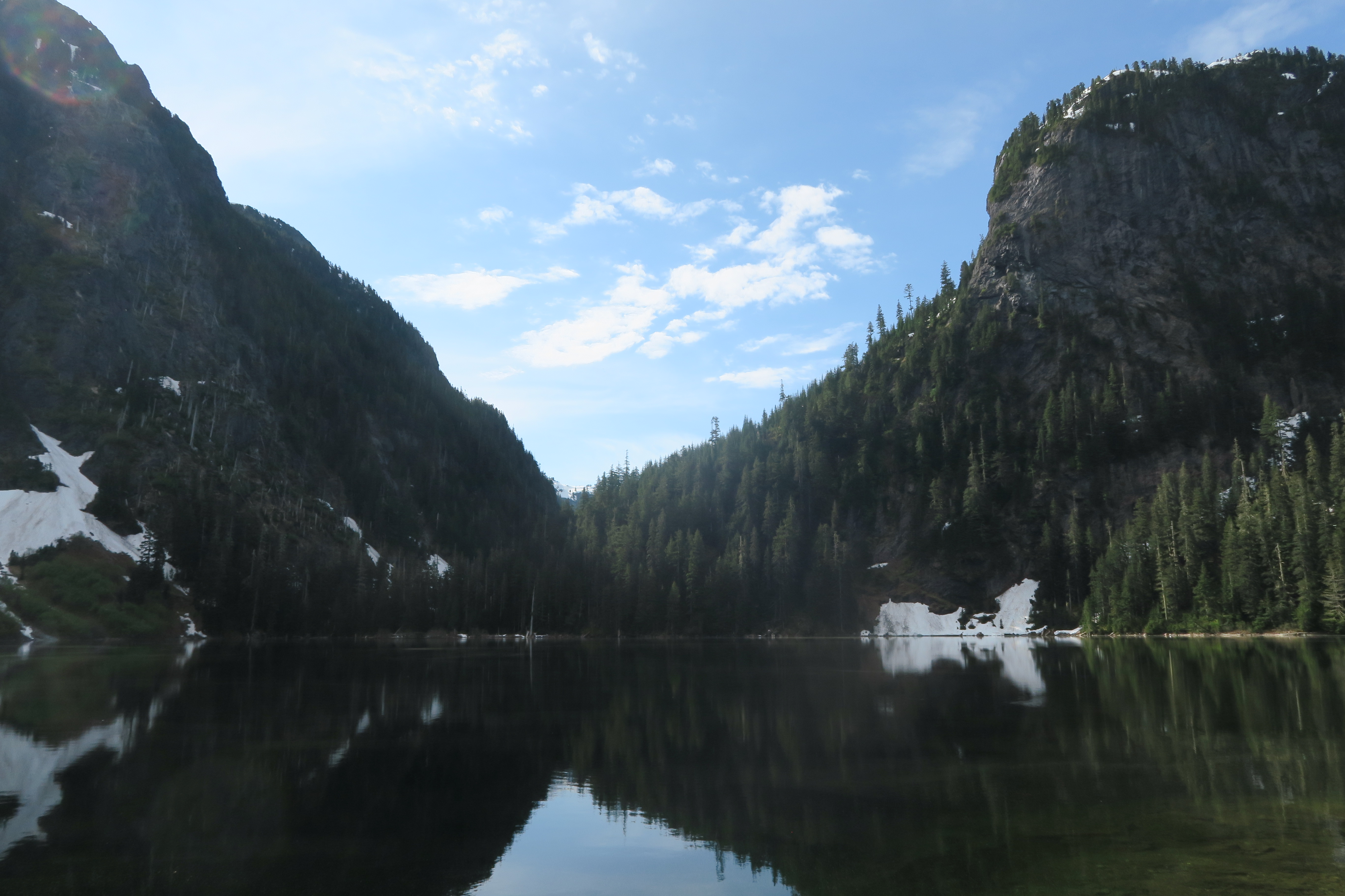
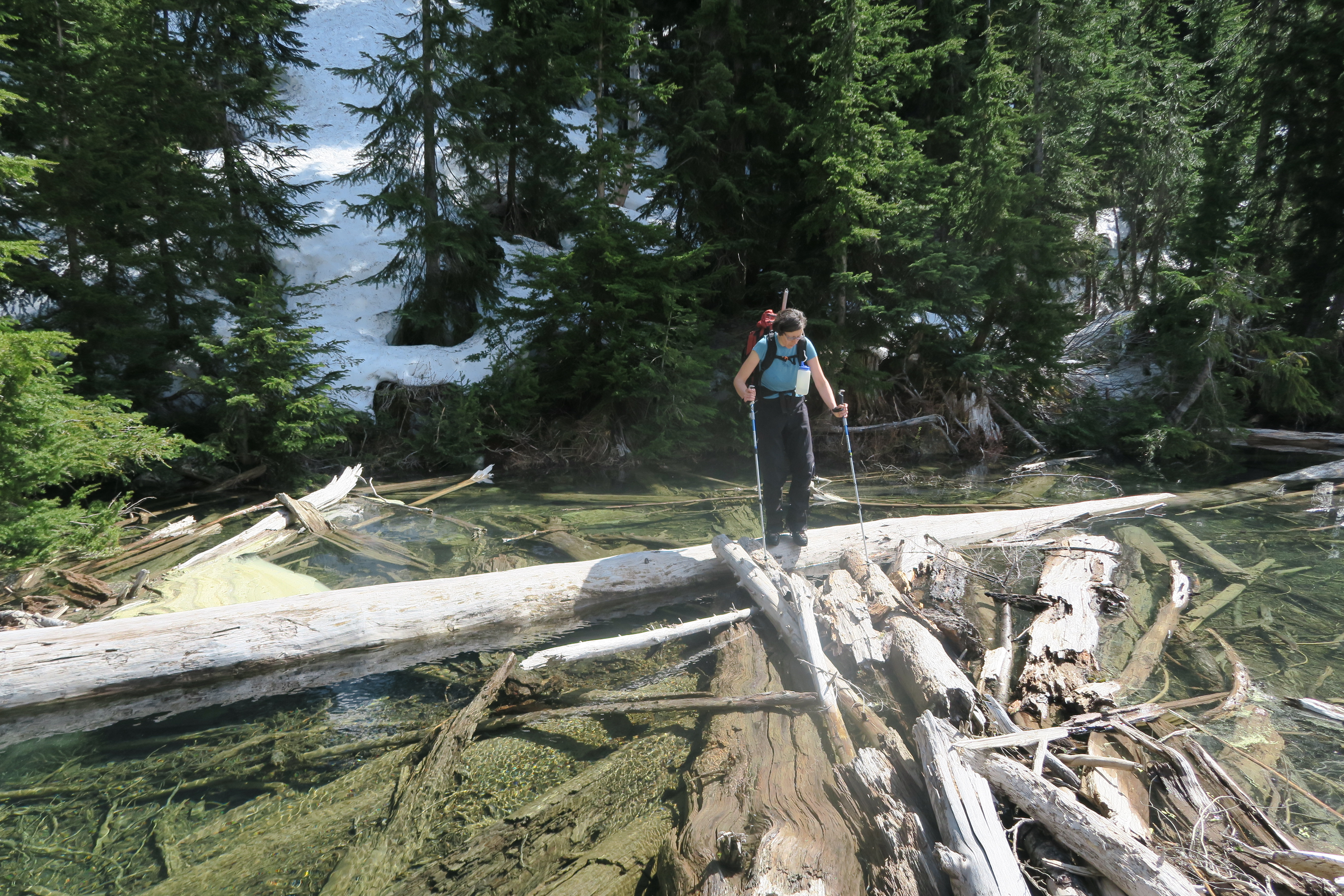
The trail to Deeks lake is in excellent condition, with only a couple minor pieces of deadfall to contend with and we reached the lake at 9:20am and stopped for our first break. Deeks lake is larger than I thought it was, and there are a couple nice camping spots by the lake. Nonetheless, we didn’t wait there long and soon turned right, crossed the logjam at the exit to the lake, and continued on the Howe Sound Crest trail around the lake and worked our way through pleasant terrain up towards Hanover Lake. The creek was running high at the place where the trail crosses to the east side of the creek, but luckily there was a large nearby snow bridge that we used to cross. At Hanover lake the trail gave way to snow, and above the lake we missed the place where the trail crosses back to the right side of the creek, but it was no problem because at the exit of Brunswick lake there was another logjam that was easily crossed, and just past 11am we were at the Brunswick Lake emergency shelter, where we stopped for our second break of the day.
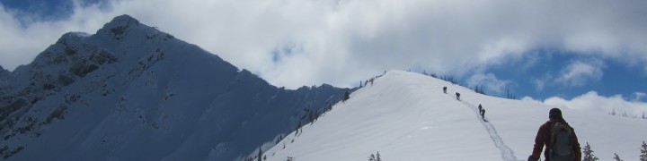
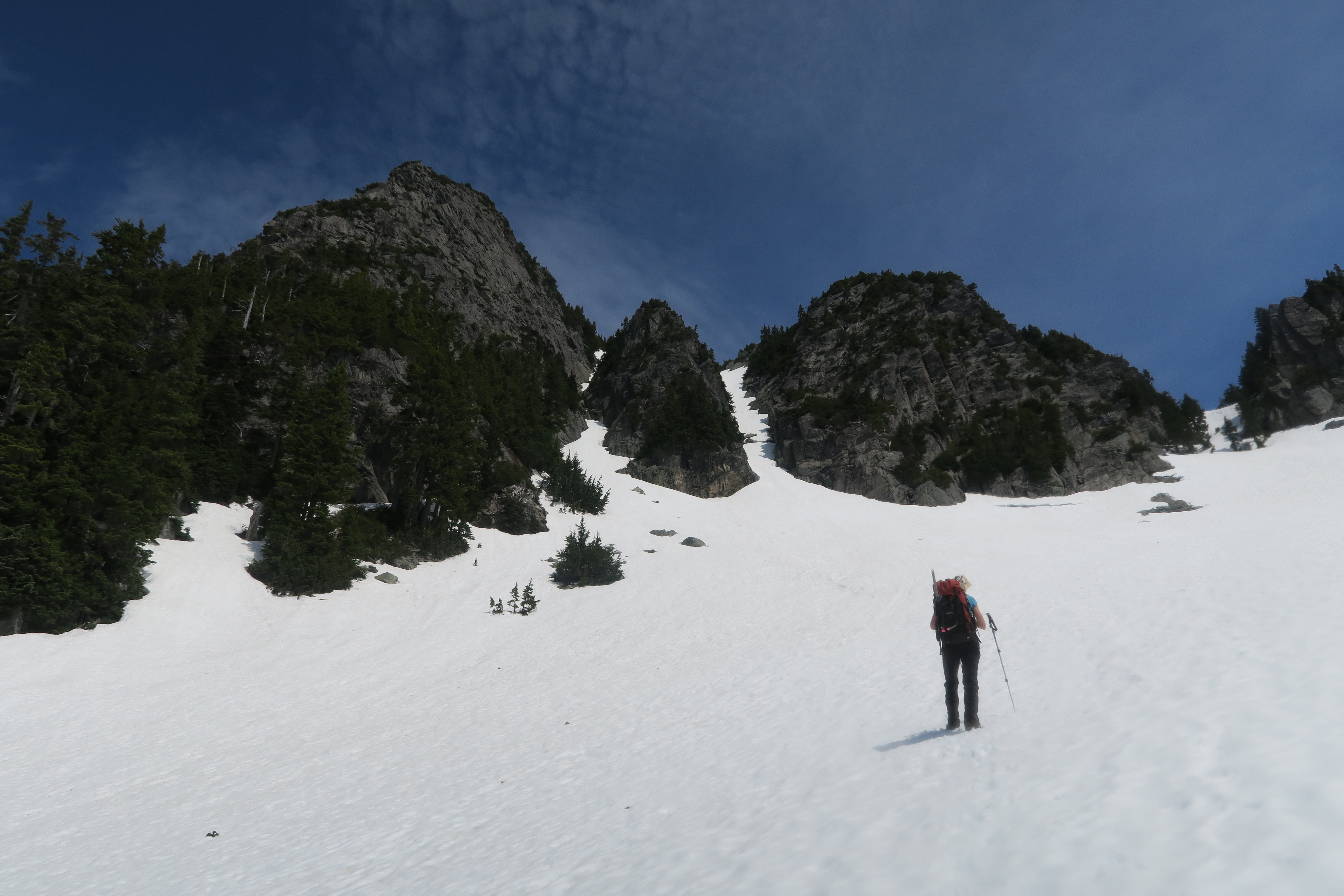
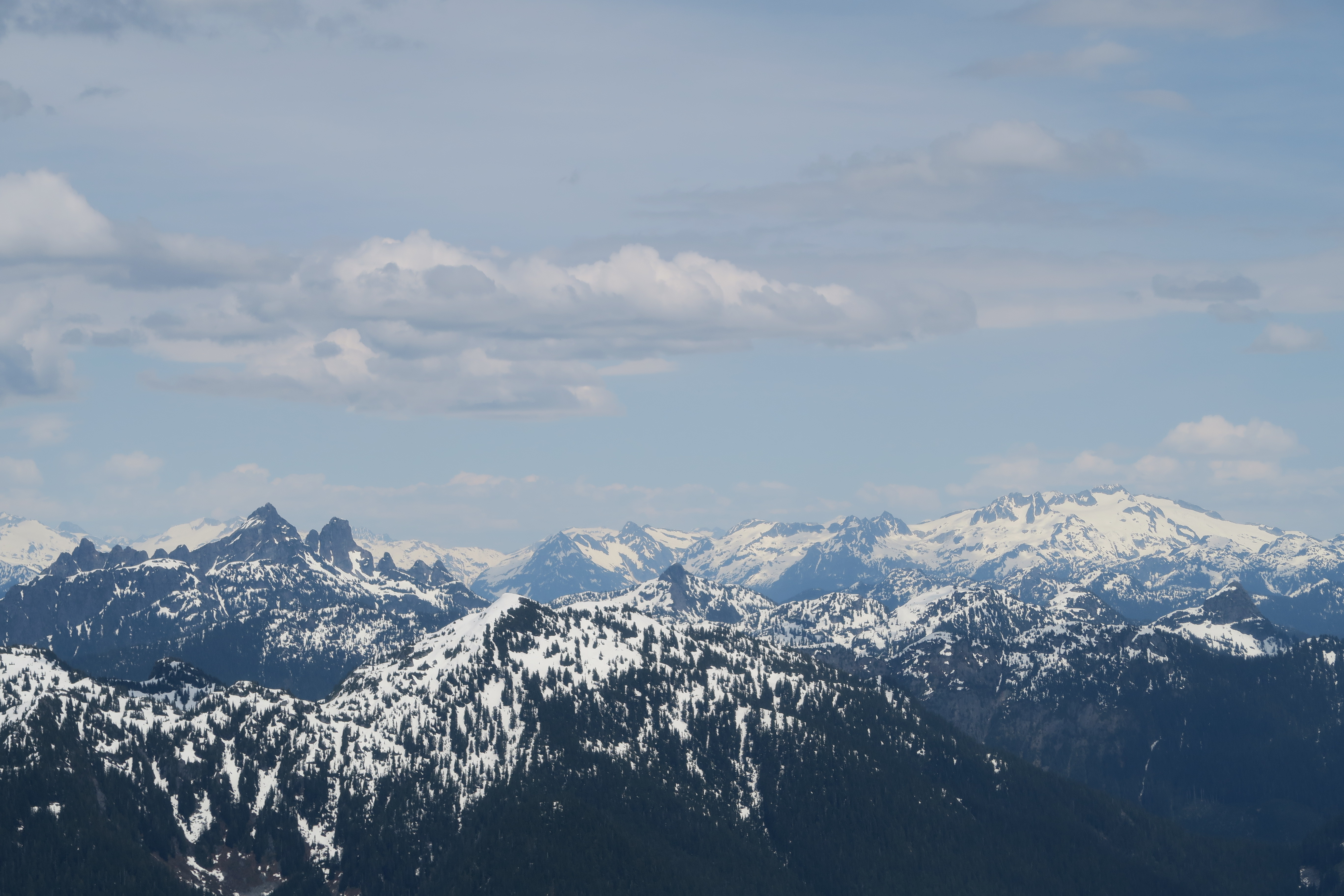
From the emergency shelter, we followed the HSCT markers towards Hat pass until the terrain became open and there was an obvious location to contour to the left onto a bench and start heading towards Mt. Hanover. Below Mt. Hanover the snow was mushy and slowed our progress, but we steadily ascending up until the notorious two gullies on the south / south east side of Hanover came into view, and we found ourselves below them at around 12:30. In summer conditions the left gully is reportedly much easier than the right gully due to some difficult scrambling moves required to get around two chockstones in the right gully. However, in mid May conditions, the left gully was an alternating mix of rock and snow patches with a few difficult looking gaps in the snow, whereas the right gully appeared to be snow filled completely and so we took out our ice axes and started up the right gully.
Not far up the right gully we encountered a significant moat in the snow at the first chockstone, a few metres deep, but not terribly wide, and we were able to bypass it on the right via a few easy scrambling moves on the rock. Above this it was steady step kicking all the way up to the summit (soft enough to not need our crampons), which we reached just past 1:30. The gully varies in steepness, but about 2/3 of the way up has a sustained section of 40 degree snow that, while not hard, was somewhat stressful due to the big hole 3/4 of the way down the gully that loomed below us. It eases off a bit below the summit, and the gully tops out on the literally a few metres from the true summit. We spent a few minutes taking photos on the summit, and the crossed back over the top of the gully to a nearby subsummit that was snow free and were we could sit on the rocks, eat lunch, and enjoy the views all around. Total ascent time: 5.5 hours.
The descent down the summit gully was slow as we had to face inwards and carefully follow our steps the whole way down. At the gap / chockstone, I misplaced one of my poles on the rock and it slipped down into the hole. Luckily, it landed on a snow lip and I was able to get myself into a position where I was able to fish it out with my ice axe. That left the chockstone hole unsatisfied and demanding sacrifice, and as Radmila crossed from the rock back onto the snow, she dropped one of her poles into the hole, where unlike my pole it did not land on a ledge and is now waiting to be found by another adventurer.
By 3:15 we were back on the easy snow below the summit block and put away our ice axes. From here, we motored down nonstop, and reached the car at about 10 to 6, for a total descent time of about 3.5-3.75 hours. Car to car time was a bit shy of 10 hours. In all, it was a great early season trip. I probably could’ve chosen a shorter/easier trip for my first real hiking/scrambling trip of the year, but given my lack of free time it was great to get out and knock off one of the remaining local mountains from my hit list. Mt. Hanover is quite out of the way, and so I wouldn’t recommend tackling it until someone has already knocked off the more popular local trips (Brunswick, Harvey, Lions, etc), but it is nonetheless a worthwhile outing. Many thanks to Radmila for accompanying me and providing great company for the day.


Tags: hanover, howe sound, north shore, scrambling
No comments
Comments feed for this article
Trackback link: http://www.geoffzenger.com/mt-hanover/trackback