Date: July 21/22, 2018
Participants: Volodymyr Koreniev, Dariia Korenieva, Nancy Zenger, Jeff Wallace, Geoff Zenger
Difficulty: 3/4
Report: Beaujolais and Sockeye Horn (“Mystery Peak” in Gunn’s scrambles book) have been in my sights for years, but the opportunity to get in and have a go at them just didn’t come about. However, with my parental leave coming to an end I found myself with a couple free days and made plans to head up for the weekend.
We met Friday evening and camped in a large clearing off of the Lillooet River FSR, and the next morning drove up the Hurley, then up Hope Creek FSR, and up the east branch towards the trailhead. There has been recent logging in the area this year, and the bridges are in great shape. Just after crossing the second, a new branch to fresh logging heads off to the right, so to reach the trailhead, continue straight / left on the older road. Past this point, the road is water barred and alder is growing in from the sides, so Jeff left his CX-5 at a pullout and we all piled into my XTerra for the final 3 or so kilometres up to the trailhead. The waterbars are all small, and any stock HC 4×4 will have no difficulty making it all the way up, with the aforementioned caveat that you will be getting an alder bath in places.
We left the car at about 9:55 and followed a faint path down to the first creek crossing. The creek is not too hard to cross (note: there is a log about 30m upstream that can be crossed if desired), but Nancy slipped and soaked her boot. Luckily the creek was only about 1 minute from the car and she was able to run back for some dry shoes and socks.
Across the first creek, we *should* have turned about 20-30 degrees to the left and wandered through a small clearing to the second creek, meeting the second creek close to where another creek flows into it from the pass above. A trail up to the pass begins just to the left of the creek flowing into the second creek, but we only found this on the way down. Instead, we continued straight ahead after crossing the first creek, and straight ahead after crossing the second, and spent the next 40 minutes bushwhacking up through dense bush before we found the trail just below the pass and followed it up until it crested the ridge.
From here, we followed the trail that branches off to the left, descending slightly to the pass and then rising up on the shoulder that we would contour around to get into the large valley below Beaujolais. After an hour or so of sidehilling, we crossed a small creek and reached a relatively flat area near a small lake that appeared to be an ideal camping spot, so we set up our tents and hoped that the grey skies would clear.
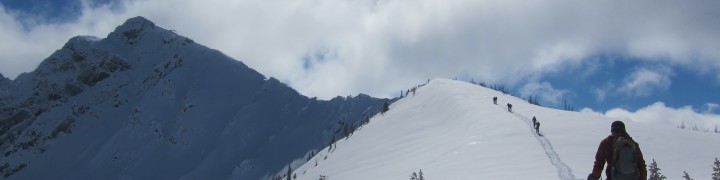
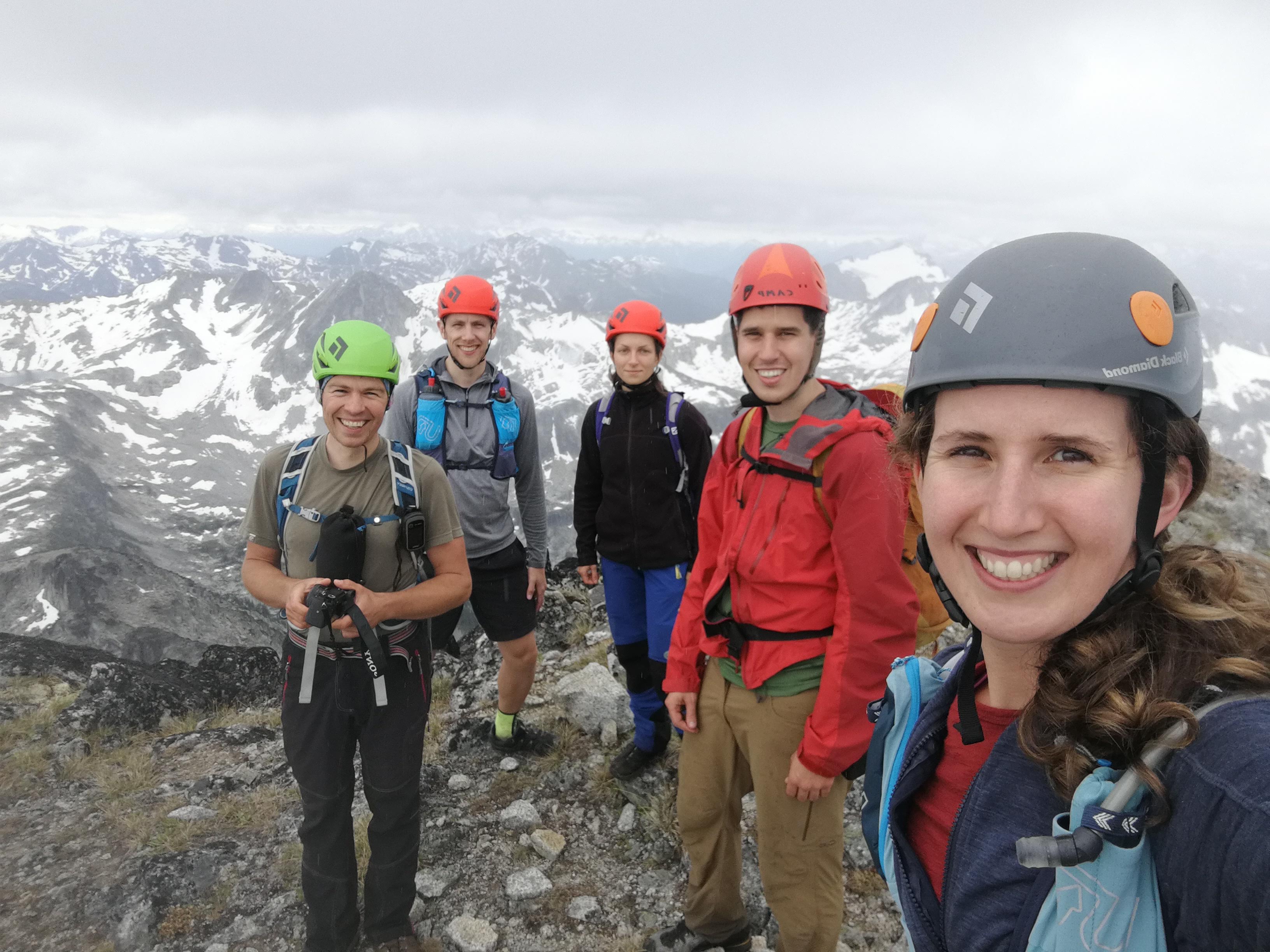
A bit past 1 o’clock we were all set to go, and departed for our go at Sockeye Horn. A seeming eternity of sidehilling later (in fact more like 1 hour 20 minutes), we reached the large lake below Sockeye Horn, and after a quick break, went around it and started winding our way up through the talus to join the ridge (as described in Gunn’s) book that would lead us to the summit. We reached the ridge at 3:35pm, and from there continued up towards the summit. The ridge is almost entirely straightforward and obvious scrambling, with the only difficult spot being moments before the summit, where you can either make an exposed step right on the ridgeline (as Volodymyr did) or descend a few metres and scramble up a slightly awkward corner to join the other route just a few metres below the summit. We reached the summit at about 4:15pm to dark skies, and didn’t wait too long to start our descent because we were worried about rain.
Of course, by the time we reached the bottom of the summit ridge, the clouds were almost all gone and the blue skies filled with sun. Two and a half hours later we were back at our campsite where we all enjoyed a hearty meal in the company of the worst mosquitos I’ve ever encountered in our local mountains.
The following morning, we woke modestly early and departed camp around 7:15am to head up to Beaujolais. The weather was gorgeous and we were up at the col below Beaujolais by 8:15. Here the scrambling started and we quickly made our way up the lower ridge towards the crux. Just before the crux slab the ridge narrows and we got a good view of the slab and the narrow ridge above it. Volodymyr and Jeff went ahead to check out the route and after a long period of indecision they decided that we wouldn’t be comfortable downclimbing the narrow, exposed ridge above the slab without a proper rope and so we reluctantly turned around, had a long break at the col, and went back to camp to pack up.
We left camp a bit after 11 and made good time on the sidehill traverse, finding a way to avoid some of the bushy parts we’d hit on the way in. From the pass above the parking area, we followed the trail all the way down to the 2nd creek crossing, and before we knew it we were at our car a few minutes past 1pm.
Despite our non-ascent of Beaujolais, overall this was a great trip to close out my parental leave and return to work. It was really fun to see a new area that I hadn’t been in before, we had a great camping location, we made it up Sockeye Horn, and of course the company was great. Thank you everyone for joining me, and I look forward to getting back into the area soon with a rope to have another go at Beaujolais and perhaps to make an ascent of Canine Peak as well!
P.S. The ridge dividing Beaujolais valley from Sockeye Horn (i.e. the ridge to hiker’s right of the ridge in Gunn’s book) is reportedly an easy class 2 hike/scramble for someone looking for an easier ascent of Beaujolais
-

- Second creek crossing

-

- Sidehill into Beaujolais valley

-

- Camp

-

- Reaching sockeye horn ridge

-

- Scrambling on Sockeye Horn

-

- Sockeye Horn Scrambling

-

- Exposed high, easy low near red jacket

-

- Sockeye Horn summit
-

- High on Sockeye Horn

-

- Sockeye Horn summit ridge

-

- Sockeye Horn lake and Chipmunk in distance

-

- Sockeye Horn from Lake

-

- Bugs

-

- Beaujolais scramble on lefthand skyline

-

- Beaujolais crux

-

- Looking down towards camp from near Beaujolais

-

- Molar and Canine

-

- Brief bush

Tags: beaujolais, hurley, scrambling, sockeye horn
-
Hey man, thanks for the TR. It looks like you were approaching Beaujolais from the southwest, but I believe Gunn’s description is an approach from the ENE. Does this sound right?
-
Hi Ian,
We followed Gunn’s route. His route ascends the NW ridge of Beaujolais, but to reach the ridge you ascend the broad valley to the SW of the peak. The trailhead is on the east branch of Hope Creek, which is due west of Beaujolais.
Sockeye Creek valley is to the ENE of Beaujolais and to the best of my knowledge there are no roads or trails heading up that creek.
Hope that helps!
-
2 comments
Comments feed for this article
Trackback link: http://www.geoffzenger.com/sockeye-horn-and-beaujolais/trackback