hiking

You are currently browsing articles tagged hiking.

Date: May 2, 2015

Participants: Devin Erickson, Brittany Zenger, Geoff Zenger

Difficulty: 1/2

Report: Metal Dome is a popular mountain so I don’t need to say too much.  We started out from the cars at around 9:30, parking right next to the snowmobile cabin up Brandywine FSR.  Hit snow about 5 minutes up the snowmobile access cut from there, and proceeded easily on snow to the summit.  Amazing views, great day.  Total round trip at a very relaxed pace with lots of time on the summit of only about 5 hours.  Great trip for beginners!

Tags: , , ,

Date: May 9, 2015

Participants: Ed Zenger, Geoff Zenger

Difficulty: 3 (some scrambling, steep bush)

Report: For a few years now I’ve had the idea that I want to knock off all of the north shore peaks listed in Fairley’s guidebook, and one of the closest set of peaks to Vancouver that I hadn’t previously ascended were the Needles, the 3 summits on Lynn ridge lying between Lynn peak and Coliseum mountain.  The needles are visible from much of the lower mainland, and don’t look like much, but a traverse of the Needles and Lynn ridge makes for a full day adventure, only minutes from the city.

Note: If you’re wanting to just go and bag the highest Needle (the middle), by FAR the most efficient route would be to bike up the Seymour river and take the Hydraulic Creek trail up to the South Needle and then scramble over to the Middle Needle (many people will want a rope to descend the South to the Middle needle col) and then reverse the route after bagging the summit.  We didn’t do this because a traverse just sounds more exciting!

We set out from the regular Lynn Headwaters park trailhead at 8:30 towards Norvan falls, which was the usual trudge taking a bit under an hour and a half, and from there went up the Coliseum trail.  I’ve only gone up Coliseum from the other side before so it was interesting to see that the Norvan side isn’t really that much less steep for the first bit, although it does fairly quickly (after about 30 minutes) level off as it starts traversing into the broad bowl between Coliseum and the Needles.

At approximately 800m (or perhaps just below), just under an hour after starting up from Norvan falls, the trail enters the bottom a large open slope, just to the north of the North Needle, with a steep narrow gully visible in the top right corner of the bowl above.  The ridge from the north needle to where the ridge hits the Coliseum trail is reportedly simply awful, and so rather than do the full ridge, we bushwhacked up this bowl towards the gully on the upper right (generally able to stay on boulders but some bush), and approximately 100m to the left of the upper right gully found an easy dirt slope that led up to the ridge.  On this slope we hit our first flagging tape of the day.

Note: If you’re doing the traverse in the other direction, at the first minor col north of the north needle, look for occasional flagging tape heading down to your left towards the Norvan trail.  It is probably hard to follow as it’s a little spaced, but this is your best option to get off the ridge.

The ridge up to the north needle was bushy, but otherwise no problem, and we were quickly on top, approximately 4 hours from starting at the car.  The views were great and we had a quick bite to eat before descending the ridge and going up the middle needle.  There’s a small amount of bushy, minor exposed scrambling heading up to the middle needle, but nothing bad, and on top we had our main lunch for the day.  Right on the flat summits of these two needles was the only snow of the day, just a few inches of mush.

Descending the middle needle you lose a lot of elevation into the steep col between it and the south needle, and here you encounter the only real difficulty of the day, a choice between some extremely steep bush on the right or a short (10m) 3rd class slab that was wet.  Going up was no problem, but I would imagine that many people would want a hand line or rappel to get down if doing the traverse the other way.

From the south needle onwards there’s a well defined trail, presumably to the popularity of the Hydraulic Creek trail build approximately 10 years ago.  We, however, did not take that trail as our car was down at the Lynn Headwaters parking lot, and continued past the Hydraulic Creek trail junction along the ridge.  This part of the ridge is full of ups and downs and is boring, boring, boring until the Lynn peak viewpoint, after which it is all downhill on a tedious old rocky skid track.

I wouldn’t do the traverse again unless someone built a proper trail due to the bushiness in places, but it was a very full day with lots of adventure and aside from the last couple hours of the trip was actually a lot of fun.  Total time required: 9.5 hours, total distance just under 19.6km, and total elevation gain slightly over 1900m!

Last word: Should I do the traverse N -> S or S -> N?  I would highly recommend doing the traverse N -> S instead of the other way around because from below it’s easy to see how to shortcut onto the ridge at the right place (so fewer route finding difficulties), the 2 scrambling steps are done going up instead of descending them, and because the toughest parts of the day are done early on when you’re fresh instead of at the end of the day.

GPS Track: Link to KMZ

Needles route

Tags: , , ,

Mt. Baird

Date: March 8, 2015

Participants: Dylan, Martin, Brittany Zenger, Ed Zenger, Geoff Zenger

Difficulty: 2

Report: A trip report on clubtread of a visit to Mt. Baird in the waning days of February spurred my interest to visit this rarely climbed peak near Hope.  The previous weekend I’d been exploring the roads on the east side of Harrison Lake (long story short, the road to Nahatlatch is washed out just 4km from Nahatlatch) and had tried to approach the Old Settler from the east, but no luck.  This weekend I’d be able to climb Mt. Baird and get good views of the Old Settler from the south east.  The forecast was looking good and a last minute trip posting on the BCMC website managed to fill up my Jeep for the excursion.

We met up at Columbia Station in New West at 7:30 and made our way out to Hope.  The access to Mt. Baird is easy right now via Nickelmine Road which if you follow it is well maintained for by both a local offroad association and for active logging and leads into Emory Creek.   We parked right next to the turn off for spur 3569 (just a bit past the 11 km marker), walked up the short spur, and then ducked into the trees.  We found ourselves on the left side of a creek, and made our way up the left side of the creek through open easy forest all the way up to treeline.  This appears to be the ideal route up the mountain.

We hit snow around 1200m, and by 1400m were on a long ridge heading up towards the summit.  At about 1400m there are some bluffs and we chose to head around them to the left, which we did and followed some snow filled gullies up towards the obvious broad snowslope leading up towards the left of the main summit.  It was a reasonable route, but on the way down we came down the other side (climber’s right) and found it to be even easier going and more straightforward.  The snow leading up to the summit was very pleasant and enjoyable, and at a quarter to 1, less than 4 hours after leaving the cars, we found ourselves on the small rocky summit of Mt. Baird.

The views from the top of the Old Settler were grand as expected, but what was unexpected was the fantastic views of so much more.  From the summit there are great views of the Anderson River group, Needle Peak, Cheam Range, Judge Howay area, Baker area, and even the Outram and Silvertip regions of Manning Park!

We spent a good long time on the summit in the unseasonably warm temperatures before eventually making our way back down to the car.  The descent on the snow was fast and descent through the trees was easy and quick as well, and we made the descent in well under 2 hours.

Thank you to everyone for the great company and great trip.  You need a low snow year like this year, but if you’re able to drive to at least 800m on the logging road, Mt. Baird makes for a great early season or winter trip!

Tags: , , , ,

Date: Oct 21, 2014

Participants: Geoff Zenger, Peter Woodsworth

Difficulty: 1/2 (if on route), 2/3 (route taken)

Report: This report contains the story of the first BCMC expedition to Turtlehead Mountain, Nevada.  After a few training days climbing routes in Red Rocks such as Cat in the Hat (all the way to the top of Mescalito), Geronimo, and Physical Graffiti, Peter and I left the rest of our party down in the valley and ventured forth on an unguided, unassisted, siege-style expedition to conquer Turtlehead Mountain.  No fixed ropes were used.

The morning of the ascent, we had an anti-alpine start, and weren’t at the the Sandstone Quarry parking lot until around 10 o’clock when the solar effect on conditions was already considerable, but as experienced mountaineers we elected to make the ascent regardless.  The route wound its way upwards through cliff bands and desert creek washes, and soon we found our way in the large valley/gully leading up to a col just west of the summit.  Unfortunately, due to congestion on the route due to the hordes travelling downhill, our party became separated and although Peter continued upwards to the col via the standard class 1/2 route, I was sucked offroute into a steep gully, which ascended to the ridgeline above the col.  In places the may have approached class 3.

Just past noon we found ourselves on the summit by ourselves where we celebrated with Gatorade, wraps, and a family sized bag of Sun Chips.  Gazing back down the route to the valley and Sin City below we reminisced on our accomplishment and an hour or so later began our way back down.  An epic was avoided (unlike our tale from 3 days earlier) and we were back in camp with only a few hours of daylight to spare.  The rest of our crew had made it up Birdland today, which I must admit looks fairly impressive from below, but it has nothing on the altitude gained on our expedition to Turtlehead Mountain.

Tags: , , ,

Conway Peak

Date: Sept 13, 2014

Participants: Jean-Michel, Julie, Geoff Zenger

Difficulty: 2

Report: Originally intended as an overnight BCMC trip to Stoyoma Mountain and Mount Hewitt Bostock in the northern Coquihalla region, a change of plans and need to be back in Vancouver on Sunday meant that the trip had to be shortened to a day trip.  Opting against driving all the way through Merritt for a day trip, we changed our minds in Chilliwack and headed up Conway Peak, the southernmost peak in the Cheam range.

The road up to Jones Lake and then to the trailhead is in decent shape right now, but definitely requires a 4×4 HC vehicle.  We arrived at the trailhead at around 10 and started our way up the trail at about a quarter past, making our way up the switchbacks on an old road.  The road here is quite overgrown in places, but easy to follow, although we missed the 4th switchback and instead of making the turn right before a creek crossing, we hopped across the creek and continued about 15 minutes right to the end of some even older spur, wasting a good half hour of our time.

Once back across the creek where the switchback should’ve been it was easy to see where the right way to go was, and a few minutes later we entered the old growth forest to follow the old Lucky Four Trail up to Mile High Camp.  This trail is in great condition and is very pleasant.  Just before 1 o’clock we found ourselves getting hungry and decided to stop at the next knoll, and were happy to find that it was indeed the famed mile high camp!  It’d be a great spot to camp with fantastic views all around, although I personally wouldn’t really want to lug an overnight pack all the way up there…

We left the camp at 1:35, and from here the route up Conway is really nice over open heather and rock slopes, and it was easy and fun to make it up to the summit, which we reached at 2:20, 45 minutes after leaving the camp.  Total ascent time, 4 hours, including 35 minutes at mile high camp and 30 minutes on the wrong road.

We had lucked out and had amazing fall weather on the summit, warm, sunny, and clear.  We dozed off for a while, took group shots, gazed at the huge north faces of Foley and Welch, and identified peaks south of the border for nearly an hour before starting back down.

The descent was quick and uneventful and took under 2.5 hours to complete.  Total round trip time was around 7.5 hours.  In all, Conway Peak greatly exceeded my expectations and is a really nice hiking peak that doesn’t see the popularity it deserves.  Great views, nice trail (minus the bottom bit), close to Vancouver.  Recommended!

Tags: , , , ,

Date: July 27-28

Participants: Dave Scanlon, Brittany Zenger, Geoff Zenger

Difficulty: 2-5

Report: Brittany and I had gone in to Watersprite Lake with Dave and a couple others two winters ago just as a day trip to check out the skiing opportunities in the area, but until now we hadn’t ever been in the area in summer.  The BCMC (BC Mountaineering Club) has a tenure to build a hut at Watersprite Lake, and last week we were given the chance to head in there again with Dave to do a bit of improvement to the trail that he’s been building and to try and summit a few of the peaks surrounding the lake and see how we liked the area.

We met up at St. David’s at about 9 o’clock Sunday morning, just before the church crowd arrived, and piled into Dave’s 4×4 to make our way up towards the trailhead to get to the lake.  We drove up towards Squamish, turned  past the Apron parking lot onto Mamquam FSR, turned left onto the Skookum creek system just past the 13km mark and ascended the road up to the old upper staging area for the recently completed Skookum creek run-of-river IPP where we parked the car and set out up the road just before 10:30 (see image below for route drawn on map, ‘x’ marks parking spot).  Most of the drive in is 2wd accessible, but the last few km are a bit steep and loose.  The first 3.5km or so into Watersprite is on an old logging road, and after our snipping efforts last weekend is reasonably clear of alder and bush.  It took us about an hour and a half to reach the flagged turn off from the road to drop down into the meadows below where Dave has cleared and flagged a trail that can be followed up to the lake.  En route to the lake we helped fix up the trail, did a bit more snipping, and eventually arrived at the camping area / proposed hut location at the outflow of Watersprite Lake shortly before 3pm, for a total time to walk in of about 4.5 hours.

route

At the lake we set up camp and had a snack, but as the day was still young at around 4:30 I decided to head out on my own to ascend Dreadnought Peak, just to the NE of the lake.  I made my way around the south side of the lake to head up east to the col between Dreadnought and Watersprite Tower.  From here, Dave said he’d heard there was a class 3 route up to the summit of Dreadnought, but despite trying a few approaches to get onto the ridge I was unable to find one that looked like it’d go at anything less than a stiff class 4, and eventually found myself heading up the large obvious rock gully that heads up towards the west ridge of Dreadnought a couple hundred metres west of the col.  The gully was pretty unpleasant, but except for its exit, wasn’t particularly hard or steep.  On the way down I found that the steep exit can be avoided through the bushes on the left (west) of the gully.  Above the gully, pleasant easy scrambling led me to the summit of Dreadnought which I reached at 6pm.  There are three summits of Dreadnought, all perhaps 50 feet apart and all apparently within about 1 foot of elevation.  After gazing at the great view of Mamquam, Garibaldi, Sky Pilot, Tantalus, and the lesser known peaks to the east I descended back to camp for dinner and relaxation.

The following morning we headed up to attempt Watersprite Tower, Dave’s main objective for the trip.  I had brought along a 30m rope and a small set of nuts and cams, but from the sub-summit of the tower we found that our rope wasn’t long enough to rappel into the notch!  Furthermore, the climbing on the far side looked pretty difficult… After much hemming and hawing we eventually decided to give up on finding a way down into the notch and instead decided to traverse the ridge along the south side of the lake around over the high summit south of the lake and over towards Martin Peak.  Watersprite Tower would have to wait for a later attempt.  As an aside, there is a crazy balanced pillar on the sub-summit of Watersprite that couldn’t be moved into place by heavy machinery if you wanted to!

The ridge around the south of the lake is a very fun scramble.  Always interesting, and never too difficult, with a few short 3rd class sections.  The only tricky routefinding was the descent from the high point on the ridge (Peak 1877) to the col between it and the intervening bump between it and Martin Peak.  There was a cliff that we possibly could have rappelled, but we found instead that it was better to drop down heather slopes to the south, into the bowl below, and reascend to the col via heather and talus slopes.  From this point we had the option of continuing to Martin Peak, but as this col is the normal descent route from Martin Peak and we were already getting tired we decided to skip the final summit on the ridge and just descend down easy snow slopes back to Watersprite Lake.  We made it back to camp at about 2pm, so our total round trip time for the loop was about 6.5 hours.

Once back in camp we slowly packed up, and departed camp close to 3 o’clock to make our way back down to the car.  It would take us between 3.5 and 4 hours back to the car (so, so, so much easier in winter), and the final road seemed to go on forever, but we eventually made it and concluded another highly successful and fun trip.  The hiking around the lake isn’t super easy, but with some flagging it would be accessible to most experienced hikers and it is a very beautiful area.  Personally I wish the approach was an hour or two shorter, but apparently most people want a hut that’s a bit farther from the cars… apparently I dislike long approaches more than most, and 4-4.5 hours isn’t that excessive in the summer (it took us only around 3 hours in winter on skis).   Finally, many thanks to Dave for building a trail into the lake and showing us the way in.


Tags: , , , , ,

Date: Aug 1-2, 2014

Participants: Fatemeh Riahi, Ali Kamali, Devin Erickson, Brittany Zenger, Geoff Zenger

Difficulty: 2

Report: Brittany has been asking to go into Tenquille Lake and do a few of the nearby hikes / scrambles for a few years now, but until last week the time and opportunity had never arisen.  Luckily, we’ve spent the last couple weeks on vacation, and what better way to spend the last couple days of it than taking some friends out for their first ever backpacking experience at a beautiful lake and with a perfect weather forecast.

We met up at Mt. Currie coffee Friday morning at 9 o’clock, and drove off towards Birken where we took the Tenquille-Birkenhead FSR to access the area from the east.  Most of the road is in very good shape (probably want a 4×4 all the way from where you leave the Pemberton Portage road), although the last 5km or so has been deactivated and requires a high clearance 4×4.  We departed from the trailhead at about a quarter to 11, and arrived at the cabin at the west end of the lake almost exactly two hours later.  Luckily we were the first to arrive at the lake for the long weekend and had our choice of camping location.  We set up camp perhaps 200 feet from the cabin in a large open area, and sat down in the cabin to enjoy a good lunch.  The lake itself is beautiful and the view to the west is dominated by Sun God (which we ascended a few years ago, it’s easy from this angle to see how the peak got its name).

On our way we were passed by a large party of 18 mountain bikers, all on 2015 Giant Reign’s (disclaimer: I own a 2014 Giant Reign).  Apparently the group was press junket of sorts, a mix of bike company employees and journalists flown in to review the new bikes in a beautiful environment.  They had been dropped off at the head of Barbour’s valley and were making their way by Tenquille Lake in order to descend the trail down to the Pemberton Valley.  It’d be a wonderful place to bike, although I couldn’t help but notice that it would be better to bike there later in the season when it was a bit drier… some of the muddier areas near the lake looked like a war zone after all the bikes had pass through.

After a hearty lunch and setting up camp, we headed up to Copper Mound.  We misread the directions in Gunn’s book and thought that there would be a trail heading up to Fossil Pass from Tenquille Pass, but after hiking up to Tenquille Pass and descending a fair ways down the other side, we realized that that was not the case, and made our way up the open slopes to Fossil Pass and from there up the easy scree and talus fields to the summit of Copper Mound.  The views from the summit were excellent!  There were a couple of paragliders flying overhead, the Pemberton Valley long below on one side, and views of Goat, Tenquille, the Sampson area, Currie, Ipsoot, Rhododendron, and the peaks at the northern end of the Pemberton Icefield.  While the rest of our party wanted to lounge about on top, I wanted to bag another peak, and set off for a quick ascent of Mt. McLeod.  I moved quick and made it summit to summit in 45 minutes, took a few quick pictures, and scurried back to Fossil Pass where I arrived just a few minutes before everyone else.  From here it was an easy descent back down to the lake where we hung out and had a great dinner.  Devin tried out the plastic kayak under the cabin while dinner was being cooked, and while it made for great photos, the kayak turned out to have holes in its bottom and he ended up unexpectedly wet and joined us back in the cabin much sooner than we expected.

On the Saturday we had a slow morning eating breakfast, packing up our tents, and talking to some of the people who had arrived in the area the previous evening.  We set off with all our gear again at about a quarter to 11, and dropped all of our bags except for two small day bags just past the turn off to Barbour’s valley.  The trail up into the valley is in great shape, and following Gunn’s directions we made our way up Mt. Barbour.  The route is mostly hiking, but has a 5-10 minute section of moderate scrambling just below the summit that added to the fun and epicness of the ascent.  Just like Copper Mound, the views from the top were great, but the summit has a much more aesthetic atmosphere than Copper Mound, and there was unanimous agreement that it was our favourite peak of the trip.  We left the summit at about 2:45 and headed down to our bags and from their to the Jeep, arriving at the Jeep just past 6:30.

Two full days of hiking, but everyone survived and at least claimed to have fun 🙂  We were even down early enough to enjoy a dinner at the Wood in Pemberton before saying goodbye and bringing our vacation to an end.  Tenquille Lake exceeded my expectations with regards to beauty and ease of access and I can see why it’s so popular these days.  The only downside of the area was the massive number of biting horseflies.  I can’t wait to get back up there and ascent the peaks on the north side of the lake!  Thanks to all for the great trip!


Tags: , ,

Date: June 7, 2014

Participants: Sergii Bogomolov, Geoff Zenger

Difficulty: 2/3 (Short sections of moderate scrambling)

Report: Hiking the Lightning Lakes trail in Manning Park out to Thunder Lake has been on my list for some time, but Manning Park always seemed like a long ways to go for just a lake hike… Luckily, a couple years ago I noticed a peak called “Lone Mountain” in Beckey’s guidebook to the north Cascades, and I decided that any trek I did out to Thunder Lake should include an ascent of Lone Mountain, located on the SW side of the lake.  I posted a trip a while ago on the BCMC schedule and had some interest from a few people, but by the date of the trip, everyone had bailed except for Sergii, and on a nice Saturday morning we met up near my place in New West and drove out to Manning Park.  In the end I’m glad that there were only a couple of us and not a larger group because the trip would prove significantly more strenuous than expected.

We started out from the Spruce Bay parking area around 9:45am, and moved quickly along the lakes trail, reaching Strike Lake camp at about 11 o’clock.  After a quick snack break we continued on towards Thunder Lake.  There was some snow on the trail in sections here, but the going was quick and we reached the end of the official trail at Thunder Lake a bit past 11:30.  We followed a little used path around the northern side of the lake up towards some waterfalls coming down from Snow Camp Mountain above the outflow of the lake.  From here we bushwhacked down the little creek to the outflow from Thunder Lake where we were happy to find a thick logjam in the river that was easily crossed, and on the other side at a quarter to 1 we stopped for a full lunch break.

There is a large talus field perhaps 100m along the lake shore from the outflow of Thunder Lake that we wanted to take up towards the ridge, and so we trekked diagonally upwards through the bush to hit it.  The dirt slopes and bush are ridiculously steep on this section, but we found our way to the talus slope and followed it upwards until it became a steep and exhausting scree gully.  The heat and scree made ascent slow, and we eventually bailed out of the scree gully to the right (north), which in retrospect was a great decision because it brought us back to a firm, open talus field that led up to the ridge.  From the topo map and Google Earth I had expected the ridge to be an easy walk, but it proved to be an alternating sequence of bushy thrashing and steep dirt, with a couple short scrambling moves thrown in.  Luckily there isn’t any serious exposure, and we eventually made our way up to where we hit snow, perhaps 100m below the summit.  The snow line was surprisingly high, but I guess it’s a big cooking bowl around Thunder Lake that traps heat.

We reached the summit of Lone Mountain around 2:45, and sat down for a long break.  The view of Hozomeen from the top is amazing.  There is probably no better vantage point possible of the group and all three peaks are visible.  There are also good views over to the Skyline trail that crosses from Lightning Lake to the Skagit River, but otherwise the summit is quite unremarkable as it is lower than almost everything else in the area.  Tired and out of water, we departed the summit a bit before 3:30 to thrash back down to the lake.

We were back down at the lake at about 4:50, and after a quick break, decided to bushwhack horizontally along the lake edge to take the lower trail along Thunder Lake back to the main trail.  Big mistake!  It took us 40+ minutes to thrash through the thick alder and other foliage.  We really should’ve just followed the creekbed back up to the upper trail.  Nonetheless, we persevered and made our way back to the main trail, where we eventually found a good creek that we could refill our water from, and made the long trudge back to the car, which we finally reached at 8:20.  10.5 hours round trip!

In the end, am I glad I went to Lone Mountain?  Yes, I am.  But I am definitely never going back there again.  After doing the trip it’s clear why it’s rarely done… it’s a long ways with a lot of bush, scree, and sheer exertion to reach a very minor summit.  Regardless, it was a great trip and I have to thank Sergii for his great companionship on this mountain trek!

Tags: , ,

Date: May 30 to June 1, 2014

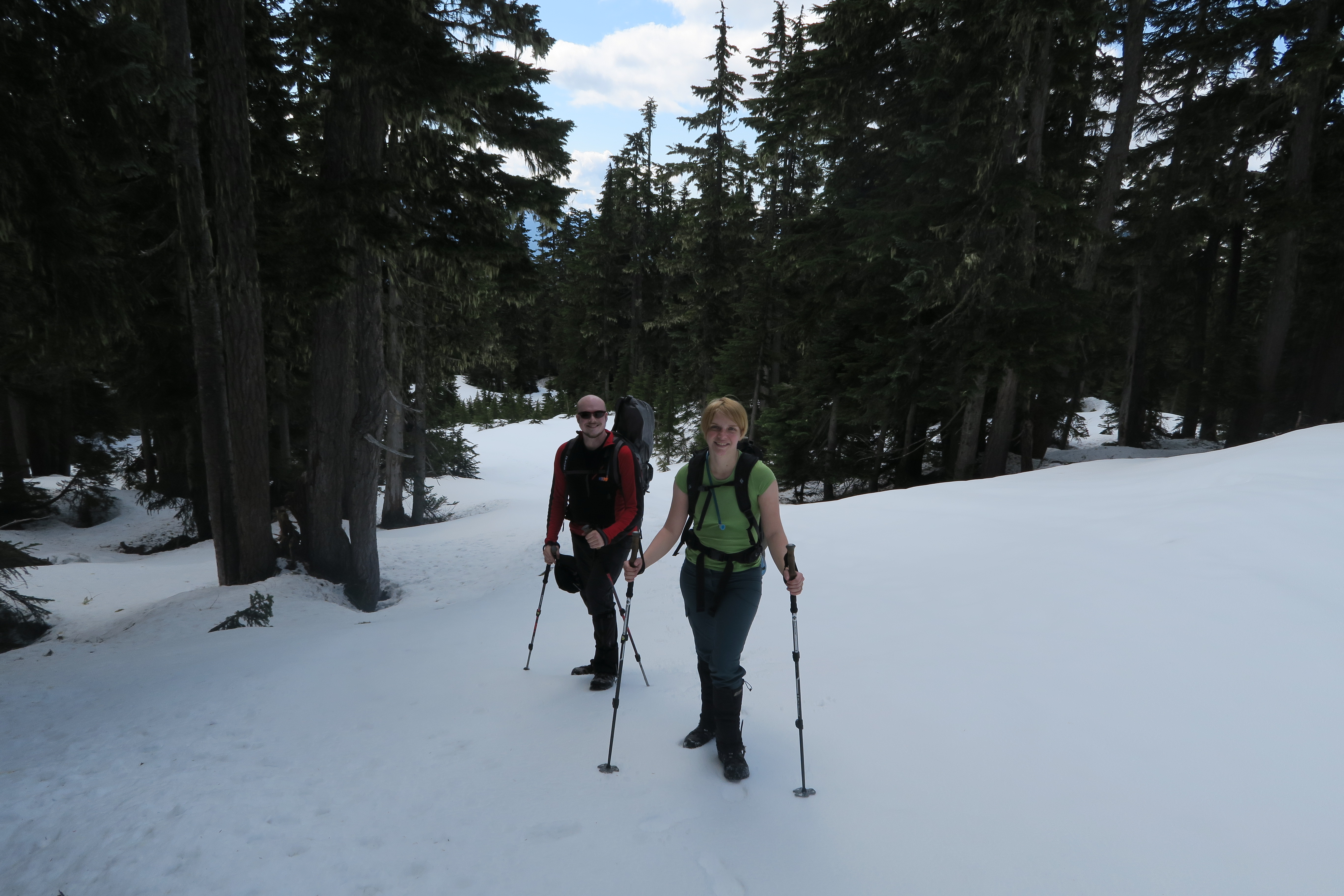
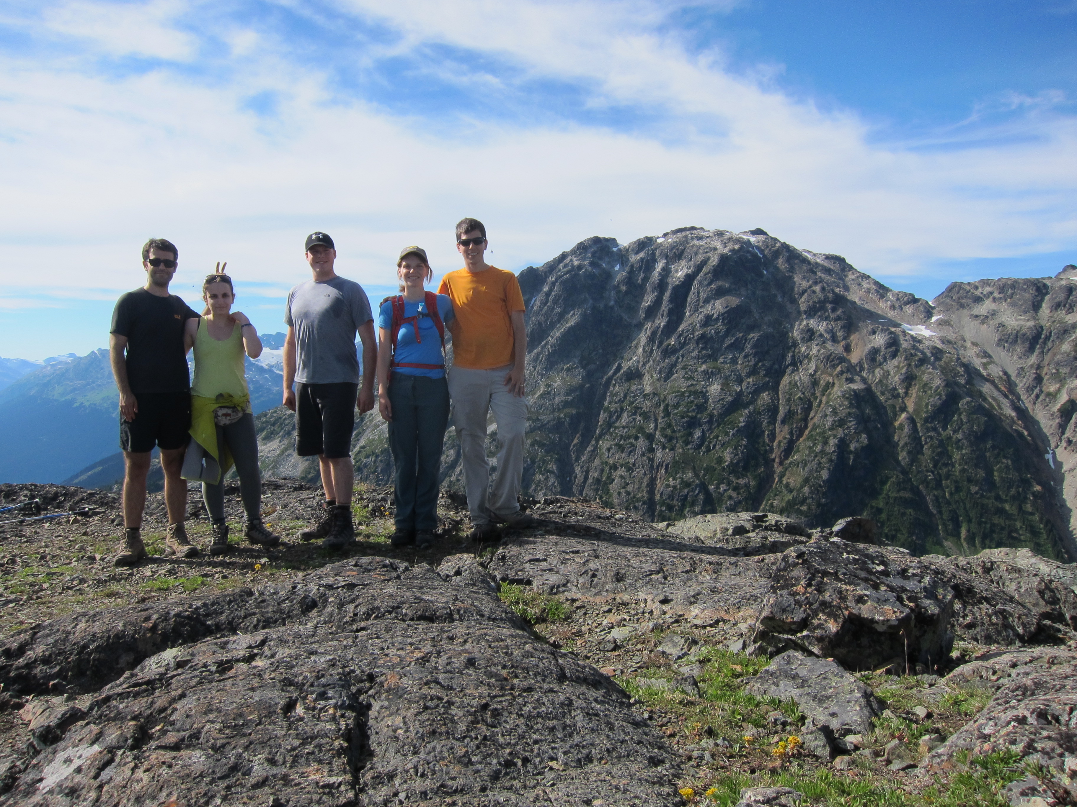
Participants: Geoff Mumford, Brittany Zenger, Ed Zenger, Geoff Zenger

Difficulty: 2 (with class 5 bush!)

Report: Coquitlam Mountain is a peak that you can see from much of the Lower Mainland, but is seldom climbed.  Why is that?  Could it be that an ascent requires over 2700m elevation gain?  The worst bushwhacking I’ve ever encountered with tricky routefinding?  Has to be timed just right for conditions to be any good?  Or all of the above?

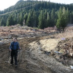
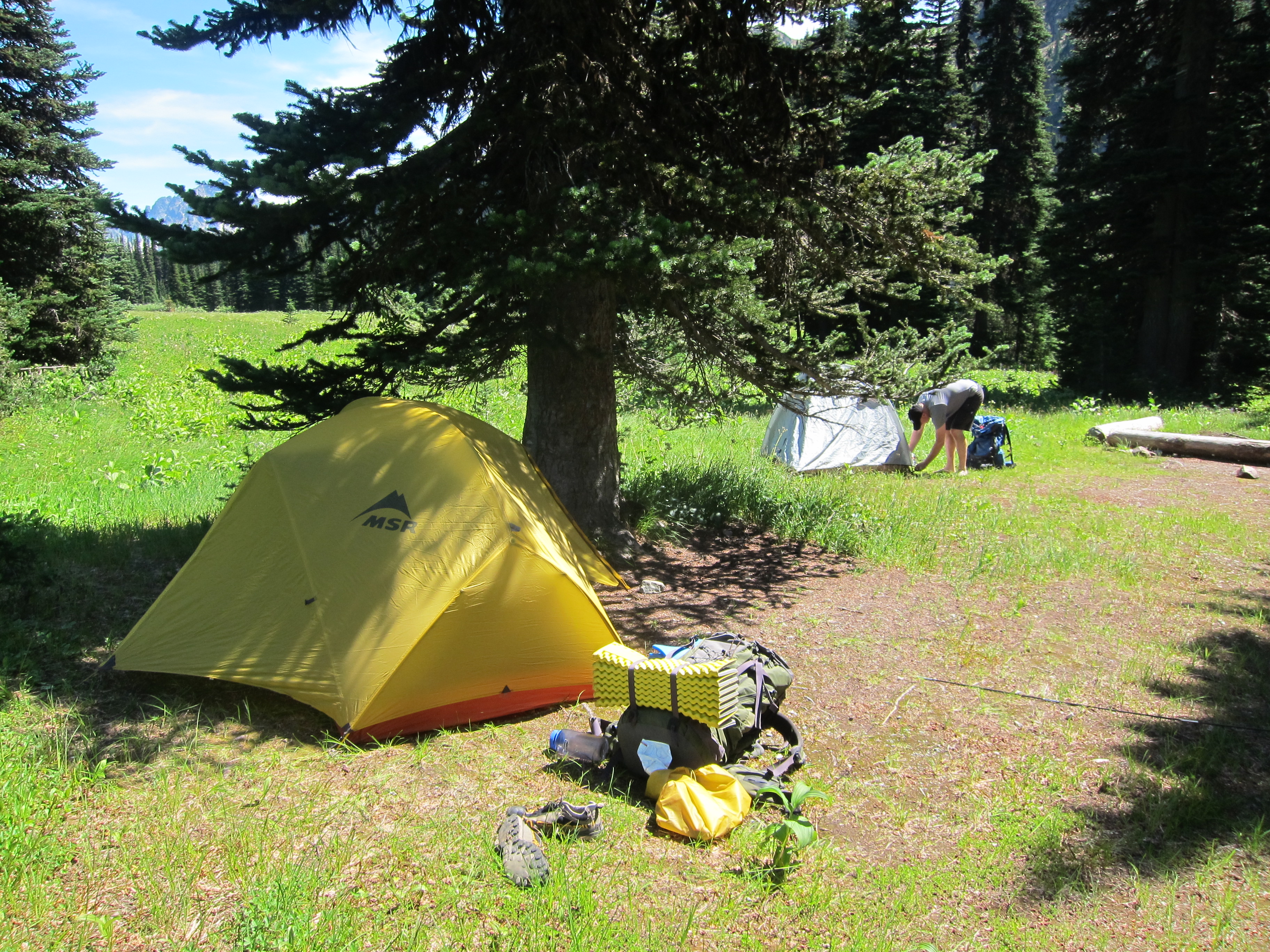
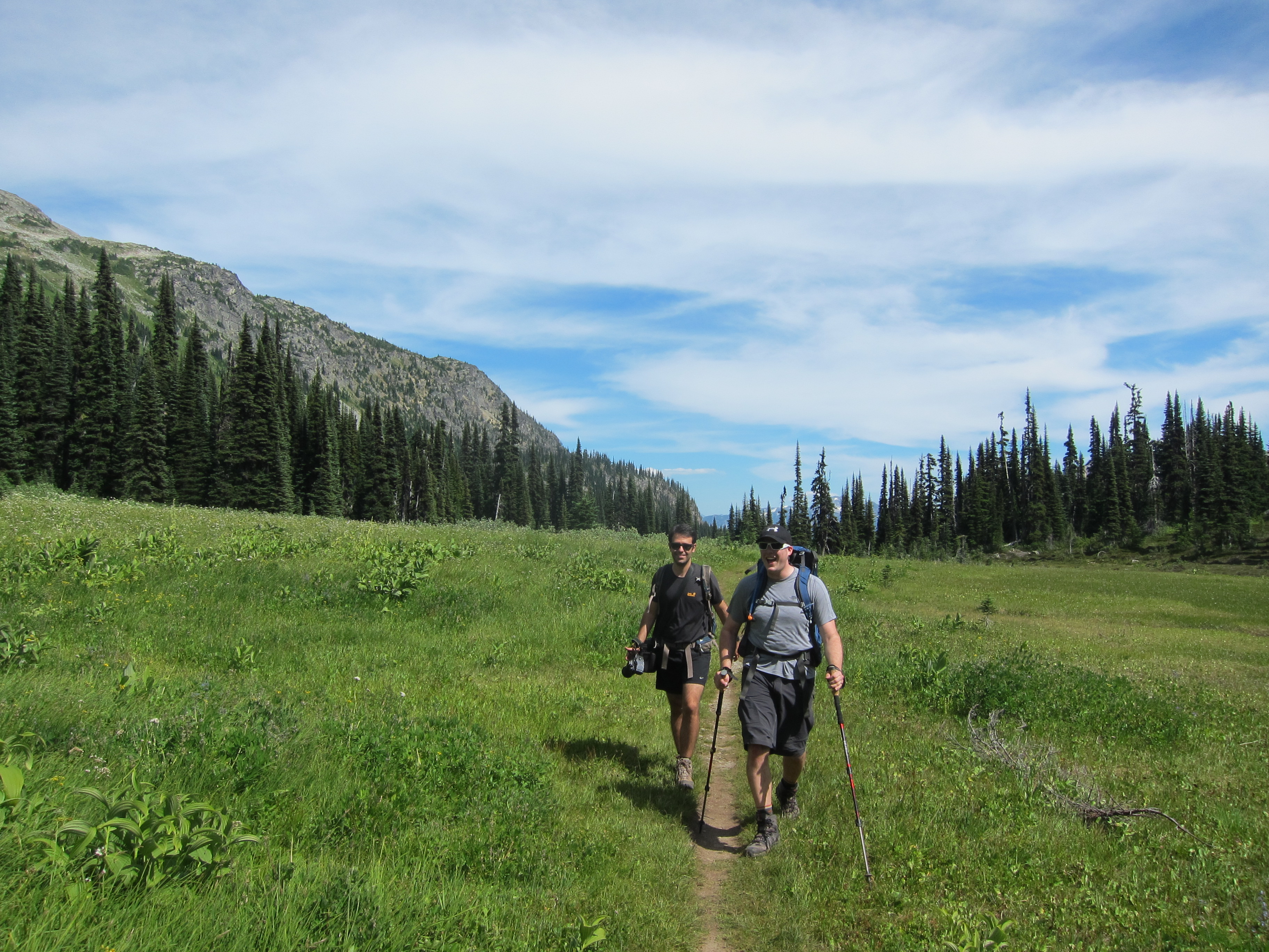
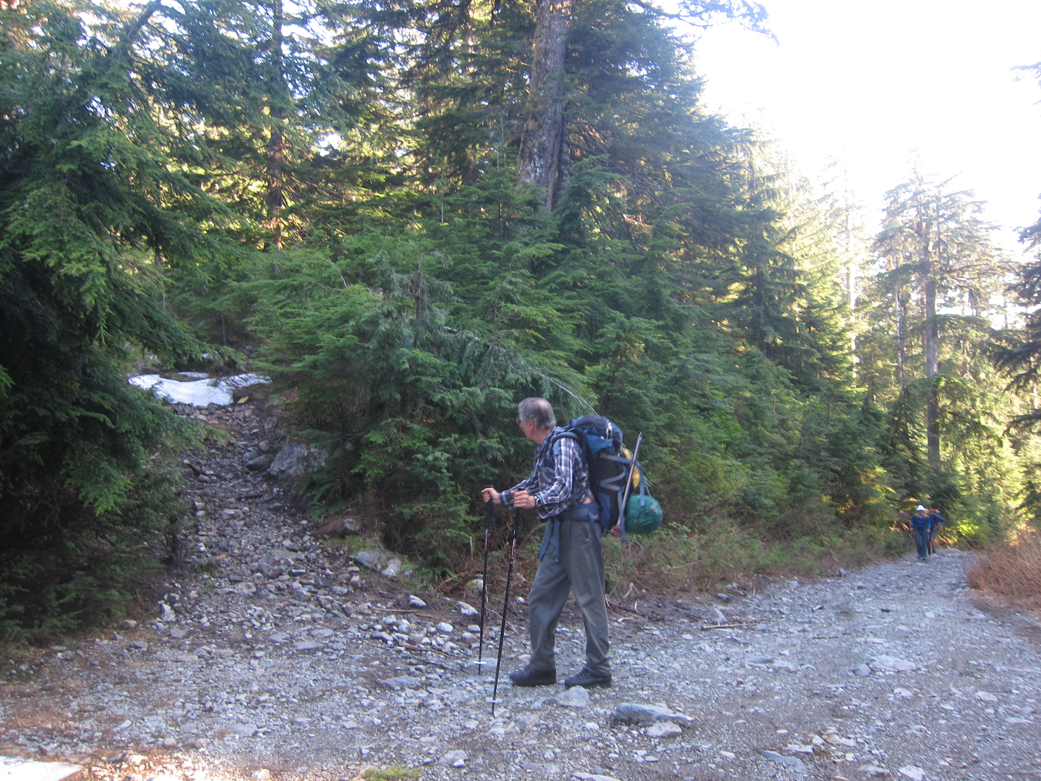
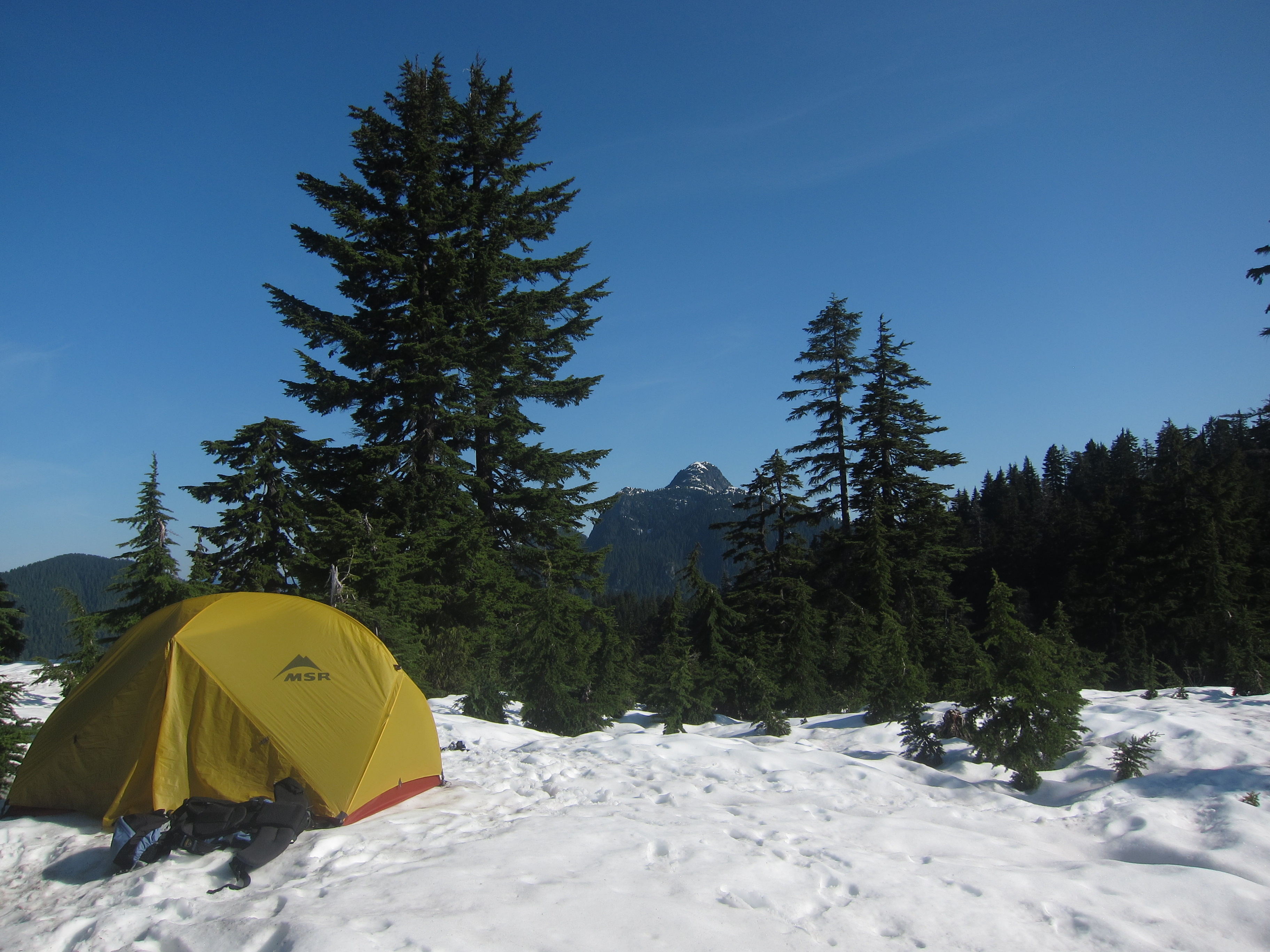
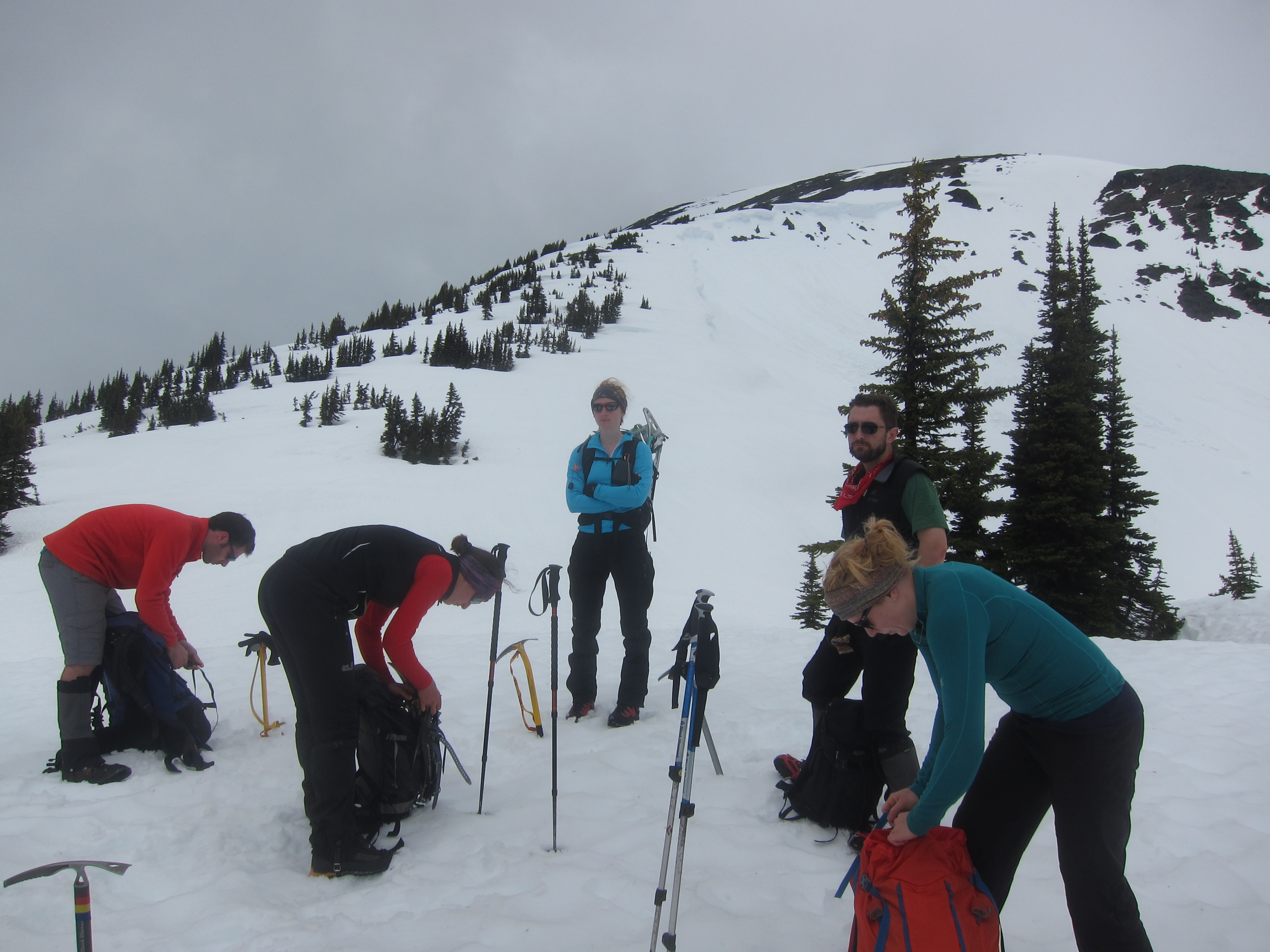
Aware that we’d be in for a long and strenuous trip, but unaware of just how long and difficult the trip would be, we met up late Friday afternoon and started the trudge up Burke Mountain around 5pm.  We had a bit of difficulty finding the right turnoff to take to find the Burke ridge trail and wasted about 15 minutes by turning off too early only to find ourselves at an old abandoned cabin and having to go back to the main road to find the correct trail higher up (see photo below for what the correct trail looks like).  Nonetheless, by a few minutes past 7 we had found the correct trail and headed up towards the ridge.  We first hit snow about 40 minutes from the start of the trail, and although in places the flagging was hard to follow, we persevered and just before 9 o’clock stopped to set up camp on a flat open section of ridge, perhaps 750m short of the summit of Burke.

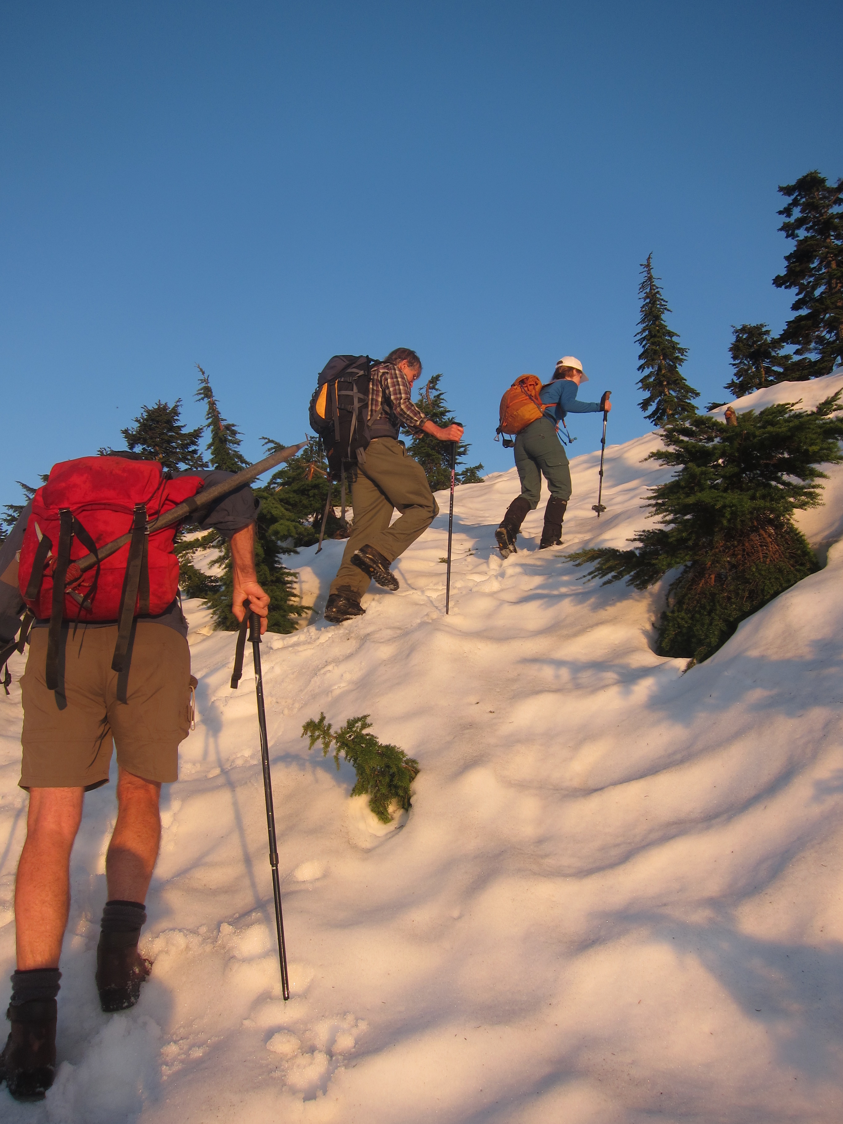
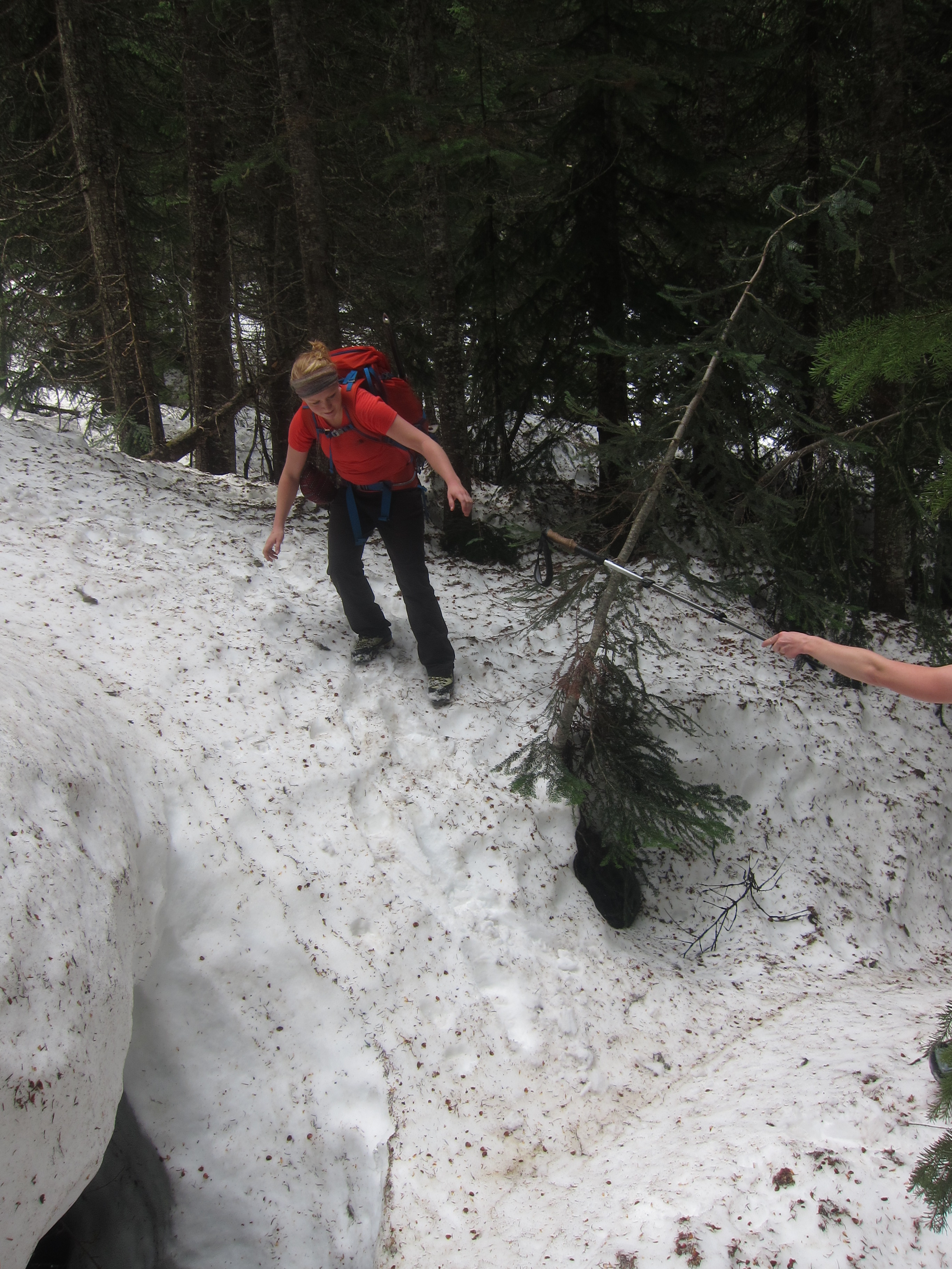
Saturday morning we woke up a bit past 6, had a slow breakfast, got our acts together, and started moving around 7:20, quickly reaching the summit of Burke.  From Burke summit it was fairly easy to descend a rib and then a gully to its left down to the creek in the basin down to the N/NW, bypassing a number of cliff bands on the way.  We were lucky to hit the creek right where a large log crossed it, and we were soon across and making our way up to the low point in the ridge above (this appears as the col just below 1000m according to the topo map).  Up to here there hadn’t been much bush, and the going fairly easy, but from here we made a routefinding blunder and decided to descend straight through the old clearcut down towards Or Creek.  The top hundred metres or so had some snow and were no problem, but below was the worst bush I’ve encountered.  No joke: the worst.  Devil’s club, devil’s club, other small prickly bushes, and more devil’s club.  It would’ve been much smarter to traverse right until we hit mature forest and to descend through it down to the road below (we would later ascend via this route).  Nonetheless, we eventually made it down to an old logging road at about 11:15, perhaps 100m upstream from where an old bridge used to cross Or Creek, and sat down for lunch.

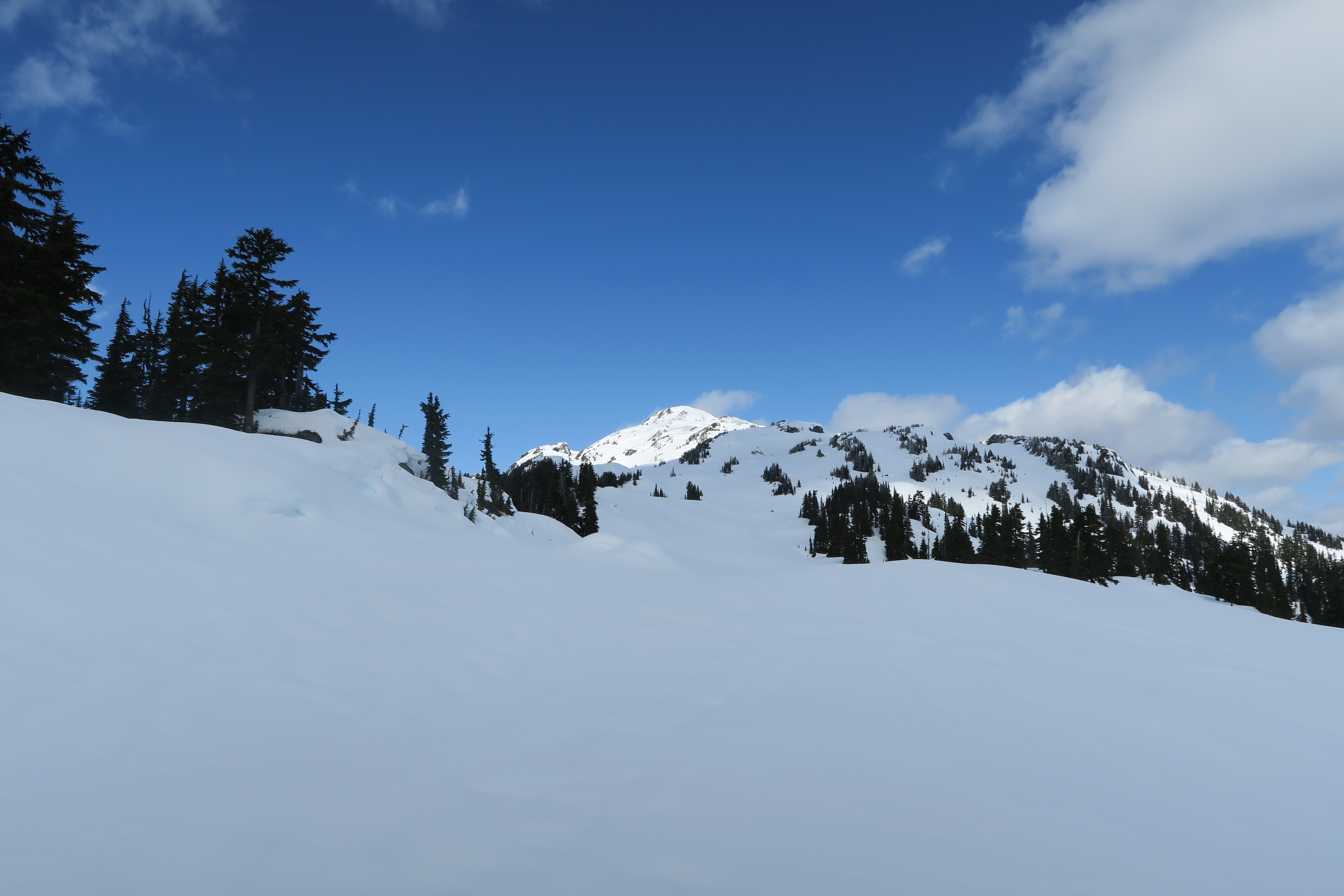
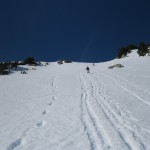
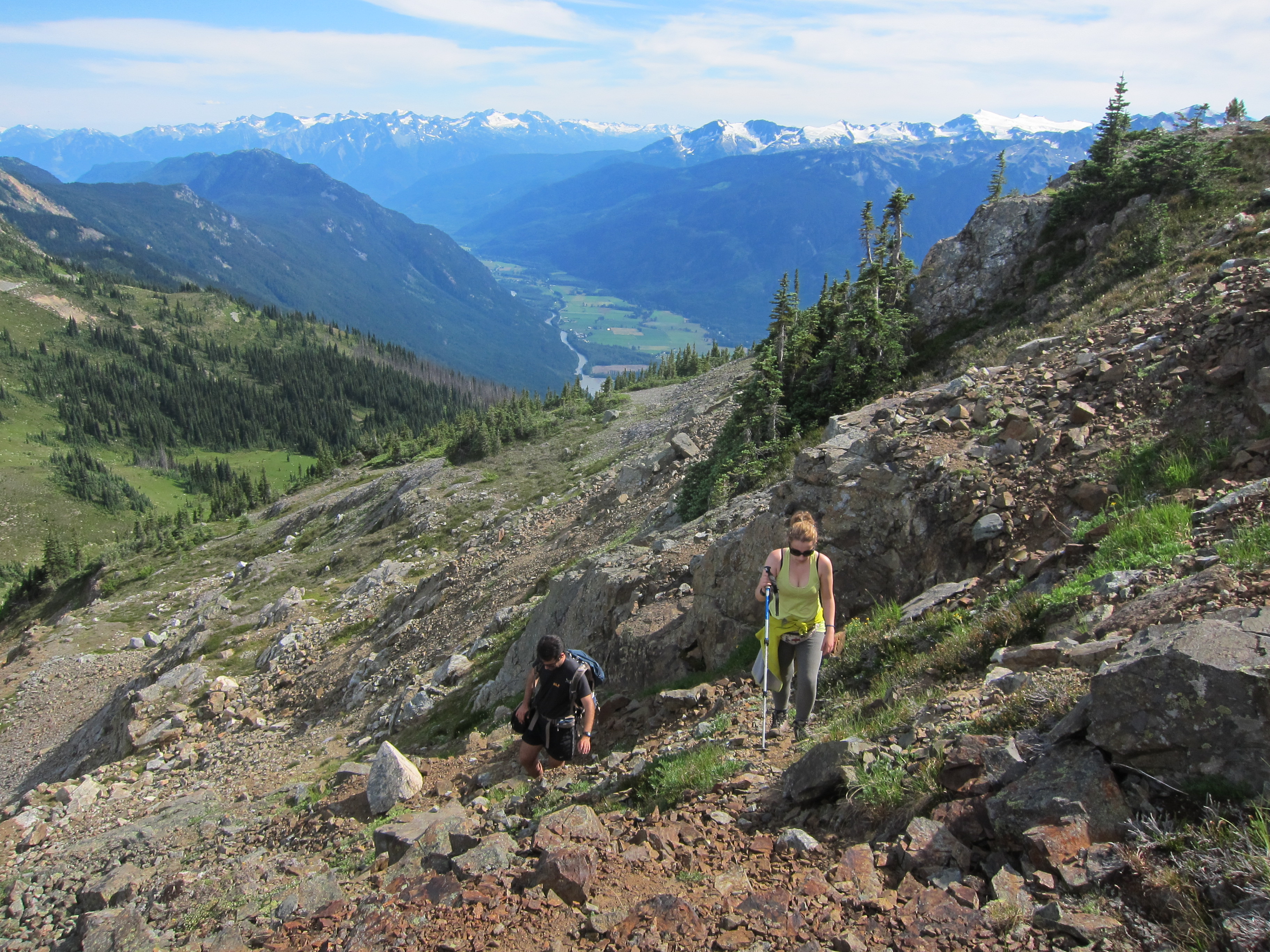
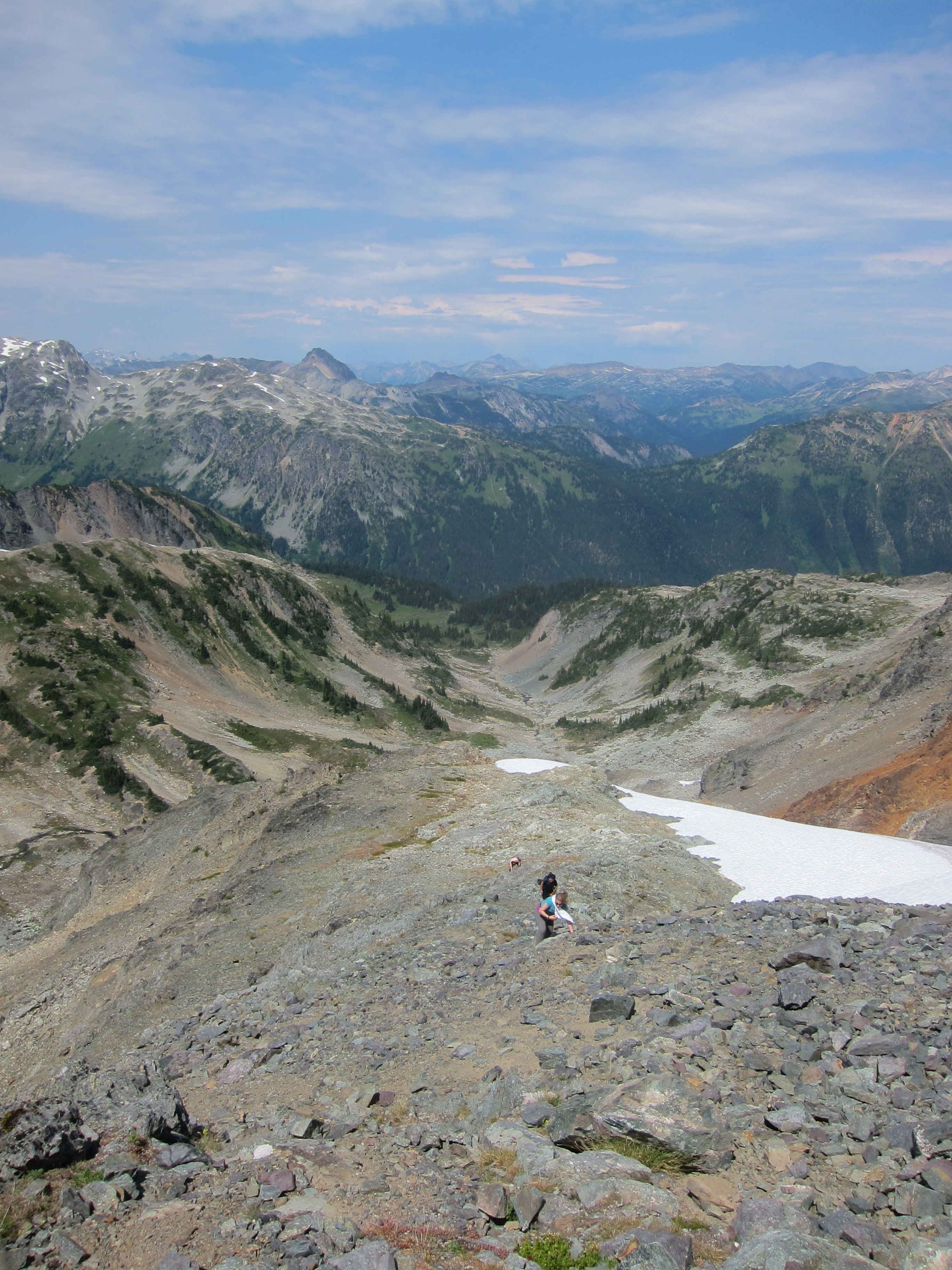
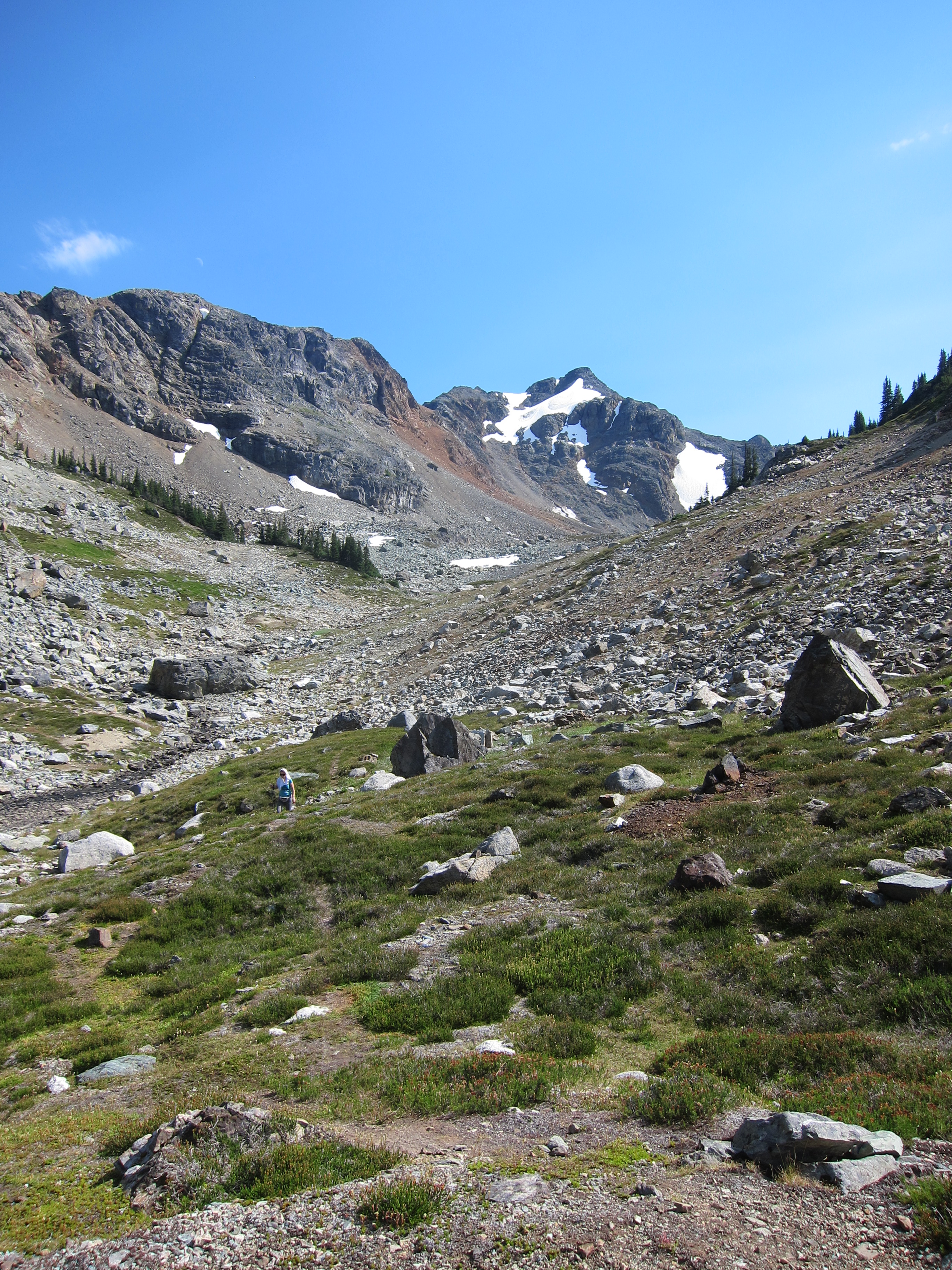
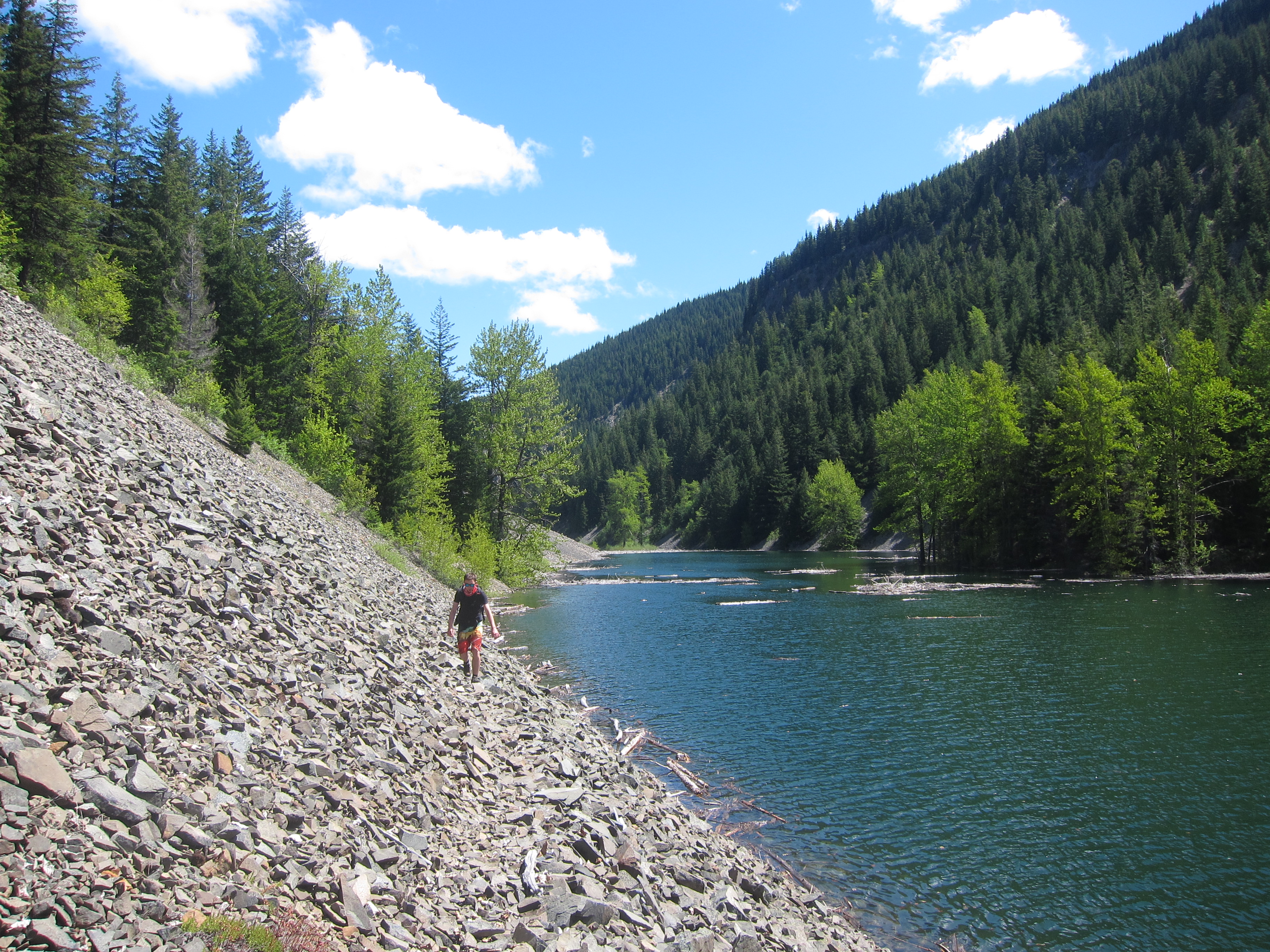
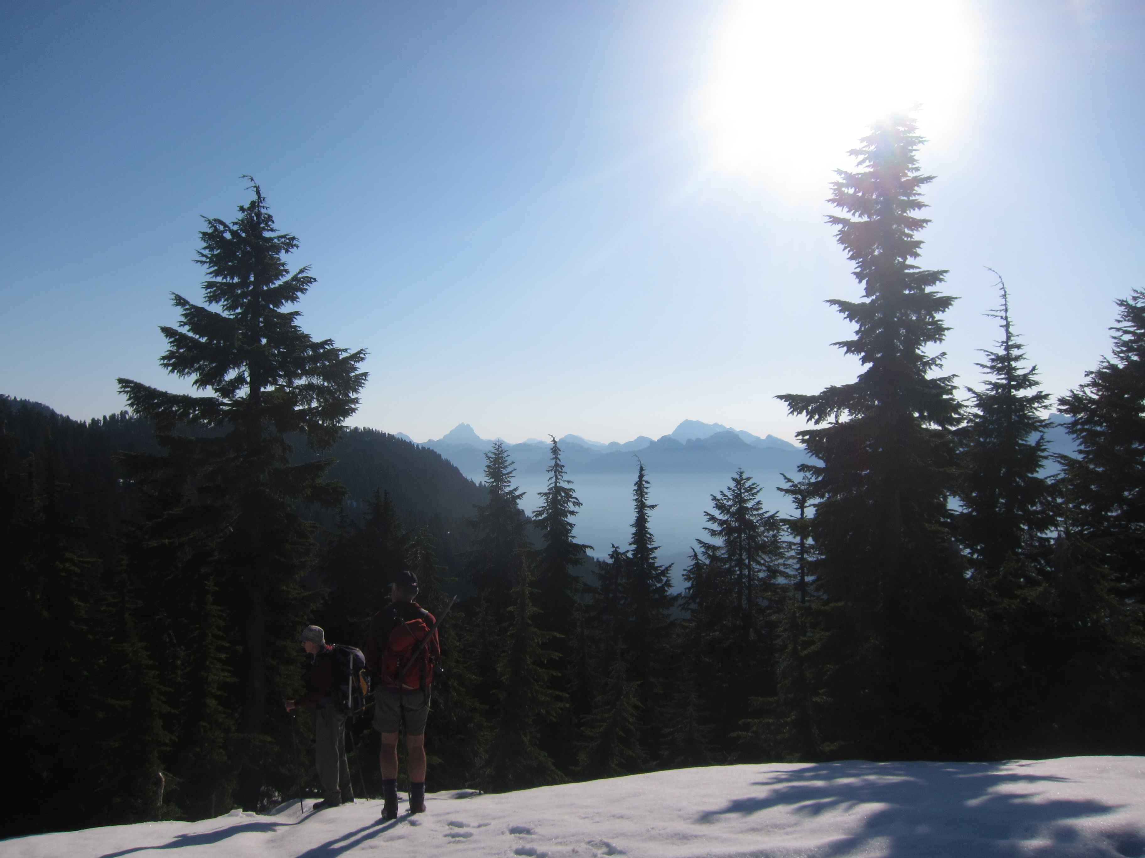
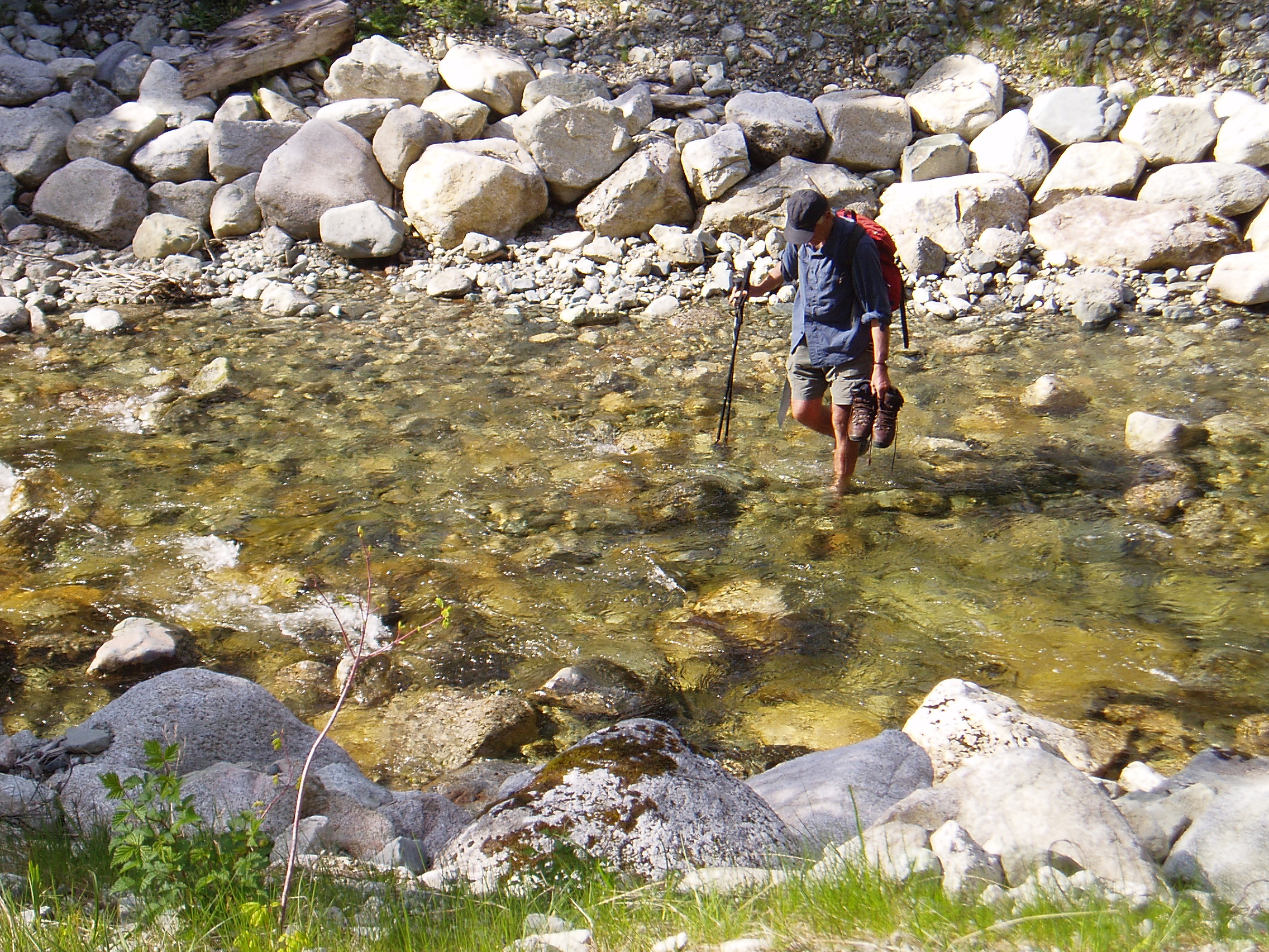
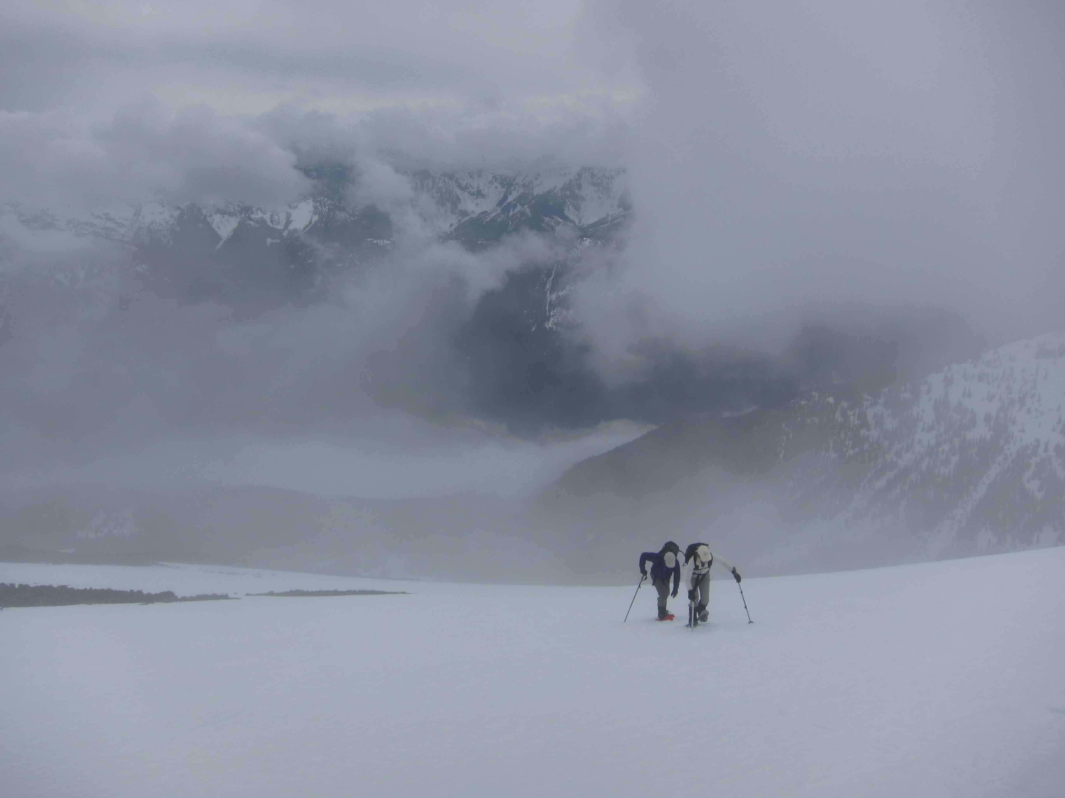
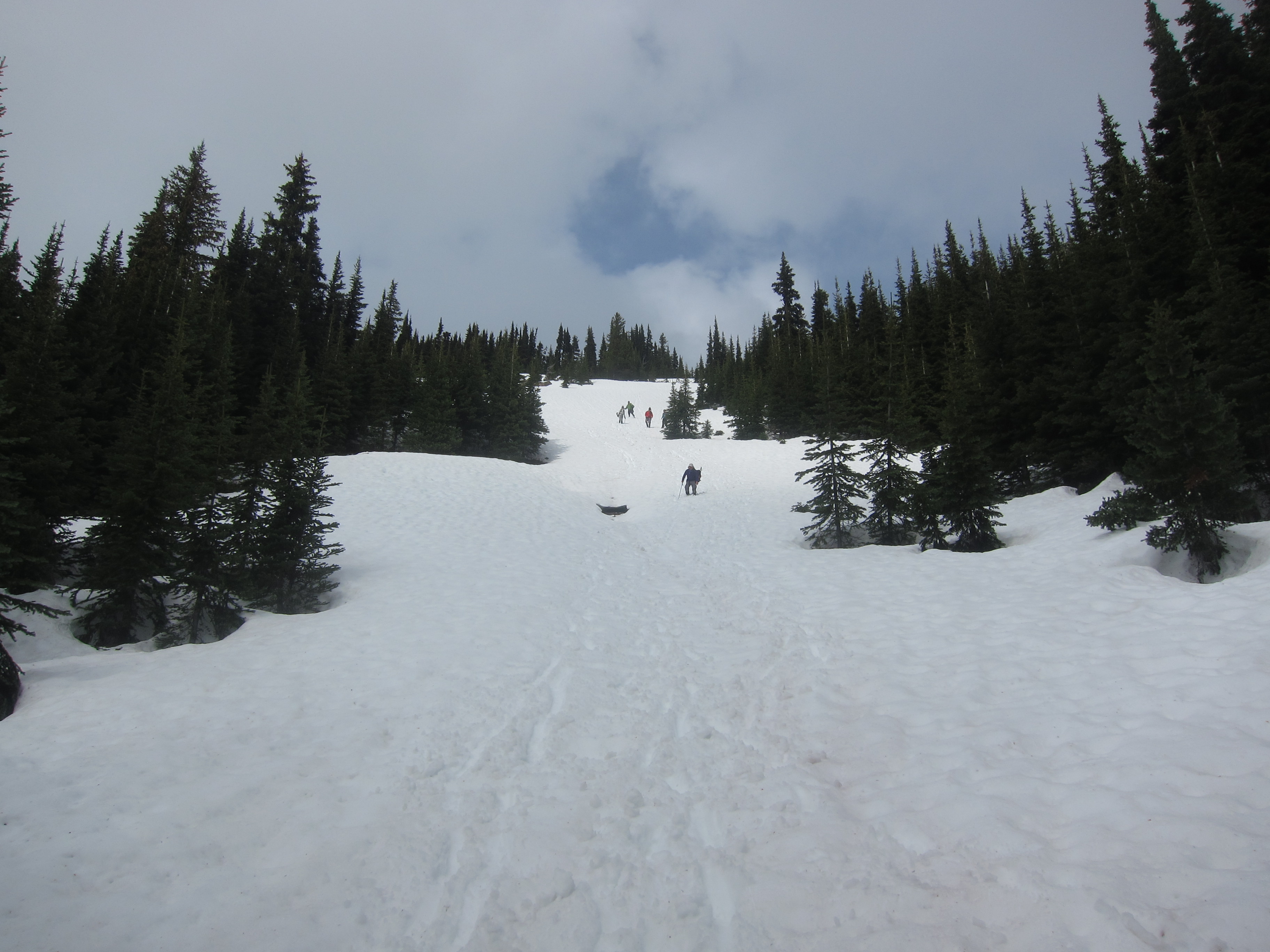
At this point we realized we were travelling significantly slower than expected, largely due to there being much less snow than expected, and soon got moving.  We quickly transitioned into our water shoes and waded across Or Creek (never more than shin deep, also Geoff M found a log across somewhere downstream to avoid wading), and travelled up the old Or Creek road to its headwaters below Coquitlam Mountain and Widgeon Peak.  By the end of the road, it was clear that there was going to be a lot more devil’s club to go through to reach the mature forest and/or snow on the ridge and Brittany wisely elected to stay put and sleep rather than wade through more bush.  Starting around noon, we headed diagonally upwards to the ridge (it would be better to stay low and traverse horizontally to the mature forest as quickly as possible), up the ridge to the left of the main creek, until it reached a large open basin to the right, and traversed left to avoid a cliff band and continue up the ridge.   It took us well over an hour to ascend the roughly 200m until we finally hit snow.  In a good snow year this would’ve taken perhaps 20 minutes.  Note that at one point someone flagged a good route up the ridge to the alpine, but the flagging has largely disintegrated and is useful only to the extent that when it is occasionally seen it can be used to affirm your routefinding decisions to that point.

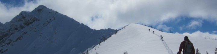
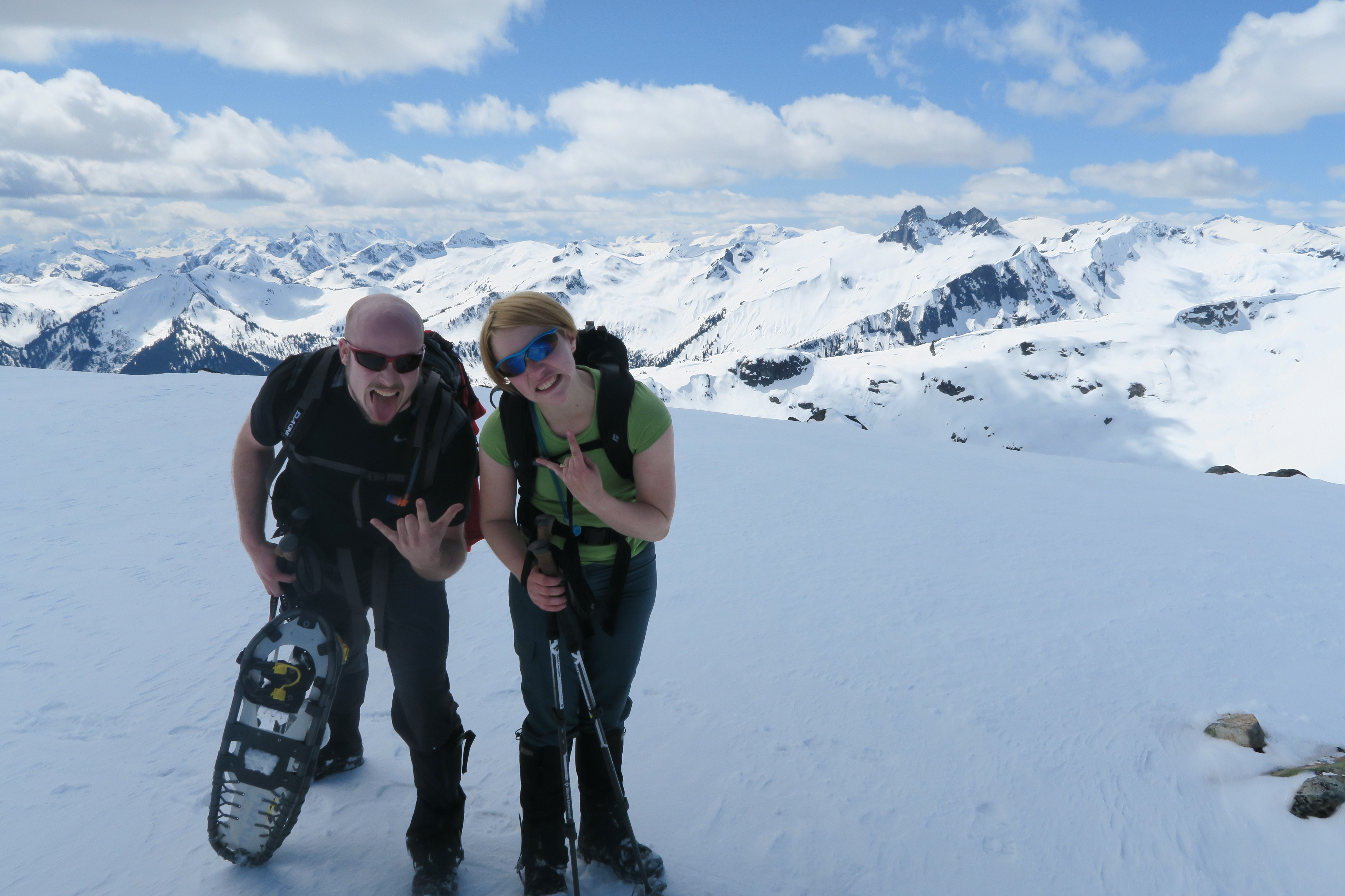
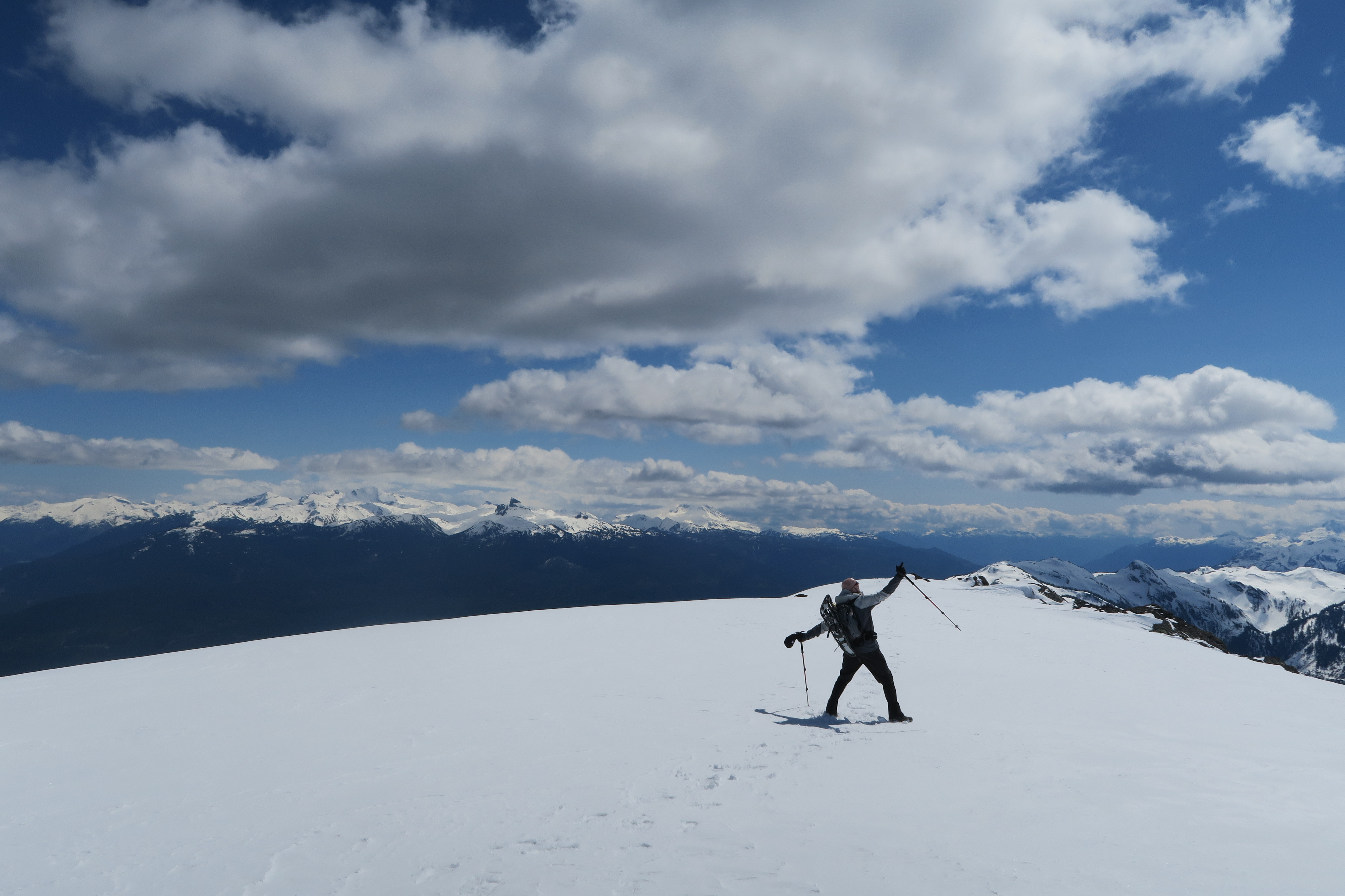
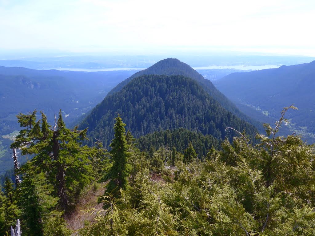
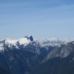
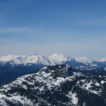
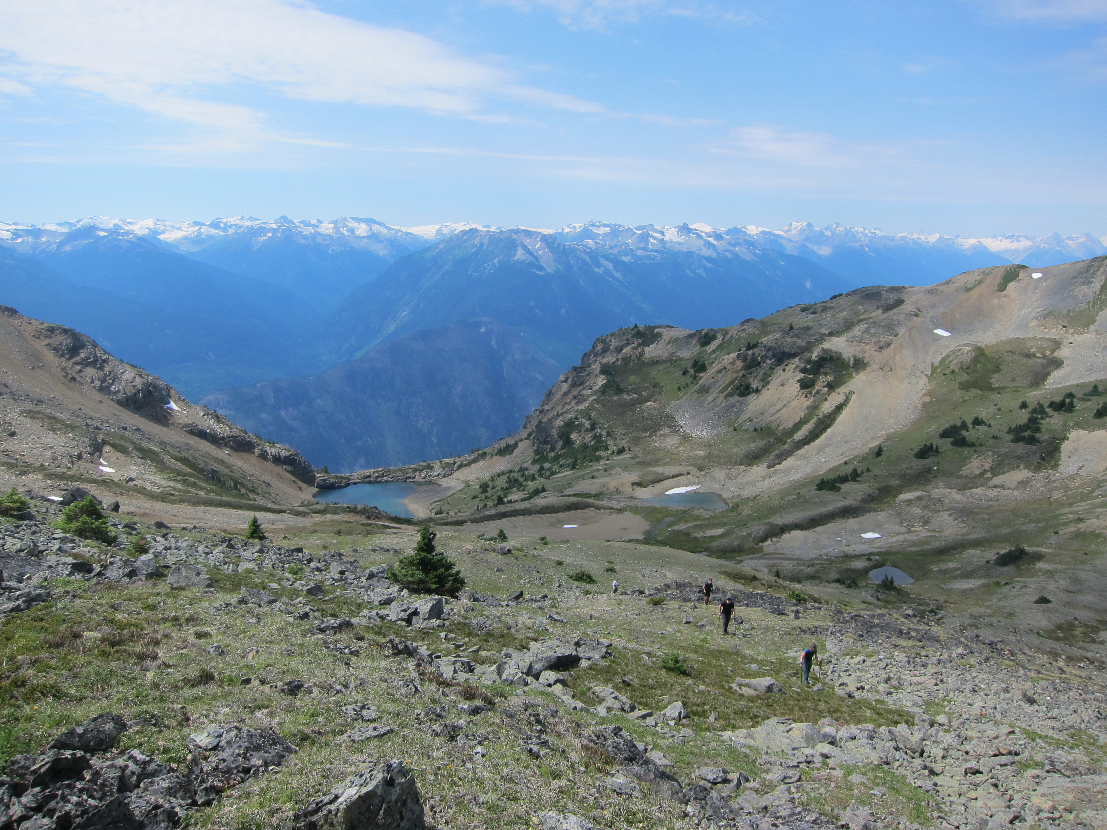
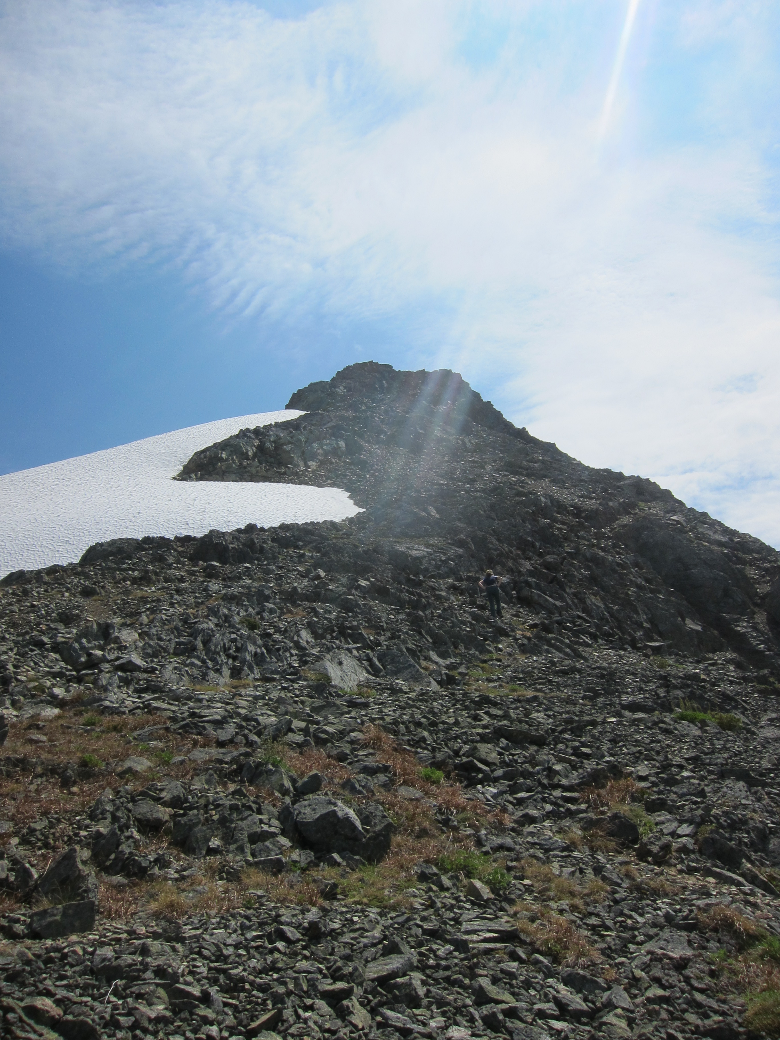
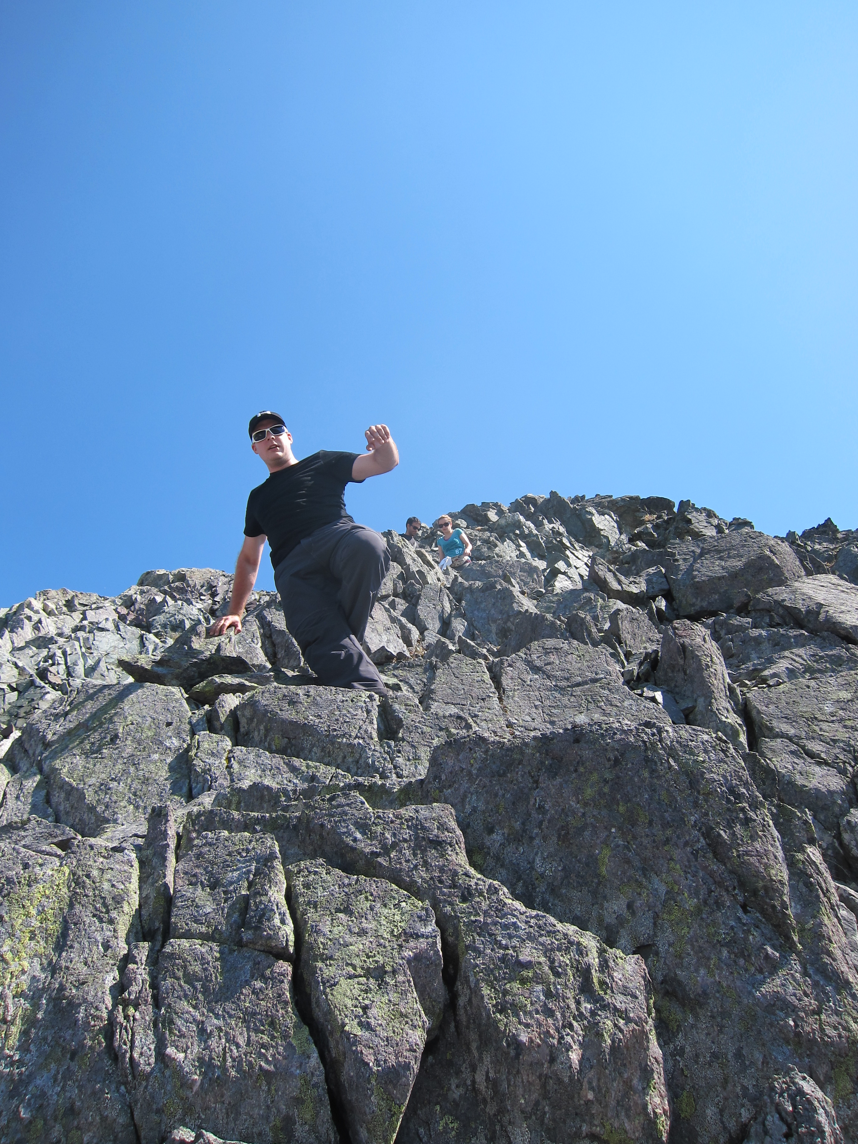
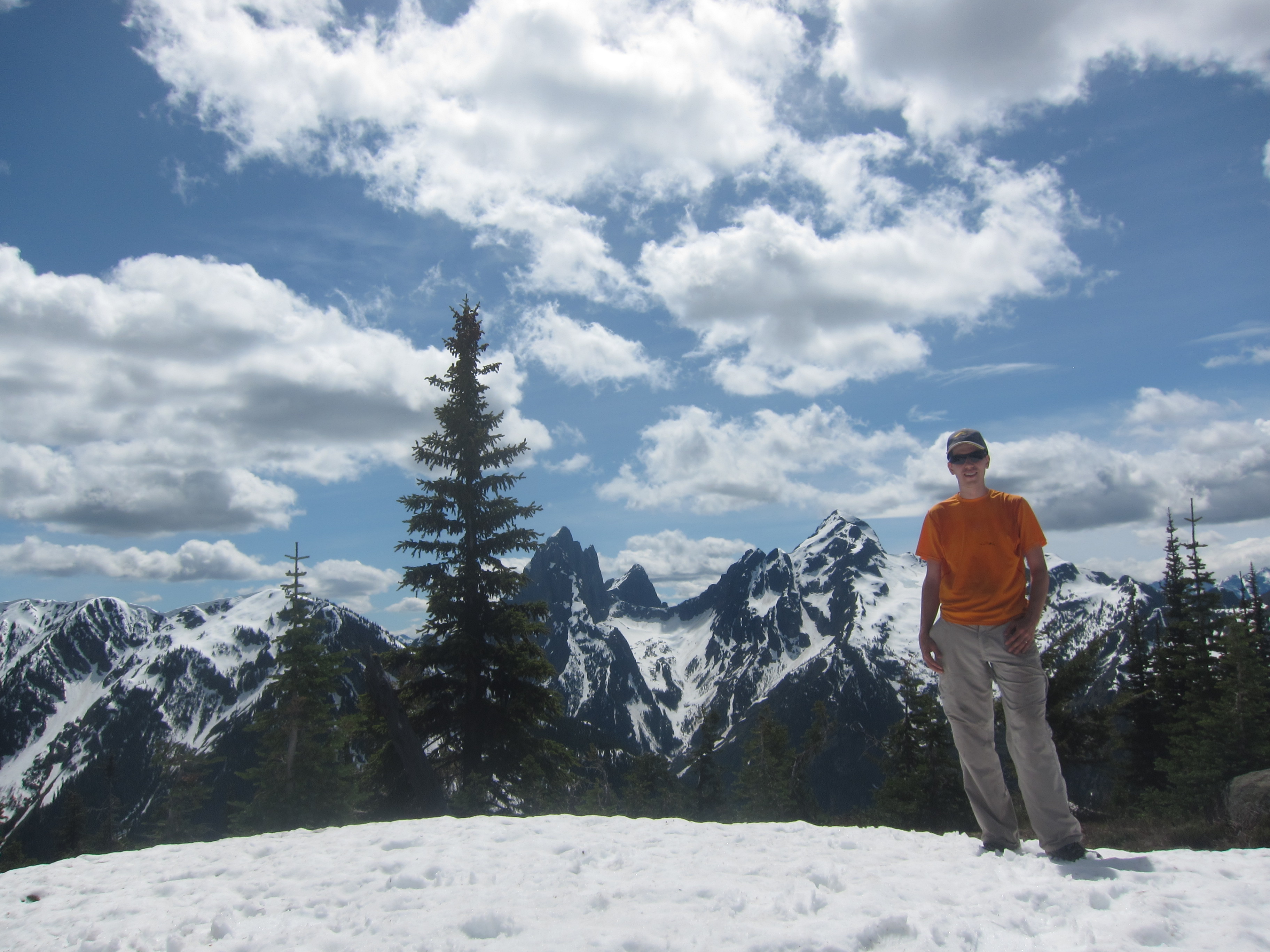
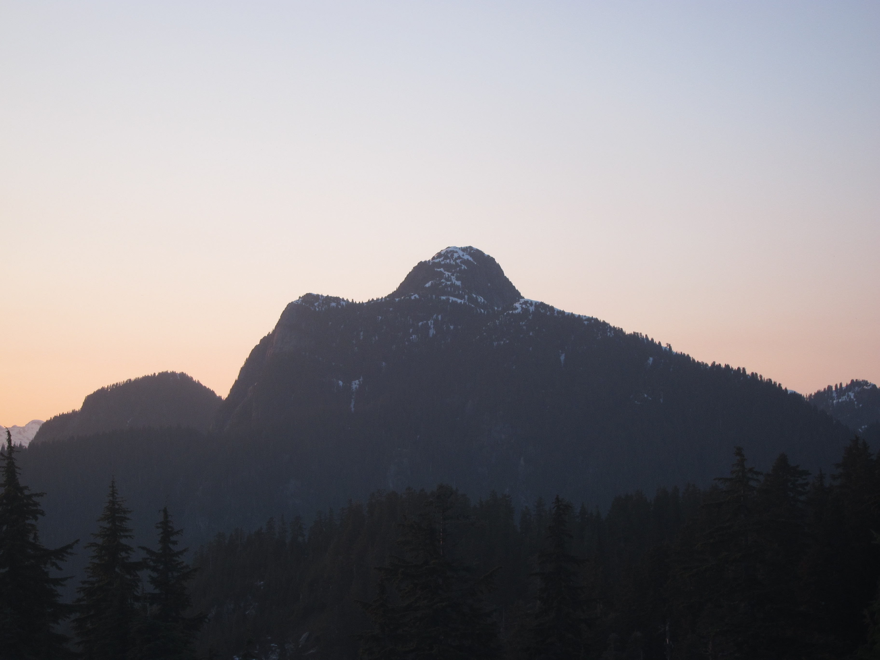
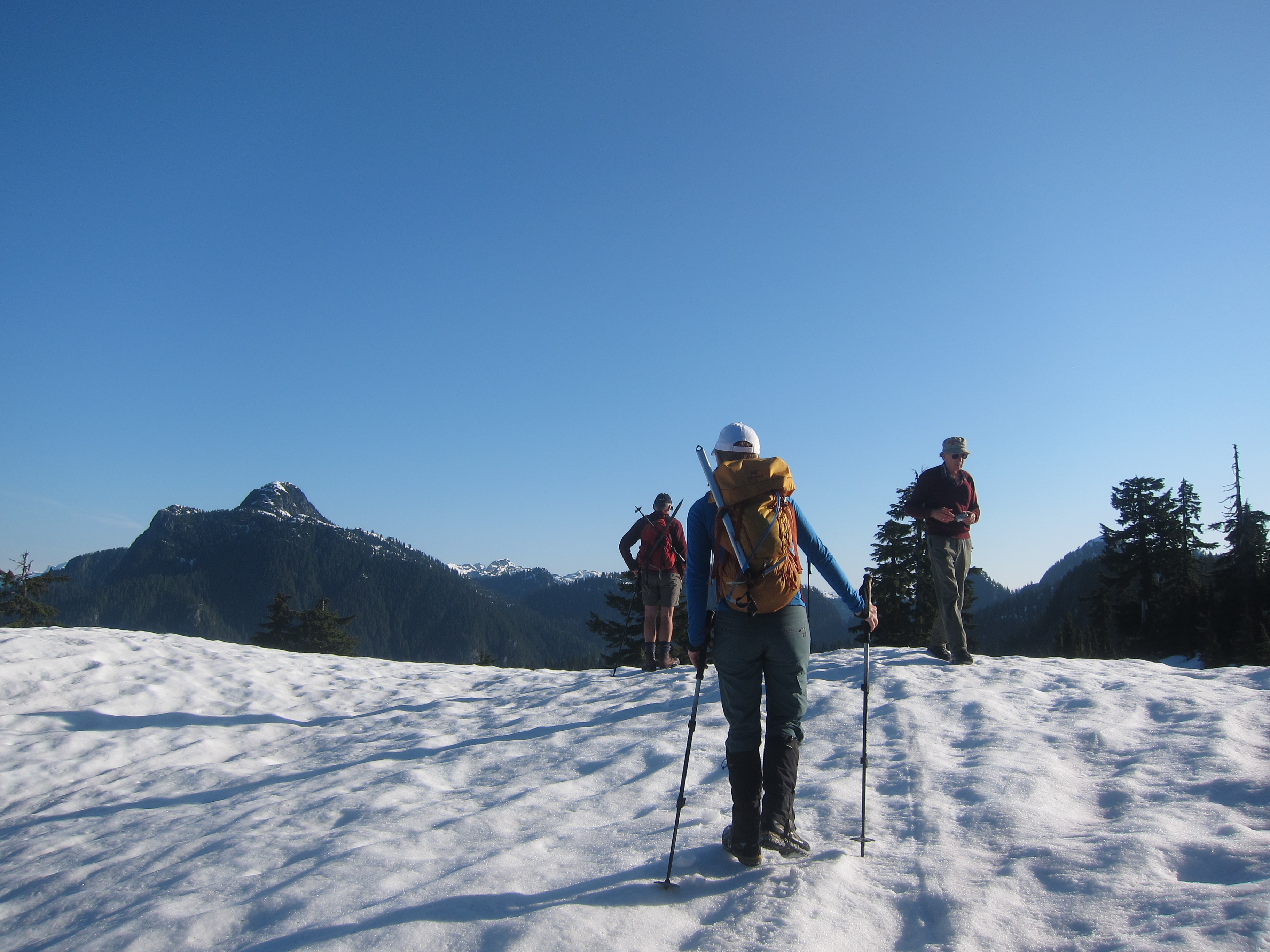
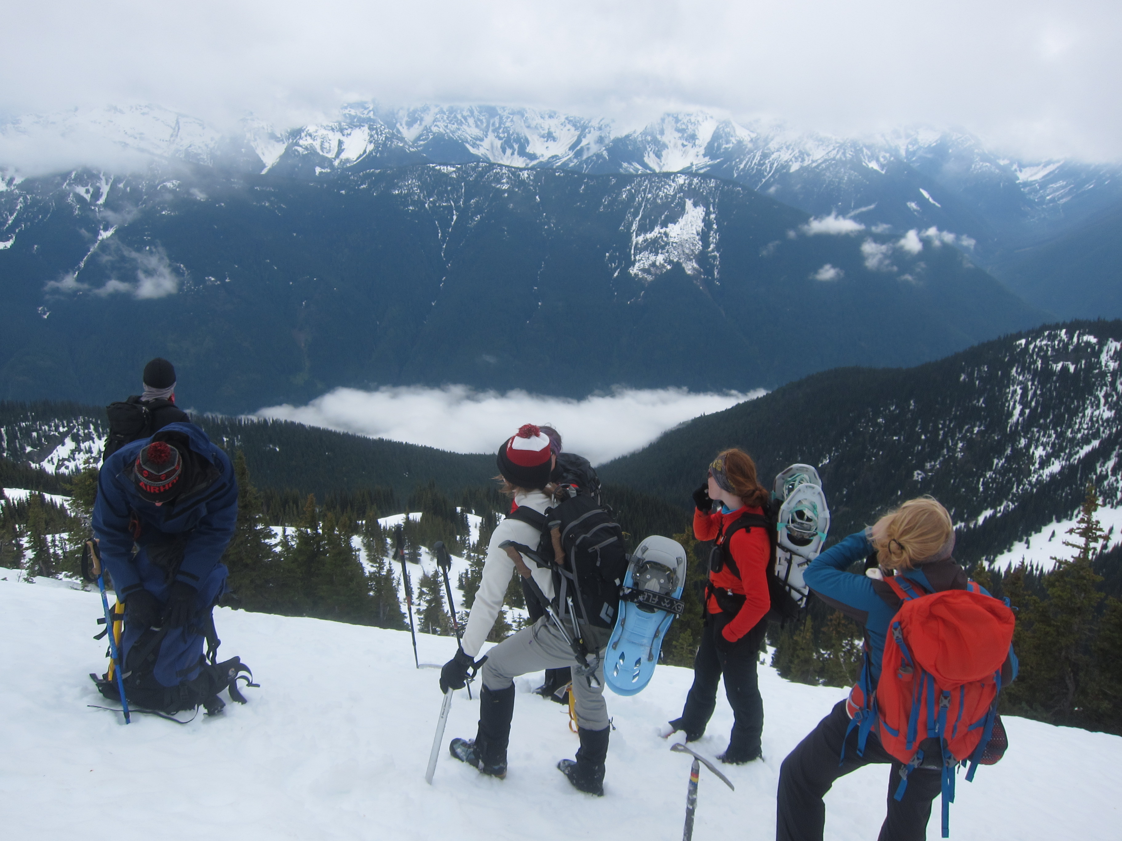
From where we hit snow to the summit was quick and straightforward, and we finally reached the summit at 2:20pm.  7 hours from leaving camp.  The views from the summit were much better than I anticipated, as Coquitlam Mountain is actually quite prominent.  There are great views of Judge Howay, Robbie Reid, the Five Fingers area, Golden Ears, and the Lower Mainland!  Unfortunately, we realized we had a long ways back to camp and didn’t wait long on the summit.  Luckily, descending on snow is quick, and we made it back to the end of the Or Creek road by 4pm.  It’s really too bad that there’s no vehicle access up Or Creek because if you could convince someone to let you drive up there, from where the bridge is out to the summit and back would be an excellent 4 to 5 hour long round trip hike if done early season on snow or if someone brushed out a route through the bush.

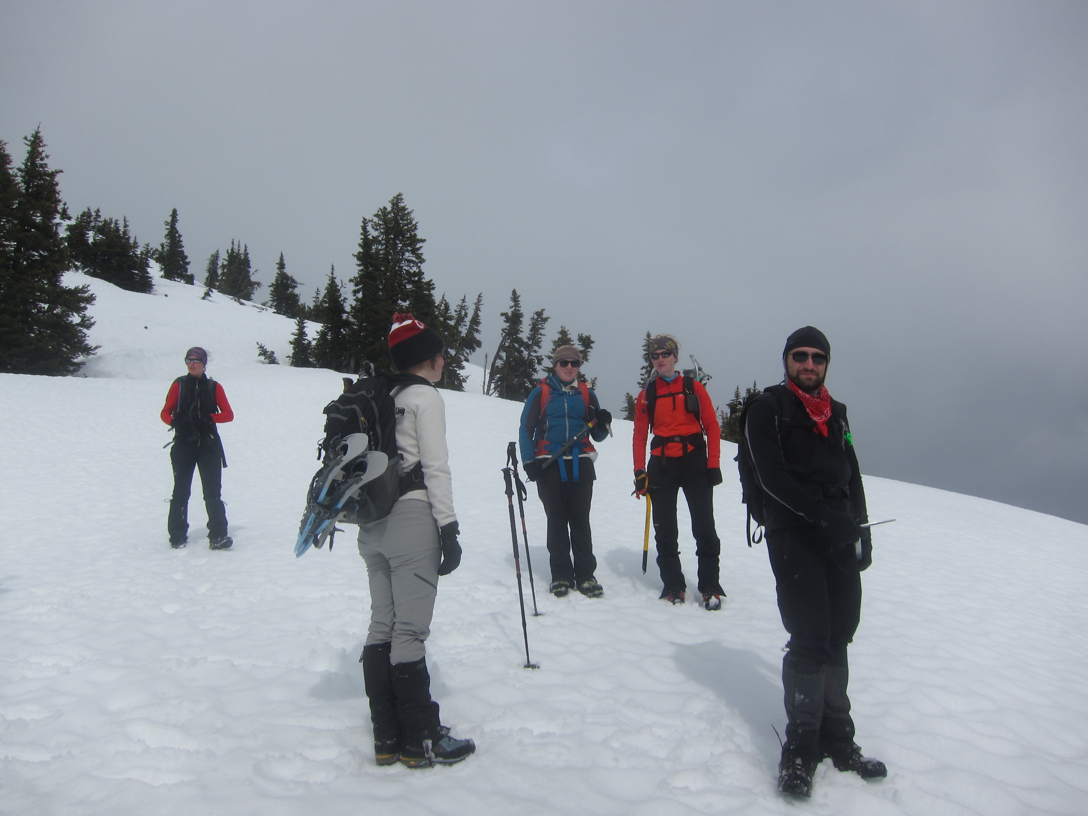
With our learning in hand from the mistakes made on the approach to the mountain, the return to camp was slow, but slightly less bushy than our trek in the other direction.  We ascended through the trees climber’s left of the clearcut back to the intermediate ridge between Or Creek and Burke Summit, reaching the ridge approximately 60m higher than necessary, but with significantly fewer scratches than we would’ve otherwise incurred.  From here it was a bushy descent down to the basin below Burke, and a long slog back up again.  We finally reached Burke summit again around 8:30 where we ran into some other campers who were surprised to see us appear up the ridge so late in the day, and after a brief chat with them finally made it back to camp at 9.  What a long day!  Between 1700m and 1800m elevation gain (on the day),  a good amount of cross country travel, and by far the worst bush I’ve ever encountered.  I was exhausted and had little appetite so after a bit of soup went straight to sleep.

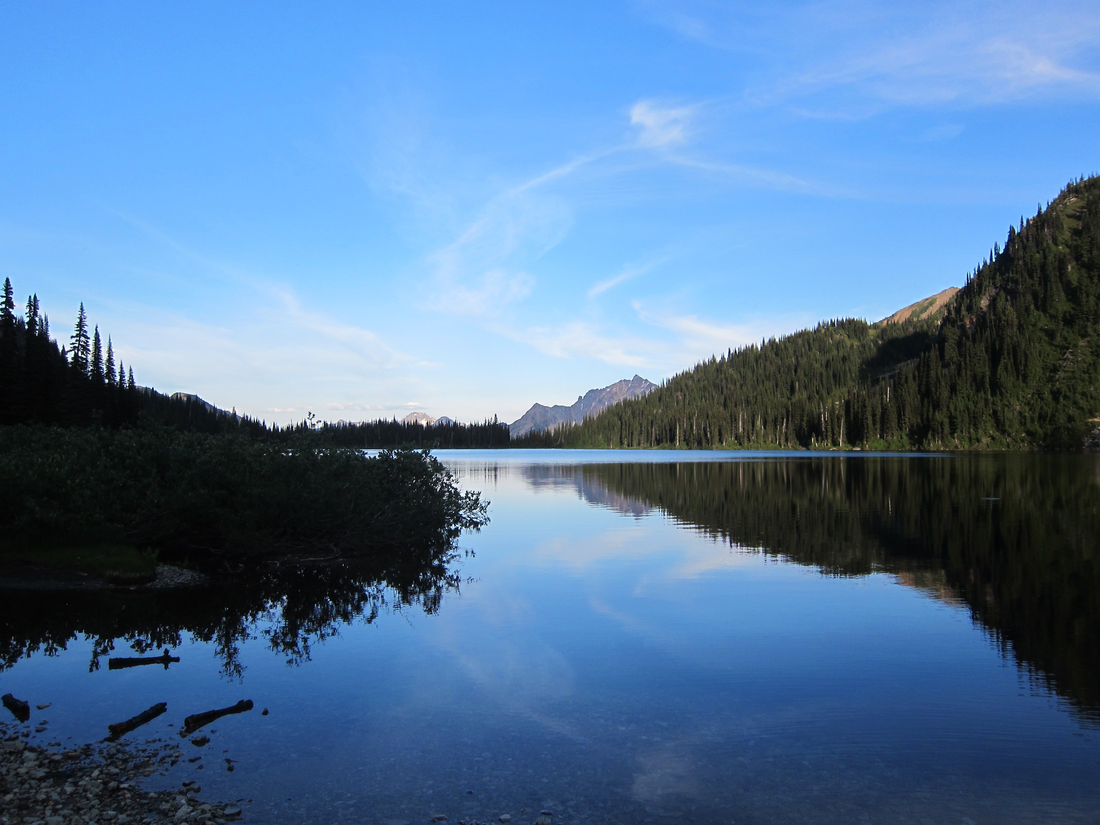
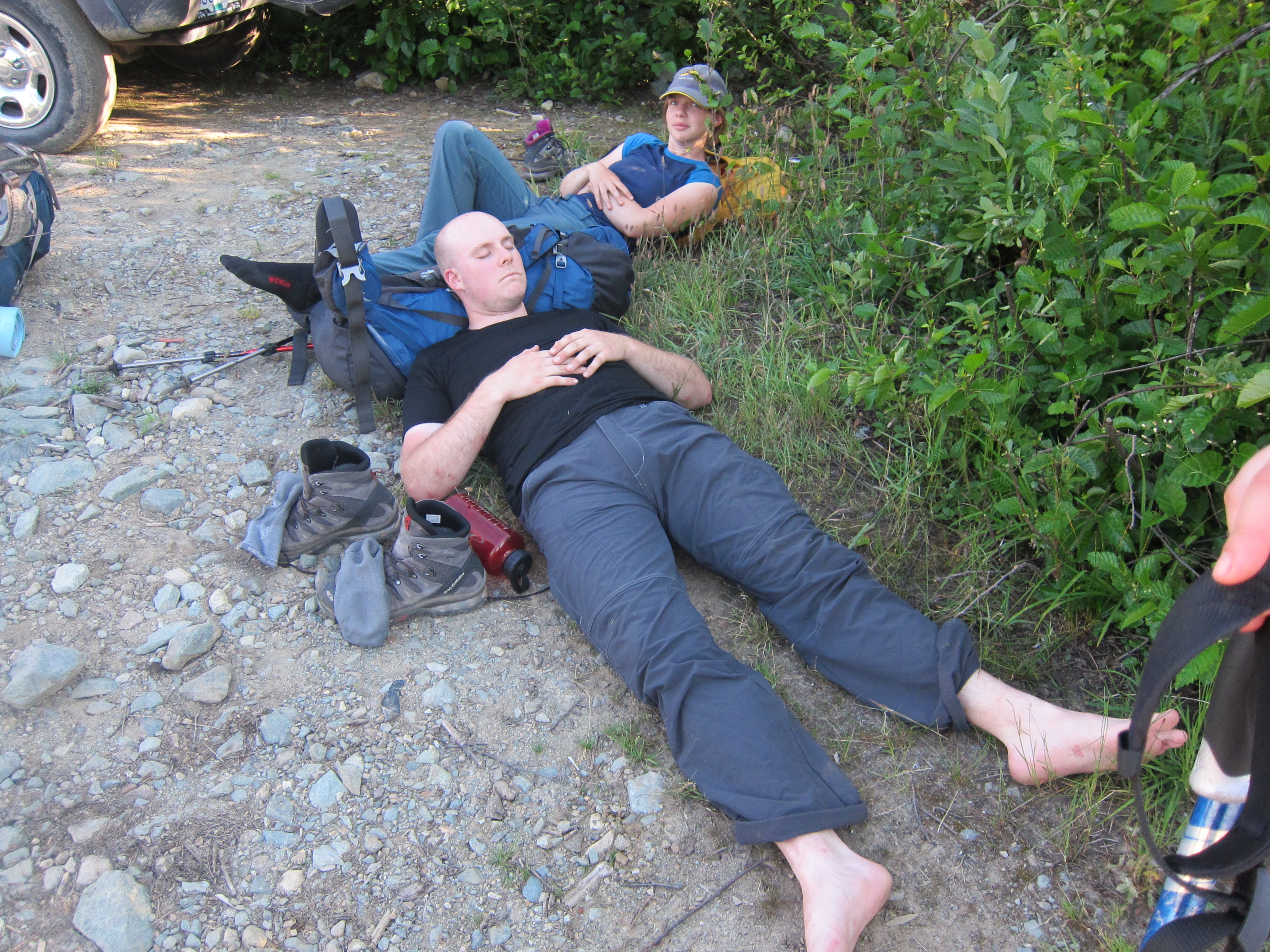
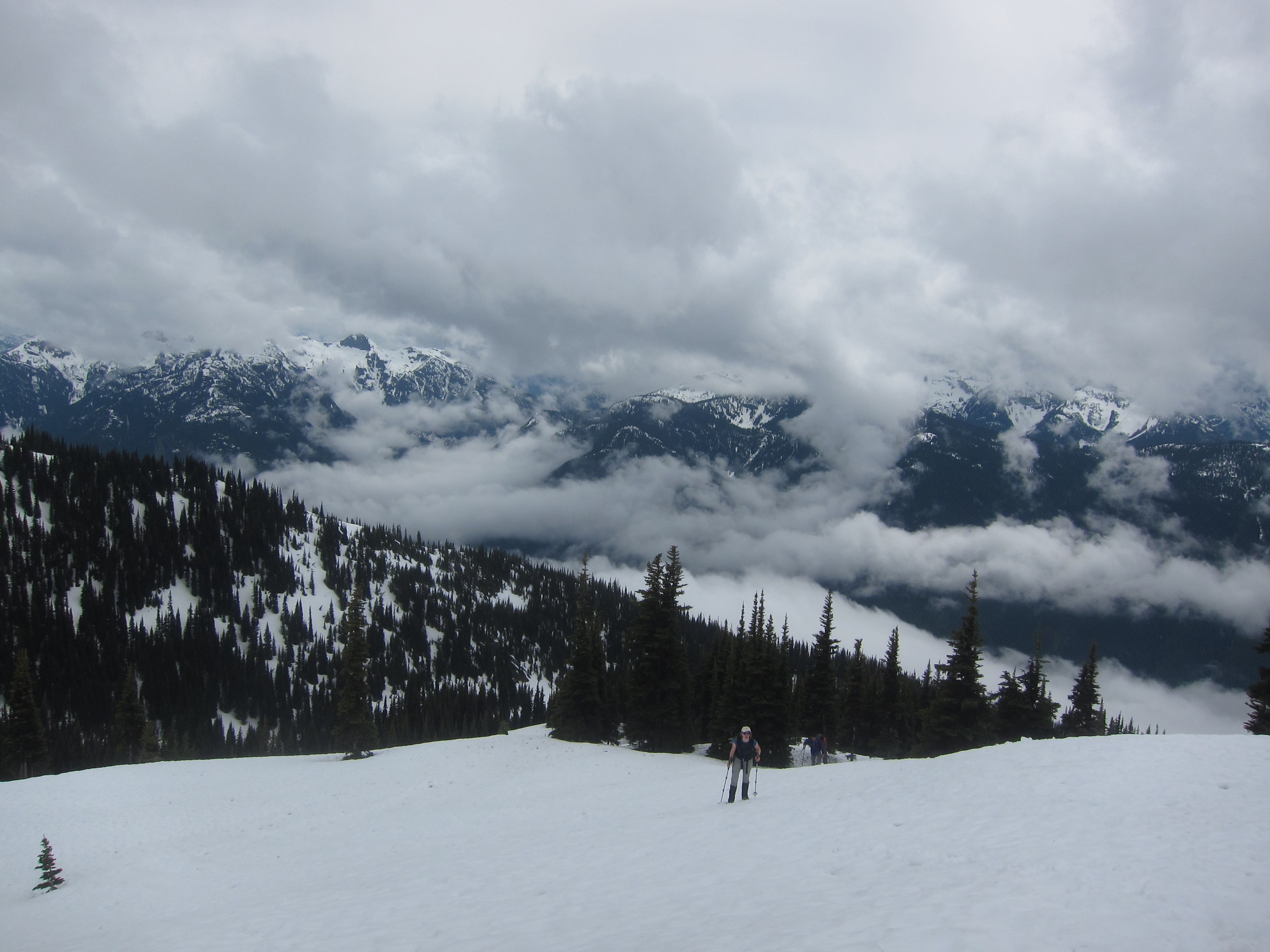
We rose late Sunday, enjoyed the beautiful sunny morning, and slowly packed up camp to get moving a bit past 9am to descend back down to our car parked near the gun club below.  The descent was easy and uneventful, and to make things a bit quicker rather than trudge down the road we descended down some bike trails like Sandinista and Deliverance to shorten our descent.  We reached the car again right at noon, fully exhausted from a long trek.  It was a good trip, but I’m never doing it again.

Lessons Learned:

  • Go when there’s snow.  With snow cover down to Or Creek (~800m, sheltered), the trip to and from Burke summit would probably be around 3 hours quicker and substantially less painful.  Some people have found ideal conditions in early June in high snow years but this year we were probably 3-4 weeks too late for good travel conditions.
  • When descending from the low point in the ridge in between Burke Summit and Or Creek, head into the mature forest to skiiers right.  Horrible, horrible bush is to be found by descending straight down.
  • If you do happen to hit bush and not snow at the end of Or Creek, stay low and travel to the mature forest to the north as quickly as possible to minimize bush.  The forest nearer the creek is reasonably open in comparison to the surrounding bush.

Tags: , ,

Date: May 24, 2014

Participants: Brittany Zenger (organizer), Paul Ng, Doug Bull, Maria Poechaker, John Blair, Britt van Rooij, Gusta van Zwieten, Rob Janousek, Geoff Zenger

Difficulty: 2 (trail and snow-walking, very long)

Report: After our unsuccessful attempt on Mt. Outram in early May a couple years ago, Brittany had unfinished business with the mountain, and posted a trip on the BCMC schedule to make another attempt.  The forecast for the day was only so-so but 9 of us were undaunted and made our way out to the western edge of Manning Park to march up towards the summit.

We started out on the trail at around 9:40am, and I was pleasantly surprised to find that someone has done substantial work on the trail in the past couple years.  The trail is in good shape and was easy to follow until we hit snow, just before the crossing of 17-mile creek (perhaps 150 metres higher than where we hit snow two years ago).  There are still a few good snow bridges over the creek, and so we had no difficulty getting over despite the rushing torrent below.  We crossed the creek right at noon, and once across the creek, we lost the markers, but as the trail just switchbacks up the ridge, we chose to ascend straight up, and popped out into the open (snow-covered) meadows just metres from where the trail does so.  We stopped here for a lunch break as the 4 hour mark of our trip ticked by, and then proceeded up the snow covered ridge to the main summit.  Generally the snow quality was good for foot travel, but in places was simply terrible, and the party members who had lugged snowshoes up were glad to have done so.  Even from the meadows it’s a surprisingly long ways up the ridge, but we finally made it to the summit a bit before 3:30, for a total ascent time of about 5:45.  Success!

Unfortunately, the views from the summit were very limited due to cloud and occasional fog, and so we couldn’t see much of anything, but we were all happy nonetheless to have made it all the way up (more than 1800m elevation gain!) and after a quick break started the long trek down.  The snow quality was even worse on the way down, and in people were postholing all over the place until we descended far enough to reach firmer snow.  This wouldn’t have been too much of a problem except that it resulted in a couple tweaked knees, which would lead to the rest of the descent being much slower than anticipated.  Lower down there were great glissading opportunities until we picked up the trail again just a bit above 17-mile creek, and from there it was a long slow journey down the trail as knees were nursed and the long grind of the day took its toll.  The last of us made it back to the parking lot a bit before 8:30pm, and we packed up as quick as we could to go enjoy some food and drink in Hope.

Thank you everyone for coming out!  It was a great trip, both long and rewarding with great company.  Thank you to Brittany for organizing!


Tags: , ,

« Older entries § Newer entries »