hiking

You are currently browsing articles tagged hiking.

Dates: May 17 & 19, 2014

Participants: Brittany Zenger, Geoff Zenger

Difficulty: 1

Report: With a poor weather forecast, we decided to stay in town this long weekend, but all three days ended up having great weather, and so we ended up doing two hikes on the Saturday and the Monday, with an intense day of mountain biking in between.

On Saturday, we hiked the Tikwalus Heritage Trail, formerly known as the First Brigade Trail or 1848 Trail (103 hikes #82).  It turned out to be a really nice hike for this time of year.  We left the car at around 12:30pm, and made our way up the recently improved trail.  The trail has seen extensive work done in recent years and now features excellent signage, good viewpoints, and many informational sign boards along the trail teaching the history of the trail and the people who built it and used it.  The campground at the far end of the trail is in great shape as well for anyone wanting to camp up there.  We took it slow, had a nice lunch break, and wandered out on the bluffs trail past the normal turnaround point (the campground), and still made it back to the car before 5, for a total round trip time of 4.5 hours.  Recommended!

On Monday, it was pouring rain all morning so it didn’t look like we’d be likely to get out, but around noon it started to clear up and we decided to check out the old Ford Mountain trail in the Chilliwack valley.  We were able to drive up to just a couple hundred metres before the uppermost trailhead (you need some aggressive 4×4 driving to make it up the last little bit), and headed up the trail.  The trail is in really good shape right now with just a little bit of snow right near the summit, and although the higher peaks were socked in the clouds, the views from the summit should be marvellous on a sunny day.  Total round trip time from where we parked was 2 hours, 20 minutes, with an approximately 30 minute break on the summit.  It’d be a fine little hike to introduce people to hiking in the valley.


Tags: , , ,

Trip Date: Nov 11, 2013

Participants: Geoff Zenger, Brittany Zenger, Ed Zenger + a BCMC party of another 12 people

Difficulty: 1

Report: A few weeks ago I chose to roll the dice on Vancouver’s November weather and put a trip on the BCMC schedule a traverse hike up and over Mt. Artaban on Gambier Island.  At an elevation of only 615m and requiring a water taxi to get to, Mt. Artaban isn’t the kind of place I’d be likely to head on a summer weekend, but it seemed like it could be a great place to head for an off-season hike.  I was right 🙂

We departed Sunset Marina just after 9am on Rembrance Day, and by 9:30 were standing on the Halkett Bay dock.  This wasn’t where we expected to be dropped off (it turned out that we actually thought we were going to Halkett Bay Marine Provincial Park, not just Halkett Bay), but after a few wrong turns and with the friendly assistance of a woman working at Camp Fircom, we found the trail heading towards Mt. Artaban and headed up.  The trail up Mt. Artaban is well marked and in good condition, never too steep and generally very pleasant.  Despite having 15 people in the party we didn’t have any trouble getting up, and were all on the summit by 11:15 enjoying the great views of the peaks above Lions Bay while enduring the blustery summit winds.

Although we had originally thought of spending a long time on the summit, the wind was too much for us and at a quarter to noon we decided to descend towards Brigade Bay to the north of Mt. Artaban.  This trail isn’t in as good shape as the trail up from Halkett Bay, but it is still easy to follow and in an hour we found ourselves back down at the water.

At this point it was only nearing 1 o’clock and we still had 3 hours to make our way over to Camp Artaban where we were scheduled to be picked up at 4pm, and so the group consensus was to try and also hike up the trail to Burt’s Bluff.  On the Gambier Island trail map the Burt’s Bluff trail looks like it’s about 250m long with 100m elevation gain and marked with green markers.  In reality, the green markers are only green on the backside and have been sun-bleached to blue/teal on the front and the trail ascends over a couple kilometres to about 450m.  That said, the view from the top is great and if you’re doing this trip I highly recommend heading up there as well.  We reached the top just before 2:30 and after a very quick break turned around to make our way down and to Camp Artaban.

Down on the main trail connecting Brigade Bay to Camp Artaban, we headed towards Camp Artaban and despite some confusion over where exactly Camp Artaban was that could have easily been avoided by looking at Google Earth before the trip, we eventually found our way to the dock at the camp with a comfortable 10 minutes to spare before our scheduled departure time from the island.  In all, a great day and a great off-season trip.  Thank you to everyone who came along!

Disclaimer: Leading Peak on Anvil Island remains my favourite Howe Sound Island hike by a significant margin.

Tags: , , ,

Trip Date: Oct 5, 2013

Participants: Wayne Pattern, Christian Molgat, Steve Pollack, Alison Coolican, David Puddicombe, James Lamers, Brittany Zenger, Geoff Zenger

Difficulty: 1/2

Report: Our original plans to head up Cypress Peak scuttered due to a large amount of fresh snow falling in the days before this trip, I looked at a map and changed destination to Mt. Brew, which we ascended via the “winter route” trail and whose trailhead lies only a couple km away from the Cypress Peak trailhead up the Roe Creek main.  The last 1.5 km or so to the trailhead require a 4wd vehicle due to the steepness and looseness of the road, but was otherwise drivable by one of our party member’s Honda Accord.

We departed the trailhead just past 10am under low overcast skies, and after about 30 minutes hit both snow and fog.  Up to Brew Lake the snow was firm enough to be easily traversable without snowshoes, but past the lake those of us who brought snowshoes were very grateful to have them as the rest of the party spent much time postholing in the boulder fields on the route towards the Brew Hut.  On the way up we caught up to a VOC work party led by Roland Burton heading in to replace some windows in the hut, and after this, eventually reached the hut at about 12:40, where we stopped to enjoy a nice lunch in the fog.

We departed the hut for the summit of Mt. Brew at 1:10, and made it to the summit in no time as we were standing on the top at 1:30, once again in total fog and without any views whatsoever.  Bored by the whiteness, we didn’t stay long and soon started on our way down to the cars, which we arrived at before 4pm, making for a very relaxed trip of less than 6 hours.  The terrain in general is very mellow and the trail is pleasant enough, it’s just too bad that we couldn’t see a thing at all for the entire day.

Tags: , , ,

Trip Date: Oct 14, 2013

Participants: Brittany Zenger, Ed Zenger, Leslie Zenger, Nancy Zenger, Geoff Zenger

Difficulty: 2

Report: How better to celebrate Thanksgiving than to climb a beautiful mountain with your family?  Thanksgiving Monday 2013 saw my mom, dad, and sister come out with Brittany and I to the Coquihalla to head up July Mountain.  We met up in New Westminster a bit past 7 and headed out towards the Coquihalla, and after breakfast in Hope and a mixup where we missed our turnoff on the highway and had to turn around to go back to the road up Juliet creek, we eventually made our way up the road and left the Jeep where we first hit snow, a 20 minute walk from the normal trailhead, starting up the the road at 10:30.

That we hit snow so low surprised us slightly given how warm the temperatures had been lately, but snow lingers easily down in the valleys and north facing slopes that this hike ascends.  It wasn’t contiguous immediately, but soon became reasonably deep and we had no footbed to follow most of the way up to Drum Lake, which we reached just before 1pm.  Here we stopped for lunch and then headed up the slopes to the right (West) of the lake, hitting the col due north of the summit of July Mountain and here made our only real routefinding error of the day.  Rather than heading up the easy snow slopes to the right of the ridge (which we would later descend), we instead scrambled up and left through an icy rock band to hit the ridge a good 10m earlier than we would have had we just followed the easy route.  Nonetheless, we persevered and made it up onto the ridge, upon which the travel is easy and we quickly made our way to the true summit of July Mountain, reaching it before 2pm, only around 45 minutes from the lake.

The views on the summit were fantastic and it was great to see the snowy wonderland all around us despite the temperatures hovering in the t-shirt range.  July Mountain is the highest peak for quite some distance and there were great views of the Anderson River Group, the area around Coquihalla Mountain, and even as far away as the Old Settler and Mt. Urquhart.

We lingered on the summit for half an hour before starting our descent, which was quick (only 30 minutes) down to the lake, and less than 2 hours from there down to the car.  Total round trip time was just over 6 hours, so the 103 hikes time estimate of “allow 6 hours” would be easy to achieve by any party moving at a moderate pace provided that they were able to drive to the trailhead.  In the end, I was very impressed by this hike.  The setting is fantastic, and the route varied and interesting.  In fact, it may well be one of my favourite hikes from 103 hikes.

Tags: , ,

Wells Peak

Trip Date: Sept 1, 2013

Participants: Alex Le, Nikta, Ed Zenger, Brittany Zenger, Geoff Zenger

Difficulty: 2/3

Report: Although only 16 days after quite invasive surgery, a great Sunday forecast gave me the energy to try and do something other than rest and recover and instead to get out in the mountains for the first time in a few weeks.  Wanting to find something within my diminished energy levels, I hit on the idea of going to Wells Peak, the southern neighbour of Hope Mountain (which I climbed last October).

We met at my place in New Westminster and set out towards Hope just before 9am, and after a quick stop in Hope, headed up the Mount Hope FSR.  The road leading up to the final junction is in slightly worse condition than it was last fall, but shouldn’t give anyone with a high clearance 4×4 any trouble.  It is a bit loose in places, and some small rocks needed to be cleared out of the way, but the water bars are all well constructed and easily passable.  Last fall, the last 500m of road, from the final junction to the trailhead was badly overgrown with alder, but someone has done a great job clearing the road, and we were able to drive the last section of road with nary a scratch on the Jeep.  Many thanks to whoever cleared out the road and repainted the trailhead signs!

We started on the trail just past 11:30, and were pleasantly surprised that although the first part of the trail through the cut block is quite overgrown, it is overgrown with soft bushes and grasses, unlike the Hope Mountain trail, which is overgrown with small conifers through the cut block.  Once the old growth is reached after around 20 minutes of hiking, the trail is well built and easy to follow as it rises steeply up towards the beautiful meadows below Wells Peak.

Up in the meadows, the trail peters out and we stopped for lunch.  Having forgotten our trail description back at the trailhead, we set out towards the notch just NW of the main summit of Wells Peak (climbers right of the summit, 103 hikes recommends crossing the meadows and heading up the ridge climbers left).  Although it looked steep from a distance, reaching the notch was only class 2, and from there we turned left and headed up on the ridge crest towards the main summit of Wells Peak (note that the summit NW of the notch has a large cairn on top, but is not the highest summit).  The NW ridge has some exposure and one 3m class 3 step that must be negotiated before reaching the main summit, but everyone made it up, and by 2pm we were all on the summit.

The summit of Wells Peak has great views all around with clear views of the Chehalis, Judge Howay, Slesse, Rexford, Outram, Tulameen, Coquihalla, and the Silvertip group.  We sat down for another snack and to lounge about on the summit only to find that the summit was infested by a swarm of annoying (non-biting) flies.  Nonetheless, we spent 30 minutes enjoying the views before heading down towards the SE to see if that ridge provided an easier route to and from the summit.

The SE ridge of Wells Peak does descend down to the meadows without any rock scrambling, but is covered in slippery vegetation, and so in the end, I’m not sure whether it’s really any easier than the NW notch route.  Regardless, we all made it down to the meadows without injury, found the trail once again, and in what felt like no time at all, were back down at the Jeep by 4:30.  Total trip time: 5 hours.

As a final thought, which trail do I prefer?  Wells Peak or Hope Mountain?  Wells Peak is a more direct route, and less bushy, but I still prefer Hope Mountain slightly due to the route up the ridge being more enjoyable, more varied and having a much nicer summit.  Too bad someone doesn’t go and brush out the first 1km of the Hope Mountain trail…

Tags: , ,

Trip Date: July 13-14, 2013

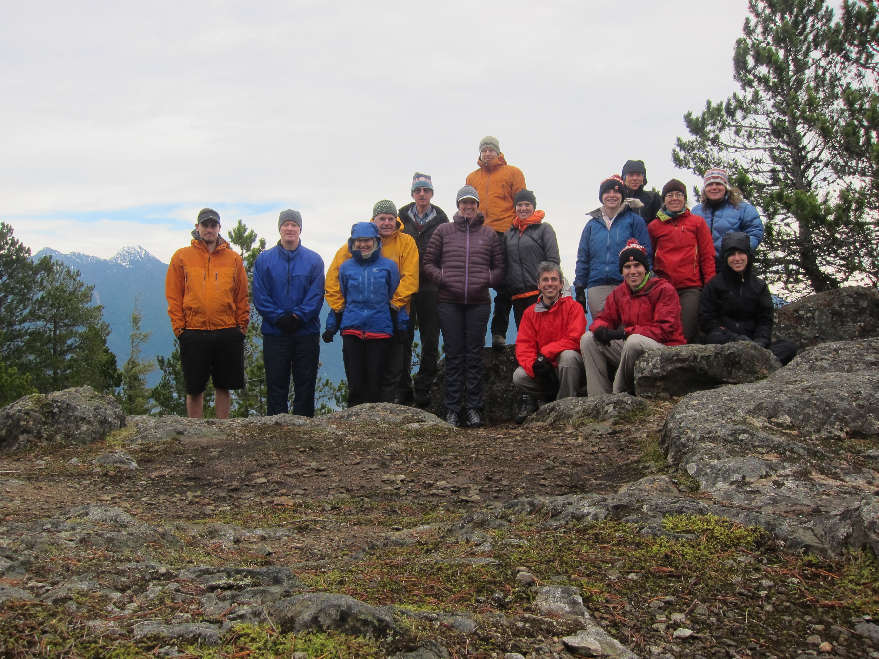
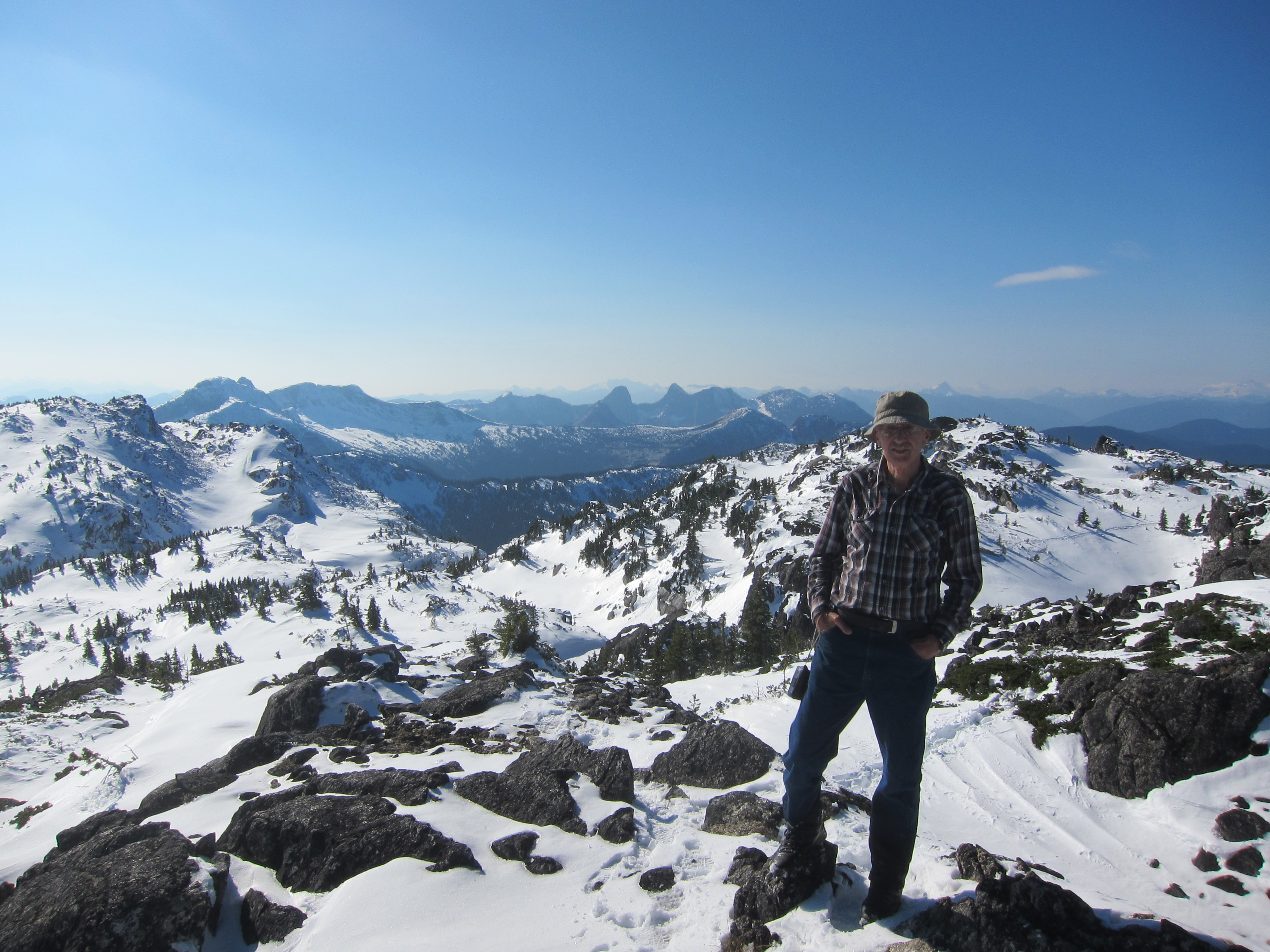
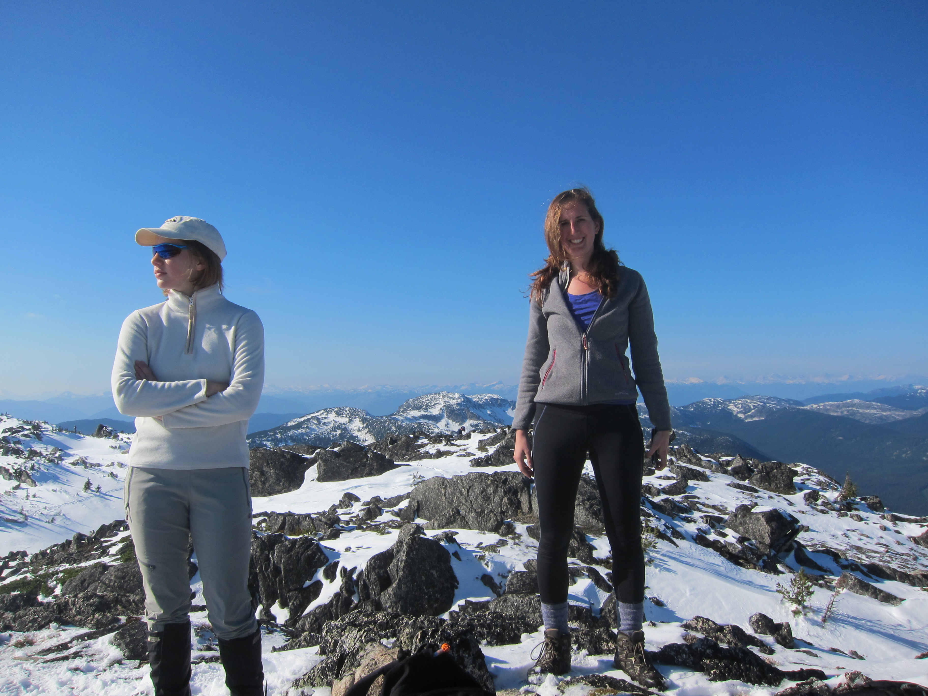
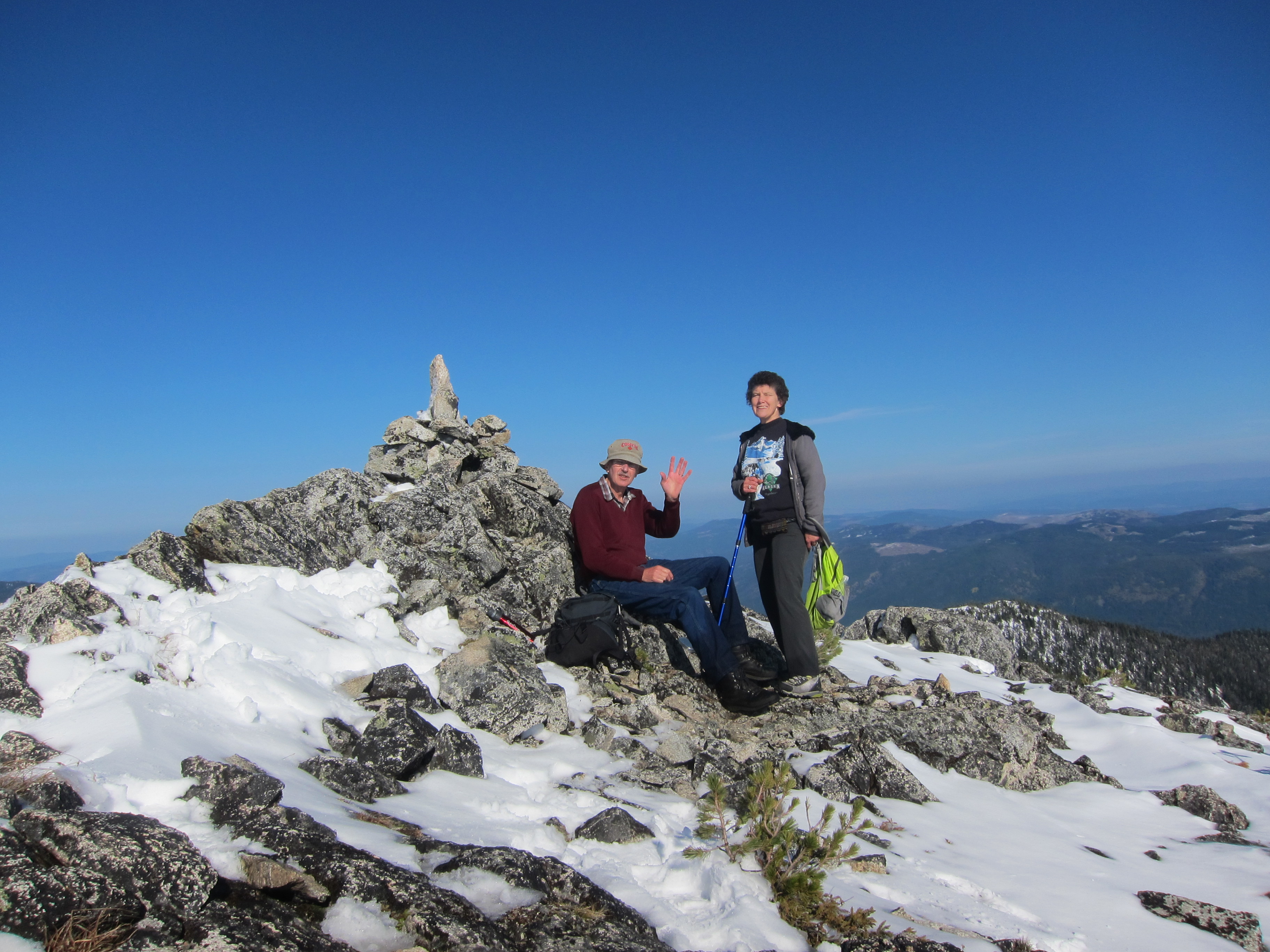
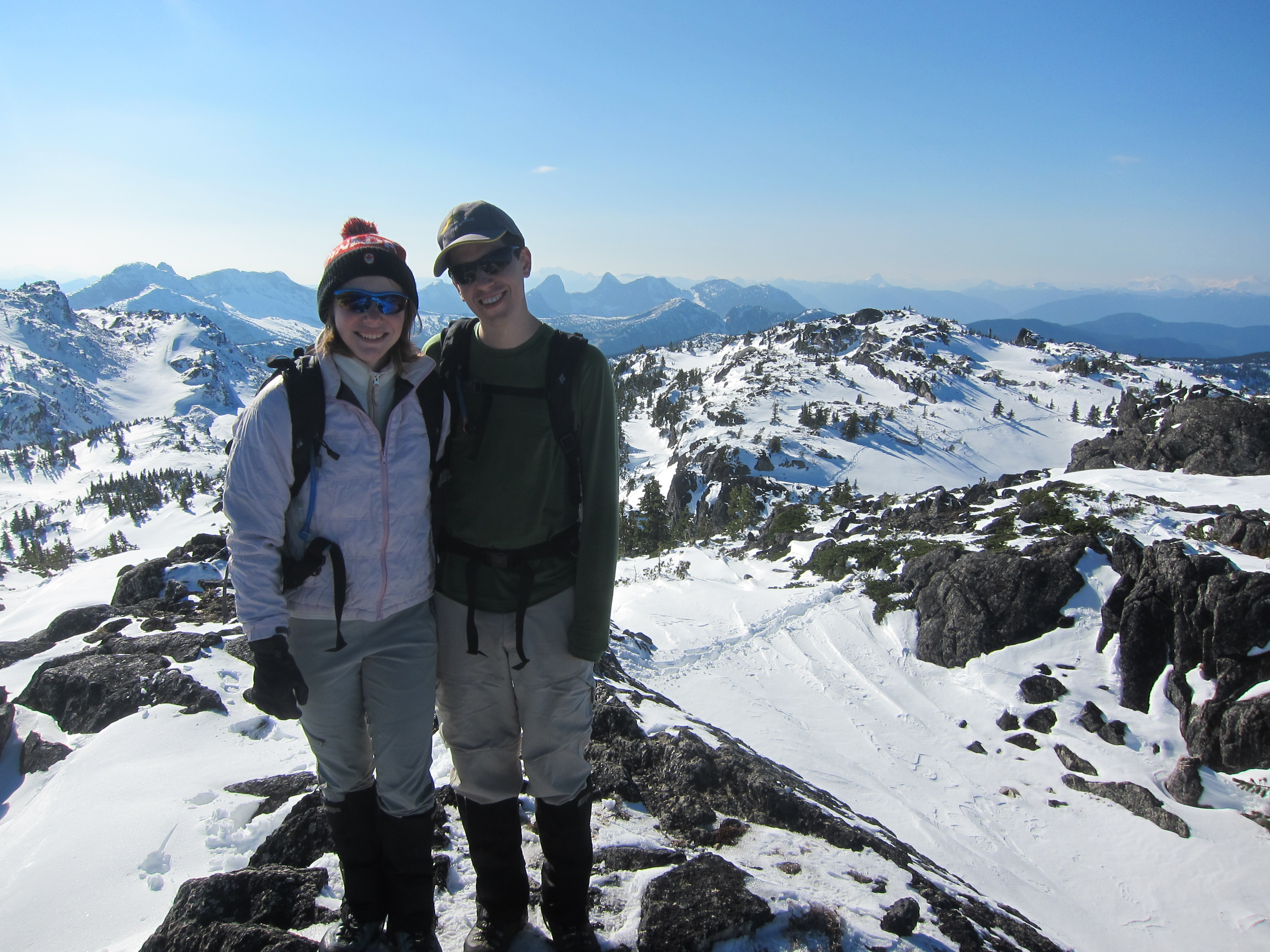
Participants: Thomas Bissig, Ed Fischer, Helen Habgood, Darrell Harrington, David Overall, Ilze Rupners, Pavel Sorokin, Christina Williams, Brittany Zenger, Geoff Zenger (organizer and reporter)

Difficulty: 2 (some scrambling, much bushwhacking)

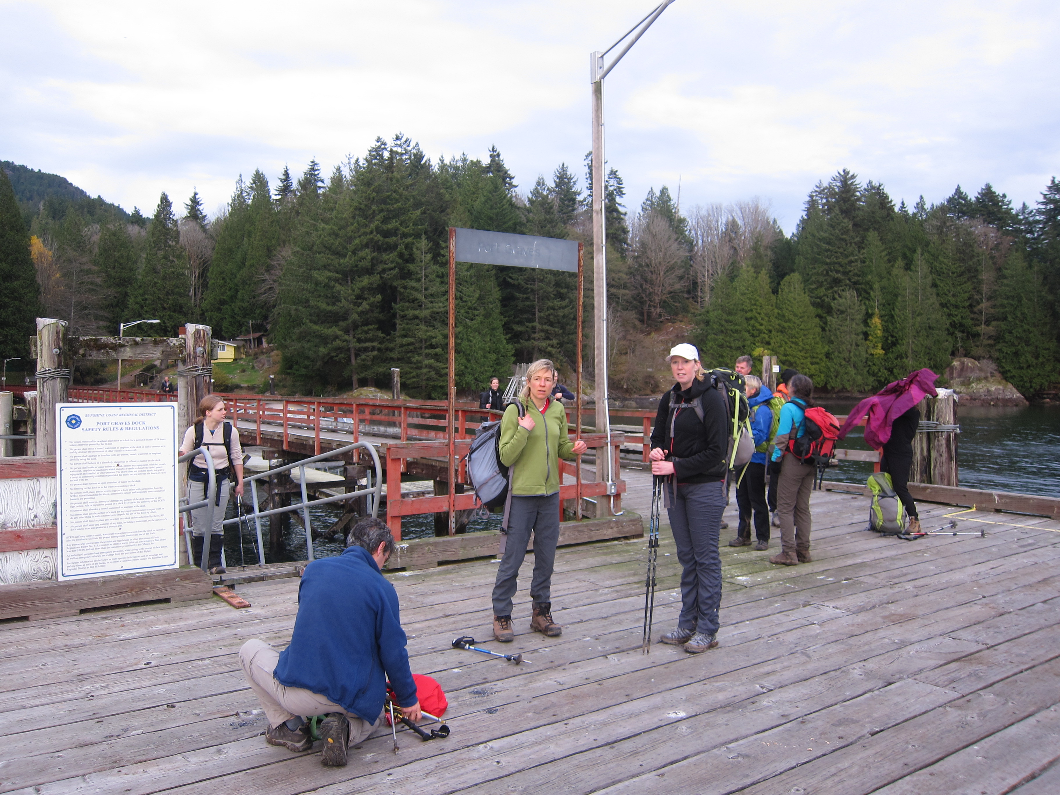
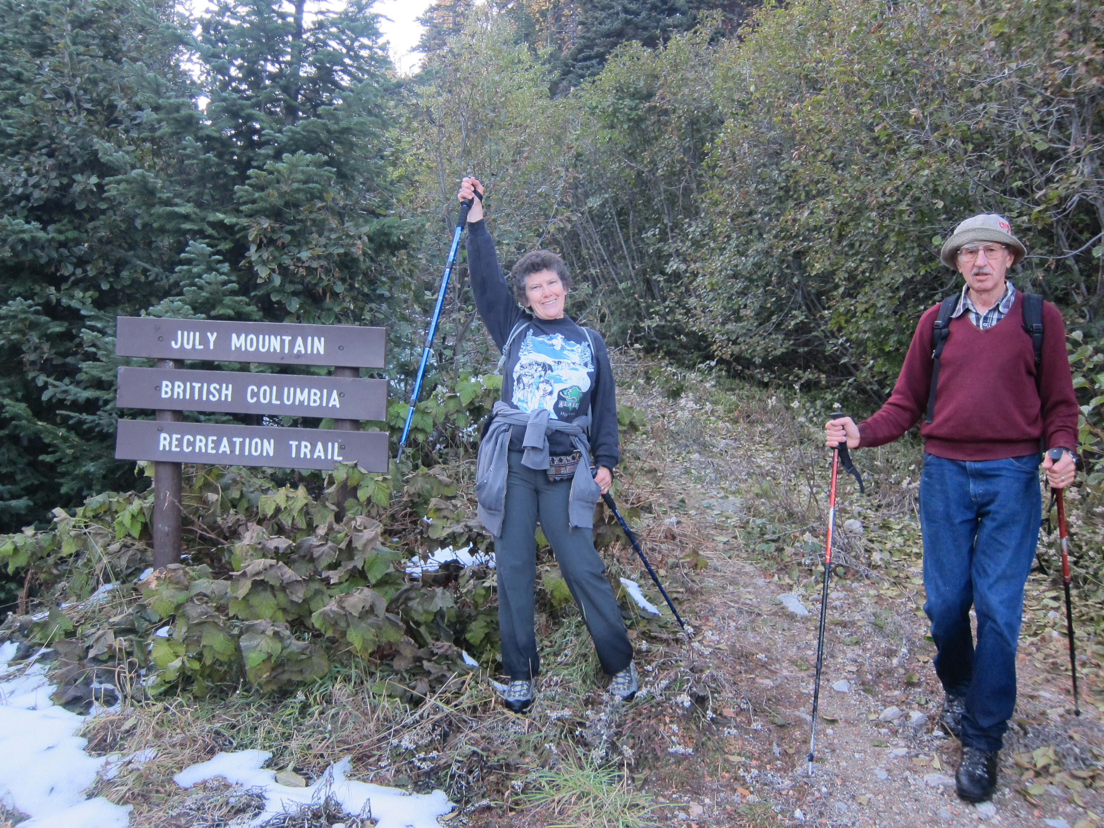
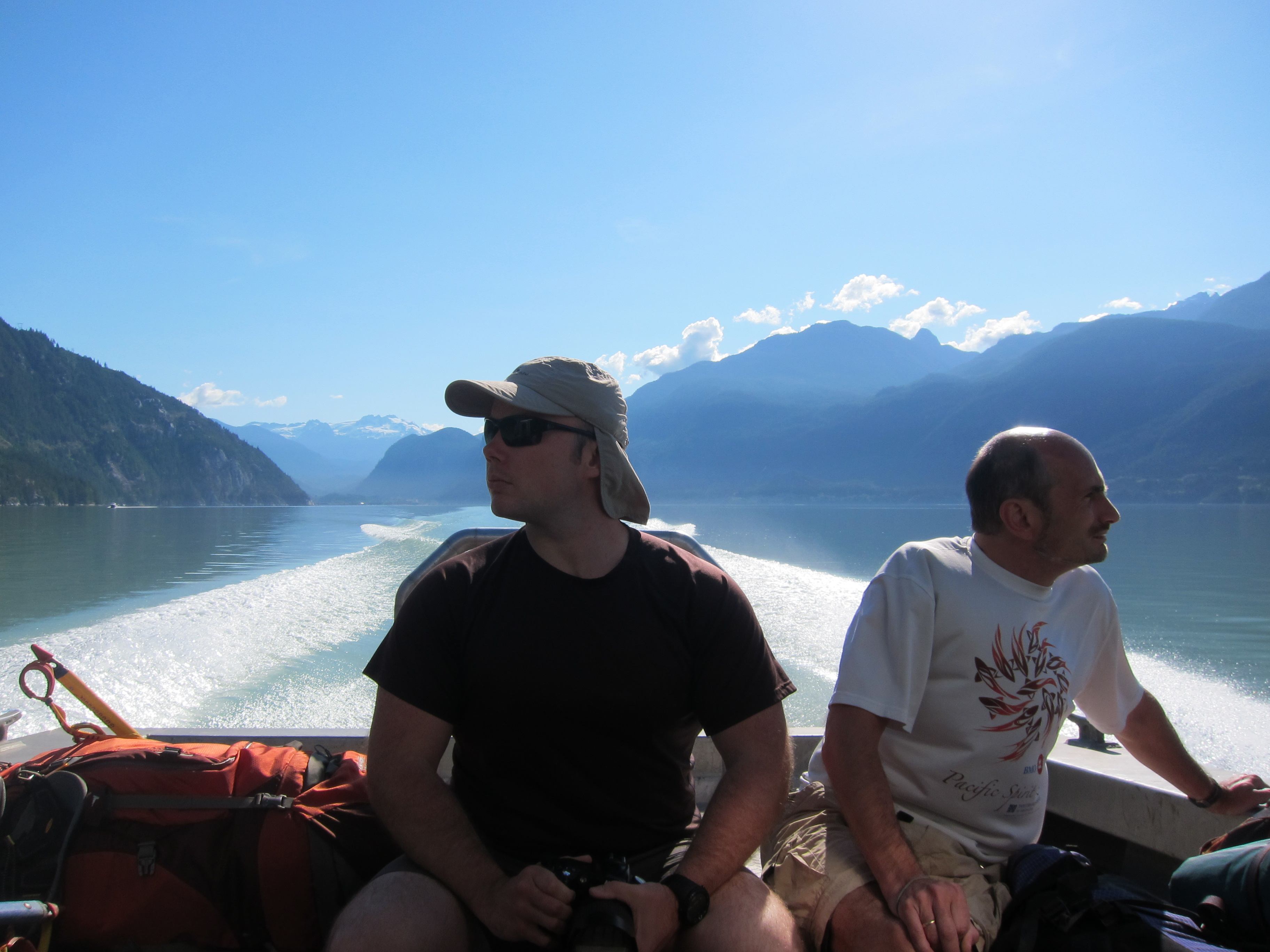
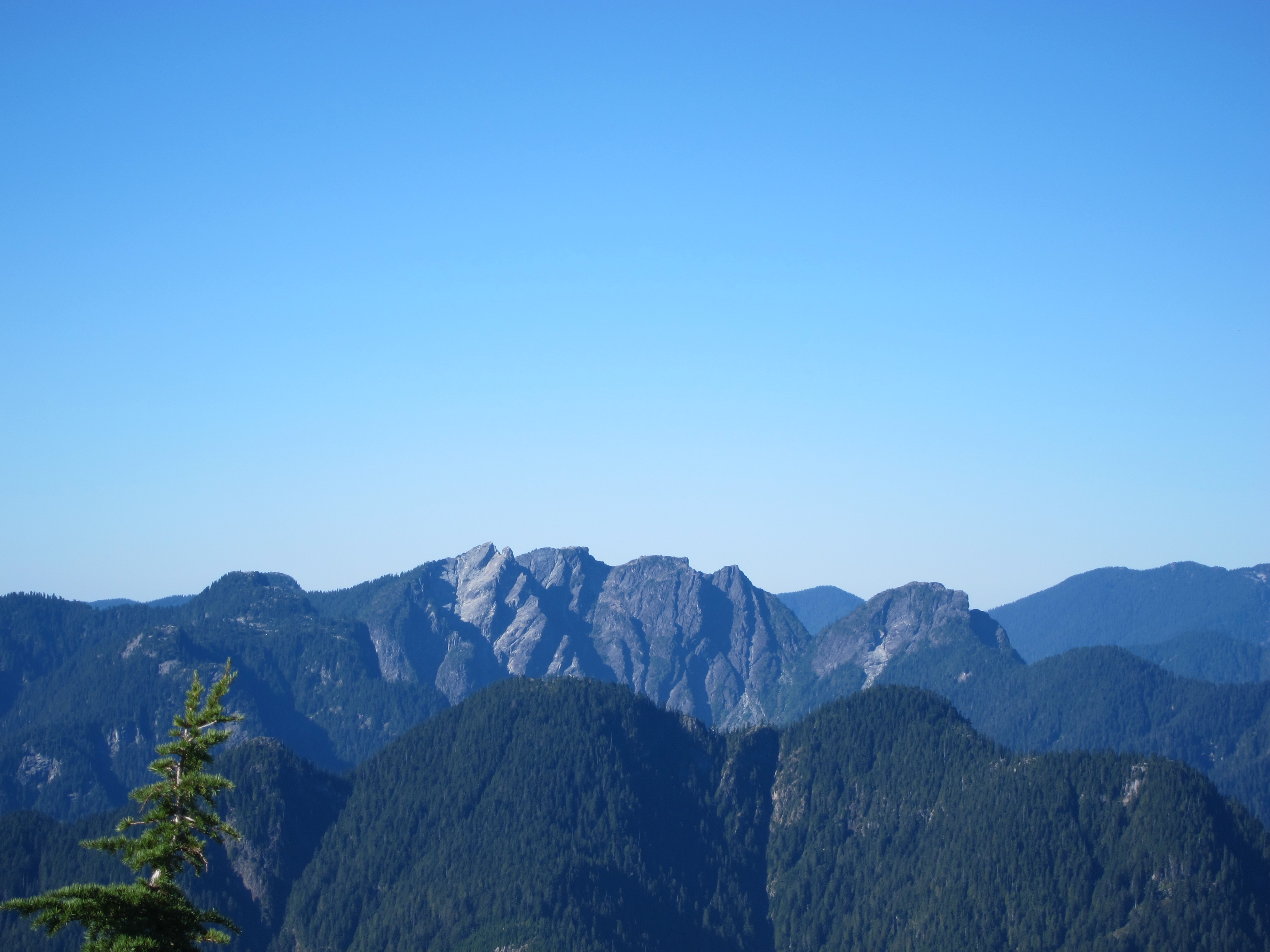
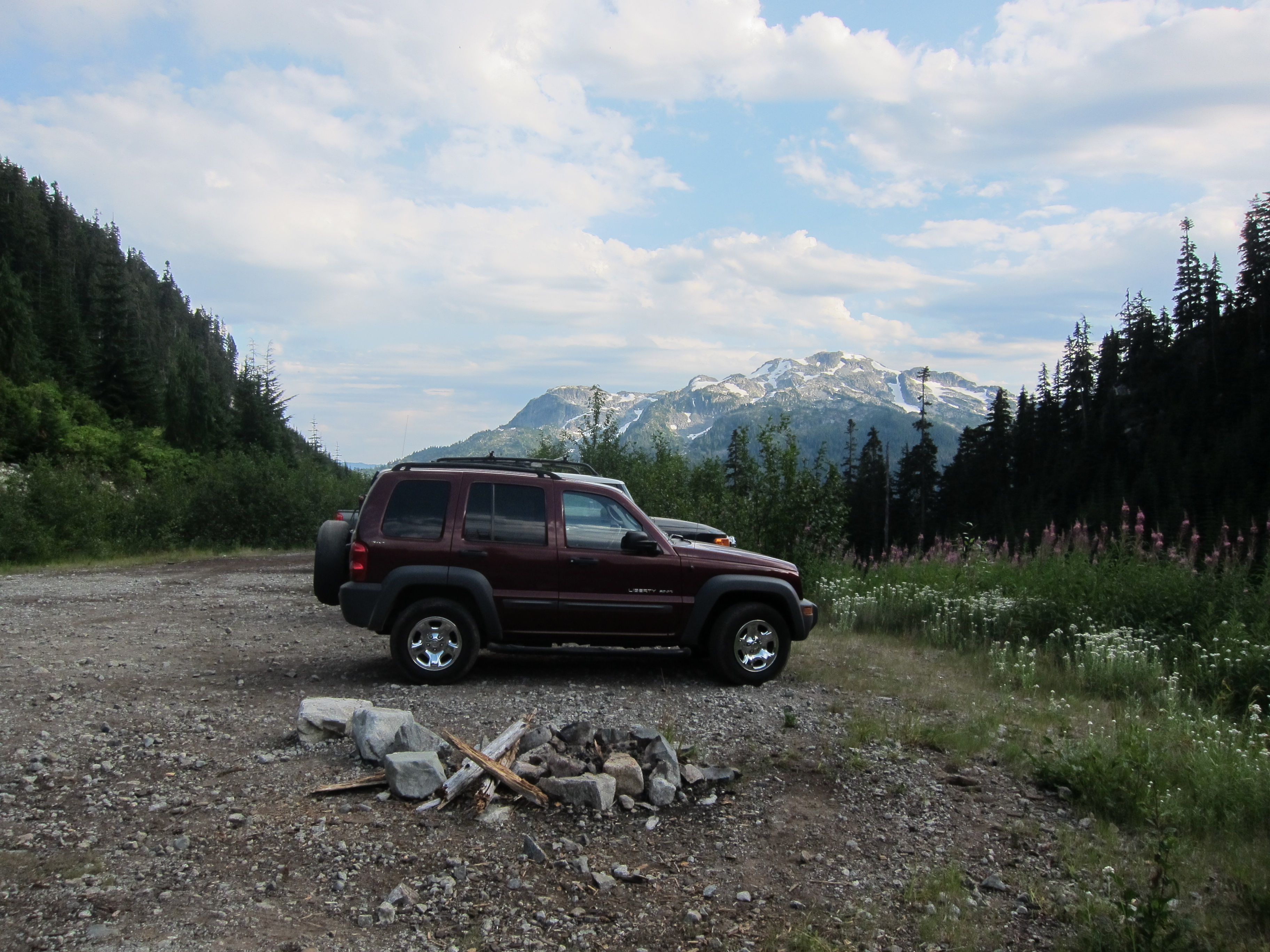
Report: I’ve stared at Mt. Sedgwick from highway 99 countless times over pretty much my entire life, but I never took advantage of the easy access to Woodfibre prior to the closure of the mill and ferry in early 2006.  Access today involves obtaining permission to dock at Woodfibre from its owners as well as arranging for a water taxi to take you over and pick you up, which can be costly.  Luckily for me, there are many others in the same situation and I was able to round up a group of 10 BCMC and ACC members to split the cost of the water taxi and head over for a long two days to the now rarely visited peak.

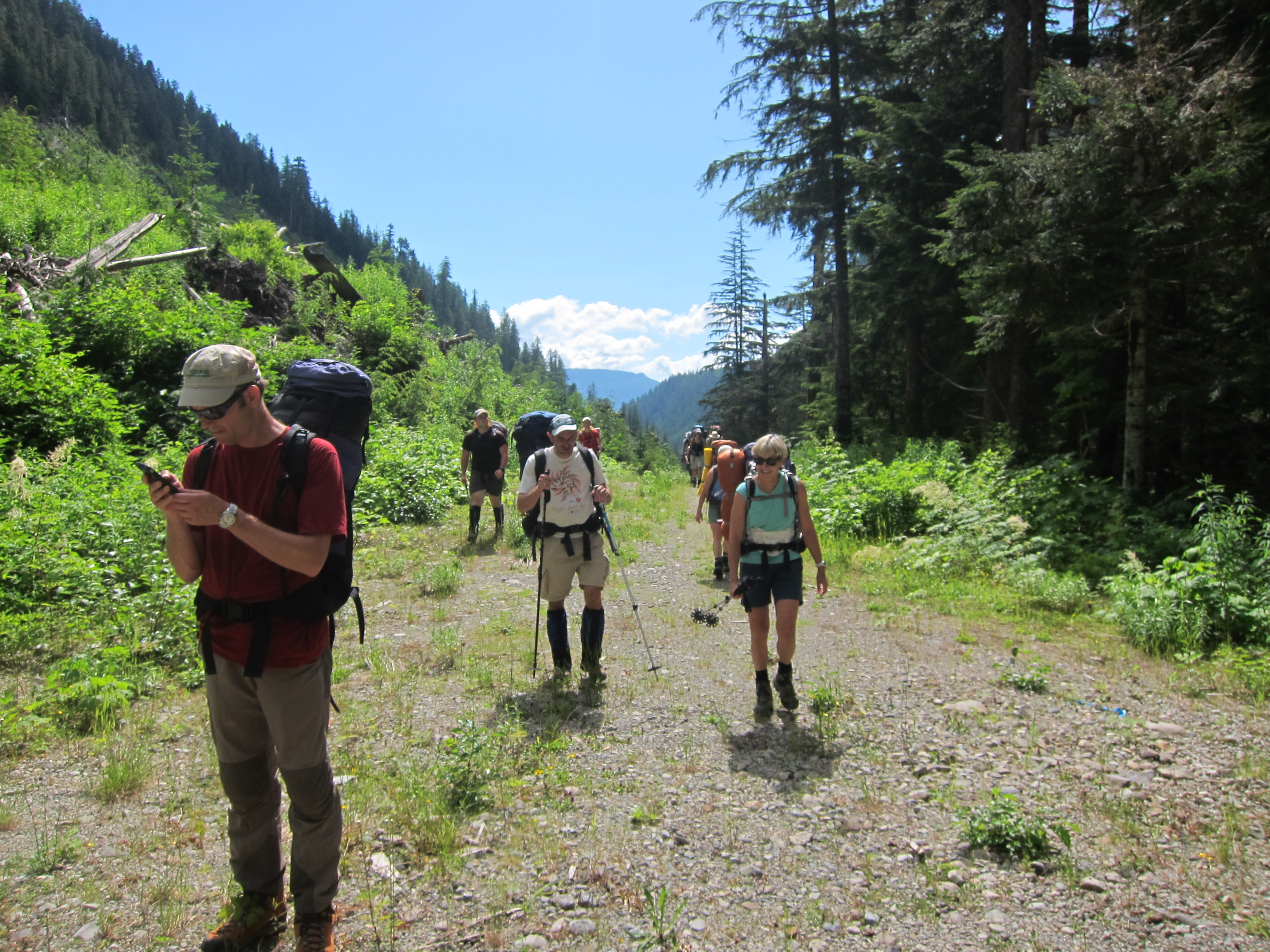
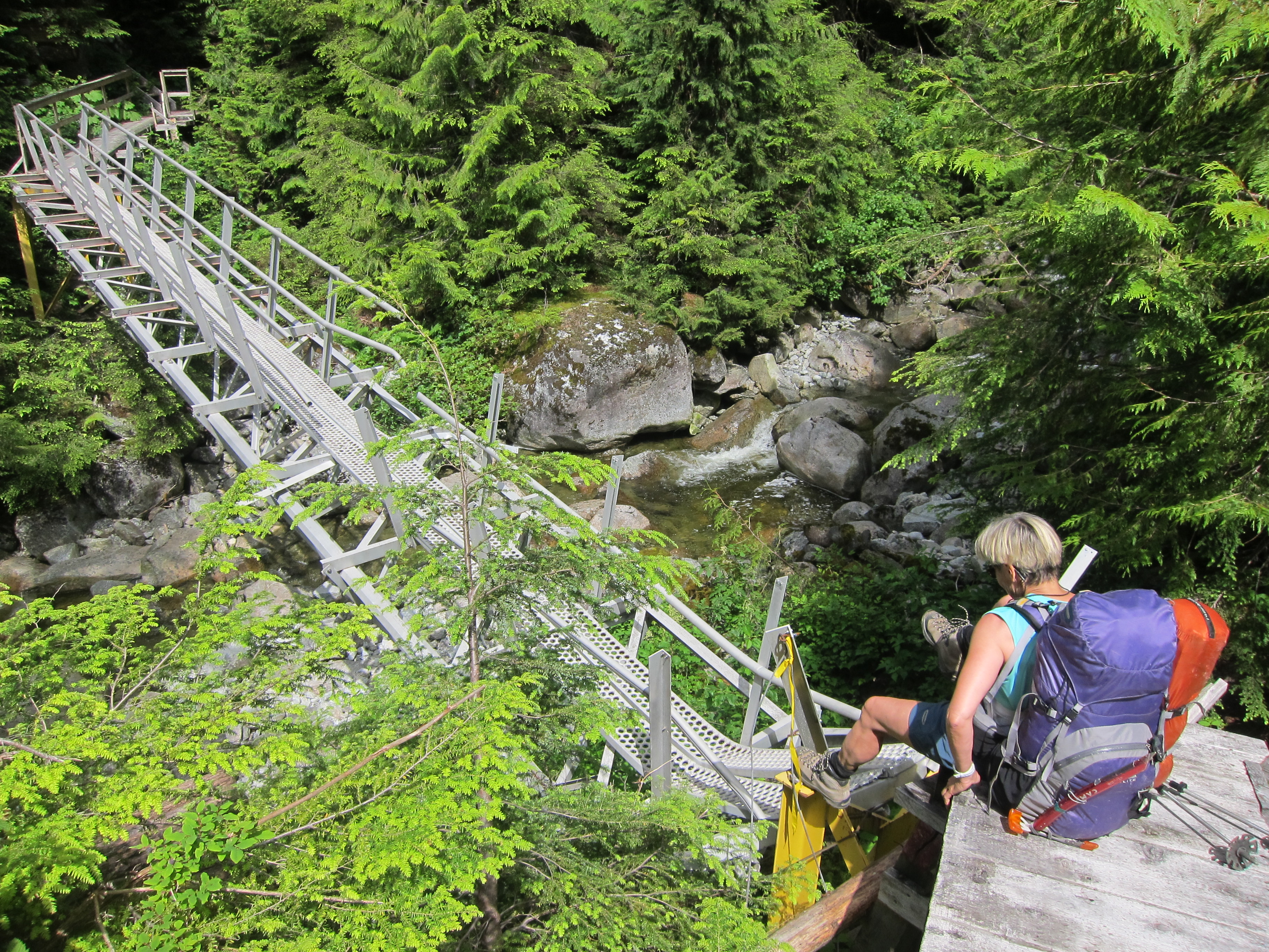
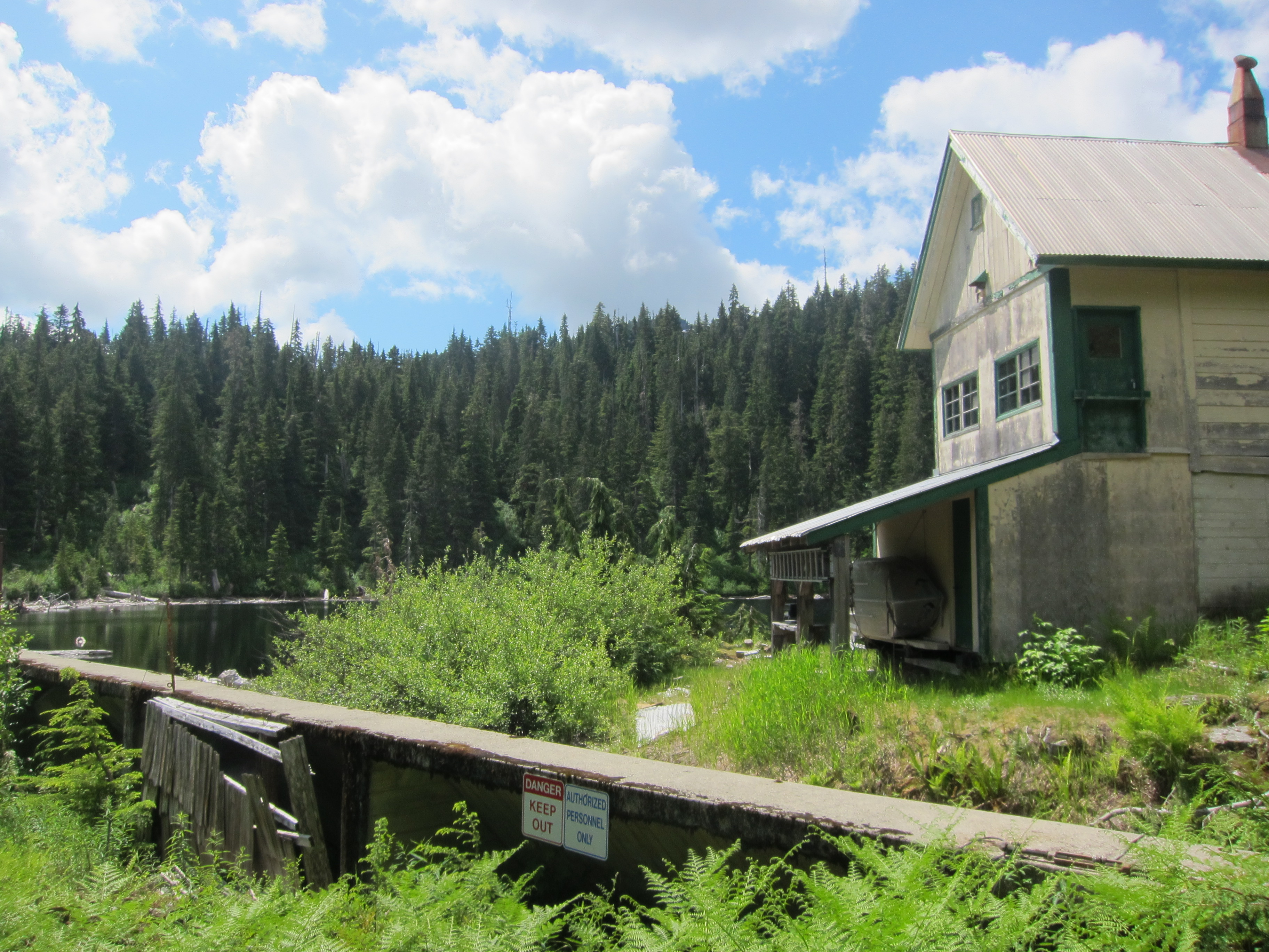
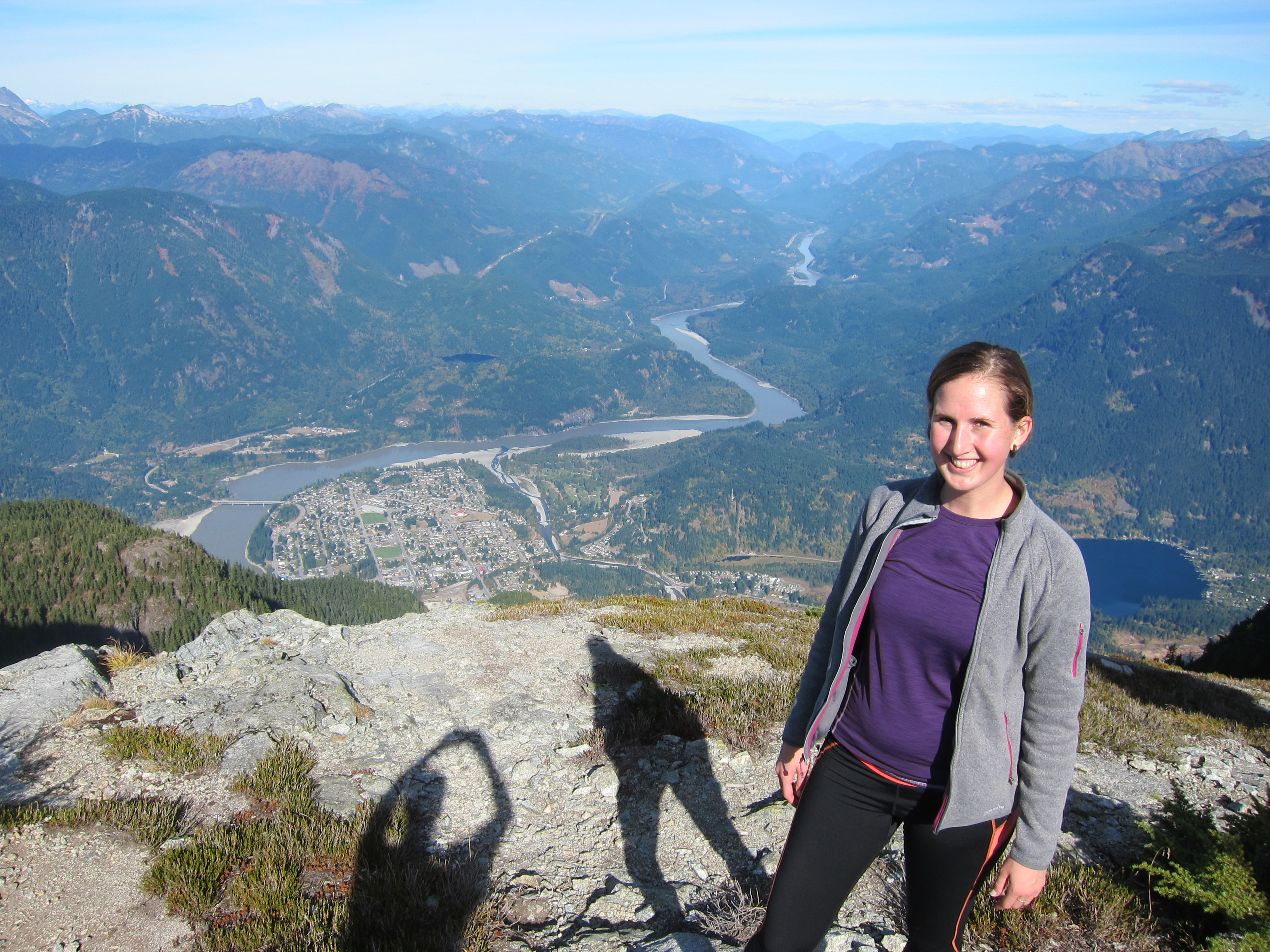
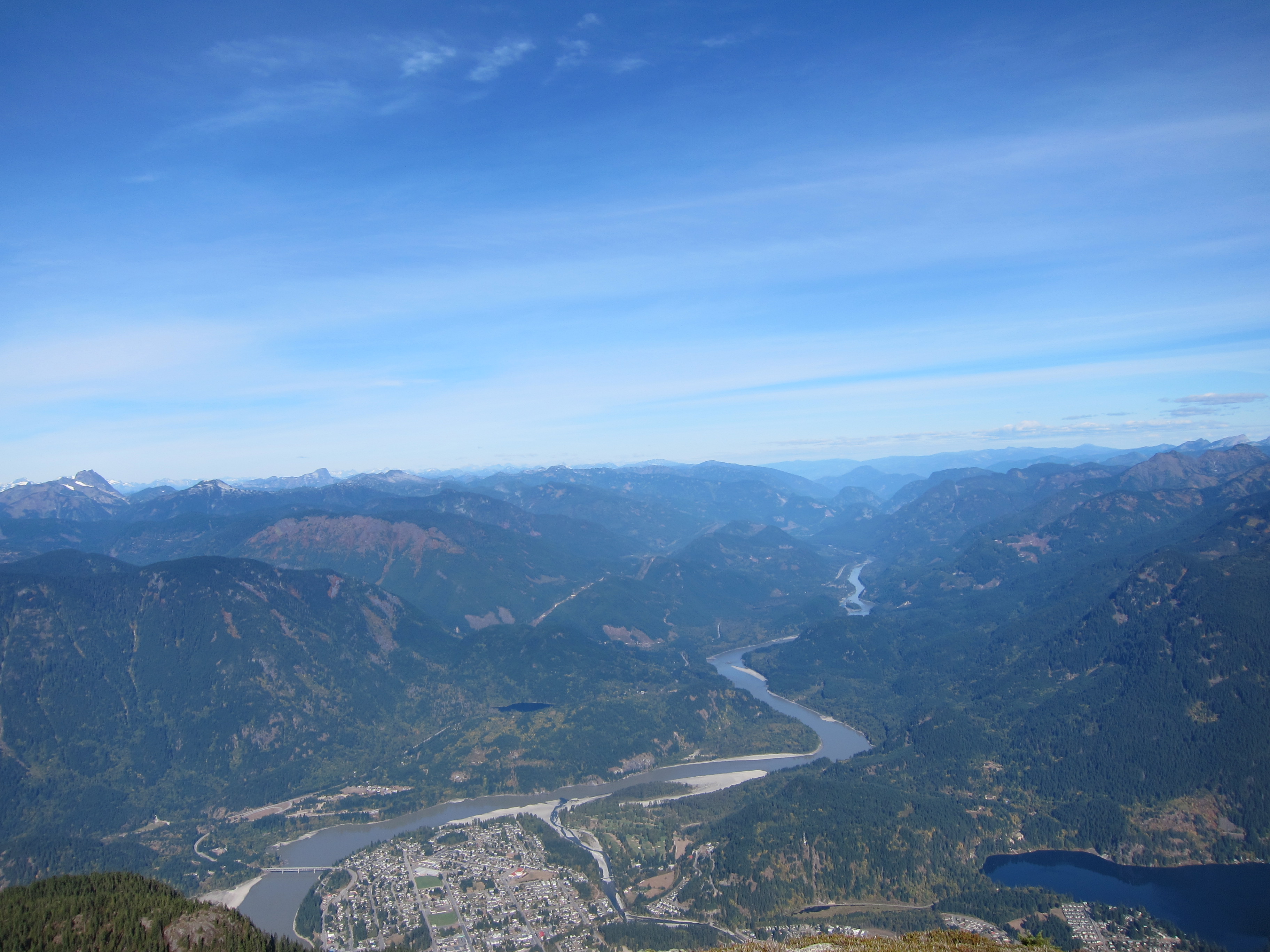
We began by catching a water taxi from Squamish at 9am on the Saturday that got us over to Woodfibre where we were met by one of the on-site weekend staff members (the site is still used for electricity generation) who took our contact info, showed us which road to start walking up, and sent us on our way.  The road behind the town switchbacks up steeply for just over 3km (ignore all new logging spurs) to a water intake facility, where the correct route takes the right hand branch just prior to the facility.  From here, it continues up Woodfibre creek for another 3km or so before reaching a footbridge over the creek and the start of the trail up to Henriette Lake.  Note that while the bridge is somewhat damaged it is still easy to cross and the creek is small enough anyways that it would be easy to cross without a bridge.

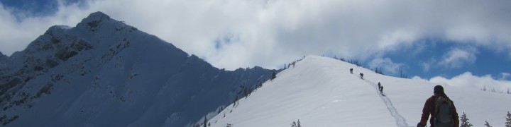
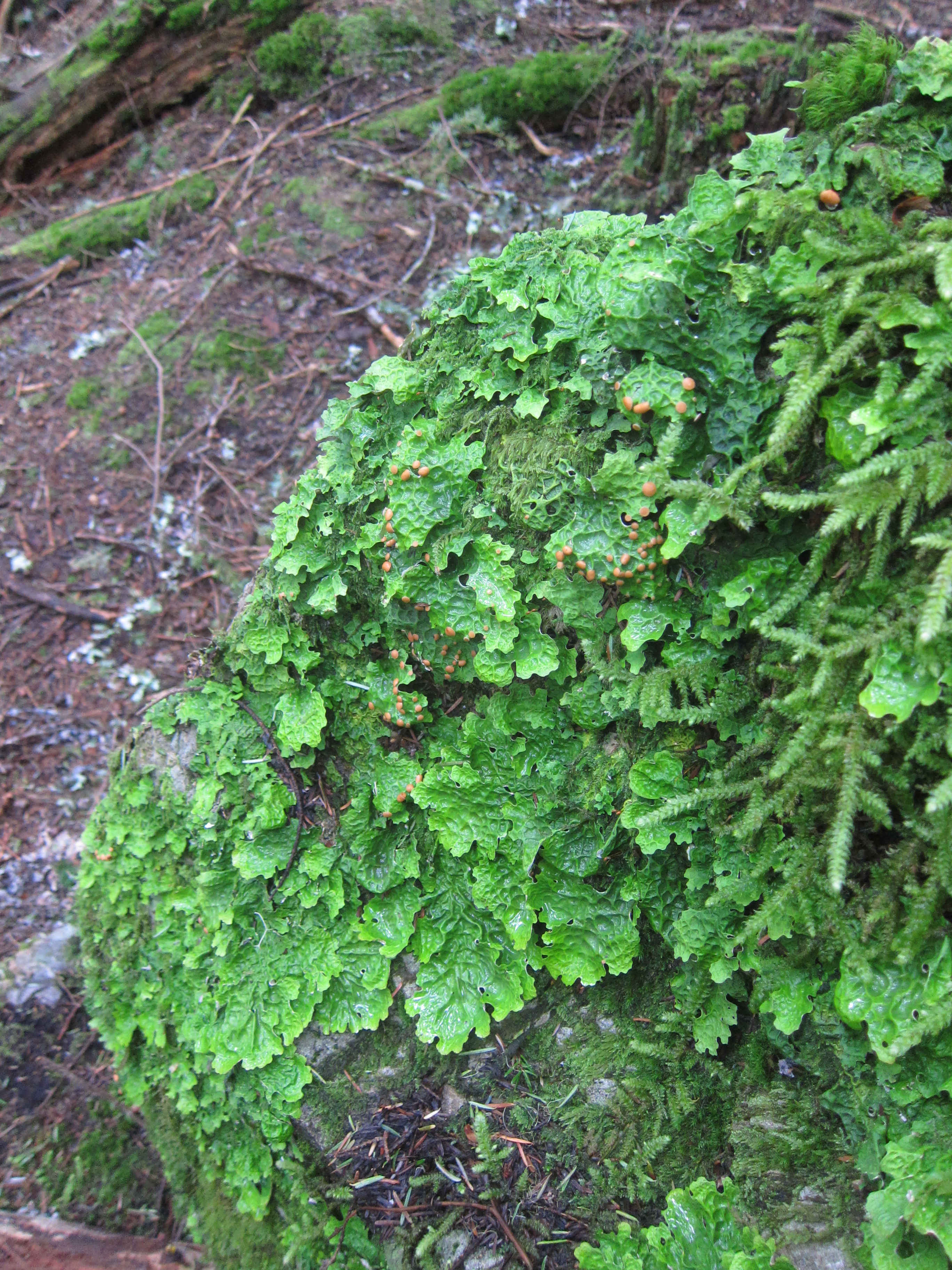
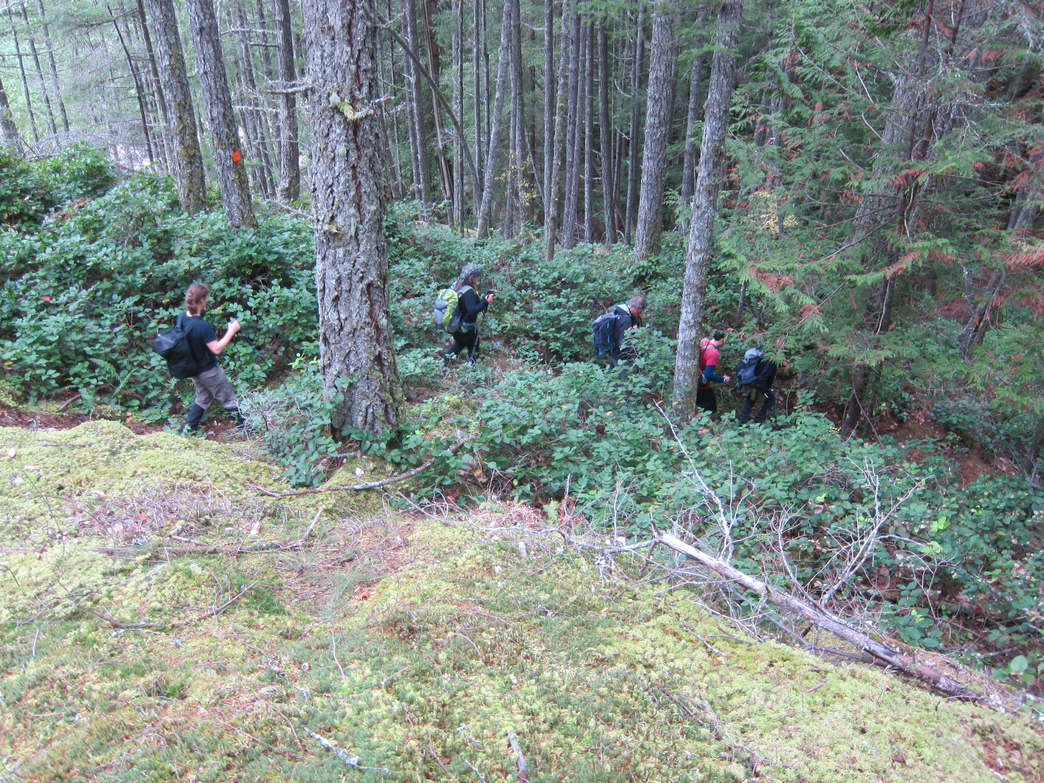
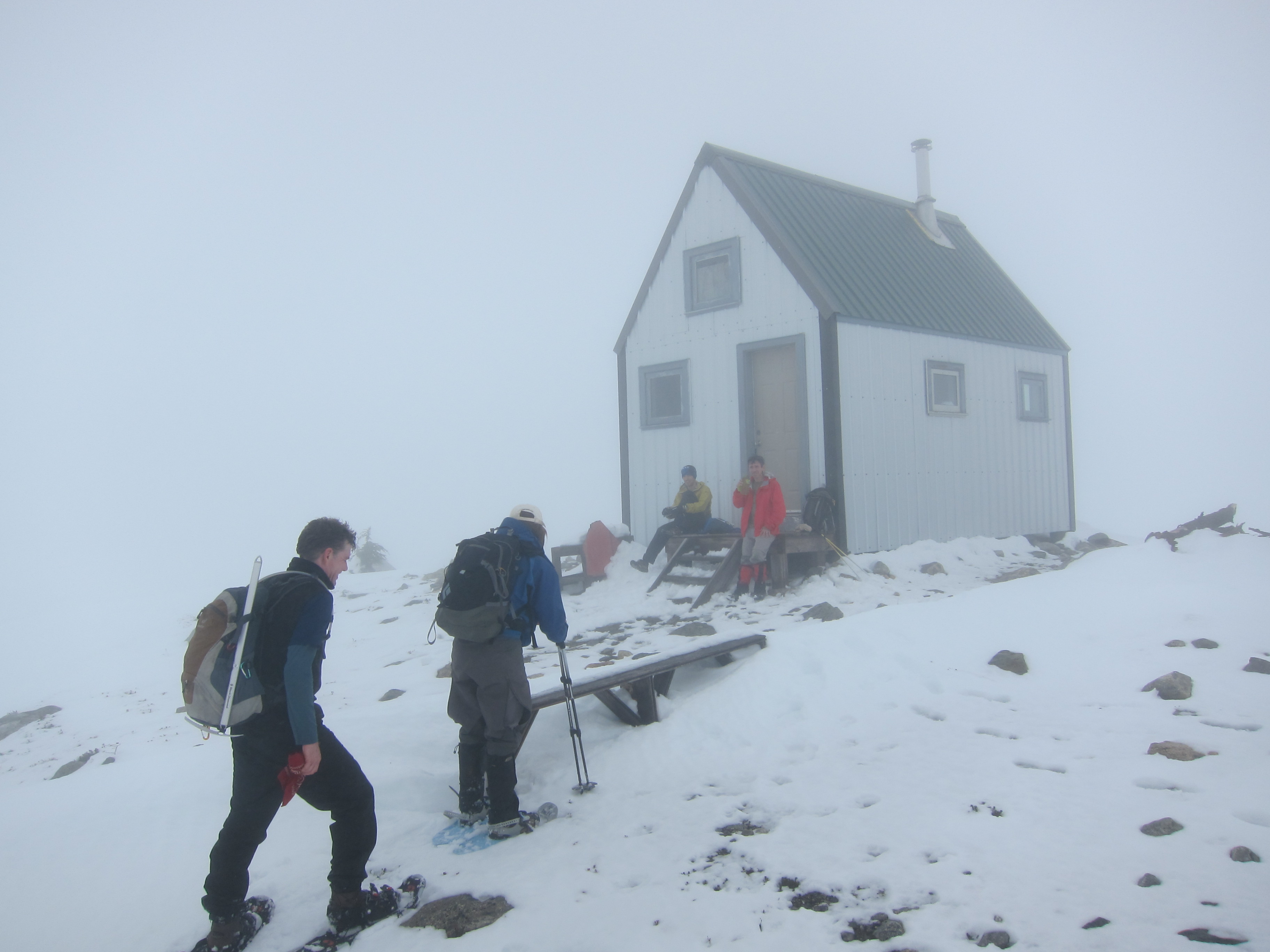
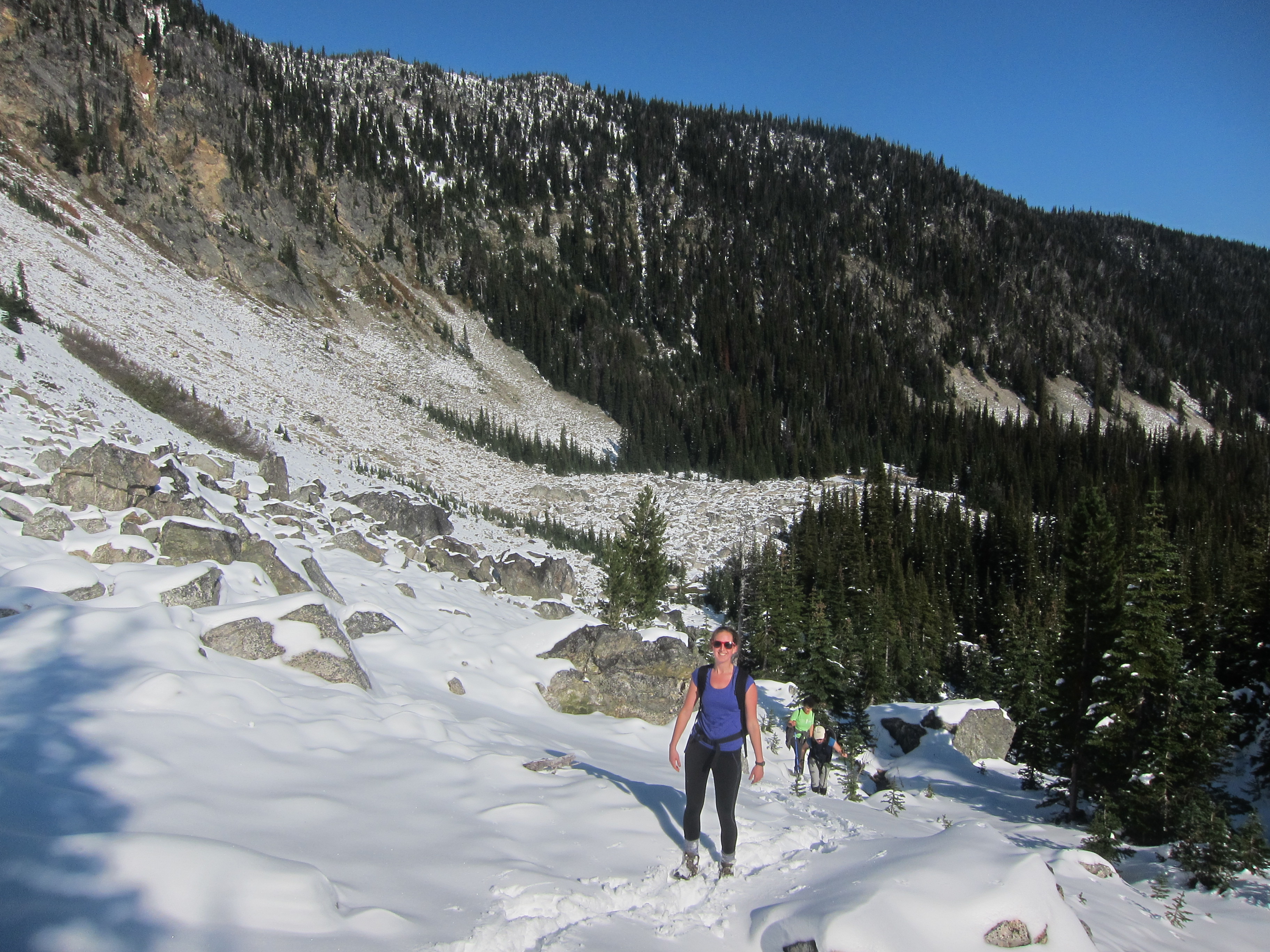
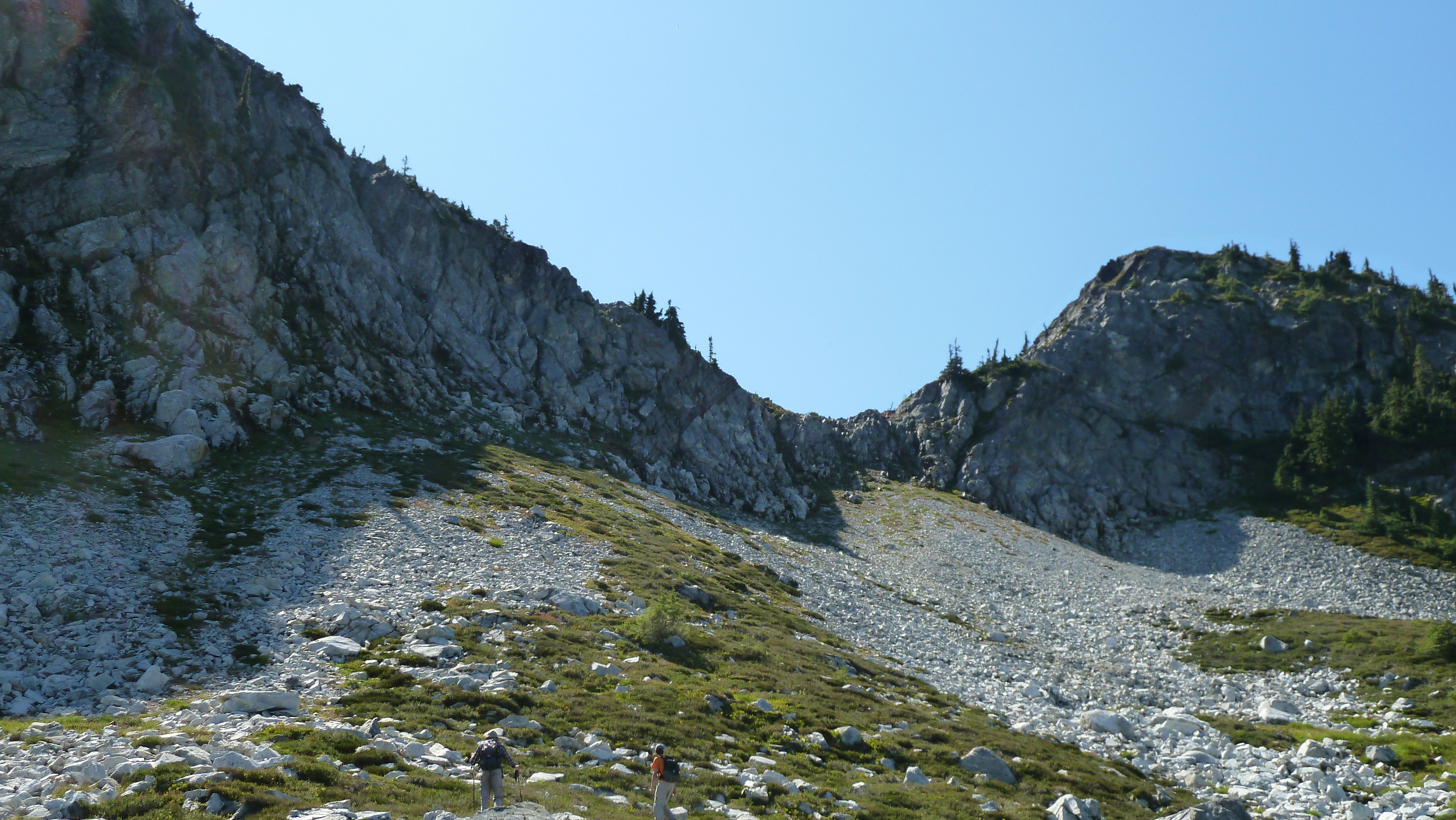
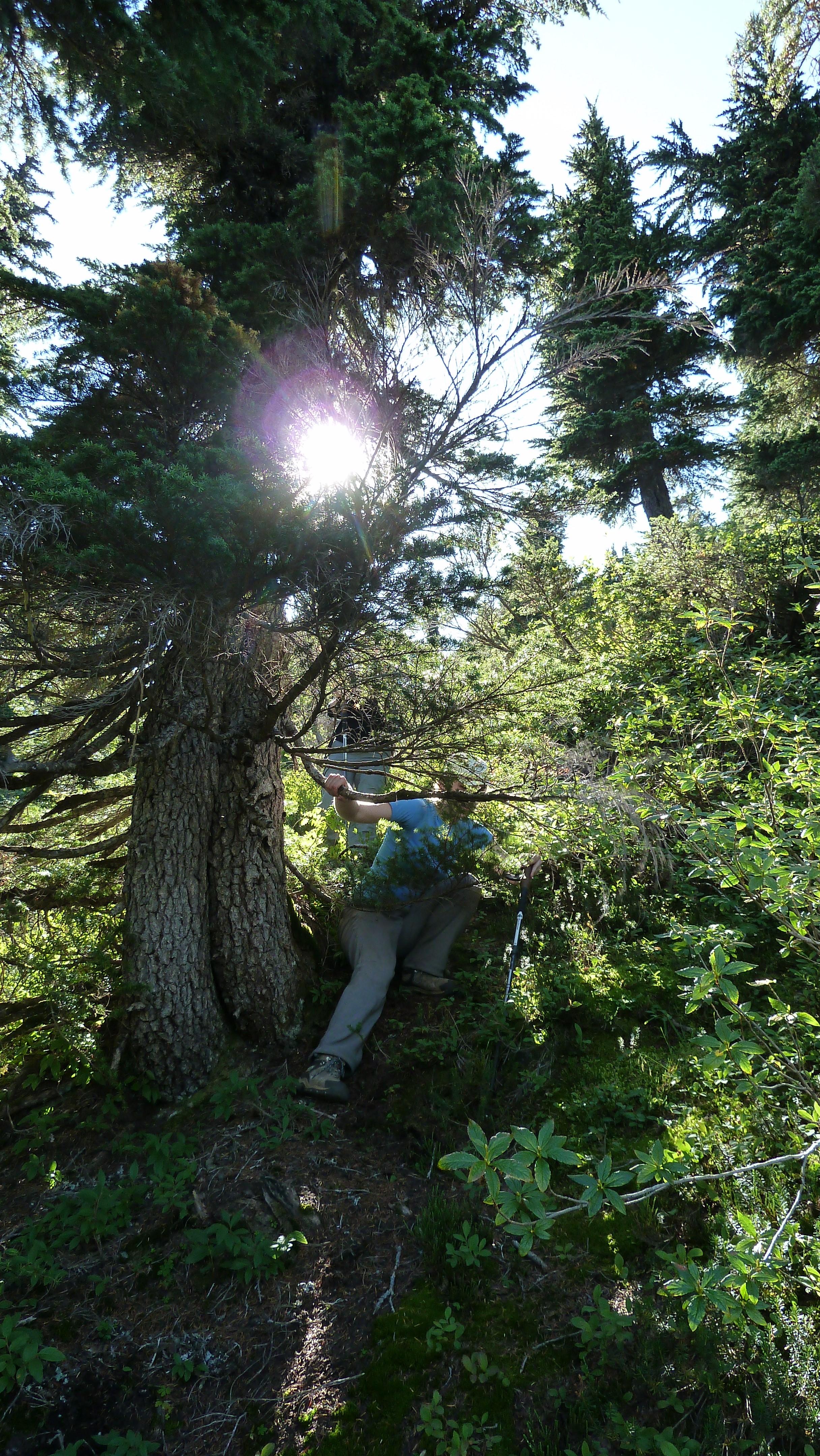
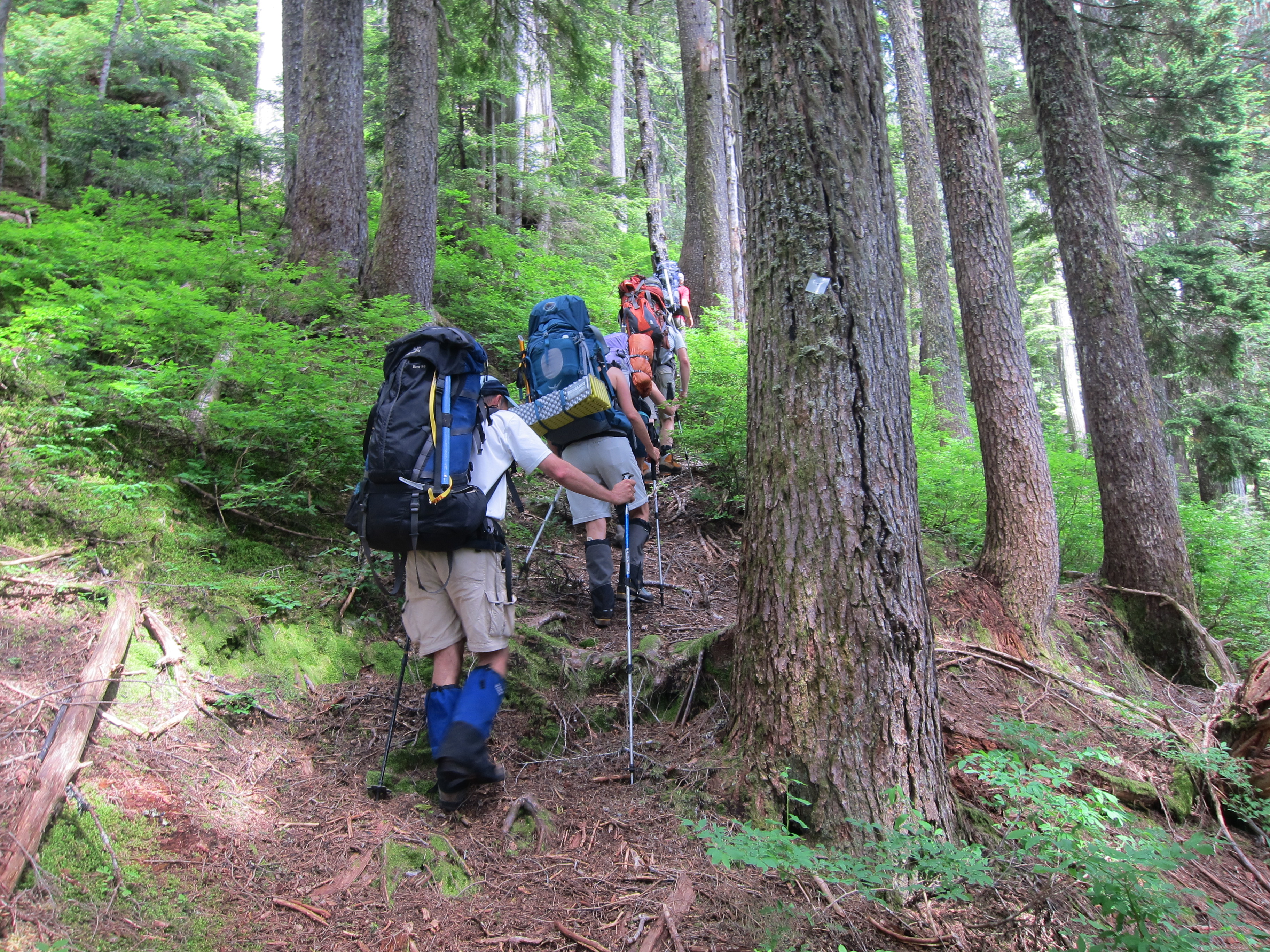
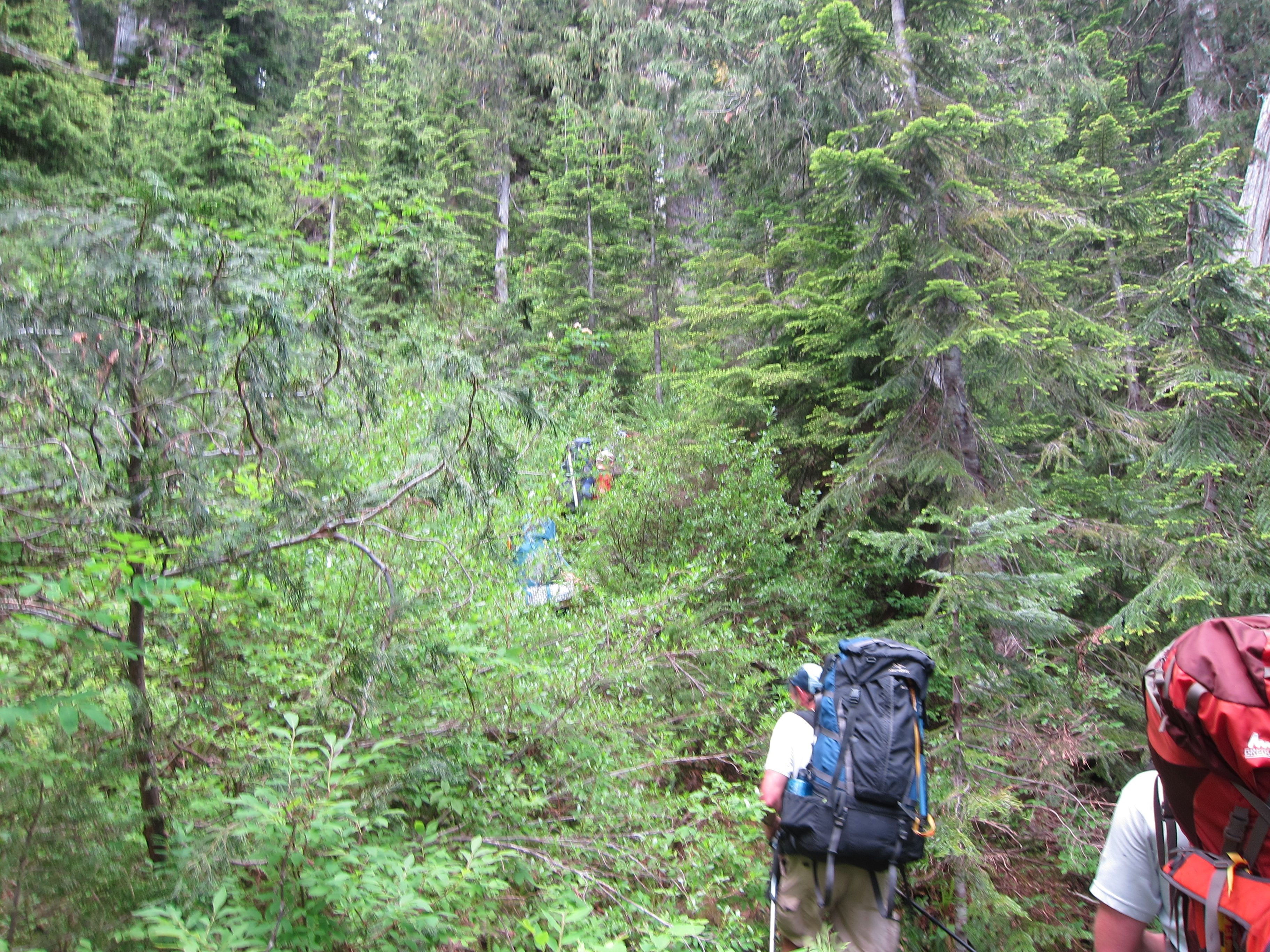
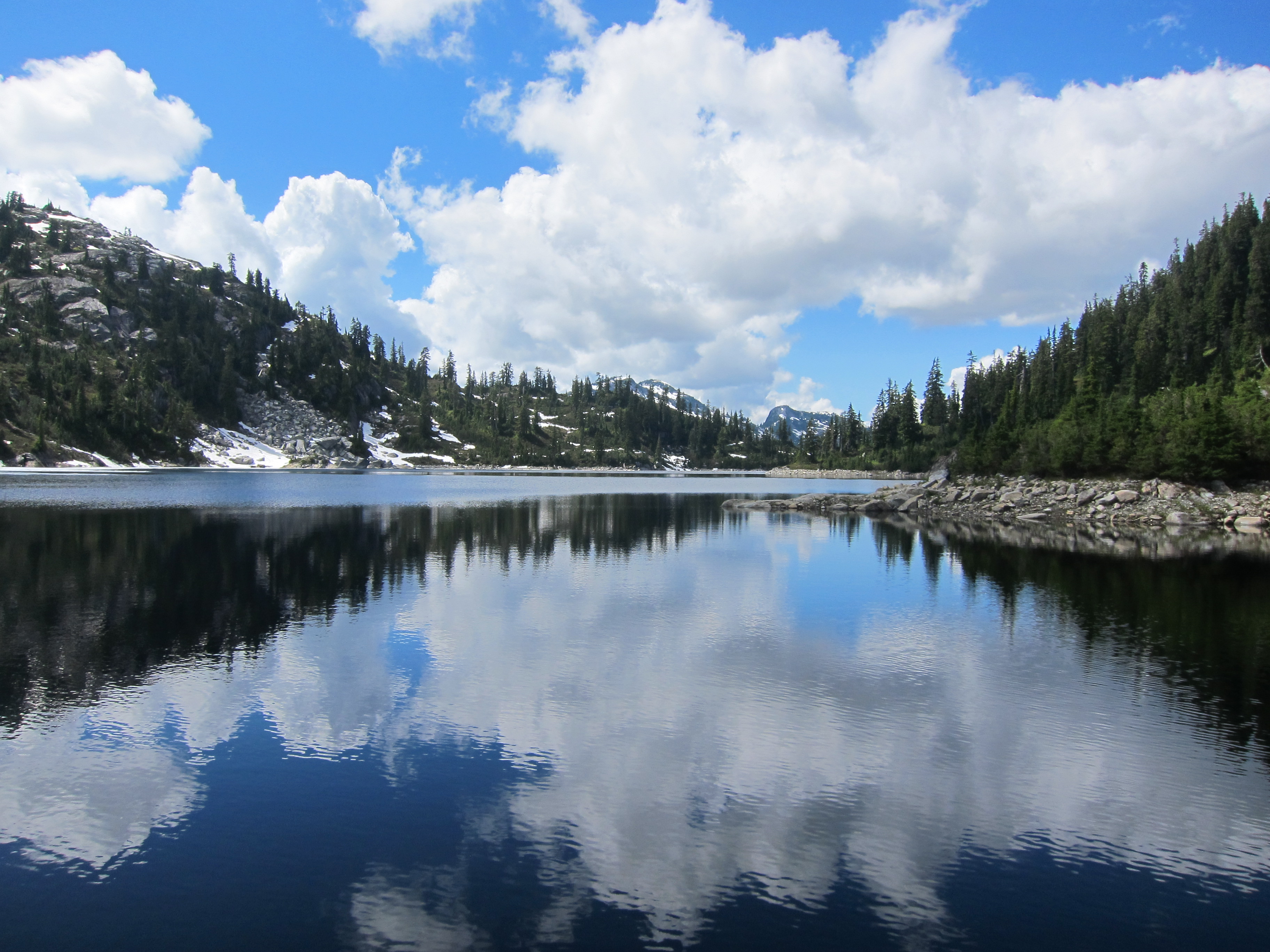
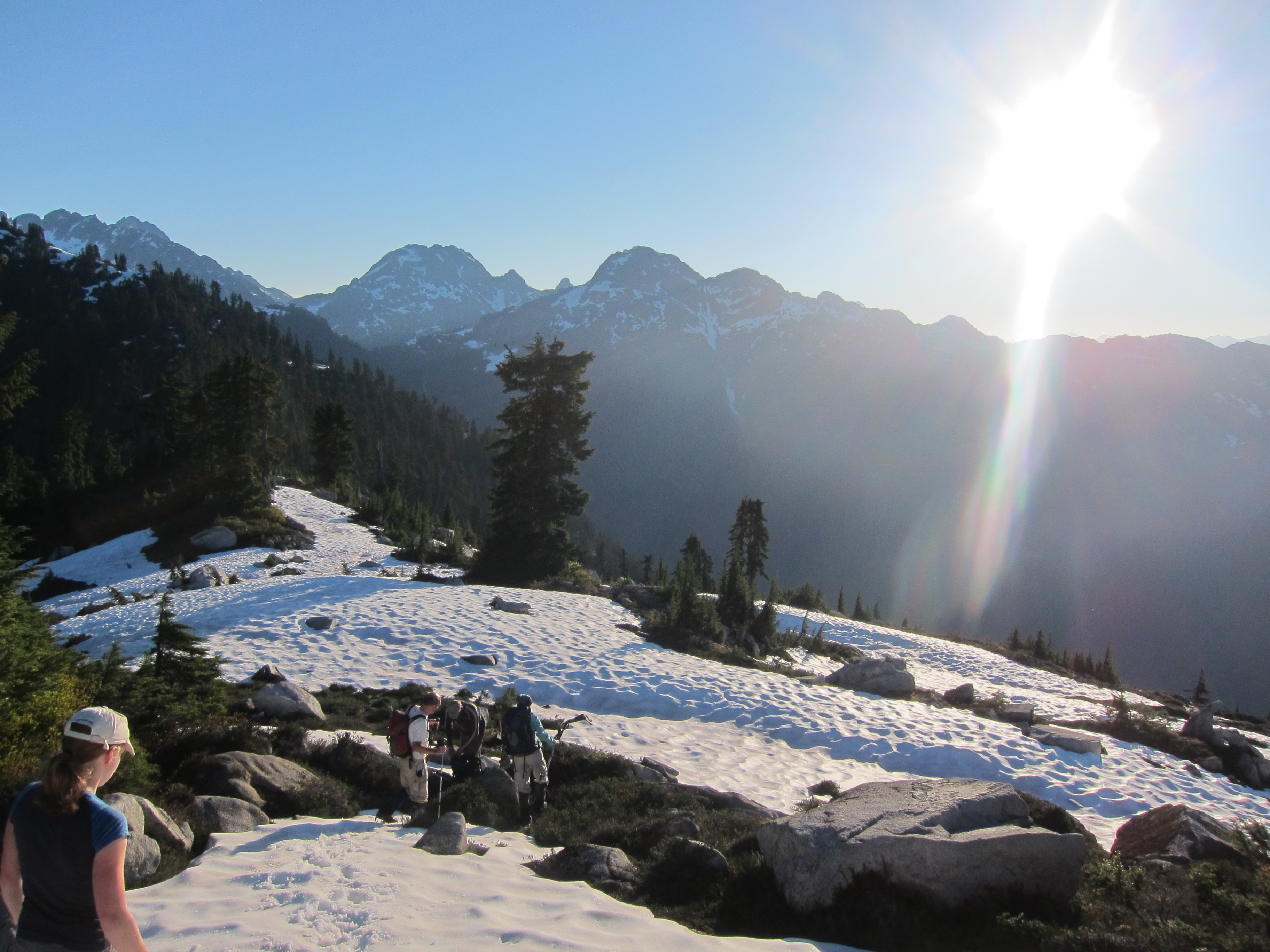
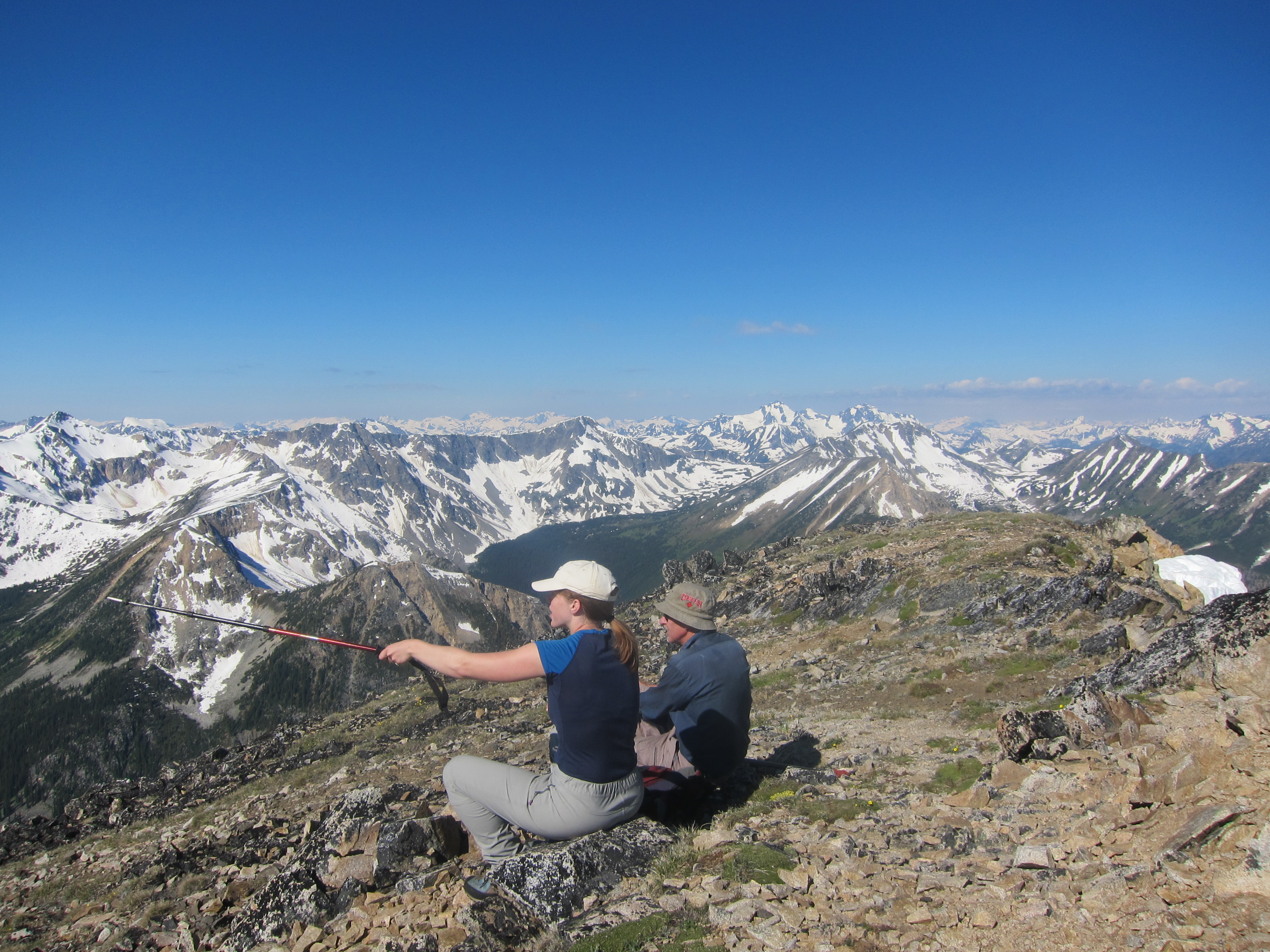
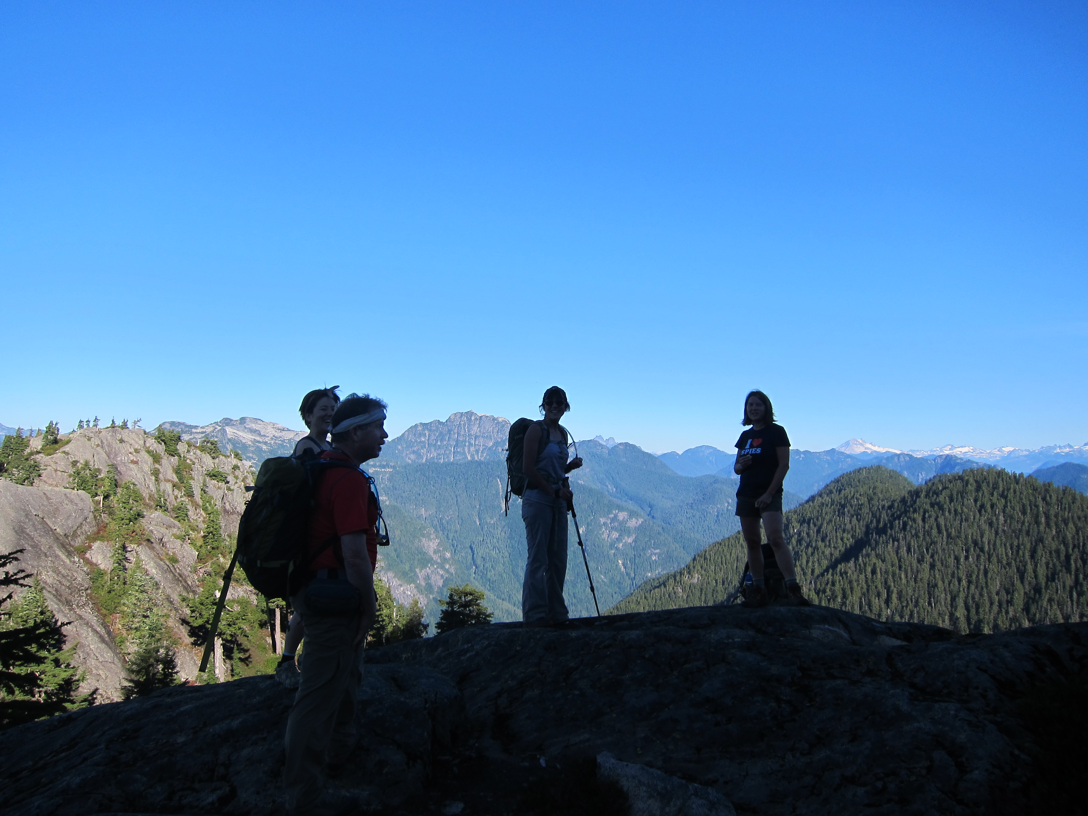
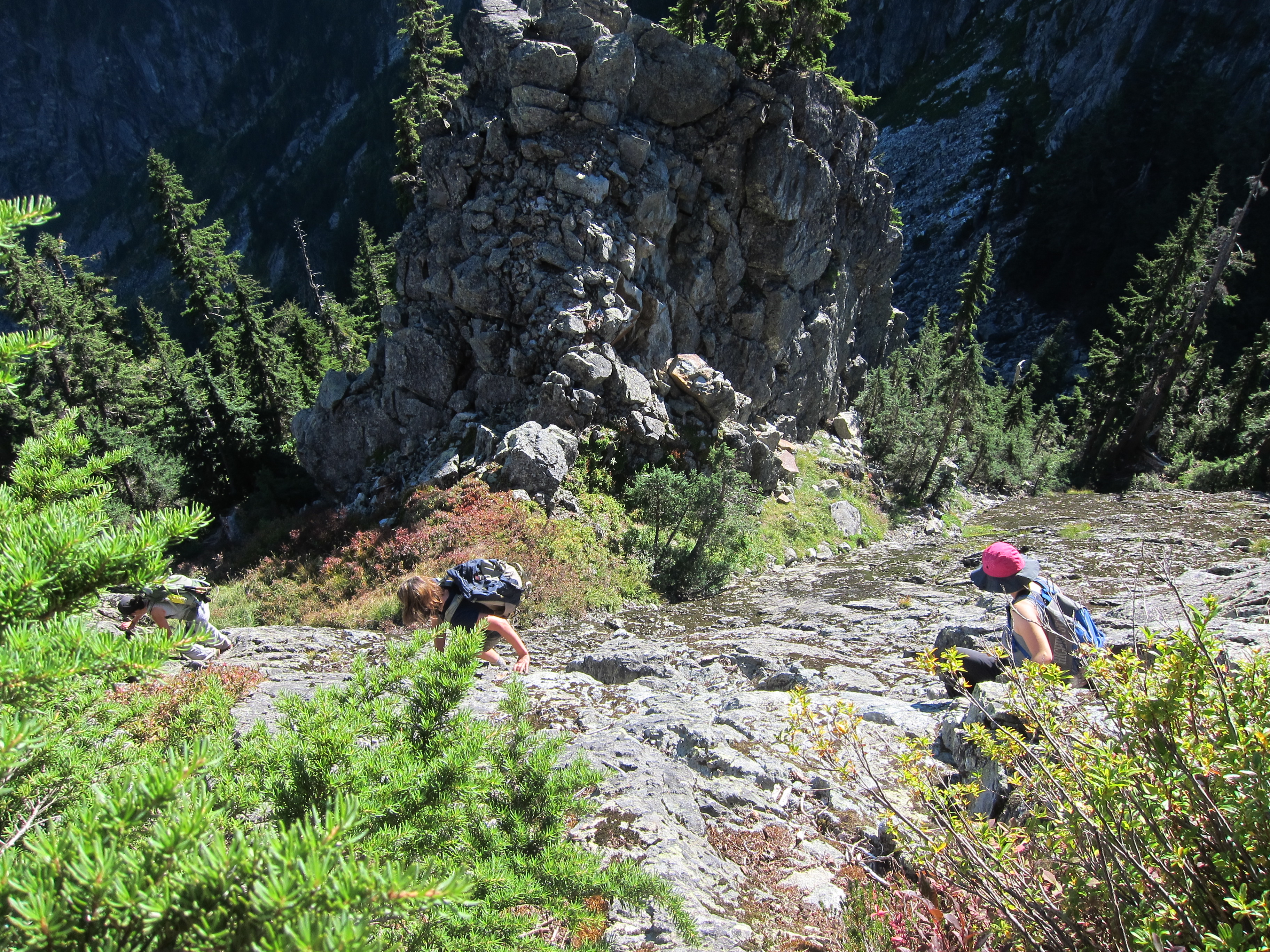
Across the bridge, the trail up to Henriette Lake is pleasant and in very good condition and we were up at the lake at noon, just 2.5 hours from when we started.  The hut is still in decent condition, albeit mouse infested.  The helipad at the lake made a great platform to relax and eat lunch before we headed off to see if the trail up to the ridge above Sylvia Lake was still in passable condition (which was considered perhaps the biggest unknown of the trip a priori).  Well… the trail is still followable (just continue on the obvious path past the helipad), and still well marked (some flagging, many markers on trees), but is badly overgrown in many places leading up to the ridge (my guess is that in another 5 years it will be getting hard to follow in places).  Nonetheless, everyone whacked through the bush in good spirits and we made our way up to the point on the ridge directly above Sylvia Lake.

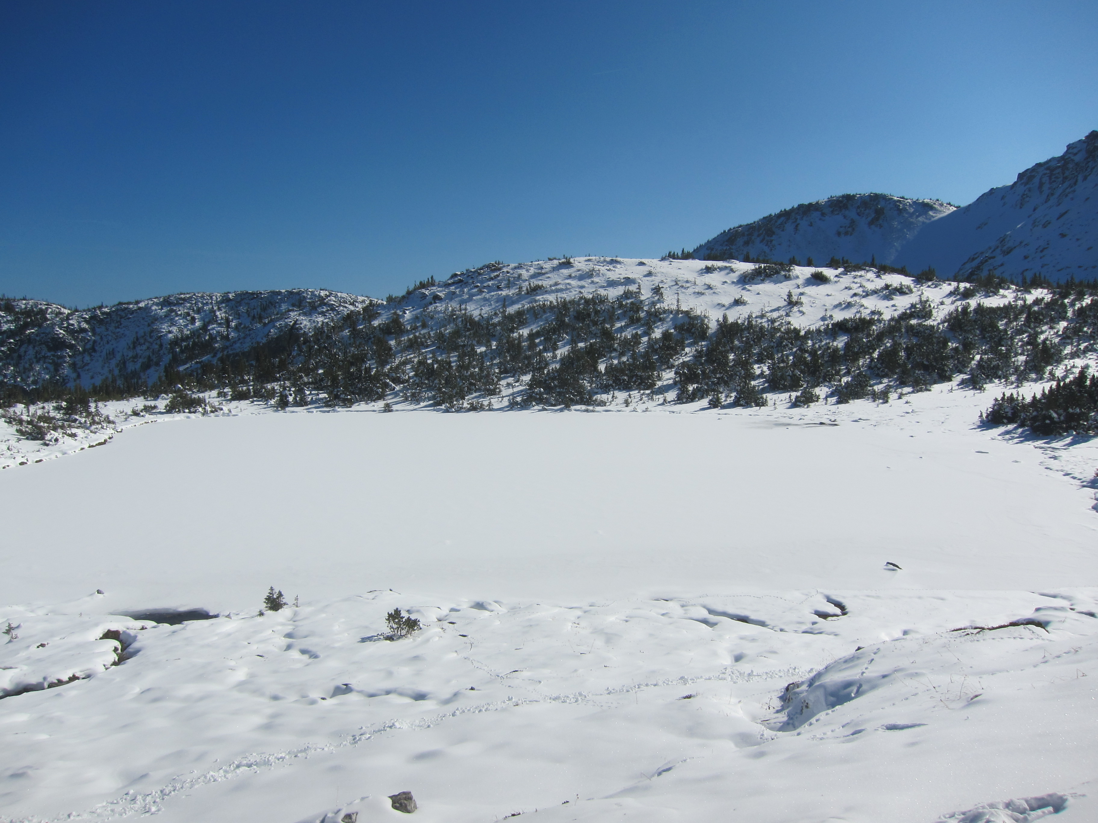
In exchange for permission to dock at Woodfibre, we had agreed to help out the owners by taking photos of the outlet of Sylvia Lake, and Thomas, Ed, and myself went down to find the outlet.  Going down to the lake took only a few minutes, but it didn’t take long heading around the lake to find a small cliff blocking our progress around the lake.  Stubbornly refusing to walk back the way we went down and take the easy way around the cliff, Thomas led us straight up through the bush.  60 degree bush, occasionally wet, this was most definitely the crux of the trip for us, our struggles completely unbeknownst to the rest of our party who were sunbathing and waiting back on the ridge.  From here it was straightforward down to the outlet of the lake where photos were taken and we hustled back to meet everyone else and continue our way towards Mt. Roderick.

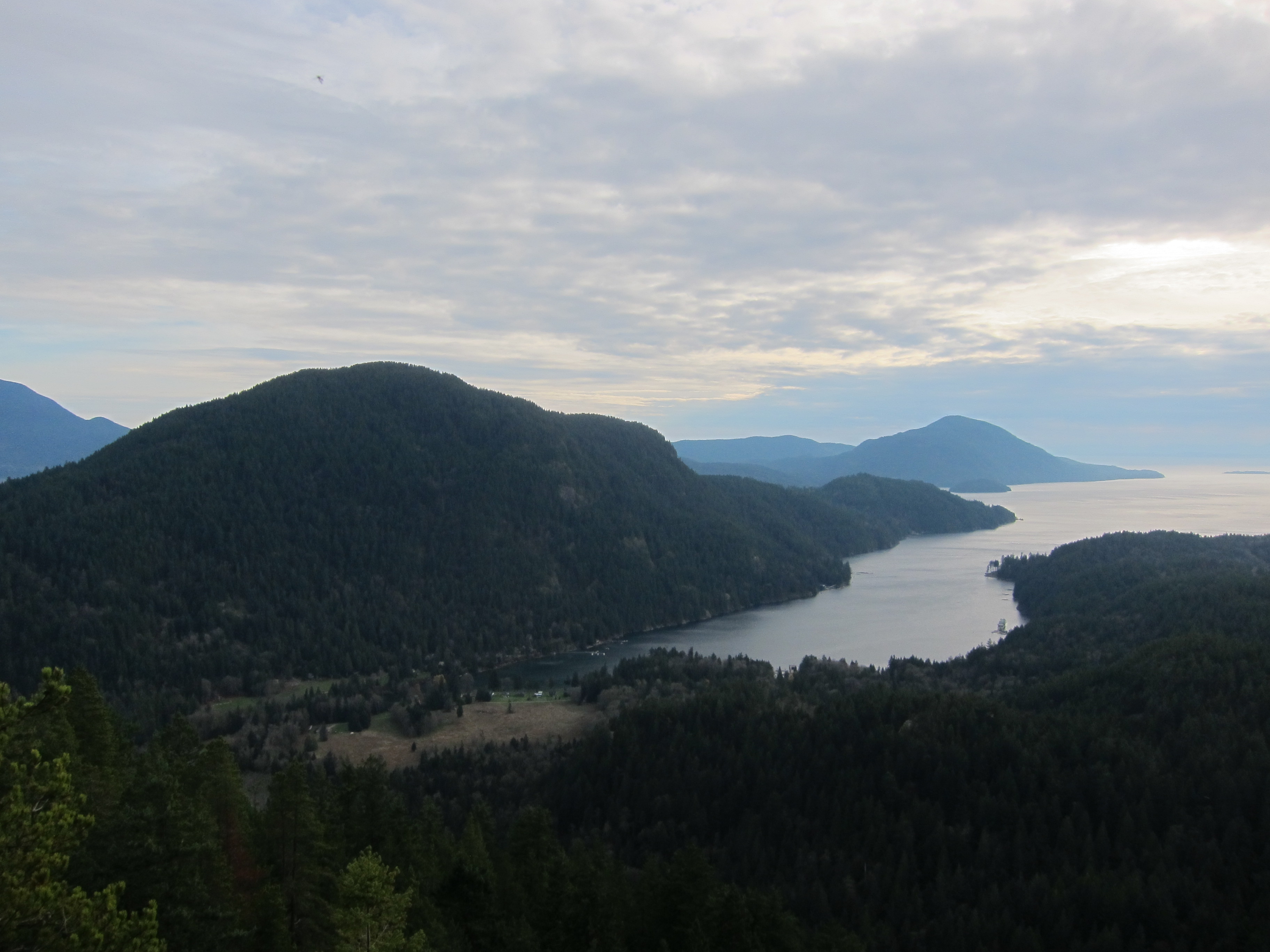
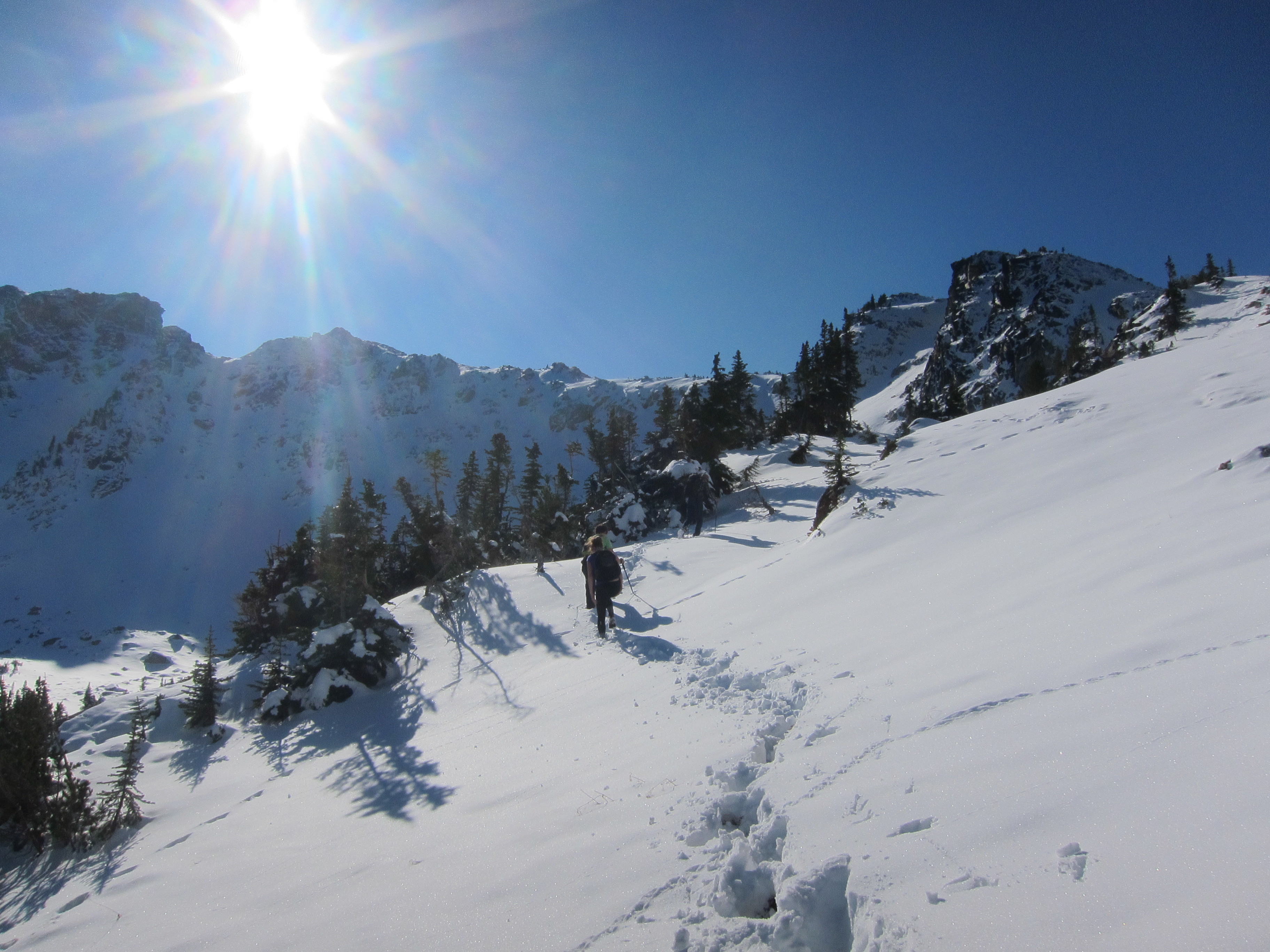
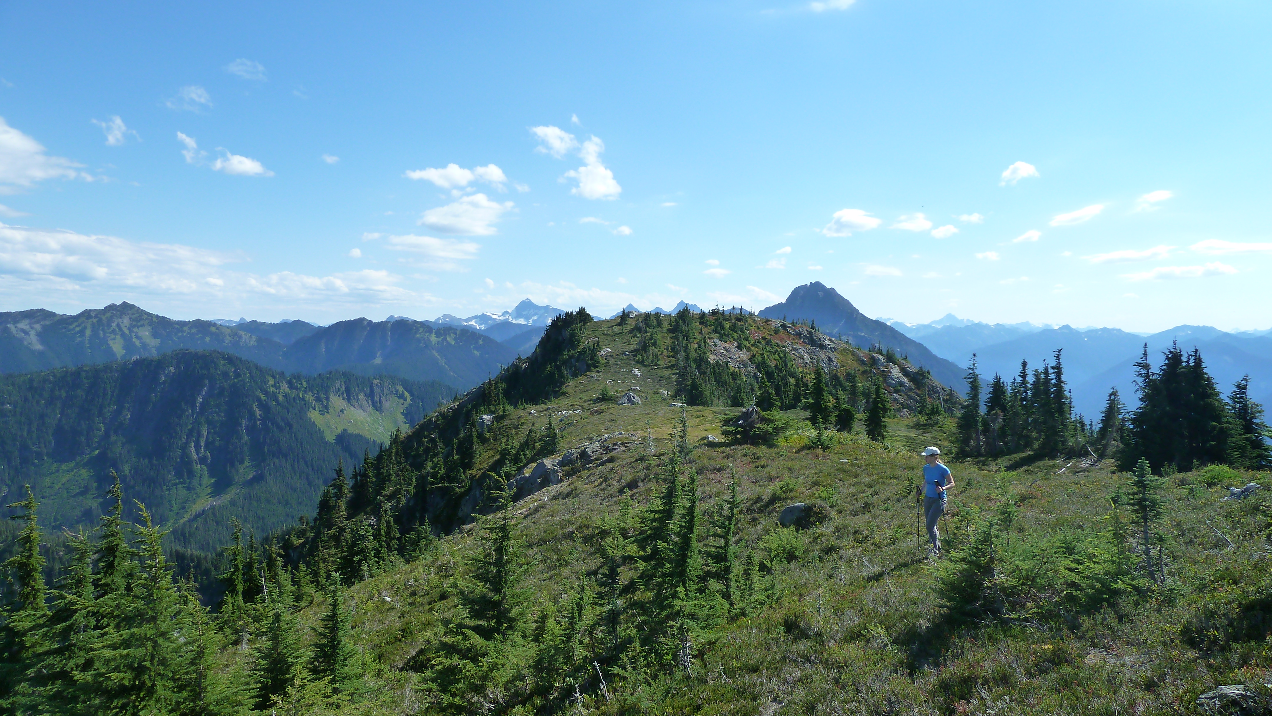
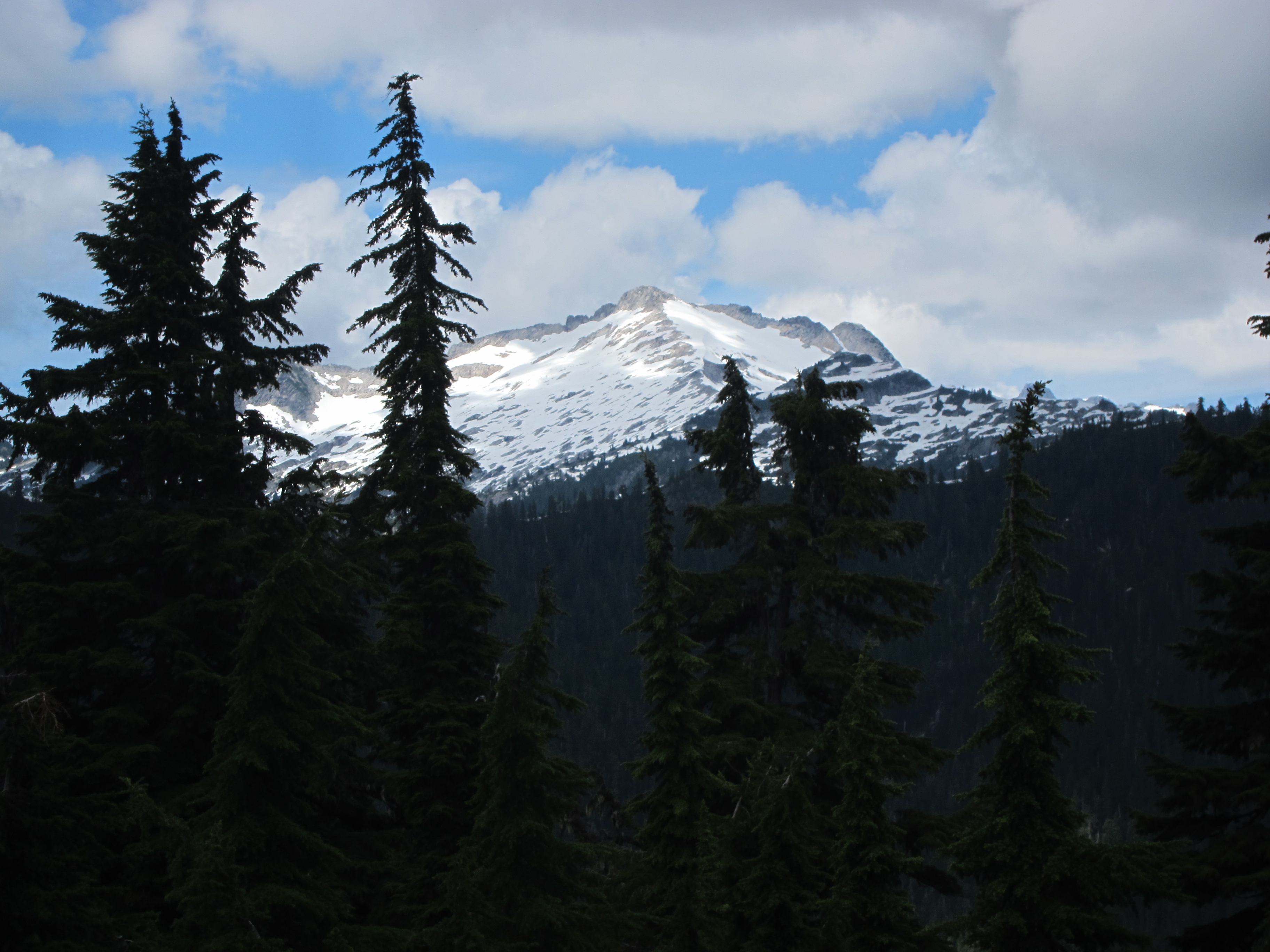
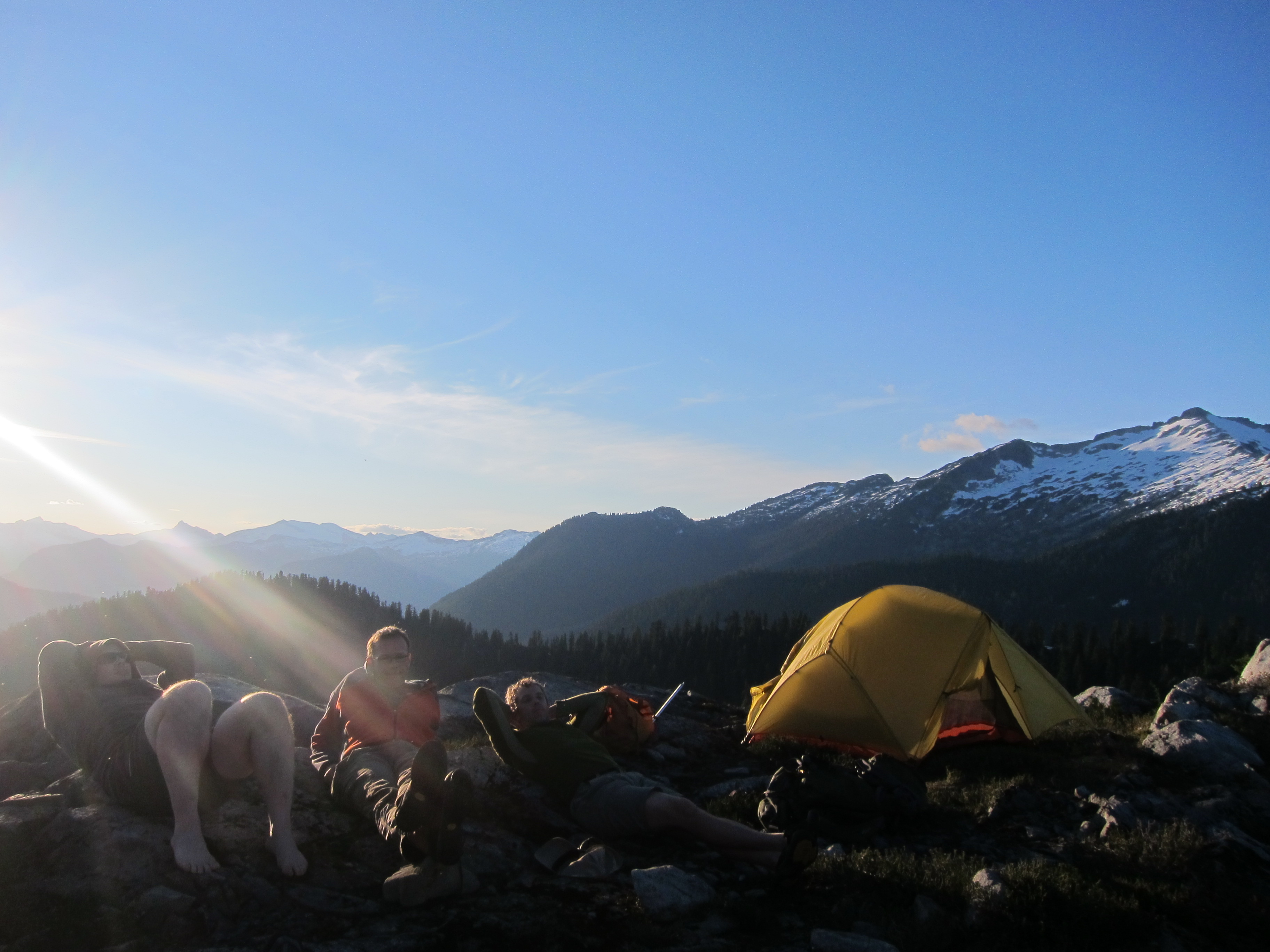
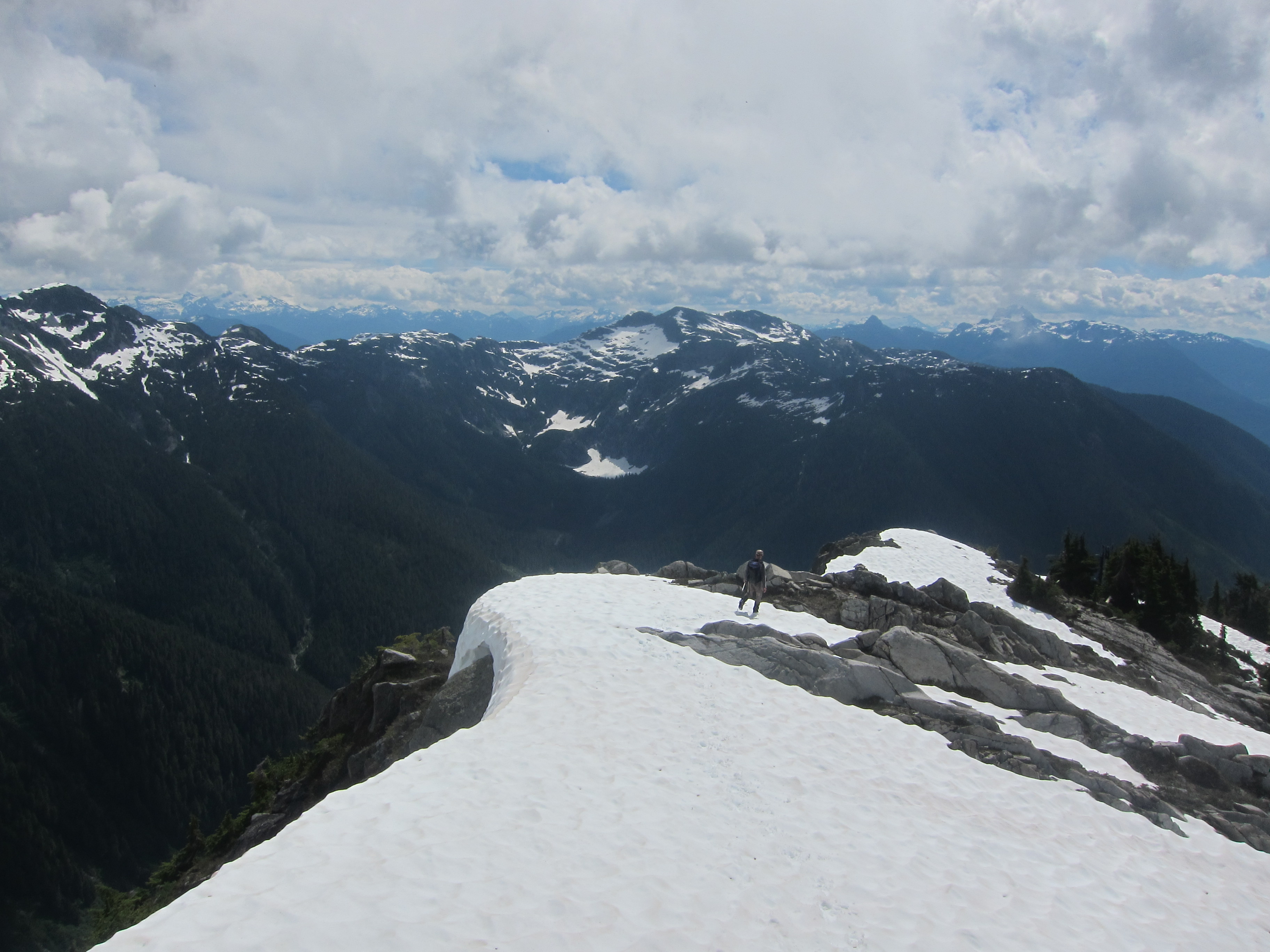
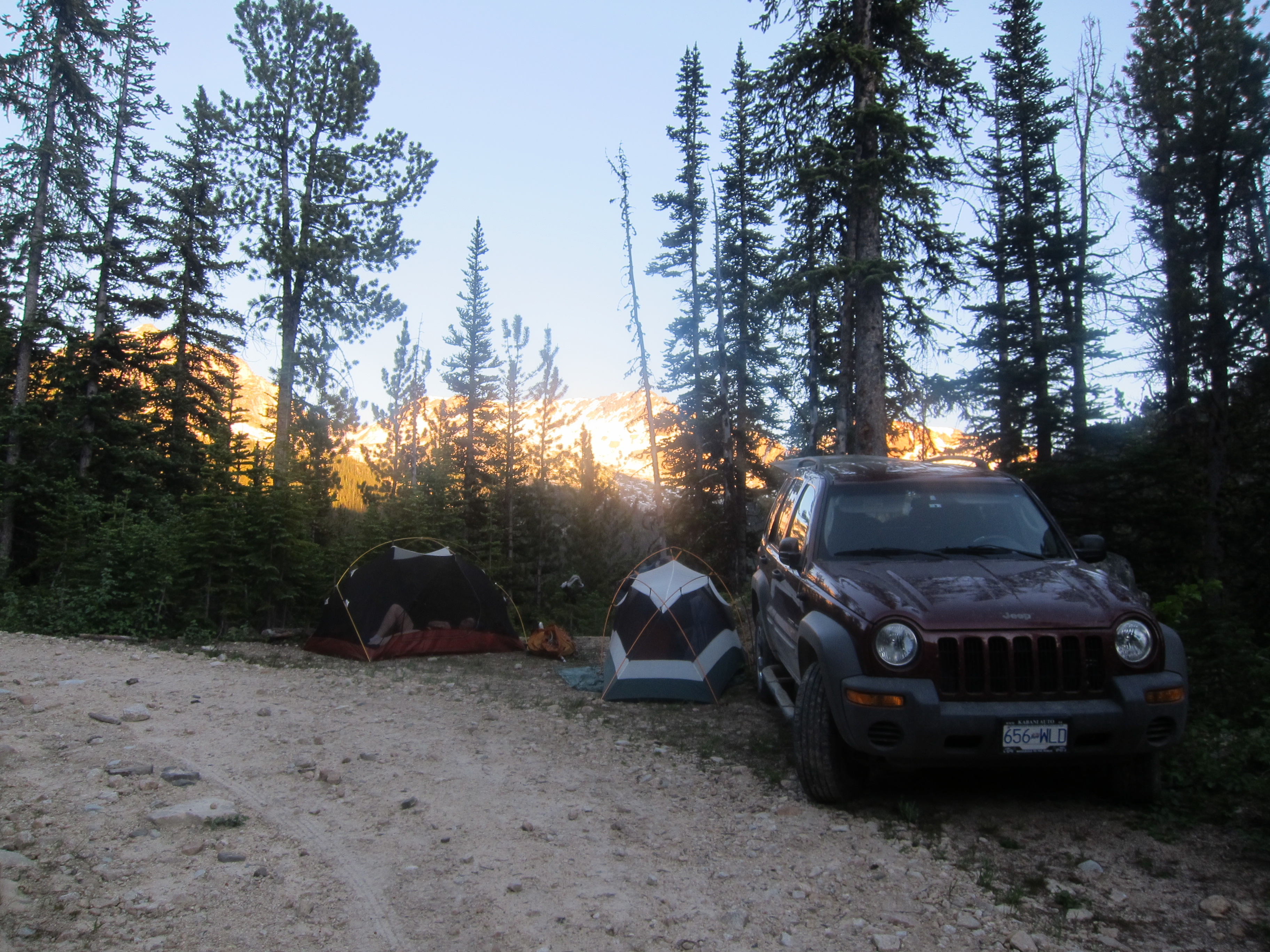
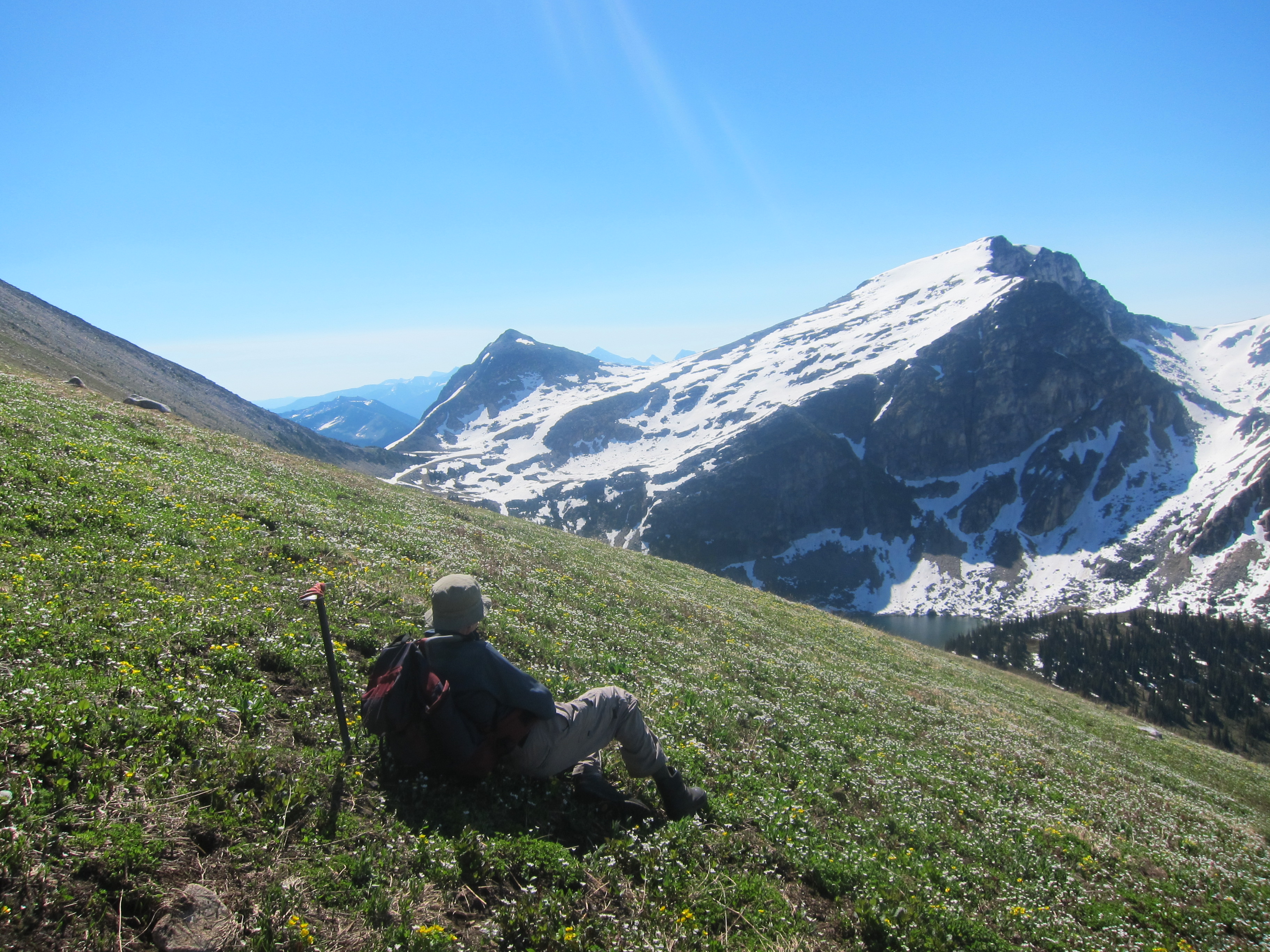
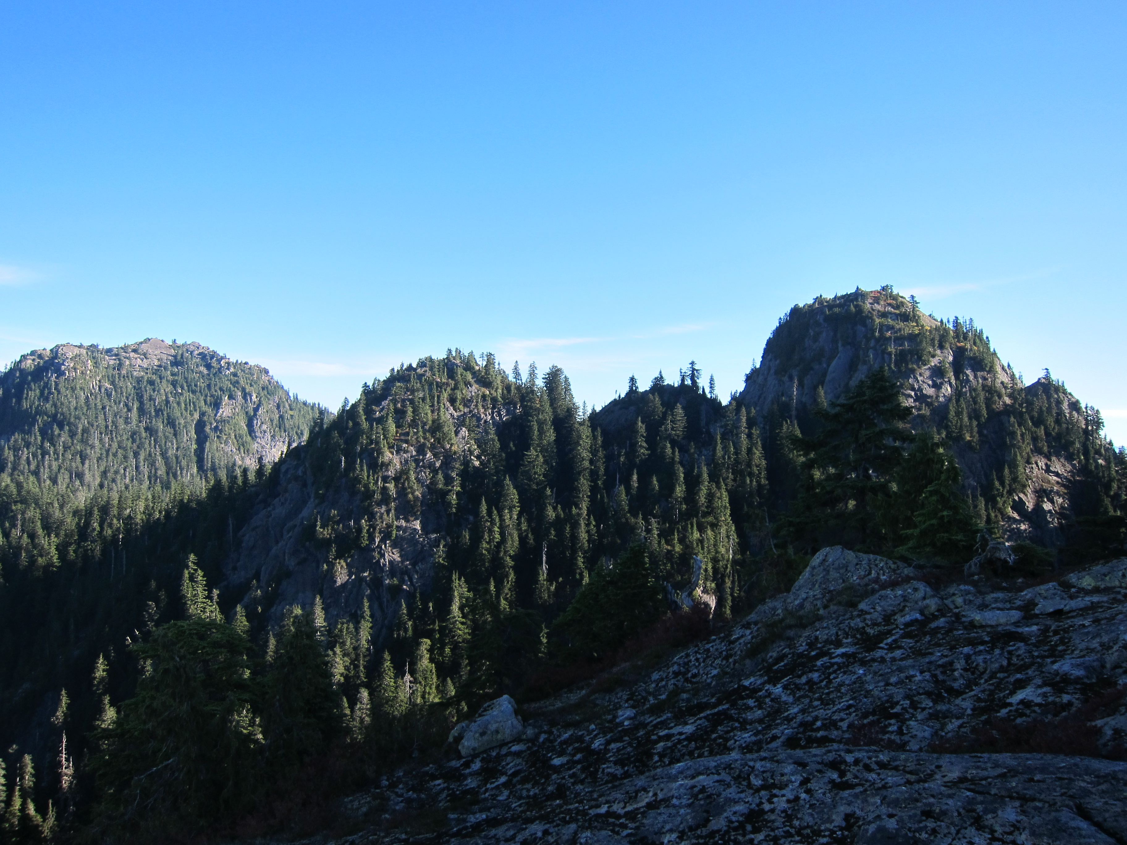
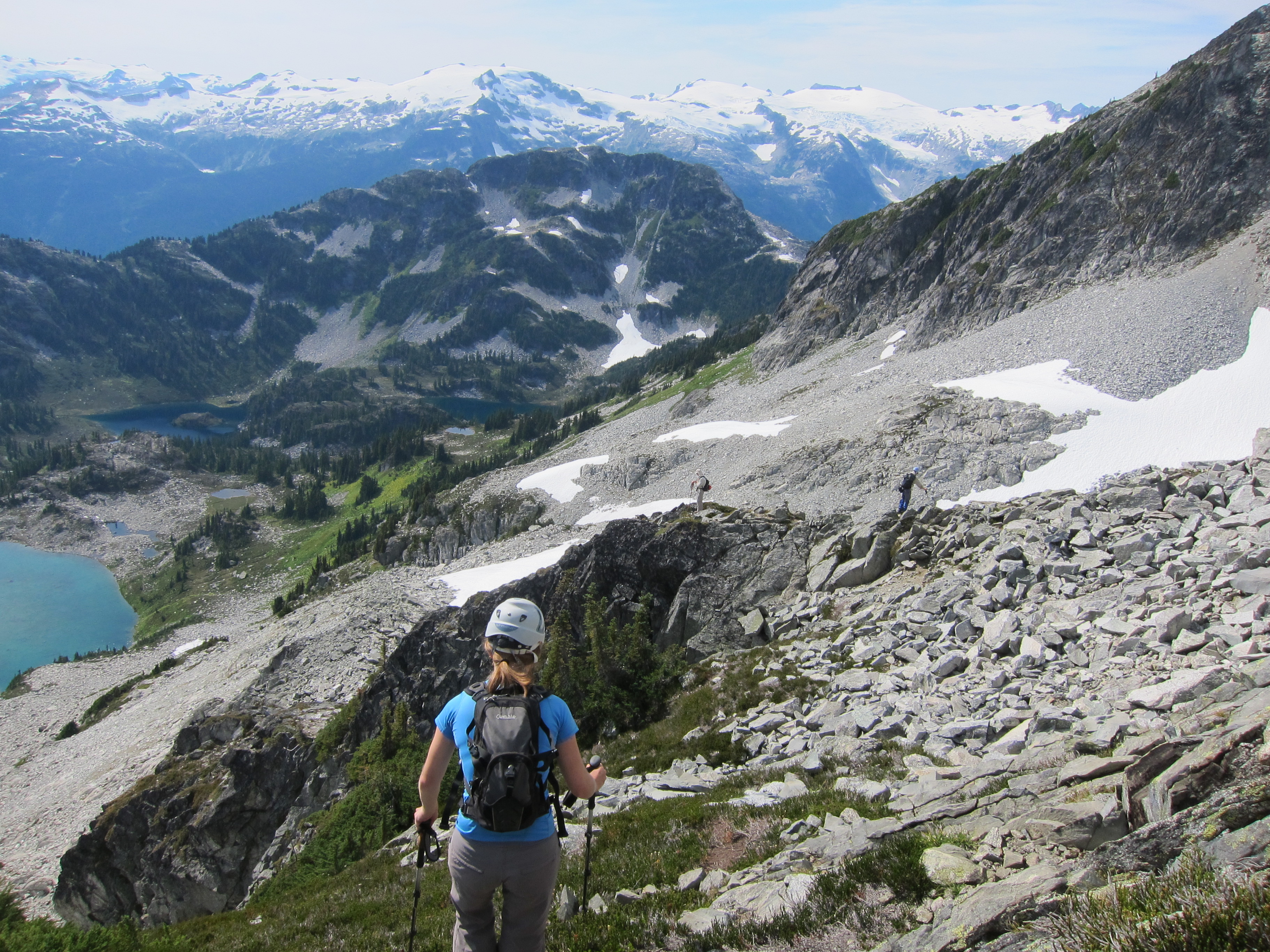
The ridge has some substantial up and down as it contours around Woodfibre Lake, but the footbed was well defined and the trail easy to follow at least 90% of the time.  The ridge is open enough that whenever we lost the trail it was always quickly stumbled upon again, and just as we started to tire we found ourselves at a beautiful camping spot on the ridge, approximately 1km SW of the summit of Mt. Roderick, a bit over 13km from where we started hiking.  The weather and views were incredible all evening, and a great time relaxing was had by all.

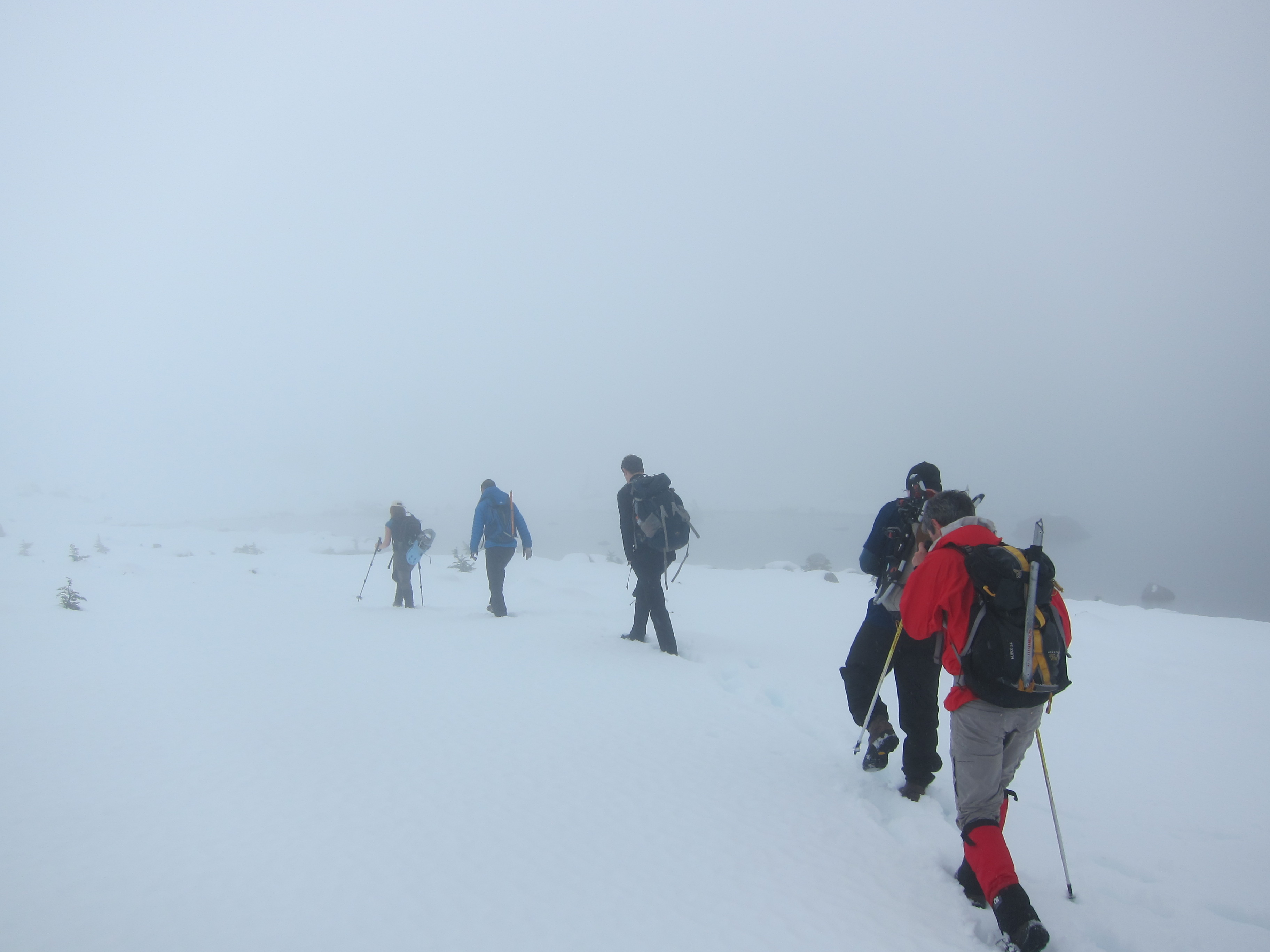
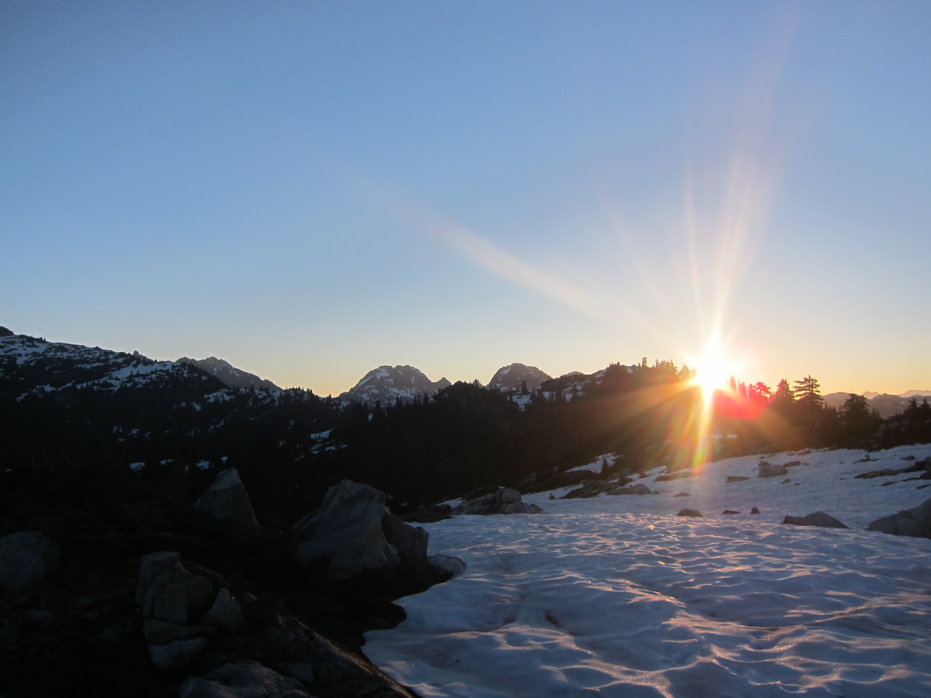
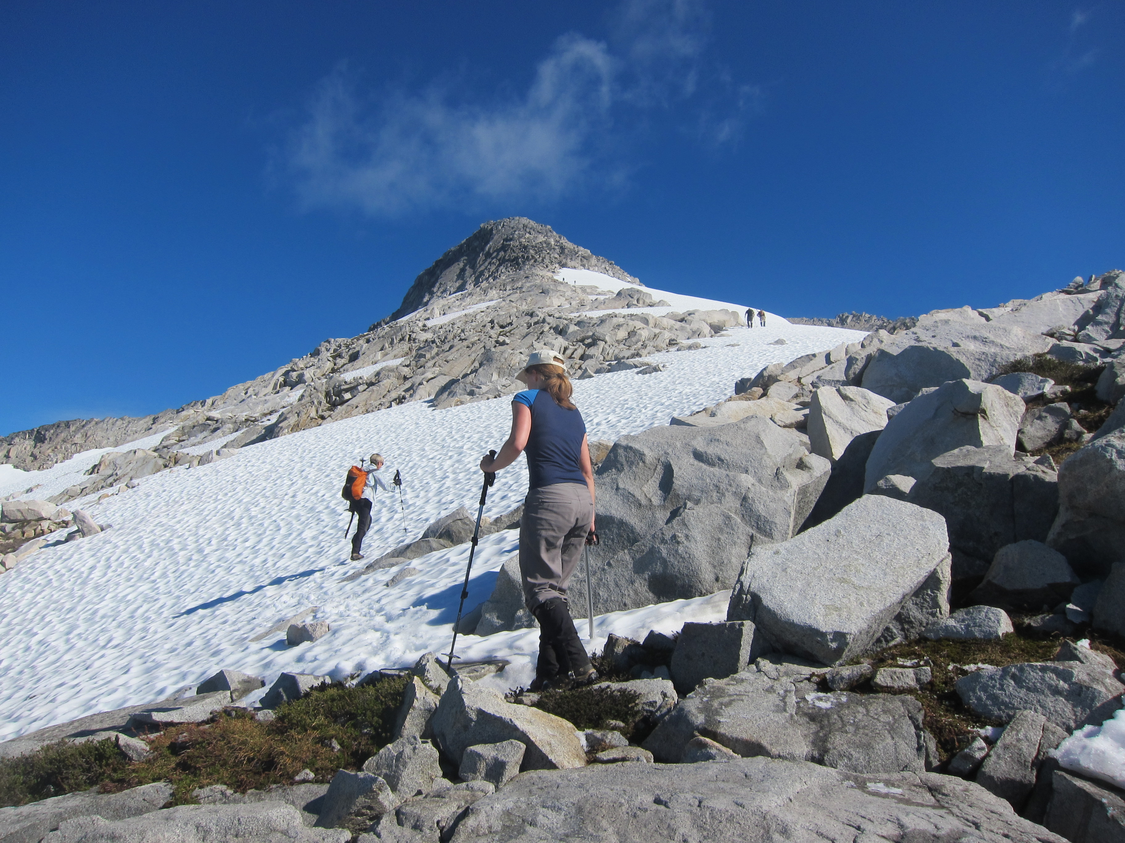
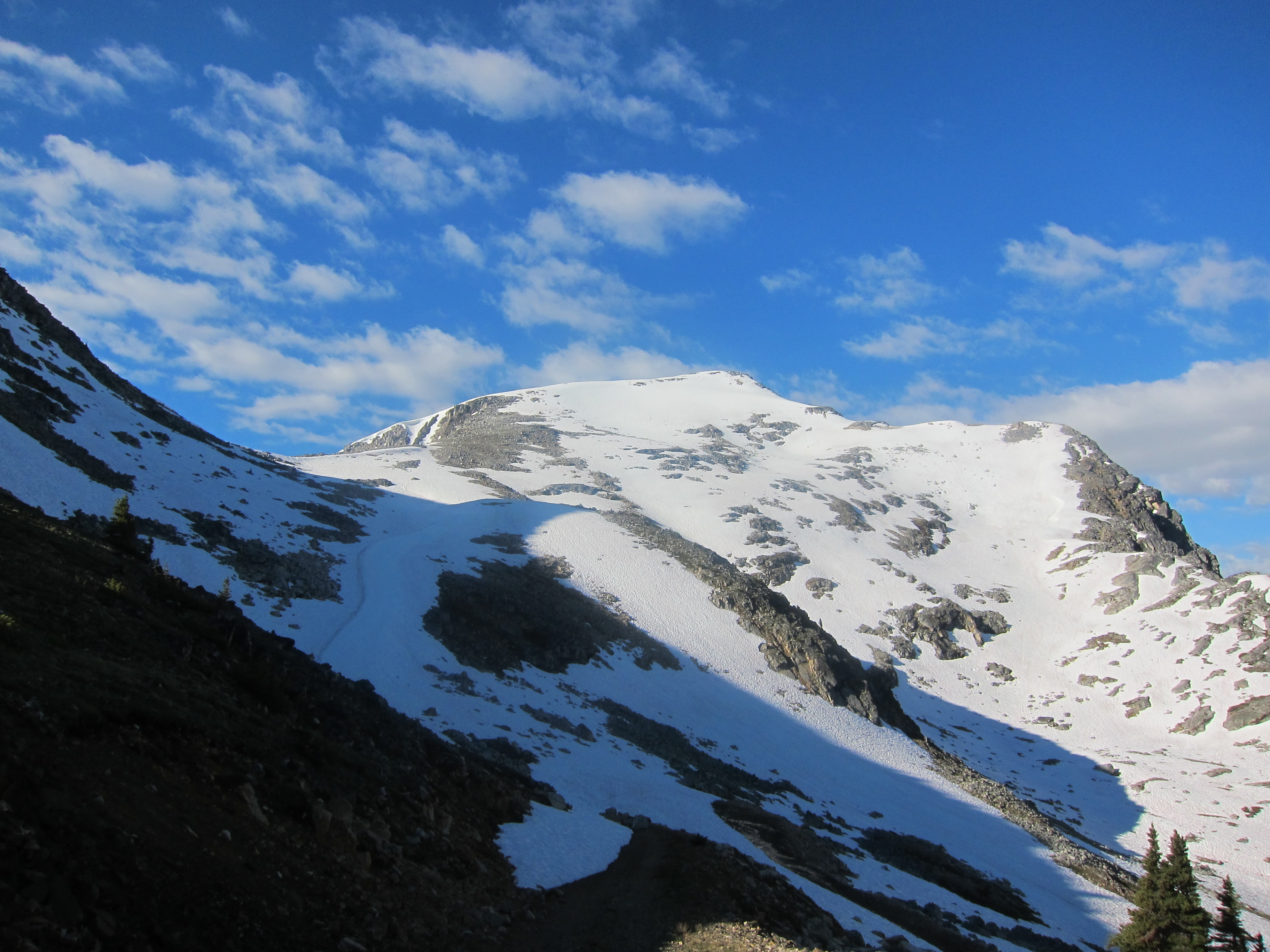
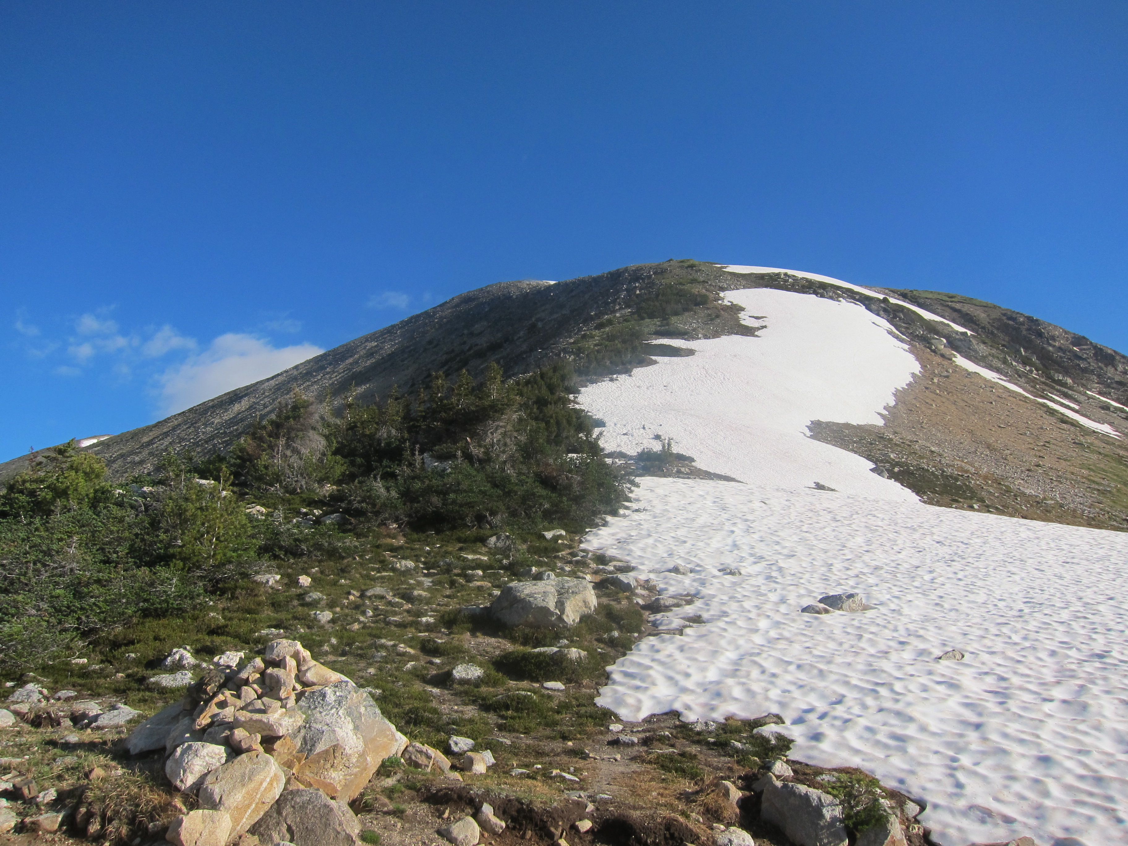
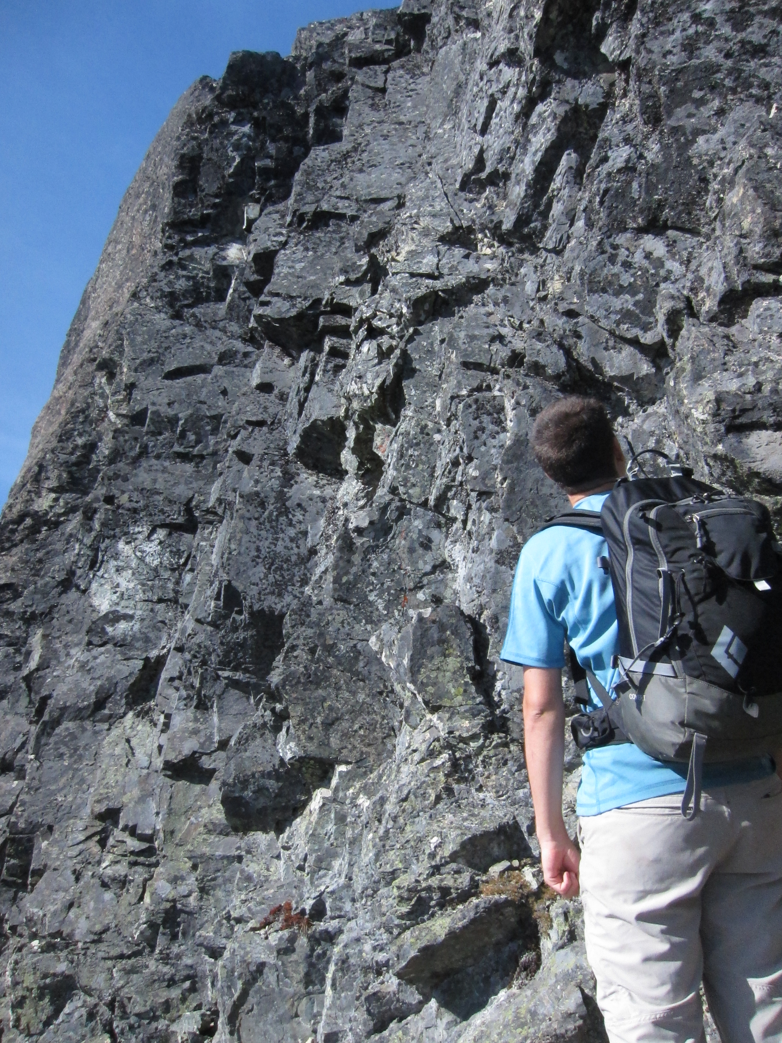
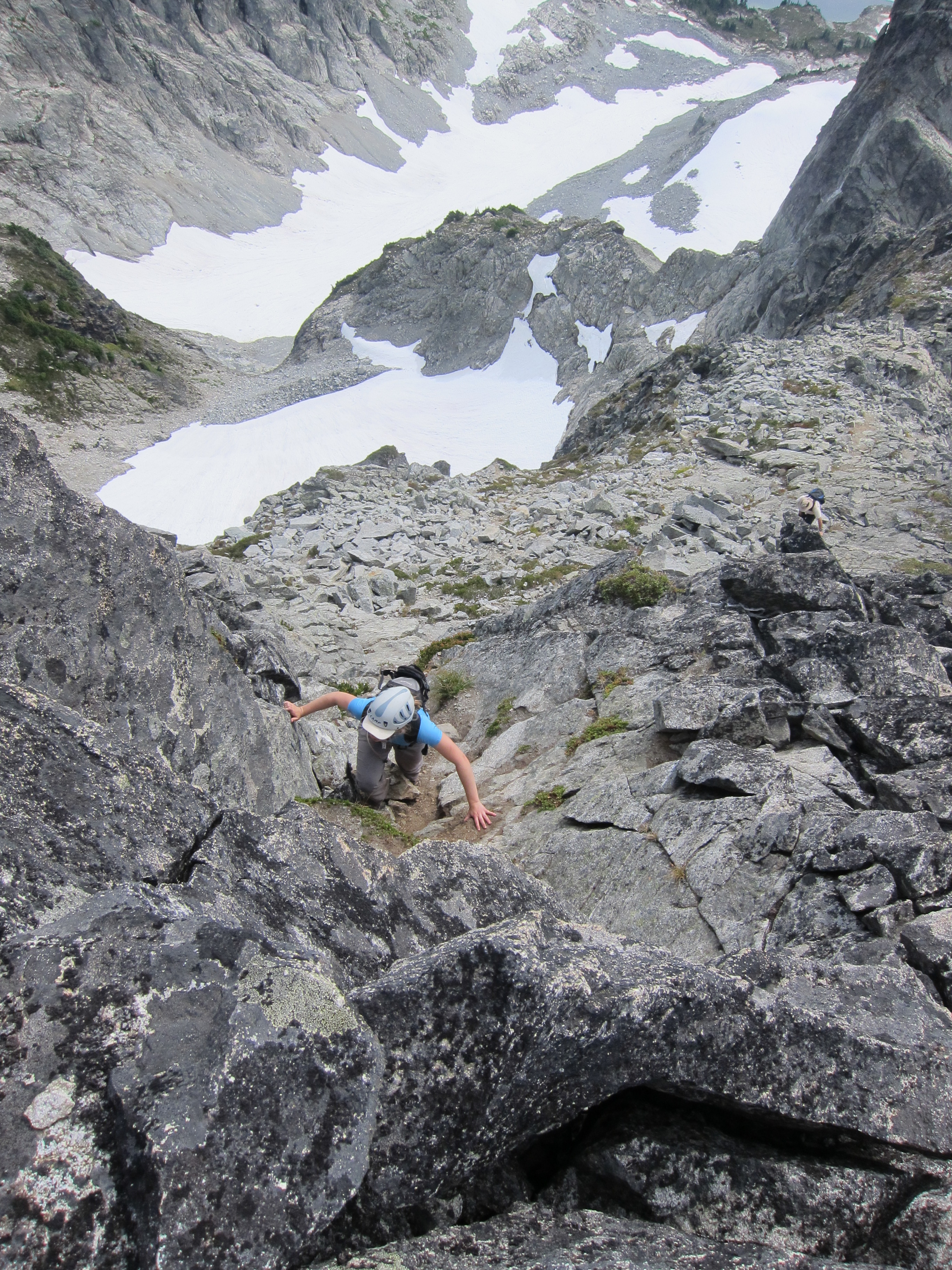
The next morning we woke up at 5am, with the goal of getting moving by 6.  The route from here to the summit of Mt. Sedgwick was straightforward, but long (still over 5km to go), and not always quick (some lower parts bushy, some higher parts bouldery), but everyone was on the summit of Mt. Sedgwick by 9:45.  Success at last!

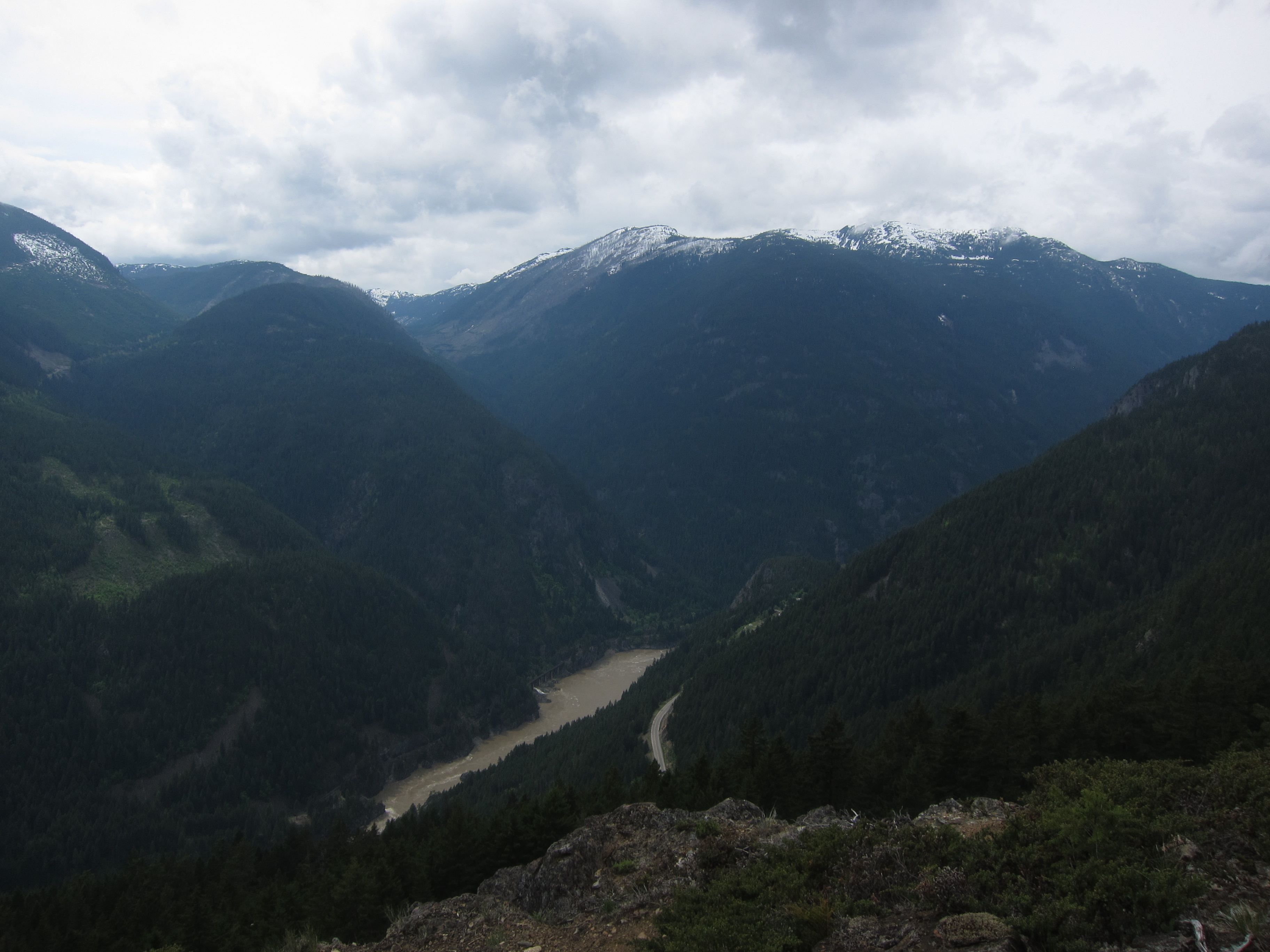
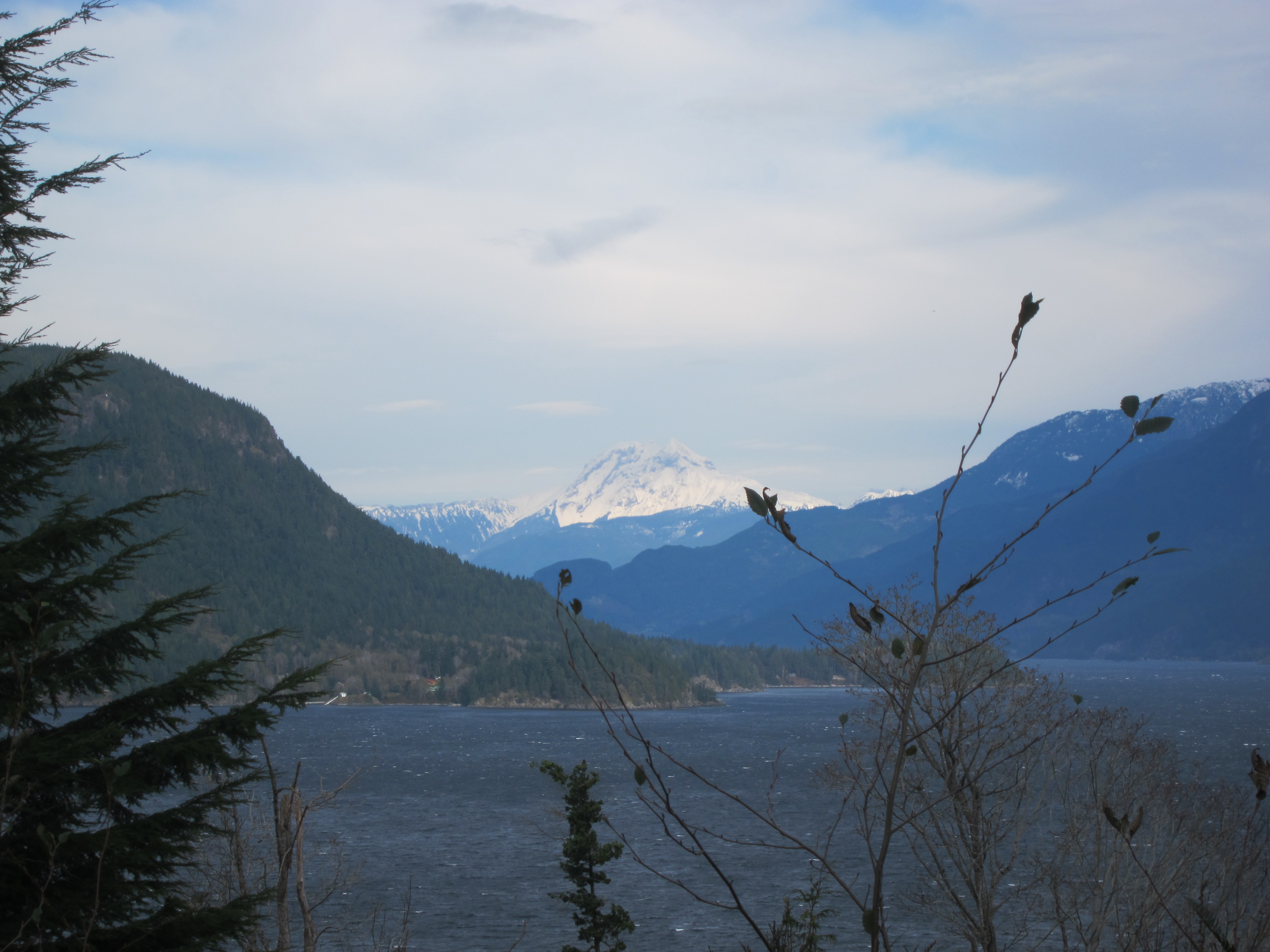
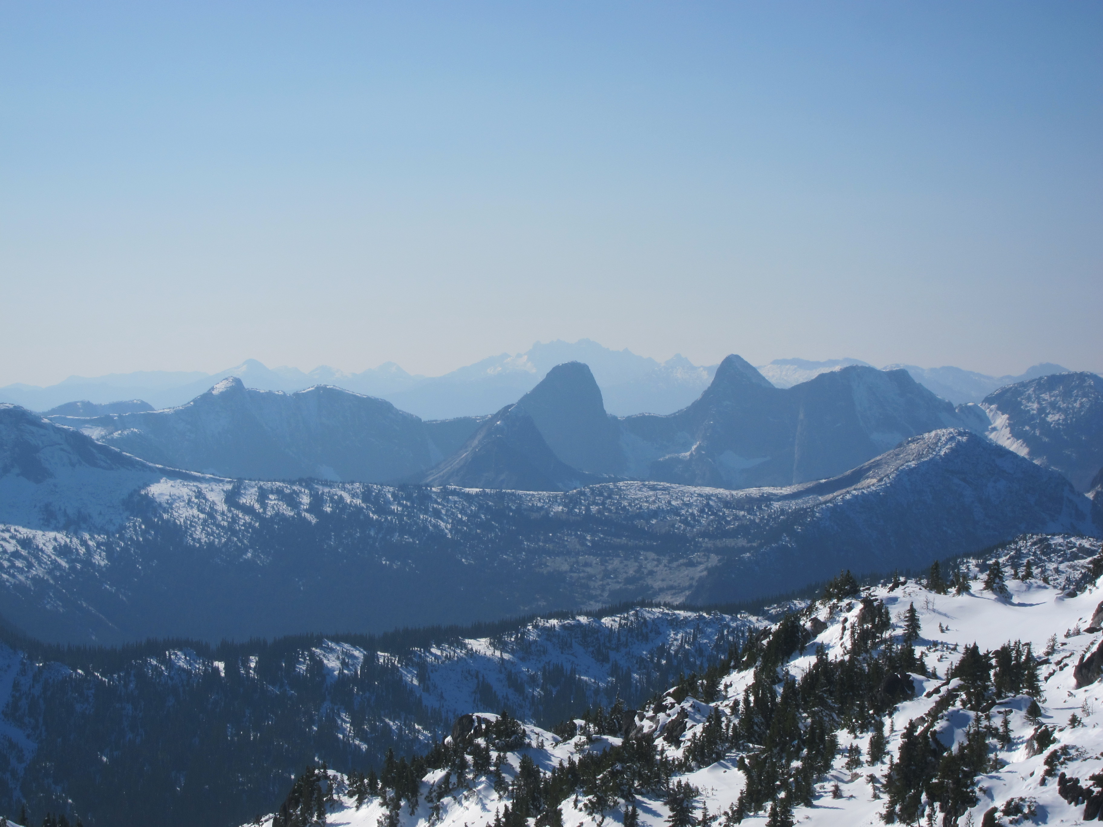
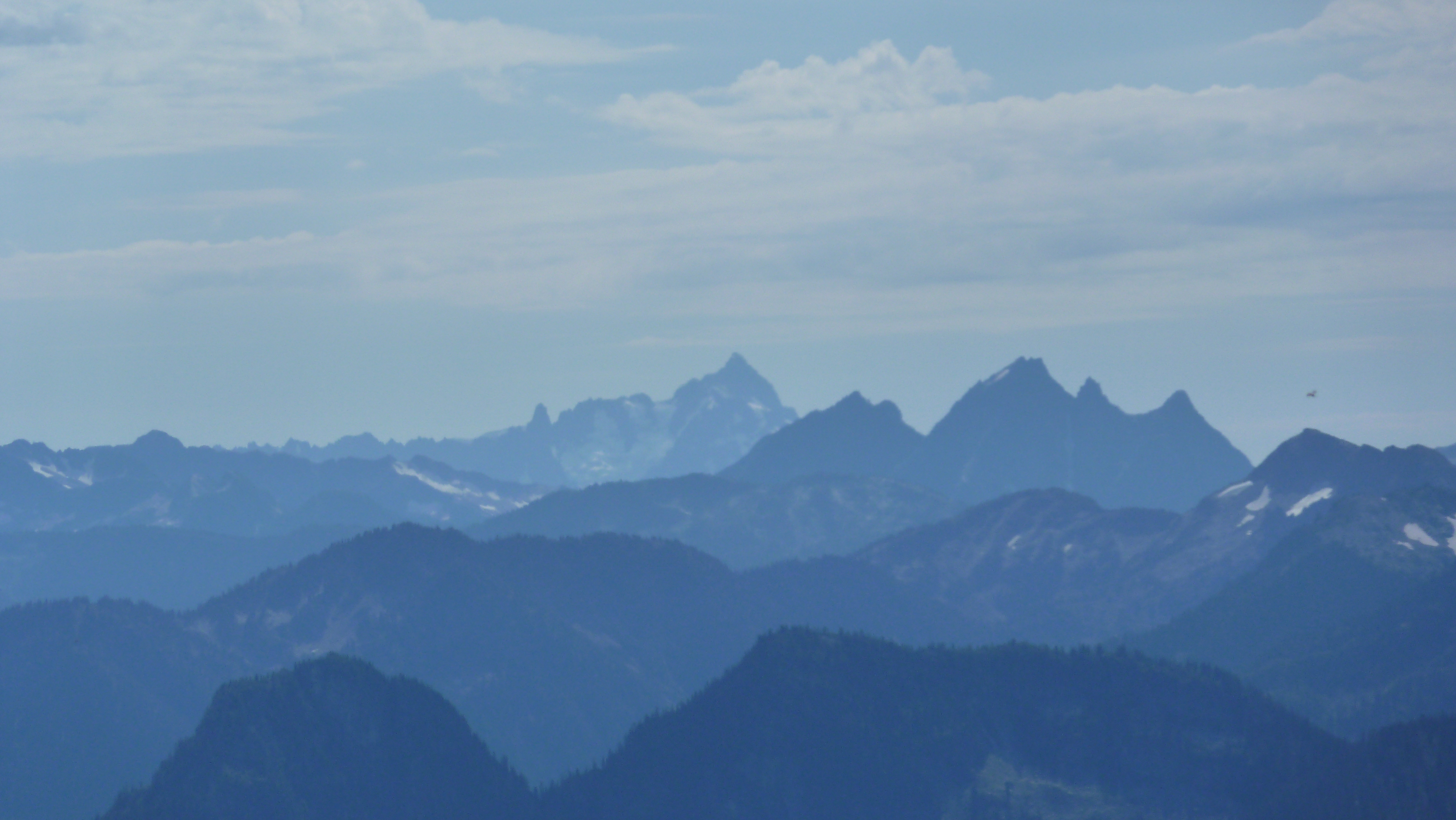
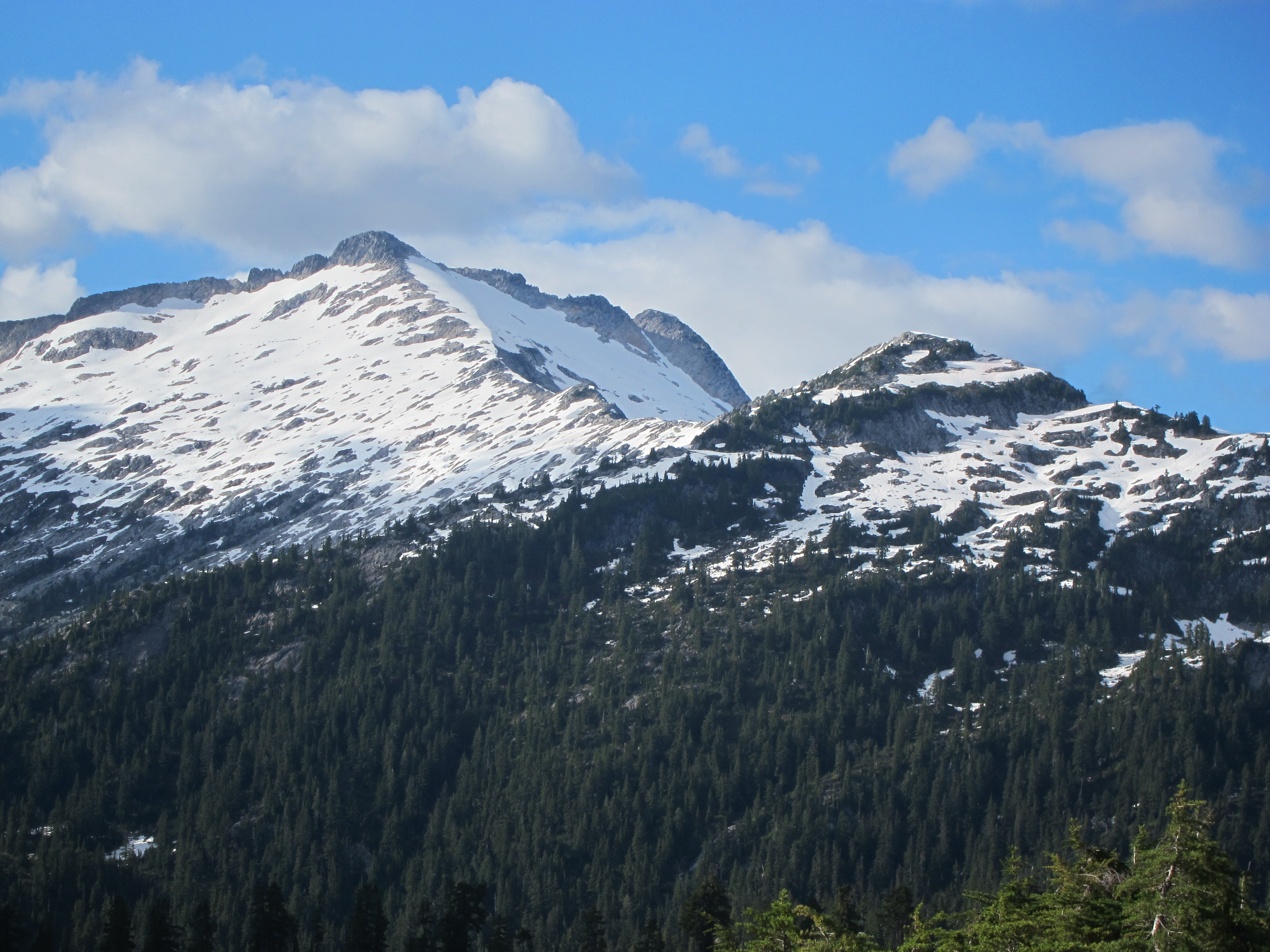
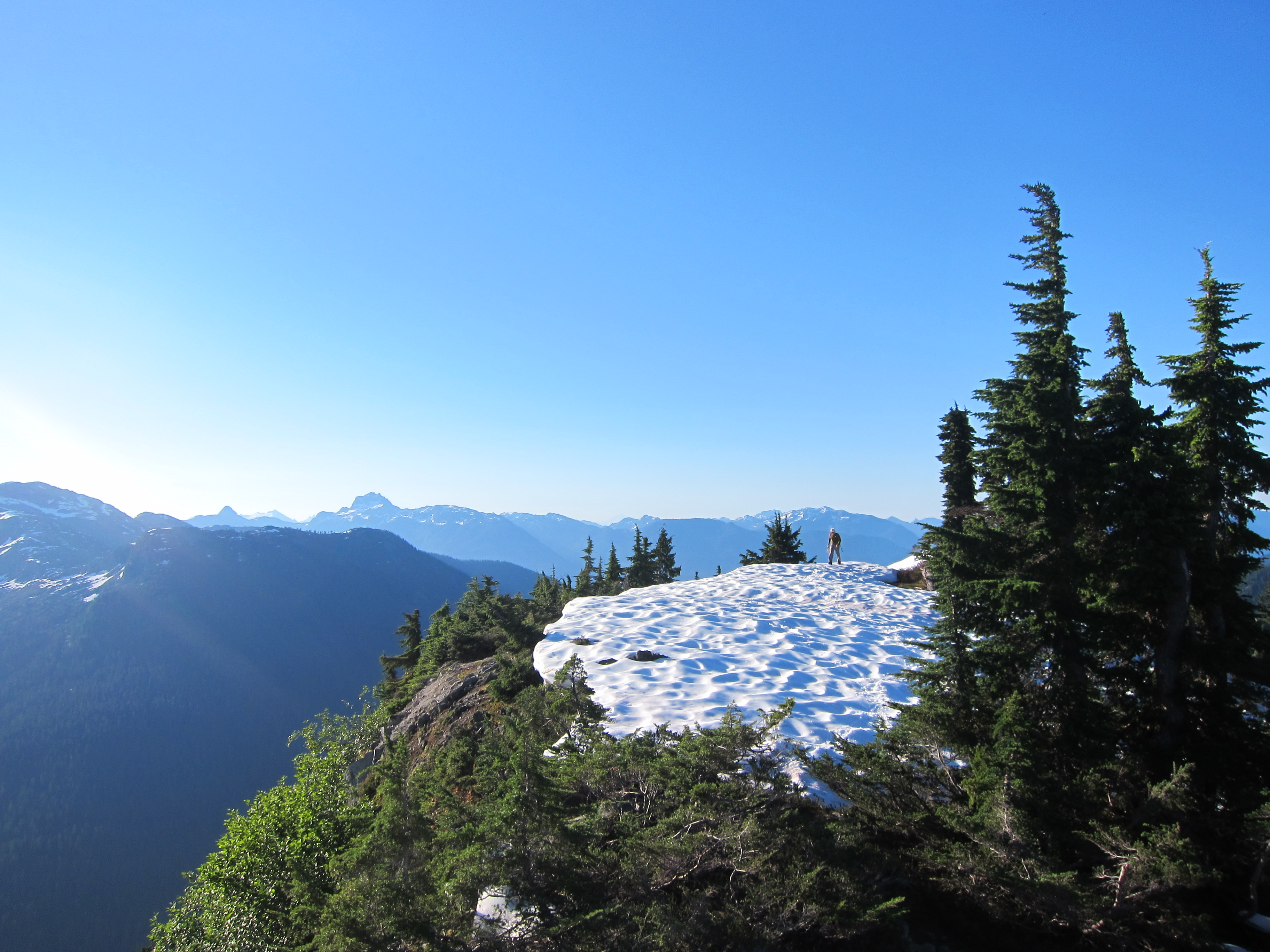
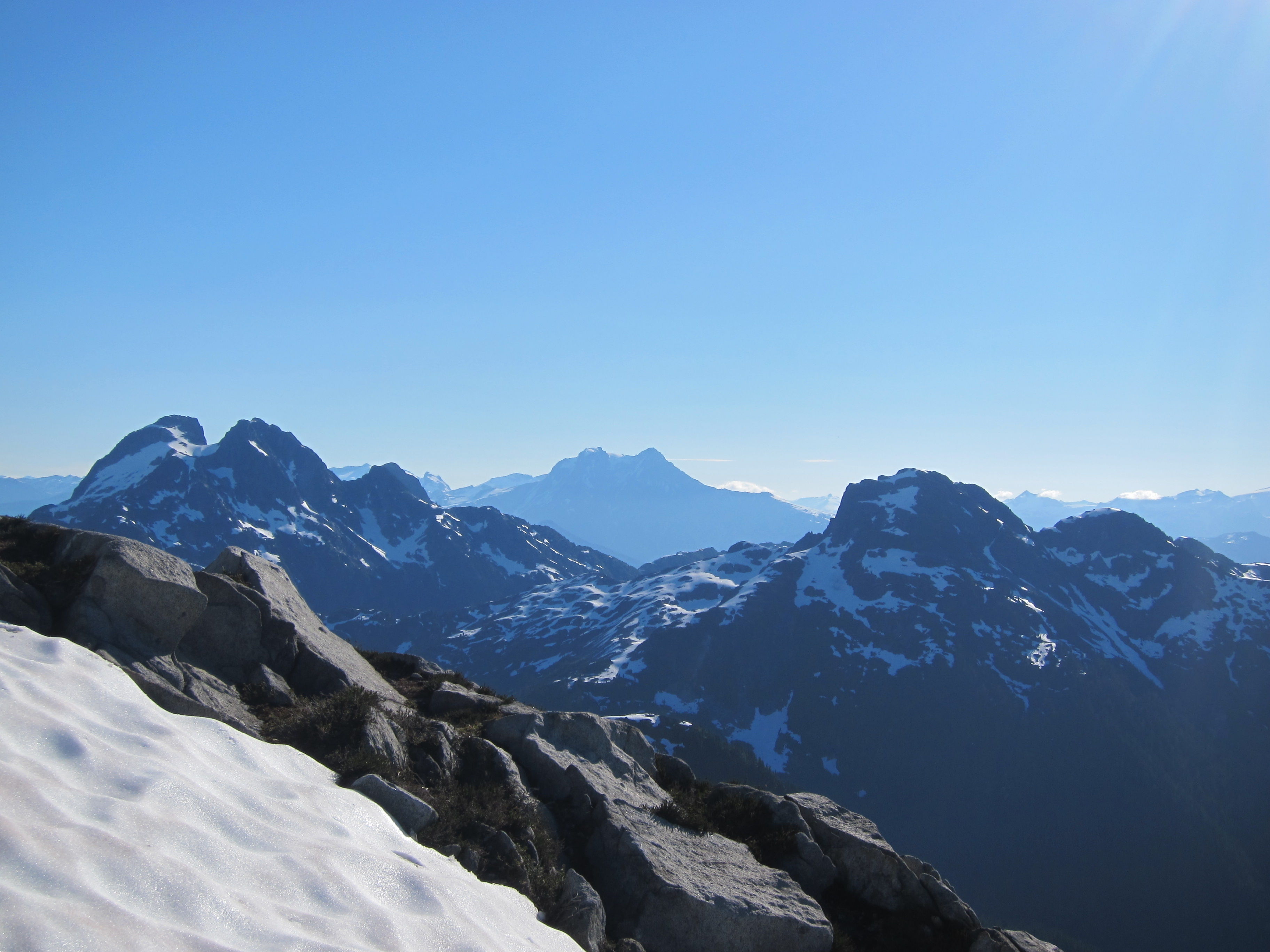
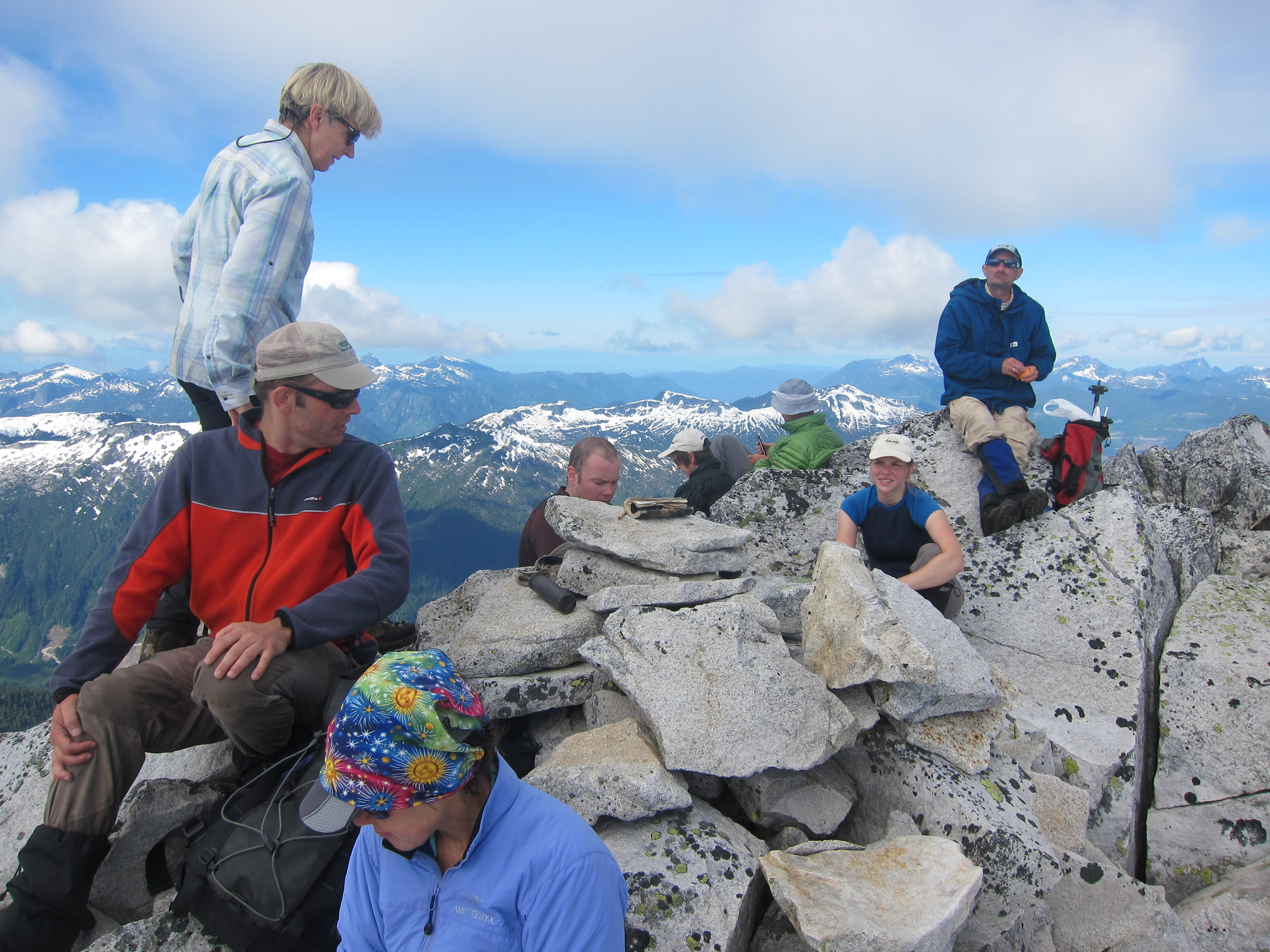
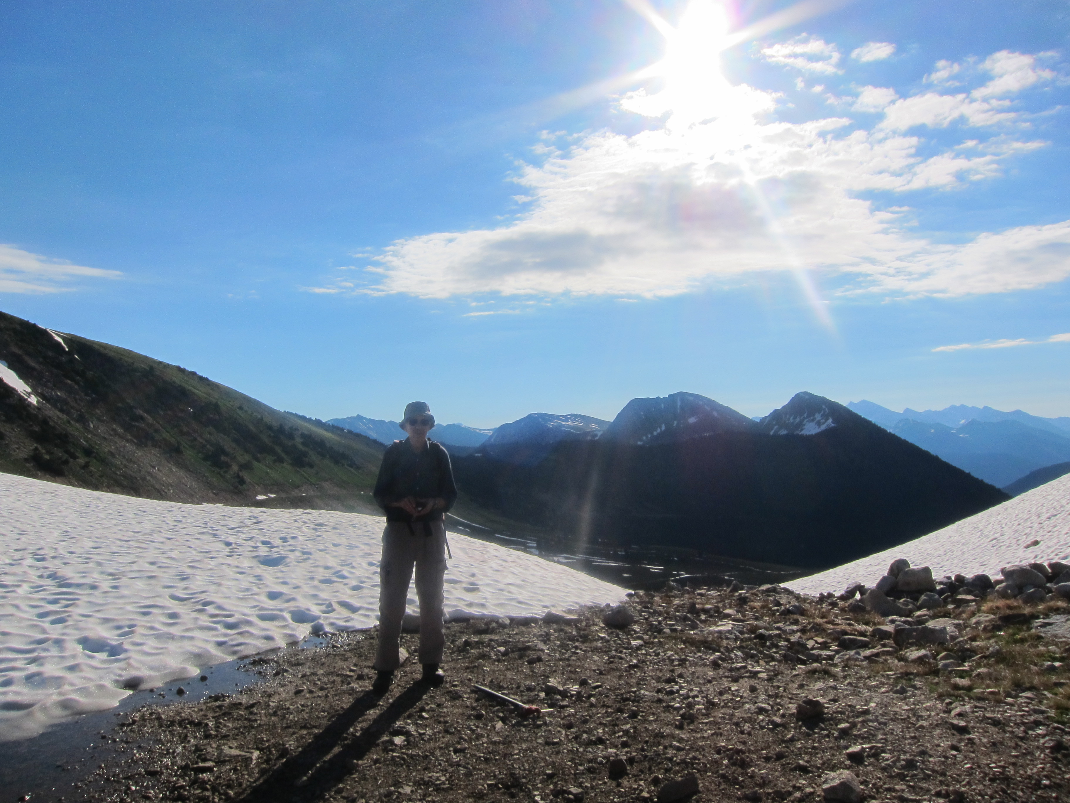
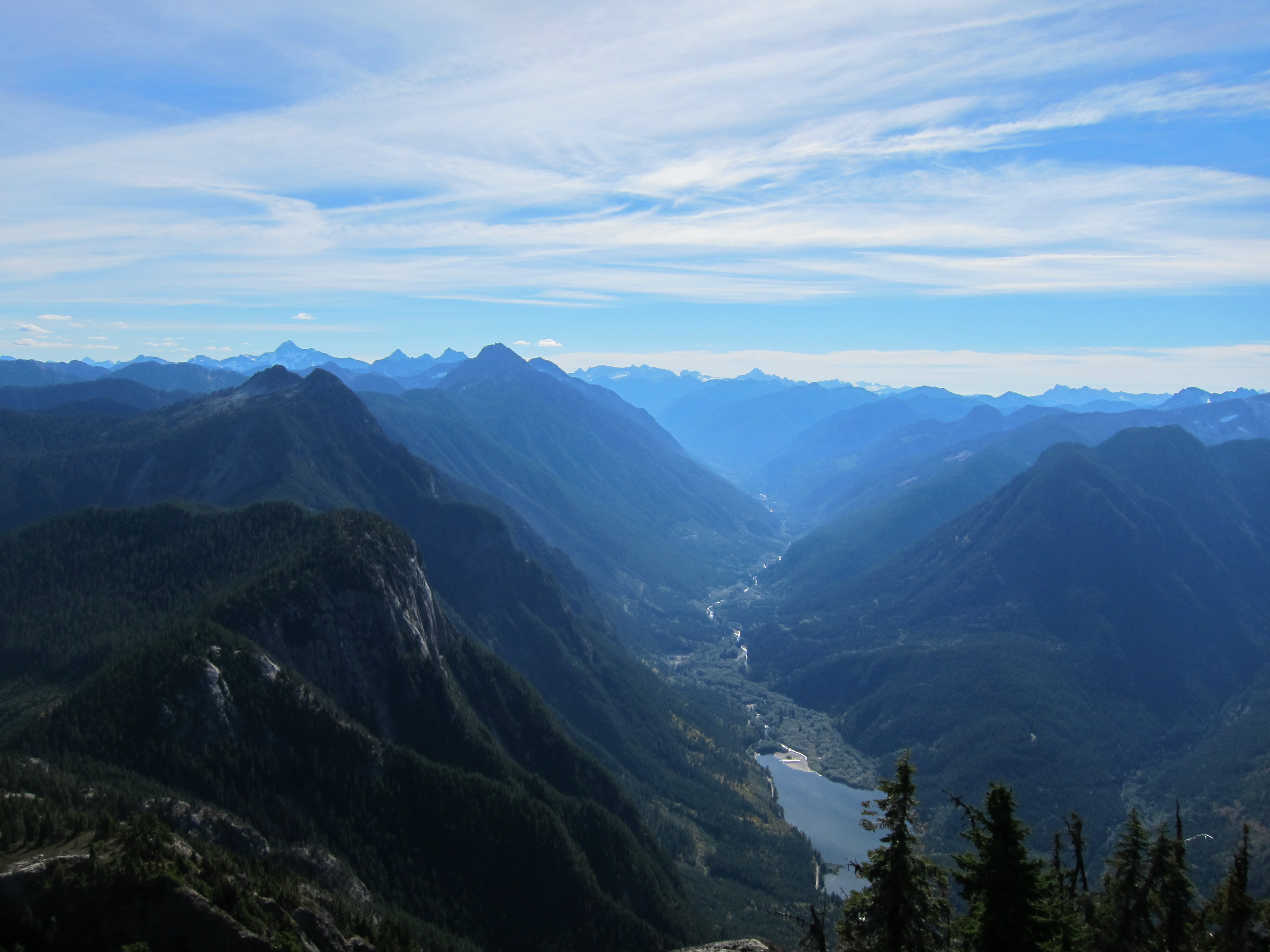
On the summit we enjoyed great views of the Tantalus range to the north, of the Sky Pilot area to the east, and the rarely visited areas around Phantom Mountain and Tzoonie Mountain to the west.  Of course, we also filled our names into the summit register, and brought down an old summit register (including humourous complaints about awful weather dating back to the 1940s) to be donated to the BCMC or ACC archives.  Shortly after 10 we departed, knowing that we still had over 18km of walking ahead of us to make it back to Woodfibre.

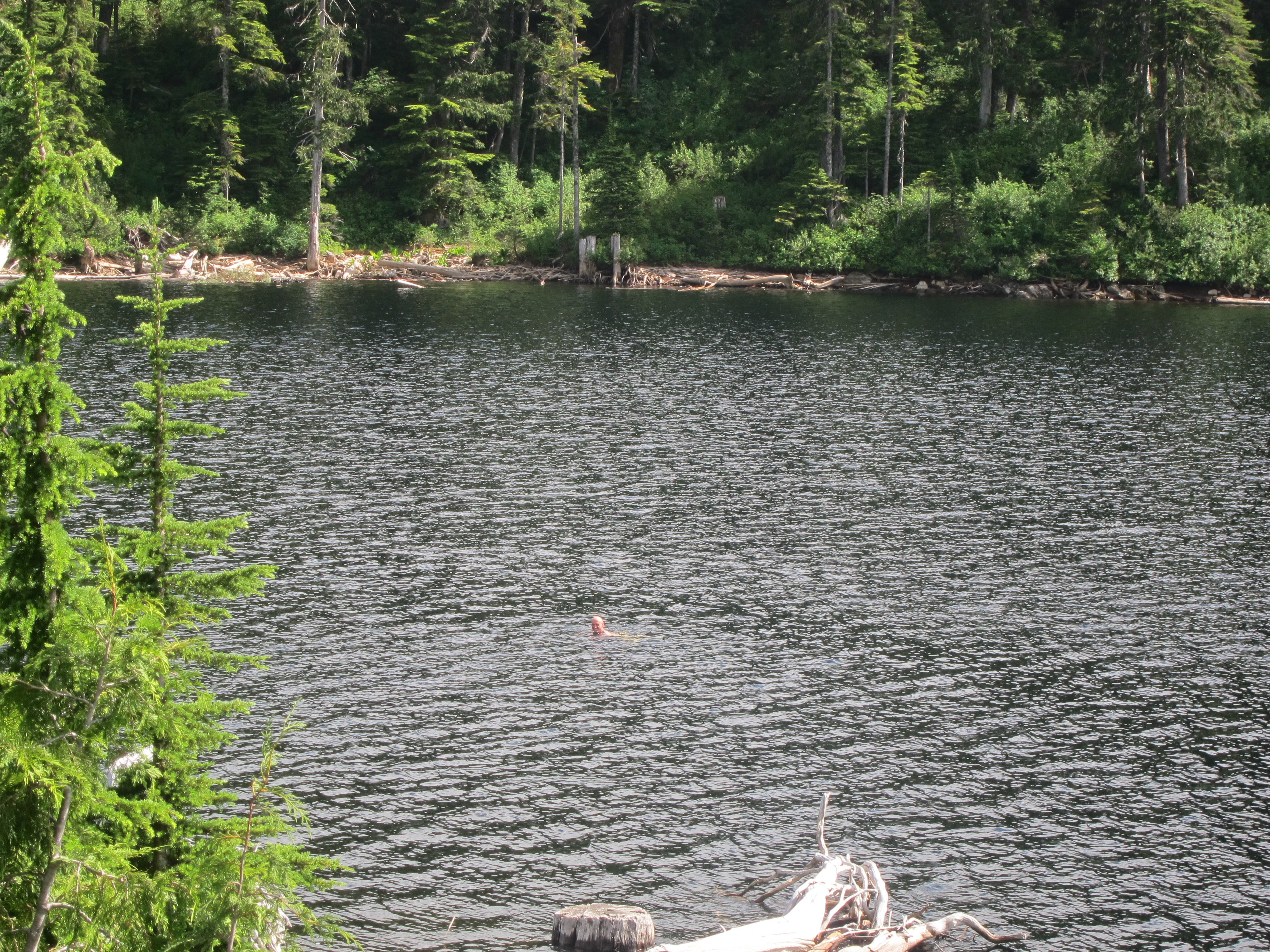
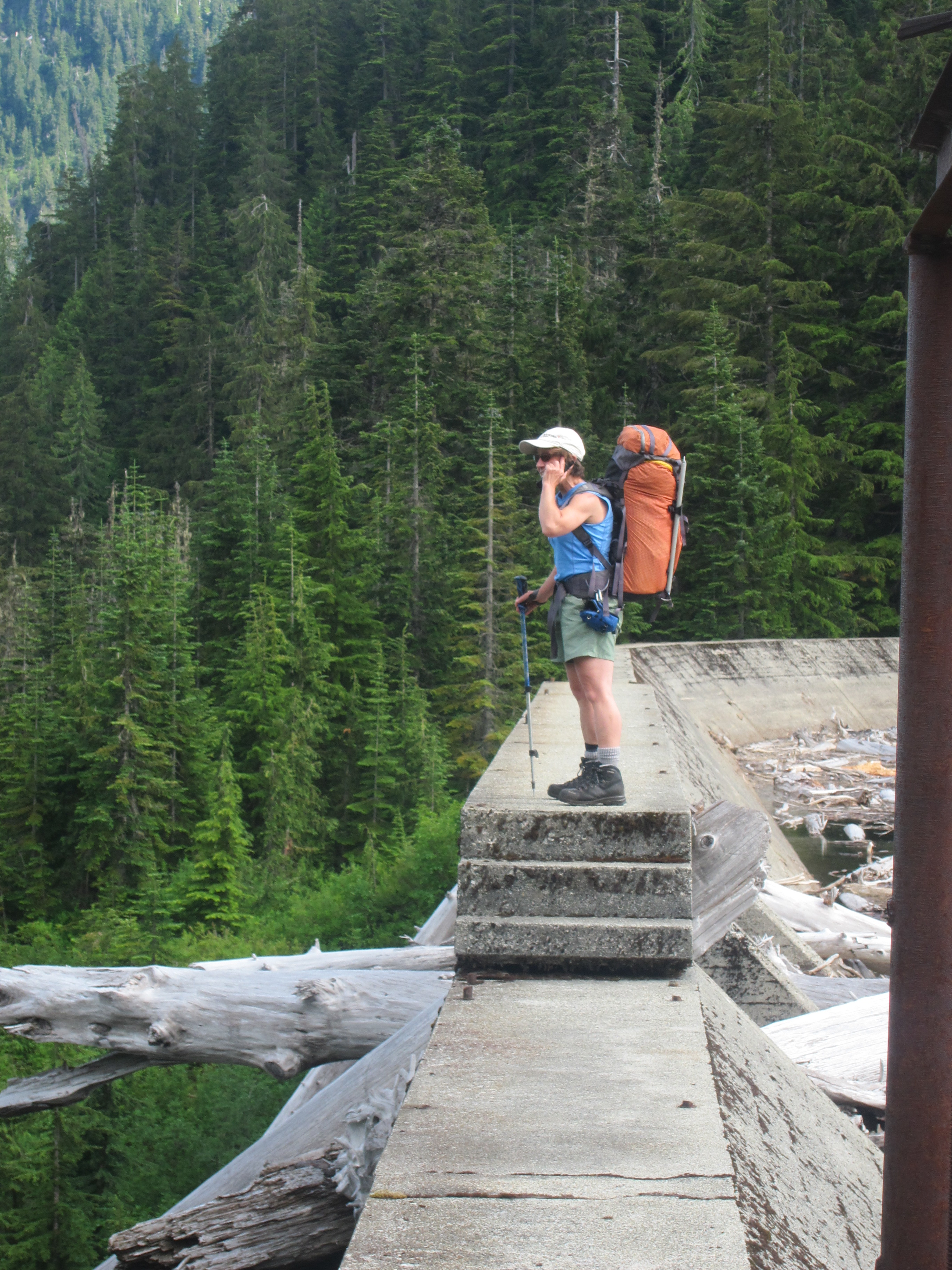
We were back in camp before 1, and on the trail again with our packs fully loaded shortly after 1:30.  From here the going was easy as we knew the route from before and made it down to Henriette Lake at about 4 o’clock for a much needed break.  Some of us rested on the helipad, others swam in the lake, and others explored the cabin, but half an hour later it was time to make a call to the water taxi (there is cell reception near the dam) to arrange to be picked up, and we started on our way down.  The road was agony, the worst part of the trip, but it eventually ended, and everyone was down and waiting by the dock by the time the boat came to pick us up at 7:00.  Sitting in the water taxi and gazing back at Mt. Sedgwick as we headed back to Squamish I was exhausted, but filled with the satisfaction of having conquered the peak at last with a fantastic group of people.  Thank you everyone for the great weekend!

Tags: , , ,

Trip Date: July 1, 2013

Participants: Ed Zenger, Brittany Zenger, Geoff Zenger

Difficulty: 1/2

Report: After returning back to the Duffey Lake Road Sunday evening so that Mr. Le could make it back home that evening to work on the holiday Monday, the rest of us headed into Lillooet for dinner and to look through our maps and guidebooks to find somewhere we could go for a short trip on Monday and still get us back in town with time to run a bunch of errands.  We decided to head up towards Blowdown Pass and hopefully make it up Gott Peak.  Given that the road heads up a north facing valley (snow?) and didn’t know the road conditions, we weren’t sure whether we’d be able to drive anywhere near the pass, but we started up the road around 7:30 just to see how far we’d get.

The road towards Blowdown pass is in good shape for the first 10km (where we could see some trucks had parked, a few waterbars just before the parking pullout), but then becomes much rougher.  We had no problems until around the 11.4km mark, where there was a nasty little section of road: a small creek crossing followed by a steep, rutted out few metres that despite two attempts, we weren’t able to bounce up.  We didn’t know what followed and so backtracked about 100m down the road to a very pleasant pullout for camping.  The next day we would learn that once past this nasty section, the road is in decent condition for another few km, and so anyone who does make it past this would have been able to drive to within about 50m below the pass, where the road became snow covered.

We woke up on the Monday at 5:30, and took our time to pack up camp and eat breakfast, and set off on foot up the road towards Blowdown Pass around 6:45, making it to Blowdown pass at about 7:45 where we stopped to enjoy the incredible morning views and eat a more substantial meal.  From here, it was about 10 minutes of walking up easy snow before the ridge became snow free, and from thereon it was easy pleasant walking over the broad heather covered slopes to Gott’s false summit, which we reached at about 8:45.  Once again we stopped to take in the incredible views and then rambled for another 20 minutes along the ridge over to Gott’s true summit (reaching it at about 9:20), from which the mid-morning views were incredible.  Gott Peak is the tallest mountain for quite a distance and so the views were fantastic over to Matier and Joffre, Silent Hub, Skihist, Stein, and so on.

Rather than head back down to Blowdown Pass and down the road, we decided to head straight down the meadows below the peak to hit the road right above where it splits to go to the lake, and this proved to be no problem.  The meadows were lush with blooming flowers from top to bottom, and we were quickly down on the road and back to the car.  Total round trip time was around 5 hours moving at a very relaxed pace.  I will definitely be back someday to explore the ridges on the other side of the pass, and to hopefully make the traverse over from Gotcha to Notgott peak.  Recommended for an easy day in beautiful country.

Tags: , , , ,

Trip Date: October 8, 2012

Participants: Brittany, Nancy, Geoff Zenger

Difficulty: 1/2 (one very short class 2 traverse)

Report: Hope Mountain dominates over the south side of the town of Hope, looks impressive, is a short hike (only 2:15 hours from parking to summit), has amazing views, is well described in 103 hikes, and yet sees relatively few ascents.  Why is that?  Bush.  The first 1.5km of this hike is as overgrown and bushy as anything can be while still being called a trail, and is badly in need of being brushed out.  Beyond that, however, the trail is in great condition, and the route is very pleasant up the largely open south ridge of the mountain to the summit.  The Lower Mainland hiking community would be well served and very grateful if somebody chose to spend a day clearing out the lower trail through the clearcut.

The road requires a high clearance 4×4, and is in decent shape until the final junction except for a short loose section a bit more than 3km up the road that would challenge a low clearance SUV.   Furthermore, the 400m from the last junction to the clearing that serves as the trailhead for both the Hope Mountain and Wells Peak trail is quite overgrown with alder and so you can expect to give your vehicle a thorough alder scrubbing if you choose to drive all the way to the end (we did).

Nancy was visiting town for the Thanksgiving weekend for a friend’s wedding, but made the time to accompany Brittany and me on a hiking trip to enjoy the good weather, and needing to be back in the city for Thanksgiving dinner, we chose to head to Hope Mountain.  We left the trailhead a bit past 9 o’clock on what was the last nice day of this year’s hiking season, and made our way up the badly overgrown trail/road to the ridgeline above the parking area.  From here, the trail is in better shape as it follows a road on the backside of the ridge and contours towards Hope Mountain.  Where the trail leaves the road, it is badly overgrown again for a short while until the edge of the clearcut is reached, where the trail becomes much more pleasant as it enters a much more mature forest on the ridge south of Hope Mountain.  Note that despite being badly overgrown low down, the trail is never hard to follow.

The ascent of the south ridge is pleasant and easier than it looks from below.  The trail is in great shape, and except for one short (3m) traverse on an unexposed ledge about half way up requiring the use of hands, it is a straightforward trail hike.  We reached the summit around 11:30 in beautiful T-shirt conditions and sat down a short ways away from the communications structures on the summit to enjoy the fantastic views all around.

We lounged on the summit for a full hour before starting our descent.  The trip down was quick and uneventful, and we were down at the car just past 2 o’clock, 5 hours from when we started.  A couple days after this trip, the Vancouver weather turned sour, and so this was a great trip to cap off this year’s hiking season.

Tags: , ,

Trip Date: October 6, 2012

Participants: Alice Hwang, Leif, Dave Percival, Chloe Tergiman, Lida Vavrova, Bob Woodhouse, Geoff Zenger

Difficulty: 2 (Elsay), 3 (Runner Peak)

Report: Time and time again I’ve gone to the top of Mt. Seymour and gazed over at Mt. Elsay, and at long last, I got around to putting a trip to Mt. Elsay on the BCMC schedule.  We met in the Seymour parking lot just before 8:30 with the objective of reaching Mt. Elsay via the trail that descends to the west from the col between the second and third peaks of Seymour.  Despite being early October, the sun was already shining bright and the air quite warm by this time in the morning.

We made excellent time up the Mt. Seymour trail, taking a small detour to scramble directly up the face to Pump Peak, and reached the col between the second and third peaks of Seymour just before 10 o’clock.  From here, a flagged route descends to the west and contours around the third peak of Seymour, eventually descending to a basin below Runner peak, and from there rising once again towards Mt. Elsay (albeit with plenty of up and down).  The trail is generally in great shape, although in a few places it’s easy to accidentally wander off the route on old game paths, as a few of us did on a couple occasions.  I had initially thought that it would take us a good 4 hours to reach Mt. Elsay, but we were on the summit at 11:45, just three and a quarter hours from when we started.  With the clear autumn air, the views from the summit were fantastic.  Peaks as far away as Shuksan, Cheam, Slesse, Sky Pilot, Mamquam, and Robie Reid were all clear in the distance, and of course all of the north shore mountains were visible too much closer by.

We departed the summit around 12:30 and were back in the basin below Runner Peak a bit before 1:30.  Although not an official objective of the trip, with the day so young, most of us decided to make a detour and climb Runner Peak as well (two party members headed straight back to the cars in order to be back in town by mid-afternoon).

Some wishful thinking and questionable routefinding decisions led us to try to short-cut the need to climb to the Seymour-Runner col before ascending Runner Peak, and we began by climbing a steep bushy gully, only to find that it petered out near the top.  Everyone except Bob decided to descend back down to the rocks and snow below, and to head up to the standard route via the Seymour-Runner col.  Bob, however, decided to forge his own traverse route around Runner Peak on a series of vegetated ledges, apparently also with a fair bit of 4th/low-5th climbing needed to move between them.

Someone has flagged the route up Runner Peak from the Seymour-Runner col, and is it easy to follow.  There is a short 3rd class section about half way up from the col, with little exposure.  It was a little awkward to descend, but is unlikely to daunt anybody willing to make the trek all the way over there from Seymour.  Above the 3rd class section there are only another few minutes of scrambling / hiking needed to reach the summit.  We summited Runner at 2:30, and once again sat down to enjoy the magnificent views (and also confuse the group of people on top of Seymour, who it seemed couldn’t figure out how we had gotten over to Runner Peak).

We left the summit of Runner Peak at about 3 o’clock, and made our way down to the low basin below the peak to regain the Mt. Elsay trail.  The hardest part of the day was making it back up from here to the Mt. Seymour trail.  The trail is steep, and we had already been hiking a long time.  Nonetheless, everyone made it up with their spirits still intact, and once on the Mt. Seymour trail it was quick going down to the cars, which we reached just before 5:30.  In the end, my B2 trip turned into a C3, but it was a great trip nonetheless.  We had perfect conditions, interesting objectives, and a great group of people.

Tags: , , ,

Tricouni Peak

Trip Date: September 8

Participants: Andrzej Jarzabek, Paul Ng, Arnold Witzig, Will ?, Brittany Zenger, Geoff Zenger

Difficulty: 2/3.  Easy scrambling, some mild exposure on route

Report: I bought myself a used Jeep Liberty two weeks ago, and now having a 4×4 I decided to change the destination of my trip on the BCMC schedule to Tricouni Peak, which is essentially inaccessible with a 2wd car.  The trip was scheduled for the same day as the Vancouver-Whistler GranFondo bike race, but a bit of investigation revealed that the first road closures would be at 7:15 in Porteau Cove, and so by leaving Vancouver early enough, I determined that we would be able to stay ahead of the road closures and make it up the Squamish Valley to High Falls Creek.

We met at the Chevron station at Boundary & Dominion at 6:15, and quickly head off for Squamish, reaching Squamish at around 7:30, and made our way up the Squamish valley, and then up the High Falls Creek road network.  There is one nasty section of road about 2.5km from the Tricouni Meadows parking area, but after this the road is in fairly good shape until less than 1 km from the landing at the end of the road.  This last section of road is in really rough shape, but we pressed on to the end, and were able to set off on the trail a bit past 9 o’clock.  At this point, the weather was cool and sunny, but it would soon warm up rapidly.

The Tricouni Meadow trail is easy to follow, but ridiculously muddy until near the first lake.  From the first lake, we quickly ascended to the second and third lakes, and from there on up the standard route towards the summit of Tricouni.  The lakes are clear and turquoise, and the flowers in the meadows above the third lake were in full bloom.

We took our time on the ascent and descent, stopping frequently to enjoy the views and the warm atmosphere, but nonetheless were on the summit about 4 hours 15 minutes from when we started.  The route is primarily a hike, but the there is a short scrambling section about 30 minutes below the summit, and the last 10 minutes up the summit ridge itself are over enjoyable scrambling terrain, with mild exposure.  The summit of Tricouni itself is fantastic, with nice places to sit, and views all around.

We lounged about on the summit for nearly an hour, and departed just past 2.  The descent was quick and easy, and we had the time to stop at the first lake for a while, where Arnold and Andrzej summoned the courage to go for a quick swim.  From the first lake it was back to the mud below, and finally back to the cars.  Including the swim stop, the descent took just a few minutes over 3 hours, completing a great trip to cap the summer.


Tags: , , ,

« Older entries § Newer entries »