hope

You are currently browsing articles tagged hope.

Mt. Baird

Date: March 8, 2015

Participants: Dylan, Martin, Brittany Zenger, Ed Zenger, Geoff Zenger

Difficulty: 2

Report: A trip report on clubtread of a visit to Mt. Baird in the waning days of February spurred my interest to visit this rarely climbed peak near Hope.  The previous weekend I’d been exploring the roads on the east side of Harrison Lake (long story short, the road to Nahatlatch is washed out just 4km from Nahatlatch) and had tried to approach the Old Settler from the east, but no luck.  This weekend I’d be able to climb Mt. Baird and get good views of the Old Settler from the south east.  The forecast was looking good and a last minute trip posting on the BCMC website managed to fill up my Jeep for the excursion.

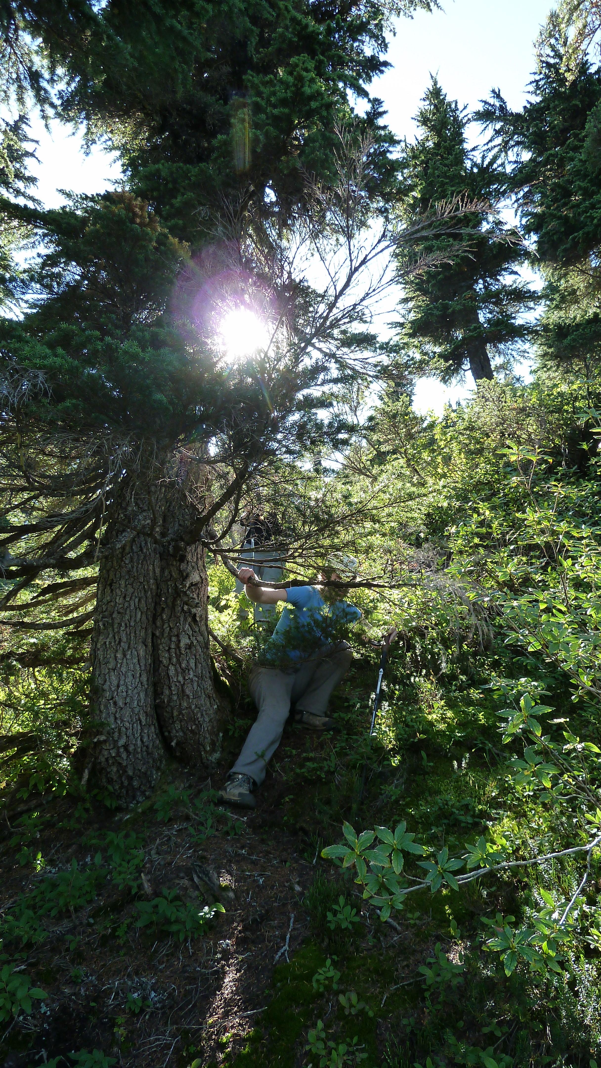
We met up at Columbia Station in New West at 7:30 and made our way out to Hope.  The access to Mt. Baird is easy right now via Nickelmine Road which if you follow it is well maintained for by both a local offroad association and for active logging and leads into Emory Creek.   We parked right next to the turn off for spur 3569 (just a bit past the 11 km marker), walked up the short spur, and then ducked into the trees.  We found ourselves on the left side of a creek, and made our way up the left side of the creek through open easy forest all the way up to treeline.  This appears to be the ideal route up the mountain.

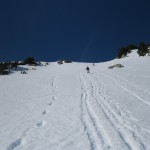
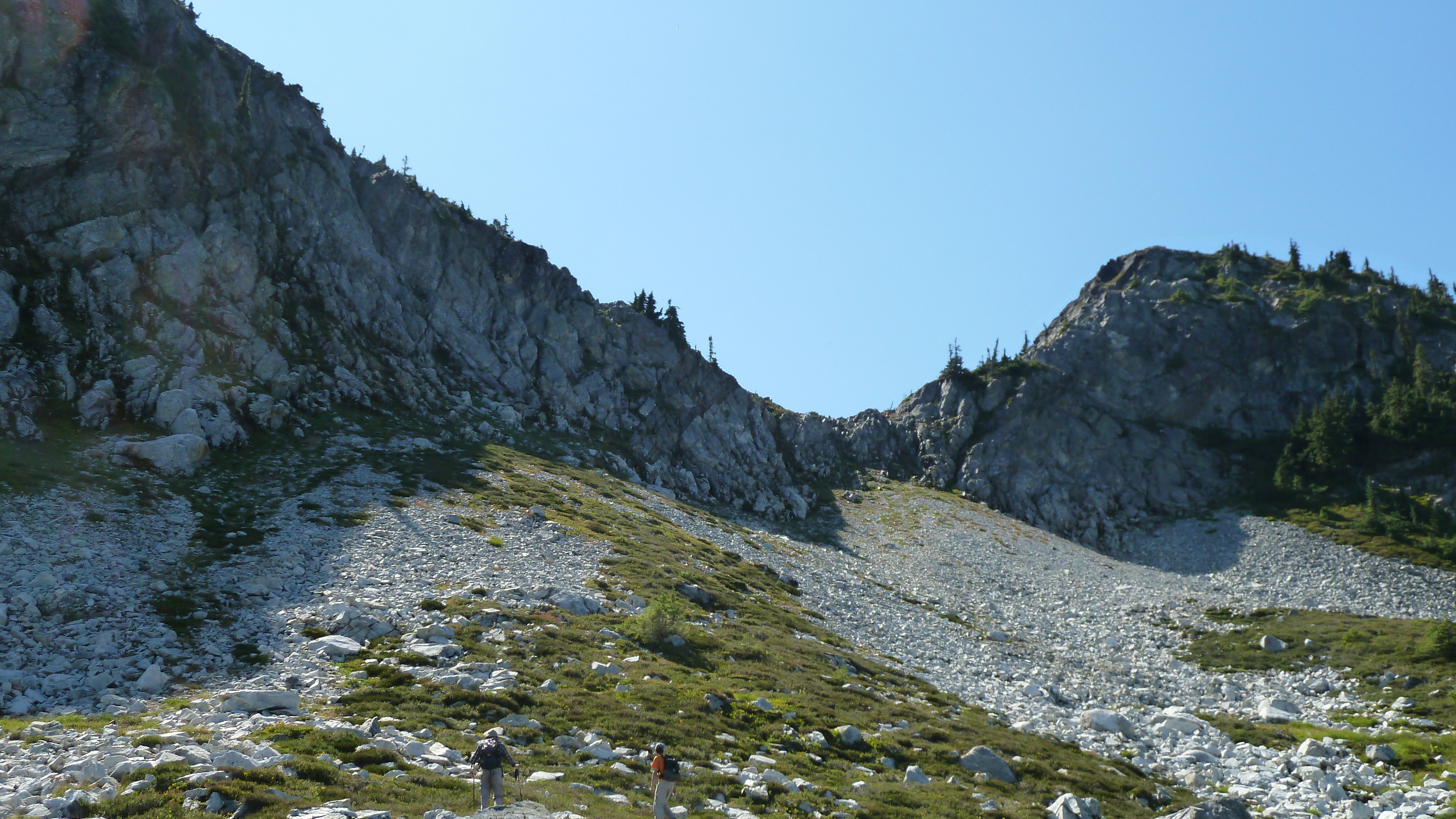
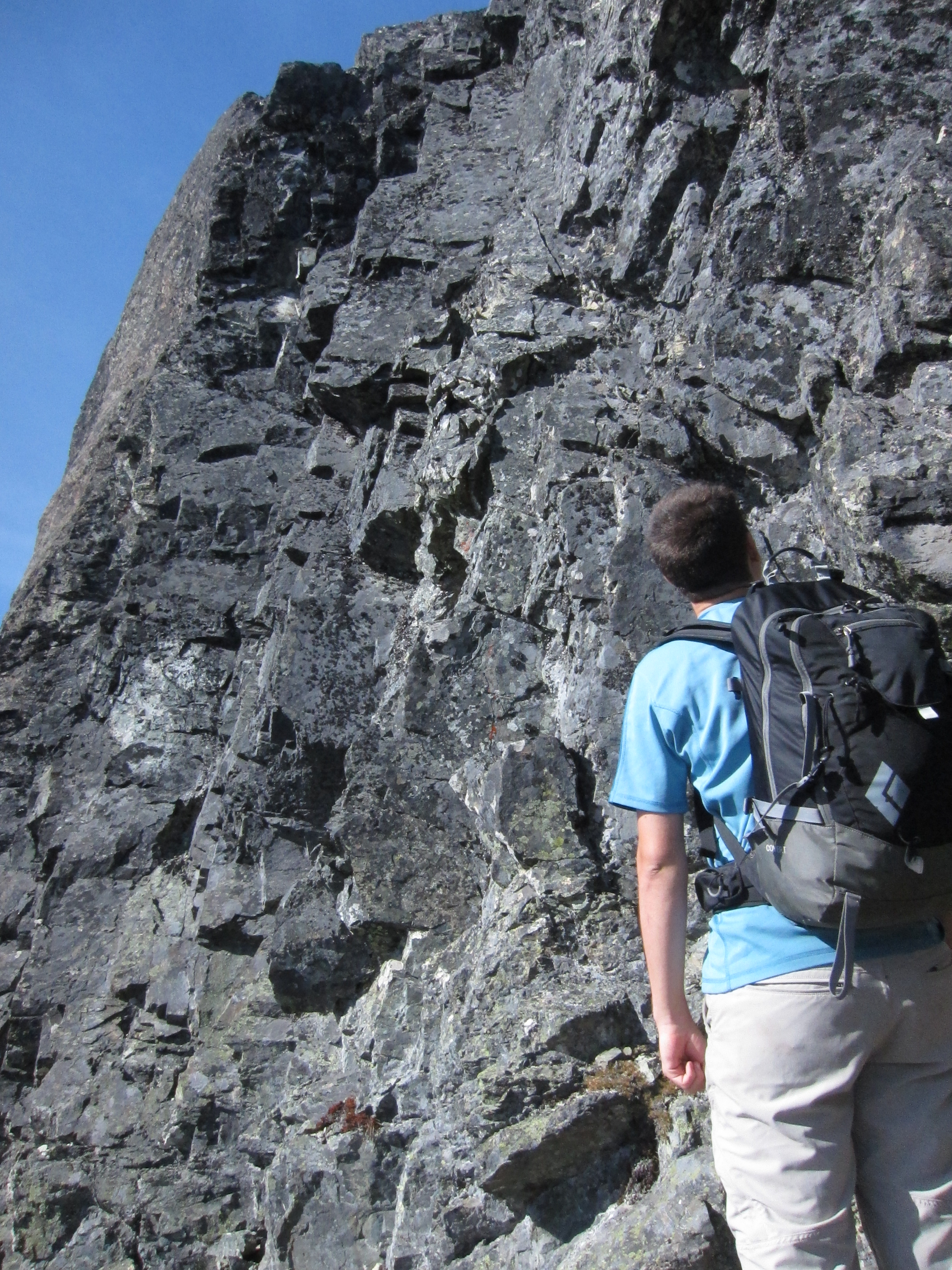
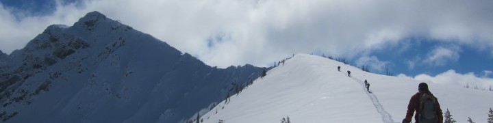
We hit snow around 1200m, and by 1400m were on a long ridge heading up towards the summit.  At about 1400m there are some bluffs and we chose to head around them to the left, which we did and followed some snow filled gullies up towards the obvious broad snowslope leading up towards the left of the main summit.  It was a reasonable route, but on the way down we came down the other side (climber’s right) and found it to be even easier going and more straightforward.  The snow leading up to the summit was very pleasant and enjoyable, and at a quarter to 1, less than 4 hours after leaving the cars, we found ourselves on the small rocky summit of Mt. Baird.

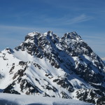
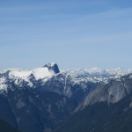
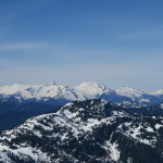
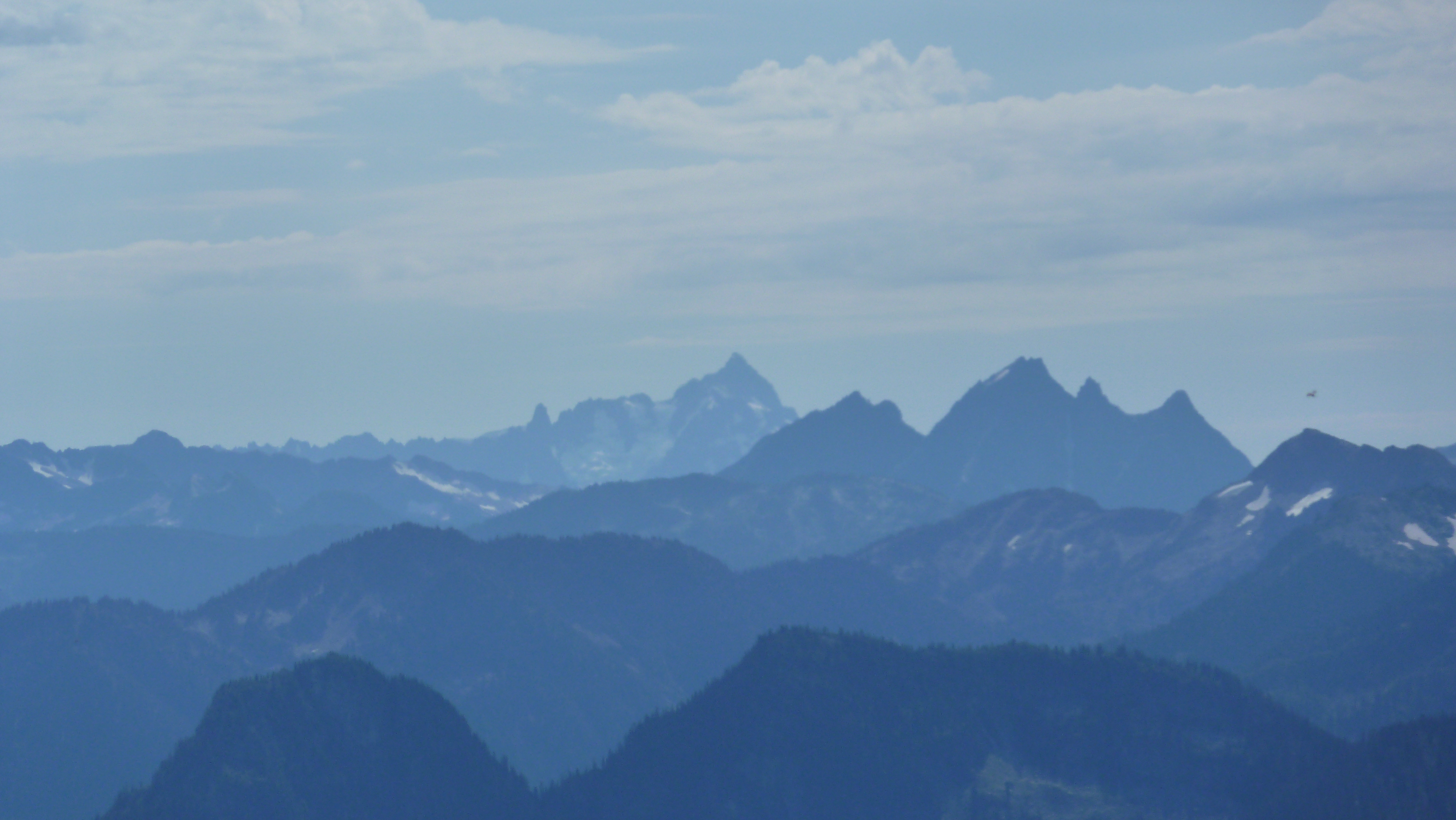
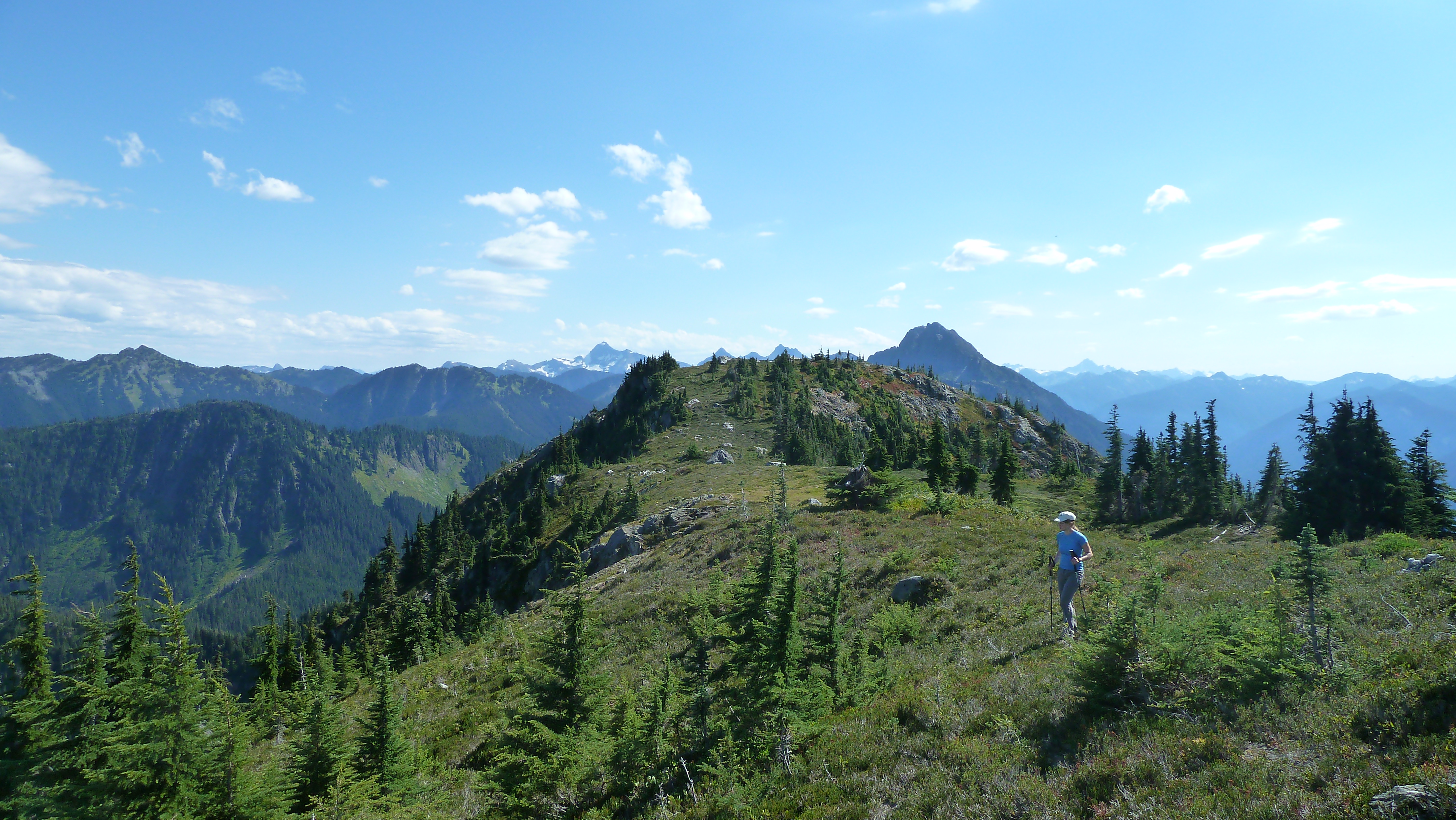
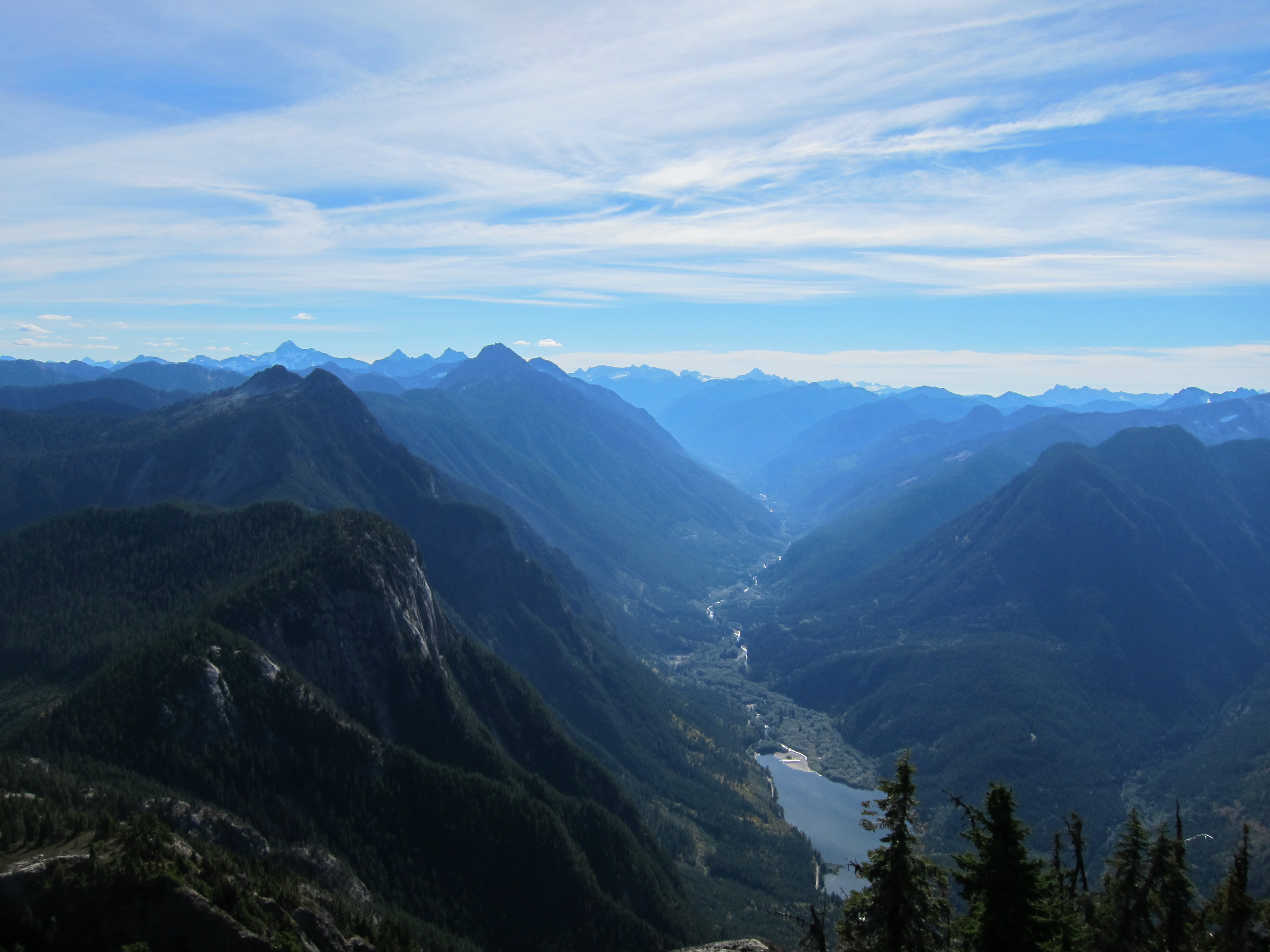
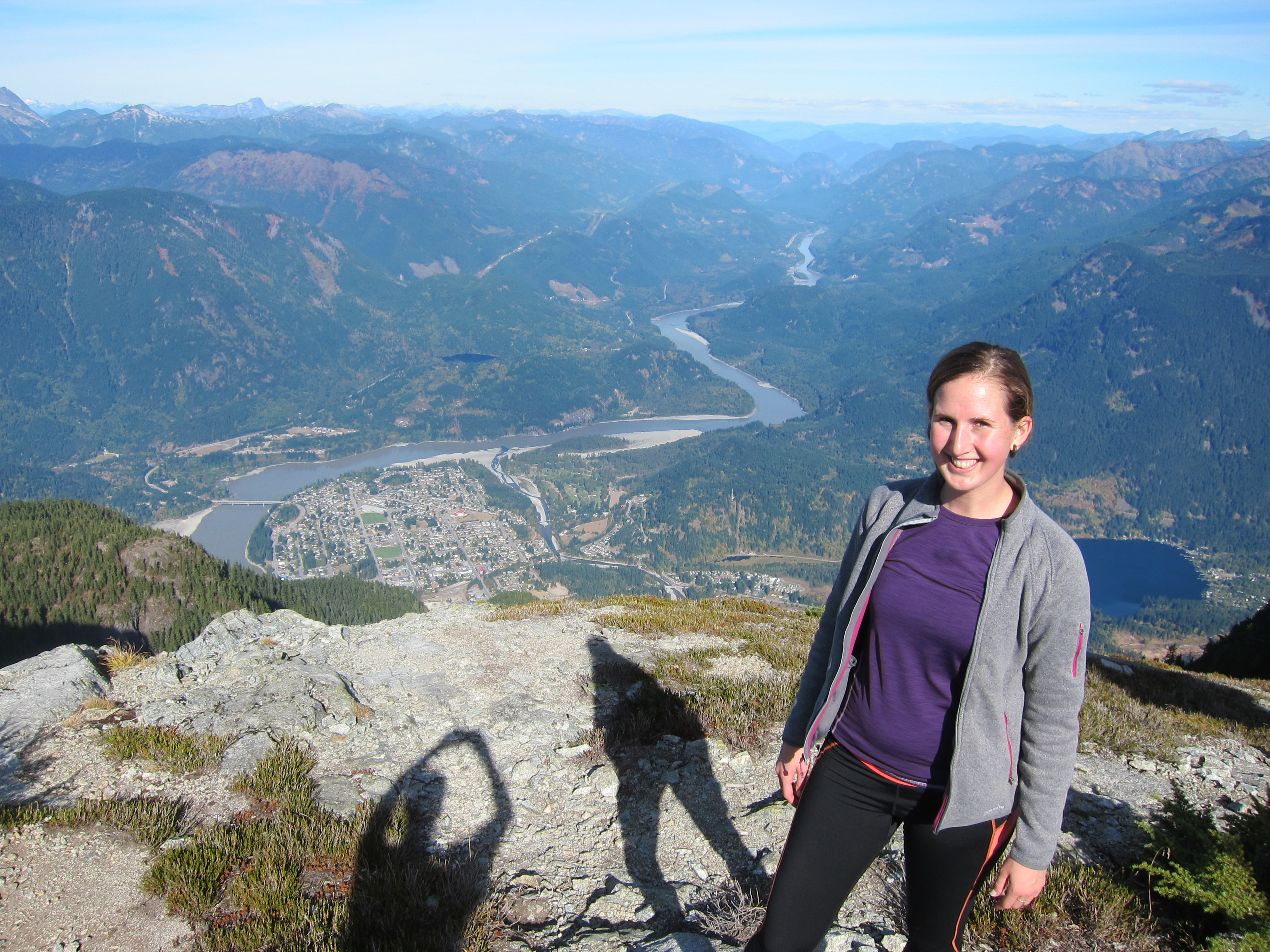
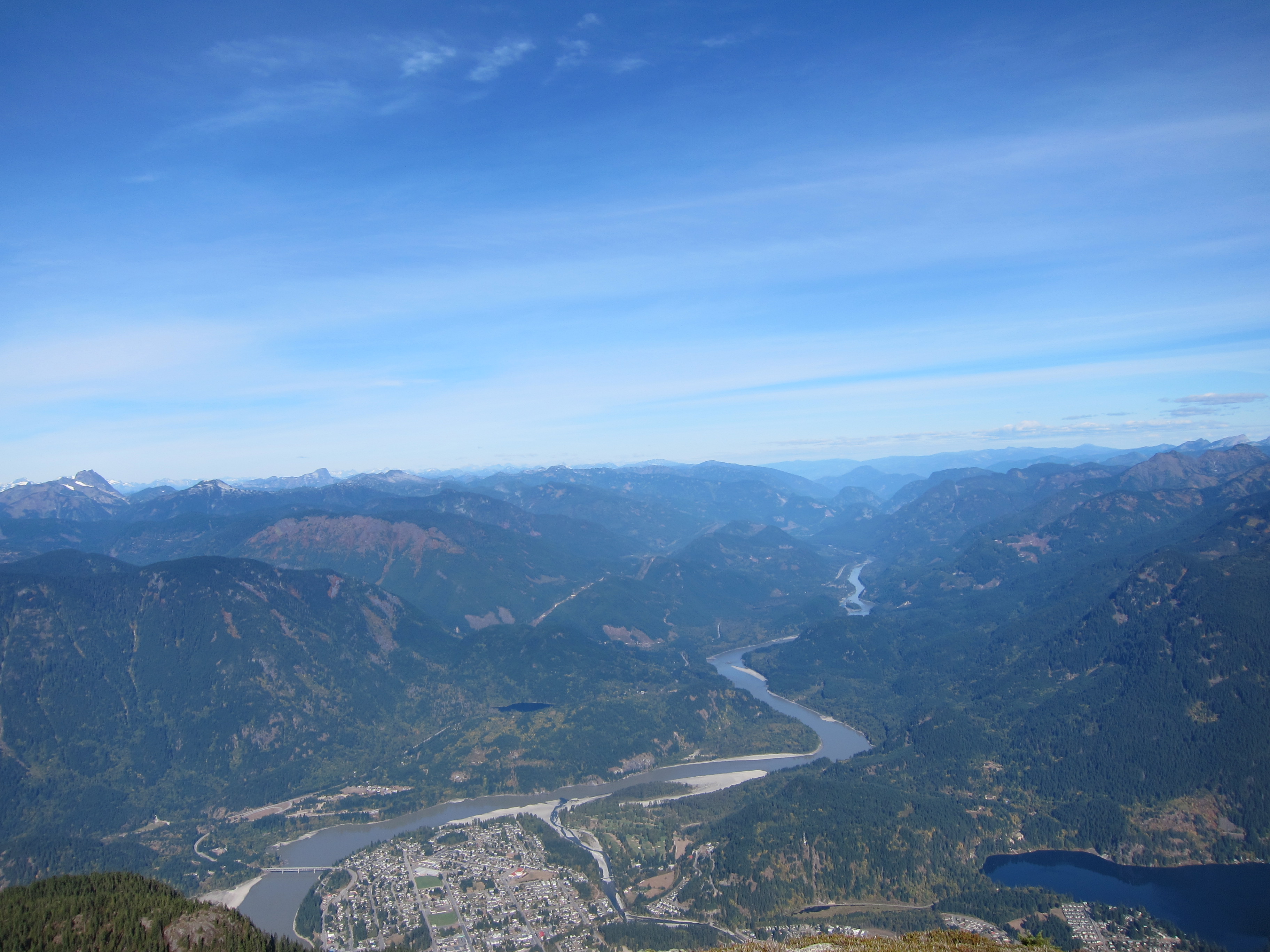
The views from the top of the Old Settler were grand as expected, but what was unexpected was the fantastic views of so much more.  From the summit there are great views of the Anderson River group, Needle Peak, Cheam Range, Judge Howay area, Baker area, and even the Outram and Silvertip regions of Manning Park!

We spent a good long time on the summit in the unseasonably warm temperatures before eventually making our way back down to the car.  The descent on the snow was fast and descent through the trees was easy and quick as well, and we made the descent in well under 2 hours.

Thank you to everyone for the great company and great trip.  You need a low snow year like this year, but if you’re able to drive to at least 800m on the logging road, Mt. Baird makes for a great early season or winter trip!

Tags: , , , ,

Wells Peak

Trip Date: Sept 1, 2013

Participants: Alex Le, Nikta, Ed Zenger, Brittany Zenger, Geoff Zenger

Difficulty: 2/3

Report: Although only 16 days after quite invasive surgery, a great Sunday forecast gave me the energy to try and do something other than rest and recover and instead to get out in the mountains for the first time in a few weeks.  Wanting to find something within my diminished energy levels, I hit on the idea of going to Wells Peak, the southern neighbour of Hope Mountain (which I climbed last October).

We met at my place in New Westminster and set out towards Hope just before 9am, and after a quick stop in Hope, headed up the Mount Hope FSR.  The road leading up to the final junction is in slightly worse condition than it was last fall, but shouldn’t give anyone with a high clearance 4×4 any trouble.  It is a bit loose in places, and some small rocks needed to be cleared out of the way, but the water bars are all well constructed and easily passable.  Last fall, the last 500m of road, from the final junction to the trailhead was badly overgrown with alder, but someone has done a great job clearing the road, and we were able to drive the last section of road with nary a scratch on the Jeep.  Many thanks to whoever cleared out the road and repainted the trailhead signs!

We started on the trail just past 11:30, and were pleasantly surprised that although the first part of the trail through the cut block is quite overgrown, it is overgrown with soft bushes and grasses, unlike the Hope Mountain trail, which is overgrown with small conifers through the cut block.  Once the old growth is reached after around 20 minutes of hiking, the trail is well built and easy to follow as it rises steeply up towards the beautiful meadows below Wells Peak.

Up in the meadows, the trail peters out and we stopped for lunch.  Having forgotten our trail description back at the trailhead, we set out towards the notch just NW of the main summit of Wells Peak (climbers right of the summit, 103 hikes recommends crossing the meadows and heading up the ridge climbers left).  Although it looked steep from a distance, reaching the notch was only class 2, and from there we turned left and headed up on the ridge crest towards the main summit of Wells Peak (note that the summit NW of the notch has a large cairn on top, but is not the highest summit).  The NW ridge has some exposure and one 3m class 3 step that must be negotiated before reaching the main summit, but everyone made it up, and by 2pm we were all on the summit.

The summit of Wells Peak has great views all around with clear views of the Chehalis, Judge Howay, Slesse, Rexford, Outram, Tulameen, Coquihalla, and the Silvertip group.  We sat down for another snack and to lounge about on the summit only to find that the summit was infested by a swarm of annoying (non-biting) flies.  Nonetheless, we spent 30 minutes enjoying the views before heading down towards the SE to see if that ridge provided an easier route to and from the summit.

The SE ridge of Wells Peak does descend down to the meadows without any rock scrambling, but is covered in slippery vegetation, and so in the end, I’m not sure whether it’s really any easier than the NW notch route.  Regardless, we all made it down to the meadows without injury, found the trail once again, and in what felt like no time at all, were back down at the Jeep by 4:30.  Total trip time: 5 hours.

As a final thought, which trail do I prefer?  Wells Peak or Hope Mountain?  Wells Peak is a more direct route, and less bushy, but I still prefer Hope Mountain slightly due to the route up the ridge being more enjoyable, more varied and having a much nicer summit.  Too bad someone doesn’t go and brush out the first 1km of the Hope Mountain trail…

Tags: , ,

Trip Date: October 8, 2012

Participants: Brittany, Nancy, Geoff Zenger

Difficulty: 1/2 (one very short class 2 traverse)

Report: Hope Mountain dominates over the south side of the town of Hope, looks impressive, is a short hike (only 2:15 hours from parking to summit), has amazing views, is well described in 103 hikes, and yet sees relatively few ascents.  Why is that?  Bush.  The first 1.5km of this hike is as overgrown and bushy as anything can be while still being called a trail, and is badly in need of being brushed out.  Beyond that, however, the trail is in great condition, and the route is very pleasant up the largely open south ridge of the mountain to the summit.  The Lower Mainland hiking community would be well served and very grateful if somebody chose to spend a day clearing out the lower trail through the clearcut.

The road requires a high clearance 4×4, and is in decent shape until the final junction except for a short loose section a bit more than 3km up the road that would challenge a low clearance SUV.   Furthermore, the 400m from the last junction to the clearing that serves as the trailhead for both the Hope Mountain and Wells Peak trail is quite overgrown with alder and so you can expect to give your vehicle a thorough alder scrubbing if you choose to drive all the way to the end (we did).

Nancy was visiting town for the Thanksgiving weekend for a friend’s wedding, but made the time to accompany Brittany and me on a hiking trip to enjoy the good weather, and needing to be back in the city for Thanksgiving dinner, we chose to head to Hope Mountain.  We left the trailhead a bit past 9 o’clock on what was the last nice day of this year’s hiking season, and made our way up the badly overgrown trail/road to the ridgeline above the parking area.  From here, the trail is in better shape as it follows a road on the backside of the ridge and contours towards Hope Mountain.  Where the trail leaves the road, it is badly overgrown again for a short while until the edge of the clearcut is reached, where the trail becomes much more pleasant as it enters a much more mature forest on the ridge south of Hope Mountain.  Note that despite being badly overgrown low down, the trail is never hard to follow.

The ascent of the south ridge is pleasant and easier than it looks from below.  The trail is in great shape, and except for one short (3m) traverse on an unexposed ledge about half way up requiring the use of hands, it is a straightforward trail hike.  We reached the summit around 11:30 in beautiful T-shirt conditions and sat down a short ways away from the communications structures on the summit to enjoy the fantastic views all around.

We lounged on the summit for a full hour before starting our descent.  The trip down was quick and uneventful, and we were down at the car just past 2 o’clock, 5 hours from when we started.  A couple days after this trip, the Vancouver weather turned sour, and so this was a great trip to cap off this year’s hiking season.

Tags: , ,