Gin Peak

Trip Date: January 15, 2012

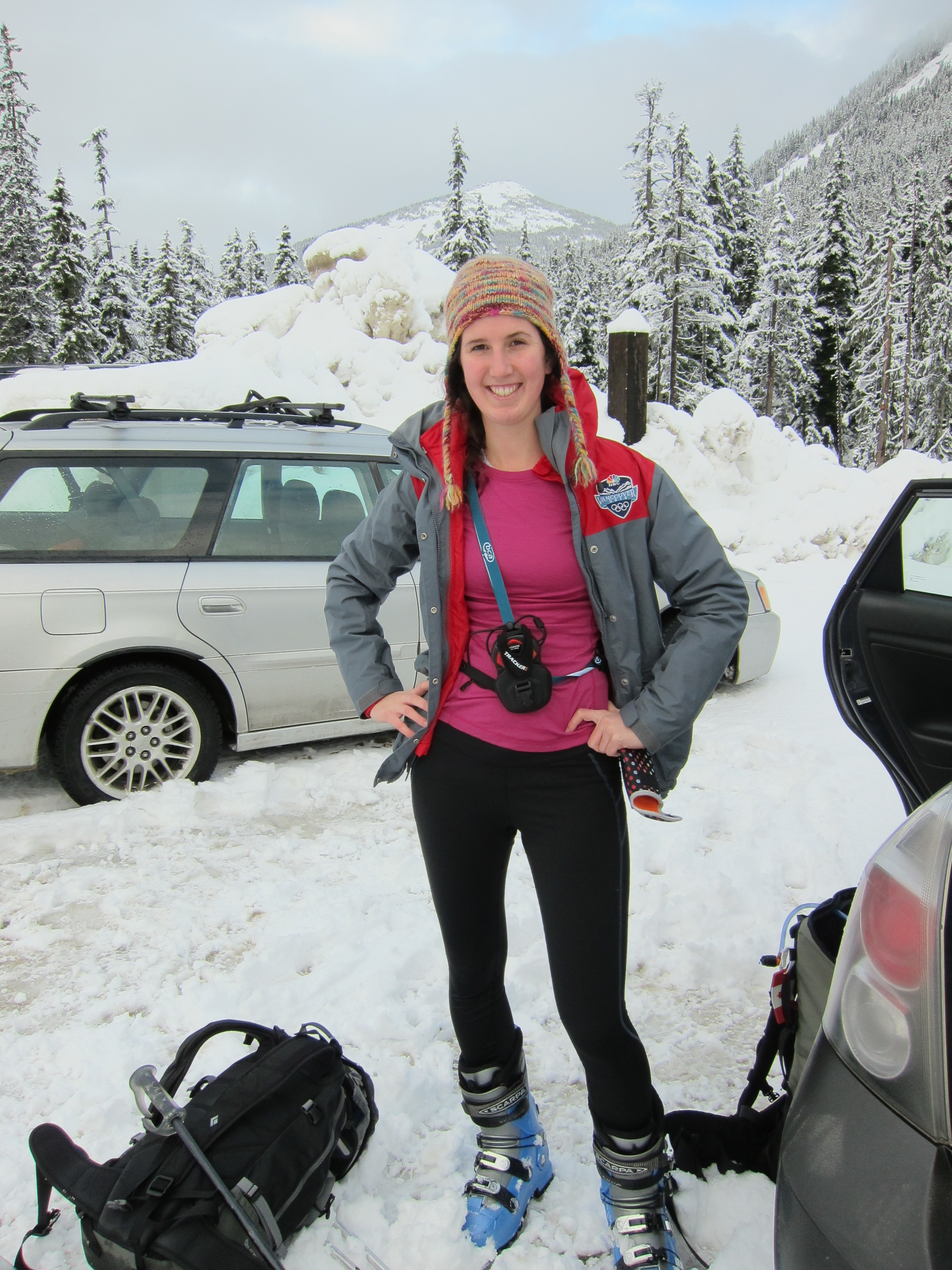
Participants: Dave Robertson, Andrzej Jarzabek, Jamal Ahmelid, Giovanni Ghigliotti, Caroline Le Bouteiller, Ed Zenger, Geoff Zenger (organizer)

Difficulty: 2

Report: Despite the best efforts of the staff at Whistler Olympic Park (WOP) to frustrate our day, my second BCMC trip of the weekend ended up a great success.  Originally we intended to meet at 8am sharp at the base of the ski jumps, but the WOP officials decided that this was not to be the case.  Despite the gate being fully manned when we arrived at 7:45am, the woman inside informed us that we could not pass until 8:30 sharp, when the park officially opened.  We (along with some other backcountry users not aware of this policy) patiently waited until 8:30, at which point we were directed to go to the main lodge to speak with a patroller, who would inform us on how we could access the backcountry.  On speaking to her, we found out that we would have to pay $10 per person to park in their lot, and furthermore, that they had decided to close all access to the backcountry from the area around the ski jumps (from which the ascent route begins in Baldwin’s description), and that the only permitted access is now from the biathlon area, a km or so to the west.  Nobody we talked to seemed to understand the lay of the backcountry around the park, and I think that it is fair to say that WOP is going out of their way to discourage backcountry users from crossing their territory.

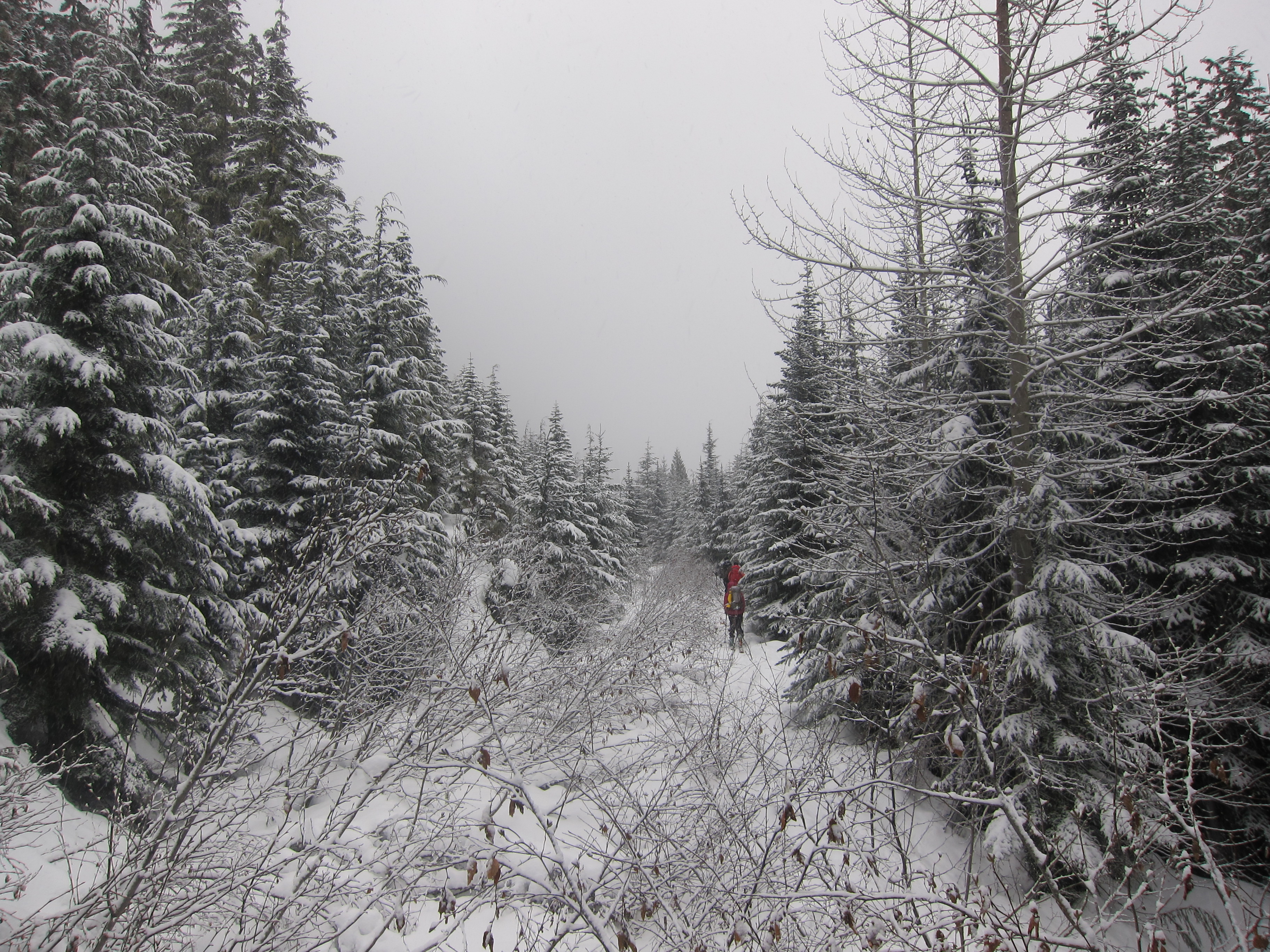
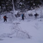
We finally got started from the biathlon facility a bit past 9am, with the intention of heading up to Hanging Lake, and from there, to Gin Peak.  On the far side of the biathlon track, there were two routes apparent to us: one, to the left, went by a box that read something like “backcountry access registration”, and the other, to the right, had no apparent sign other than one saying “ski area boundary”.  If you ever find yourself in this place, do yourself a favour and take the route to the right (the actual Hanging Lake trail), not the one on the left, as we followed the tracks on the route to the left into the middle of nowhere, and then found ourselves contouring around the hill on icy slopes for nearly an hour until we managed to hit the proper Hanging Lake trail.

The Hanging Lake trail was well trodden, easy to follow, and we made quick time up to Hanging Lake.  Of interest, we weren’t far up the trail from where we hit it, and around 1100m, encountered 3 guys hiking up the trail in snow boots, searching for their snowmobiles that they had abandoned above the knoll in the fog the previous night.  It sounded as if they had intended to descend on snowmobile from Hanging Lake to WOP, although it’s hard to see how they thought this would be a good idea, especially given how little snow there is low down.

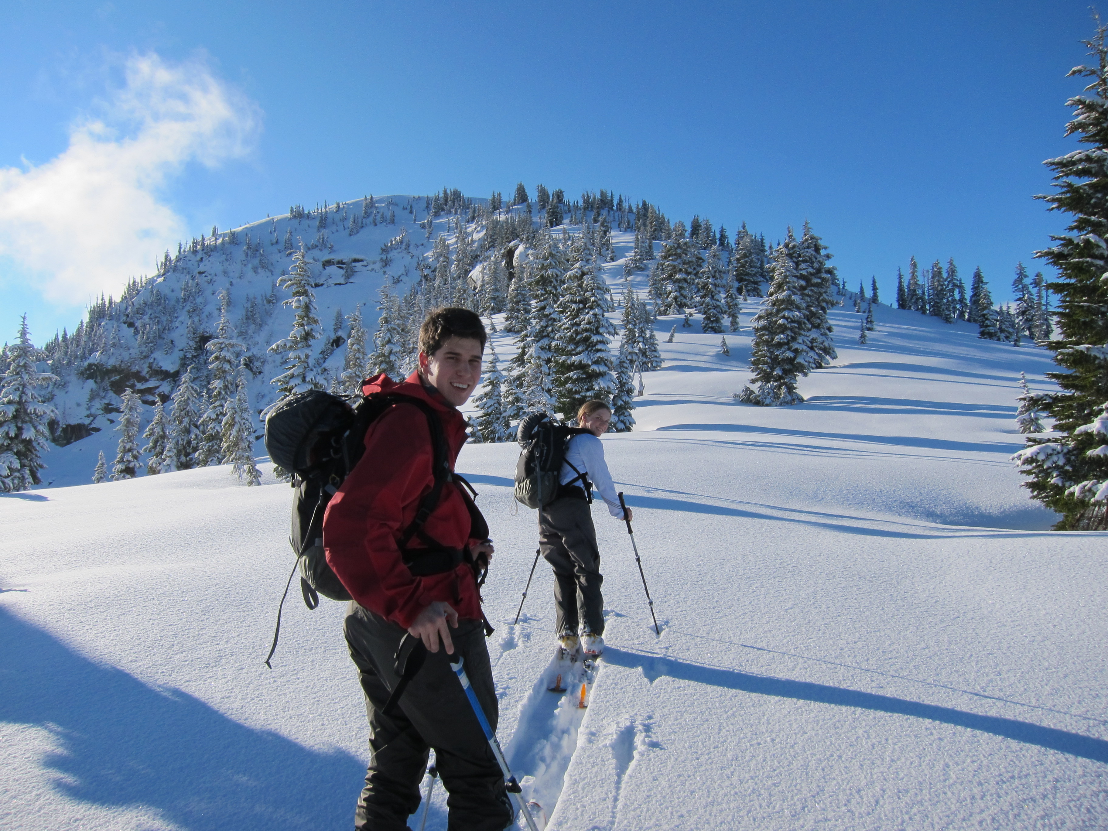
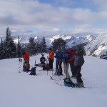
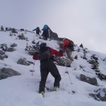
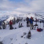
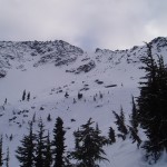
We had lunch at Hanging Lake shortly after noon, and from there it was a quick jaunt up over the ridge to the south east, where we encountered the snowmobile highway.  Leading up from Rainbow Lake to the west side of Gin Peak was, in effect, a groomed path created by dozens of runs up and down by snowmobiles.  There were at least 12 snowmobiles idling down on Rainbow Lake, and they occasionally darted up and down the slopes of Gin Peak as we ascended them.  We all hit the summit of Gin Peak (my first summit of 2012!) at about 1:45 pm, and took some time to enjoy the views before heading down.

The powder on the first few hundred metres of the descent was fantastic, even for a while below Hanging Lake, and even once the powder ran out, the descent was quick and uneventful.  We were back at the cars by 3:30, and an excellent day was had by all.

Verdict: 2/3.  Not the most exciting peak, but has a very easy ascent, fun descent, good views, and safe in most avi conditions.

Continue ReadingGin Peak

Mt. Taylor

Trip Date: January 14, 2012

Participants: Seth Baker, Andrew Brown, Paul Cannin, Cameron Coatta, Pete Finch, James Haworth, Ilze Rupners, Monica Studner, Chloe Tergeman, Brittany Zenger, Ed Zenger, Geoff Zenger (organizer)

Difficulty: 3

Report: Dark and gloomy weather brought everyone together to Pemberton’s Mt. Currie Coffee Company (a fantastic spot to meet up) at 8am for the first of my two BCMC trips on the weekend of Jan 14/15, and despite some delays (a couple party members were circling the town of Mt. Currie, looking for a coffee shop), we managed to set out on the trip from our cars at around 9:20 am.  The initial logging road stretch of the trip was ridden with alder and made for slow going, and when we reached the end of the road and started heading up through the trees, found that the surface was a nearly impenetrable ice that most of the party members without ski crampons had difficulty ascending.

Needless to say, the ascent up to treeline went much slower than expected, and after a short lunch break, we finally found ourselves in the alpine at about 1:30pm.  By this point, a few party members were quite concerned about the difficulty of the ascent through the trees, and the majority of the group decided to turn around (a few of the strongest members pushed towards the summit, but didn’t make it all the way).

For the descent, we followed the route recommended by Baldwin, and we actually had phenomenal powder for the first few hundred metres, although there were a few short traverse sections that gave some trouble to our splitboarders.  This route barely had enough snow to be feasible as it descends through a boulder field and without sufficient snow, it would be impassable.  Following the left side of the creek down towards the valley, we managed to find the correct place to cross the creek in order to descend the final icy trees and hit the road that would take us back to our cars, but this was greatly assisted by having a GPS device with an accurate altitude reading.  Without an accurate altitude reading, it would likely be difficult to find the right route back to the logging road.

The alder was just as bad on the descent as it was on the ascent, but we made it out to the duffey lake road, and hiked back down to our cars safely, with the last party members making it down at about 4:45 pm.  In all, it was a decent day, if only for the great powder line heading down from our turnaround point, but I will be back someday to make the full ascent to the summit.

Continue ReadingMt. Taylor

Silverdaisy Attempt

Trip Date: January 7, 2012

Participants: Brittany Zenger, Ed Zenger, Geoff Zenger

Difficulty: 2

Report: Seeking a reasonable destination for a day with a poor weather forecast and with high avalanche danger in the alpine, we settled on a trip to Silverdaisy Mountain, via the Cayuse FSR.  Setting out from the car at around 9:30, our first observation was that the snow level was extremely low, even for Manning Park, with only around 40cm of snow on the ground at the parking pull out.  There was a small amount of fresh snow on the ground in that area, and the going was quick for the first few km up the road, but the amount of fresh snow increased steadily as we ascended, and by the time we reached the old mine location, amounted to around 8-10 inches.  Yet at the same time, there wasn’t enough snow in the trees to ascend the ridge above the mine as Baldwin recommends, and had no option but to follow the roads towards the Silverdaisy-Claimstake col.

Needless to say, with nearly a foot of powder, breaking trail was extremely tiring and very slow, and although the road system was easy enough to follow, reaching the col requires over 10km of skiing on the road.  We reached a cluster of plywood shelters (for tree planters, I presume) approximately 150m distant (and 30 feet vertical) from the col around 2:30, which was our turnaround time.  Skiing back down the road was fun with all of the fresh powder, and took only 1 hour.  Interestingly, on the way down we noticed from tracks that a marten had walked down our skin track for several km.  In the future, I’d recommend that people only do this trip if either there is enough snow in the trees to skin directly up to the ridge from the old mine site, or if the snow is well settled so that the road up to the Silverdaisy-Claimstake col can be ascended quickly.

Continue ReadingSilverdaisy Attempt

Great Bear Peak (Iago)

Trip Date: December 15, 2011

Participants: Brittany Zenger, Geoff Zenger, Nancy Zenger

Difficulty: 2

Elevation Gain: ~600m

Report: Back in Vancouver for a few weeks, and having taken an AST-1 course last winter, my sister Nancy was eager to try out a real ski tour for the first time, and so our objective for the day was to find a reasonably short day objective without any significant difficulties and that Brittany and I hadn’t already visited (thus ruling out the usual suspects for this situation, such as Zoa, Zupjok, Kelly, and Paul Ridge).  It took us the entire ride to Hope to all agree on a destination, but in the end decided on the minor peak referred to in Baldwin’s book as “Great Bear Peak” (note: Baldwin refers to the northern summit as “Iago” and the southern as “Great Bear”)

We arrived at the Zopkios Ridge rest area on the Coquihalla highway at around 9:30, where we bumped into the Baldwin clan, who were just starting out towards Zupjok peak, and geared up for our trip.  The first part of the route to Great Bear Peak is the same as that for Zupjok Peak, up into the basin between Zupjok and Ottomite peaks.  From the basin, the second portion of the route involves making a slightly ascending contour around Zupjok peak, eventually reaching the col between Zupjok and Iago peaks.  Here we stopped for a snack break, and after a short while, proceeded up the lightly treed ridge to Iago peak.  There are a couple of short steep sections on the ridge, but there isn’t any serious exposure, and so everyone managed to make it right to the summit without ever having to remove their skis.

We reached the “Iago” summit around 1:30, and from the summit of Iago, it looks like the “Great Bear” summit is either the same height or perhaps a couple of metres lower.  Regardless, as we were planning on returning via the ridge that we came from, it made no sense for us to drop down the 30m into the col between Great Bear and Iago, ascend the other summit, and then make our way back to the Iago summit.  The views would be the same from either summit.

Leaving the summit a bit past two, it was a quick ski down the ridge back down to the Zupjok-Iago col through surprisingly nice powder, and from there it was a simple matter of following our tracks back to the Ottomite-Zupjok basin and gliding down the road from there.  In all, a reasonable first ski tour for a beginner, but for anyone else, the peak is only suitable for completionists.  The views from Zupjok are better, the run down from Zupjok is better, and ascending/descending Zupjok does not necessitate contouring around Zupjok.  I’m glad I went out this way once to see what was there, but in the future, I’ll be sticking to Zupjok for a short winter ski day in the area.

Verdict: 1/3.  Nice enough, but there are a few superior ski tours starting from the same parking lot.


Continue ReadingGreat Bear Peak (Iago)

Mt. Chief Pascall

Trip Date: December 11, 2011

Participants: Alexis Guigue, Steve Bell-Irving, David Haslam, Rob Kay, Travis McClinchey, Andrzej Jarzabek, Ed Zenger, Geoff Zenger (organizer)

Difficulty: 3.  Easy rock scrambling, slopes to 30-35 degrees, dense forest low down

Elevation Gain: 920m

Report: My first ski trip on the BCMC schedule to actually run this season!  The trip began by meeting up at the Mt. Currie Coffee Company in Pemberton just before 8am, making all of the necessary introductions, and setting off to the weather station pullout right at Cayoosh Pass.  We set off from the cars at about 9:30, with 7 of us on skis, and 1 on snowshoes.

The first 10 minutes or so of the trip were easy going, and then we hit the logging road.  When I went up towards Mt. Chief Pascall in February 2011, the logging road was completely covered, and we took it to the clearcut a couple hundred metres to the east, which was then easily descended.  This time, however, with no appreciable snowfall in 2 weeks, the logging road was a brutal alder bash, which we had to take all the way to the east side of the clearcut as from below the clearcut did not appear to be skiable.

From the east end of the clearcut, we had little difficulty ascending the forest, slowly traversing around to the east side of the ridge to avoid the bluffs high up, and soon entered the gentle basin at treeline to the north west of the summit.  From here, it was an easy skin up to the west ridge of Chief Pascall.  After a quick snack break (and to give our valiant snowshoer a chance to catch his breath!) we skinned up the narrowing ridge (with some difficulty in places due to the low snow level) up to the top of the large gully descending from the summit (~100m below the summit) and left our skis behind to scramble the remainder of the ridge.

The final ridge was an easy scramble, although the going was slow with many of the rocks covered with only a few inches of snow and ice.  We all reached the summit around 1:30 and took our time to eat, drink, and gaze at the north/east faces of Joffre.

Leaving the summit, we made quick time down to our skis (despite one of my legs post-holing into a gap between two boulders approximately 3m deep!), and began our descent by skiing the top couple hundred metres of the wide snowslope labelled “Equinox” on Baldwin’s Duffey Lake map.  With a bit of foresight, we could have left a vehicle at the Marriot basin trailhead and had a fall line descent most of the way down, but alas, that hadn’t crossed any of our minds and we quickly had to begin our traverse to the west in order to reach our vehicles.  Around treeline we found some fantastic powder, but the traversing was not steep enough for our snowboarder to properly ride and I think he found much of the descent quite tedious.

Back down at the clearcut, we started to bash through the alder on the logging road, but Alexis smartly decided to take a peek through the bushes to see if he could scout a clear line through the clearcut, and as it turned out, he could!  Although not phenomenal by any means, we had a nice run through the clearcut back down to the logging road, and from there it was a quick ski down through the trees to the vehicles, where we arrived around 4:30pm.  The route taken is definitely much more suitable for skiing than snowboarding, and so I learned something for next time.  Nonetheless, everyone made it down before dark, and fun was had by all.

Verdict: 2/3.

Note: I forgot my camera at home for this trip, and so all photos were taken by my dad on his camera

Continue ReadingMt. Chief Pascall

Mt. Seymour

Trip Date: Dec. 4, 2011

Participants: James Clarke, Stetson (James’ dog), Geoff Zenger

Difficulty: 2 (usually)

Report: By the morning of James’ early season BCMC trip to Mt. Seymour, we were down to just James, his dog Stetson, and myself.  Leaving the Mt. Seymour parking lot at 8am on a sunny Sunday, we were able to quickly ascend to the regular winter trail to the 2nd peak of Seymour before the snowshoeing crowds hit the mountain.  From the second peak we could see that there was a lot of exposed rock on the 3rd peak and that it wouldn’t be possible to ski all the way up, and so we ditched our skis in some bushes on the 2nd peak and began the traverse over to the 3rd peak.  Unfortunately for us, I had neglected to bring an ice axe and the traverse over to the col between the 2nd and 3rd peaks was covered with a thin layer of ice that, given that this was my 5th or 6th trip to Mt. Seymour in 2011, rendered the traverse too sketchy to be bothered with.

We reascended the second peak and ate our lunch as the first of the snowshoeing hordes caught up to us.  A brisk wind picked up, and we headed back down the trail, skiing down the southwest face of pump peak, and due to the presence of a dog, had to ski the trail down from Brockton Point.  Stetson at one point got distracted by the adoring crowds and disappeared for a good 10 minutes, but was eventually found mooching food from a group of friendly admirers.  Just below Brockton Point, Stetson was nearly fined by the park rangers for being off leash (a technicality, truly, as he was attached to a leash… just no human holding on to the other end), but managed to charm his way out of a ticket.  We reached the parking lot around 1 o’clock, by which point the trail was populated by the steady stream of hikers normally reserved for the grouse grind.

In the end, it was a failed attempt on Seymour, but we had fantastic weather, good views, and was a good trip for a day when I had to be back in town by early afternoon to visit with some visiting family.

Continue ReadingMt. Seymour

Alpen Mountain

Trip Date: Dec 3, 2011

Participants: Ed Zenger, Geoff Zenger

Difficulty: 2.  Difficulty rating is 2 provided that you swing around to the south ridge near the summit.  If you head straight up on the west ridge, then there are a few short, mildly exposed steps of 45-50 degree snow.

Elevation Gain: ~1200m

Report: For an early season day where I had to be back in town by early evening, my dad and I decided to go for a “short” ski trip somewhere in the vicinity of Squamish.  Wanting to avoid the crowds on Paul Ridge, the idea came to attempt the little known Alpen Mountain.  Inexplicably missing from John Baldwin’s ski touring guidebook and only an hour’s drive from Vancouver, Alpen turns out to be a great warm-up ski ascent with no crowds.

Leaving New Westminster a bit past 8, we drove up towards Squamish, headed onto the Mamquam FSR, and hit solid snow on the Alpen Mountain Spur (ungated at this time of year) at around 550m.  After taking a bit of time to get the car turned around, and get our ski gear on, we were able to set out on skis right at 10 o’clock.  Following some old snowmobile tracks, we gained the first ~800m of elevation on the main logging road (easy to follow, it’s the only non overgrown road in the area) under grey and foggy skies.  However, around 1400m, not far below the old snowmobile hut at the end of the road, the skies suddenly cleared and we were presented with amazing views of Sky Pilot, Ledge, and Habrich to the west.

From the snowmobile hut, we followed what appeared to be ski tracks off to the north east, but soon realized that we were heading in the wrong direction to the peak, and had to contour back to the south, losing some elevation.  Next time, the smarter route decision would be to turn right at the hut and head south, in order to directly hit the main basin below the summit of Alpen, where the west ridge can be easily obtained about 100m below the summit.  Still early season, there was a mix of rock, ice, and snow on the ridge of Alpen, and so we left our skis behind about 100m below the summit and climbed straight up the west ridge, just above the north face.  This route requires negotiating a few short, mildly exposed, steps of 45+ degree snow, and from the summit we learned that the smarter route would be to swing further around to the south of the summit before heading straight up.

We summitted Alpen just before 2pm, and after stopping for 15 minutes for food and photos, made our way down.  The first few hundred metres of skiing were good powder, but once on the logging road, what had been soft snowmobile tracks in the morning had frozen into icy ruts that made the run down the logging road both tiring and bothersome.  Nonetheless, we made it back to the car just before 4pm, for a total round trip of 6 hours, with a bit over 1200m net elevation gain.

Verdict: 2/3.  Worthwhile for its convenience and varied terrain.  No crowds!

Continue ReadingAlpen Mountain