Opal Lake Scrambles
Date: Aug 23/24, 2014
Participants: David Carne, Michelle Lappan, Brittany Zenger, Geoff Zenger
Difficulty: 3
Report: Opal Lake has long had my attention as a weekend destination due to the fact that the peaks on either side of it are both listed as 3 star scrambles in Matt Gunn’s guide. With only a few weeks left in summer proper, we decided to have a go at it. Setting out at a relaxed pace from the Whistler cabin Saturday morning, we had a breakfast at Mt. Currie coffee in Pemberton and headed up the Hurley and over Railroad Pass to the Hope Creek FSR. The road is in great shape until about 11.2 km, where we had to park due to severe deactivation. No worries, even if we had gone through the first big ditch, there are many more and we were glad to have parked where we did. Regardless, the end of the road is only about a 50 minute walk from this point.
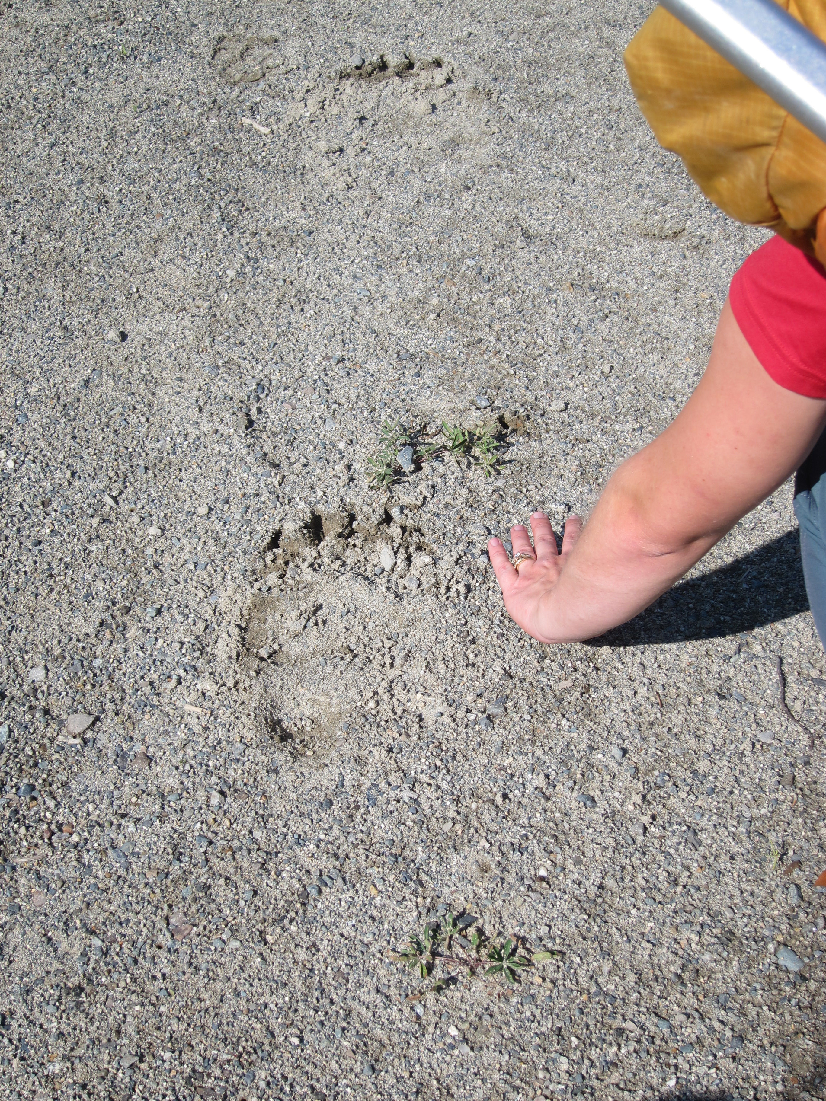
Immediately after starting up the road we encountered what we very obviously grizzly prints. Huge! We’d see many more prints over the weekend but luckily, no bear. The road went by quick, and we were pleased to find a flagged footbed through the forest at the end of the road all the way to the crossing of the creek coming down from Tenquille Glacier. The creek crossing was easy at mid day (more on this later), and although we couldn’t find any path on the other side of the creek, the going was easy through fairly mature forest and a bit of bush, and we quickly wound up at Opal Lake. Total time from end of road: 90 minutes. The lake was much nicer than I expected! This was probably because I had read a trip report that called it a “scum pond” (it’s not), but also because it’s situated in a beautiful alpine pass. At first we were worried about water, but it turns out that about 50m east of the lake there’s a great little stream with clean running water. Once at the pass, we set up our tents and prepared to set off for Chipmunk Mountain.
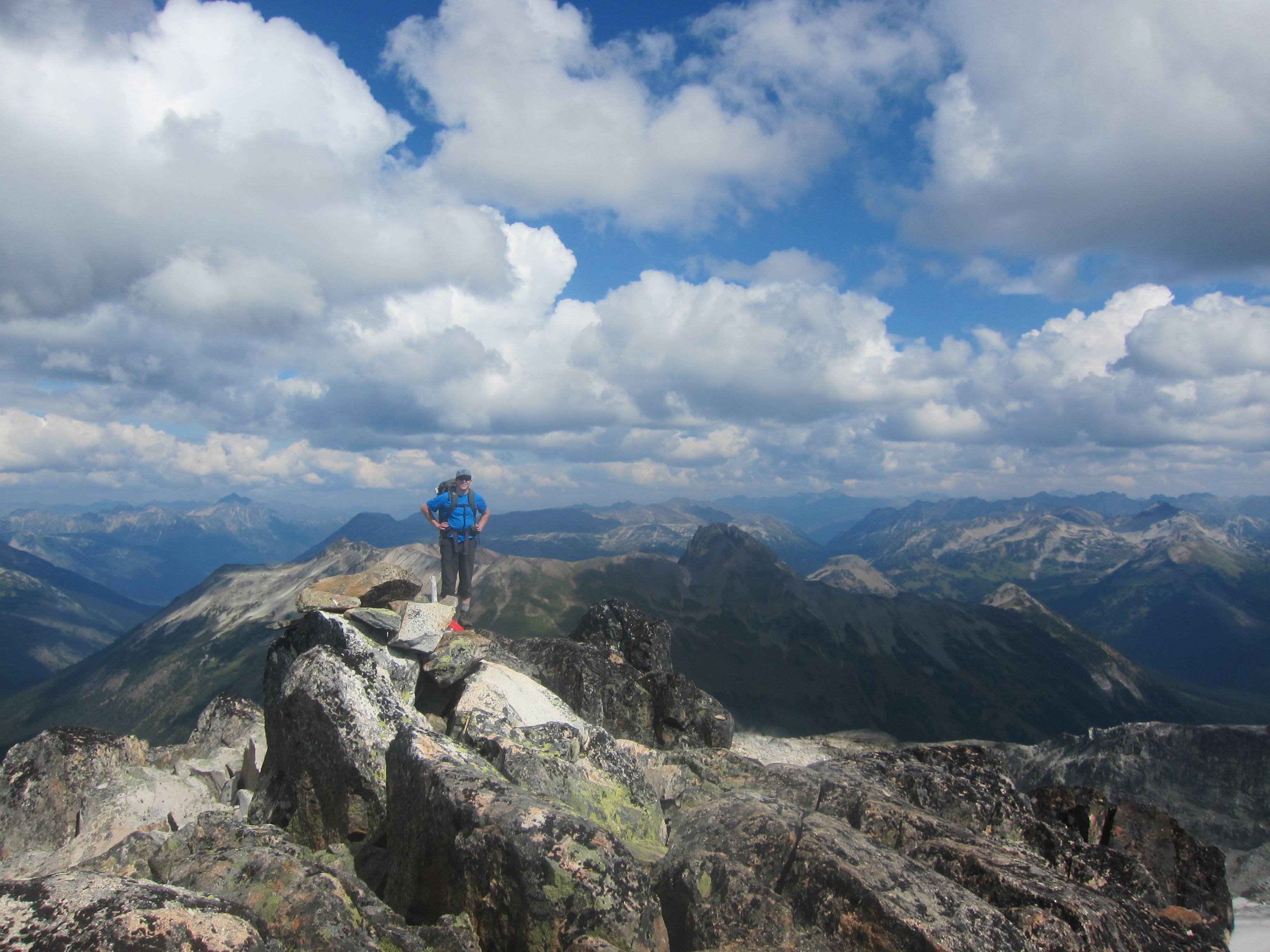
We followed Gunn’s suggested route up the “steep heather” to a gentle plateau leading to Chipmunk, and indeed the heather slope is really steep. That said, as we found on the descent, all other slopes are steep too and it probably is the best route. We moved steadily at a moderate pace and in seemingly no time made it up to the summit of Chipmunk. There was some fun scrambling found near the summit that we elected to take to avoid the loose rock in the gully bottom, but either way the summit is easy to attain. The ascent took only 1.5 hours from camp, and after a nice break on the summit to eat a snack and gaze over at the Tenquille area to the south, Locomotive & Sampson areas to the west, and Beaujolais and Sockeye Horn (known as Mystery Peak in Gunn’s book) to the east, we made our way back down to camp to enjoy a good meal before darkness fell.
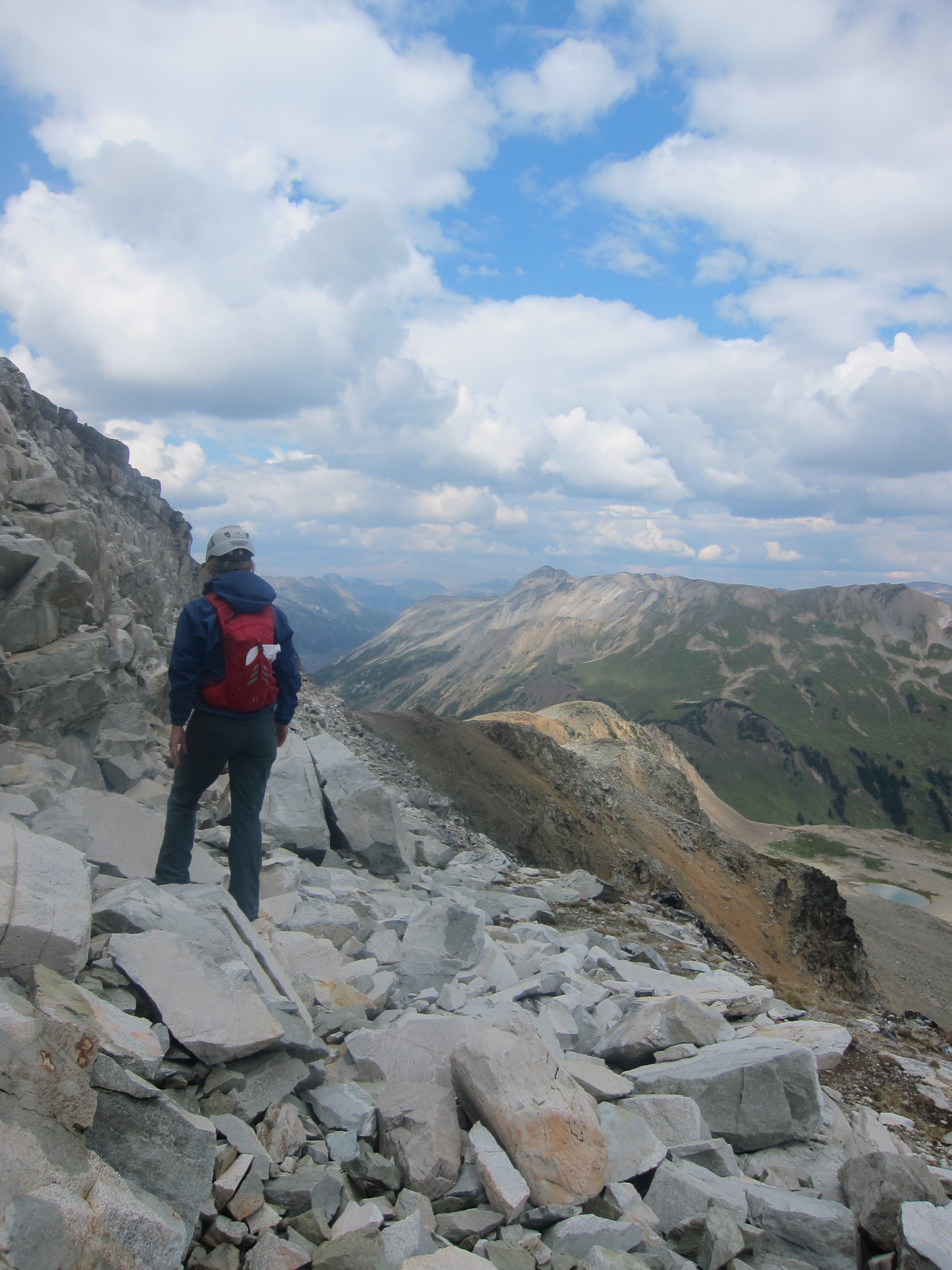
It clouded over in the evening and according to David it rained overnight, but luckily by the time we arose in the morning, the skies were beginning to clear and after a slow morning at camp, we headed up the North Ridge of Tenquille Mountain. At this time of year, the talus field below the ridge is really loose and not fun to ascend, but once on the ridge proper, the route is really, really nice. Although at times it looks like the route is going to get really hard, Gunn’s description is easy to follow and all difficulties are easily avoided. We were a bit slower ascending Tenquille than Chipmunk, but it still took only a little over 2 hours from the lake to make the summit. Once on top, we had a bit of disagreement over whether to continue on to Goat Mountain or not, but with a bit of arm twisting, David was convinced to join me, and the two of us headed for a quick jaunt to Goat while Brittany and Michelle lounged about and waited in the warm sun on the summit of Tenquille.
Although it looks tricky from the summit of Tenquille, it turned out to be easy to make it over to Goat Mountain, essentially just sticking to the good rock at the left hand side of the obvious cliff bands (and just right of the main gully heading up the face). Near the top there’s a bit of fun scrambling on good rock, and 50 minutes after leaving the top of Tenquille we stood on the summit of Goat and filled out the summit register (apparently Goat is the only mountain in the region with a register). From the summit of Goat there are great views of Tenquille Lake itself (not visible from the top of Tenquille Mountain), but we didn’t want to keep our better halves waiting long, and after only a few minutes on top made our way back to Tenquille Mountain. Although it occasionally threatened to rain at times during the day, it never did and most of the time we had good weather.
The descent back to camp was quick, and after a brief stop over to pack up, we departed camp just past 4pm. The creek crossing was quite a bit more exciting on the way back due to the increased water flow after the overnight rain and it being later in the day, but we managed to find a reasonable crossing point not far upstream from where we had crossed the previous day. From there on it was straightforward through the forest and down the road, and we reached the jeep at 6 o’clock sharp. In all, it was another great weekend. Thanks to everyone for the great trip, and hopefully there are still a few good weekends left this year!