Date: June 27, 2015
Participants: Alex Le, Geoff Zenger
Difficulty: 3 (solid 3rd, some exposure, never exceeding 3rd)
Report: Saturday was forecast to be the hottest day of the year… what could be a better idea than to do a long day hike with plenty of elevation gain to a beautiful scramble? Apparently we were the only people who thought this way, as the crowds that I expected to see up at Yellow Aster Butte and Tomyhoi Peak never materialized. Tomyhoi was one of the remaining “3 star” Matt Gunn routes that I hadn’t climbed, and aside from severe water loss due to the incredible heat (I went through 5 litres of water and was still dehydrated), we had an amazing day. Tomyhoi is a great scramble in a gorgeous area.
A few delays led us to not leave my place in New West until about 7:20am, and this meant that by the time we hit the border crossing, the line was long (45 minutes), and so we didn’t make it to the Yellow Aster Butte trailhead until nearly 10 o’clock. Note that the Twin Lakes road has degraded somewhat from the “excellent 2wd” condition described in Gunn’s book. It could probably be done in most 2wd vehicles, but a few rough sections could make some people being uncomfortable and I was happy to have brought my Jeep.
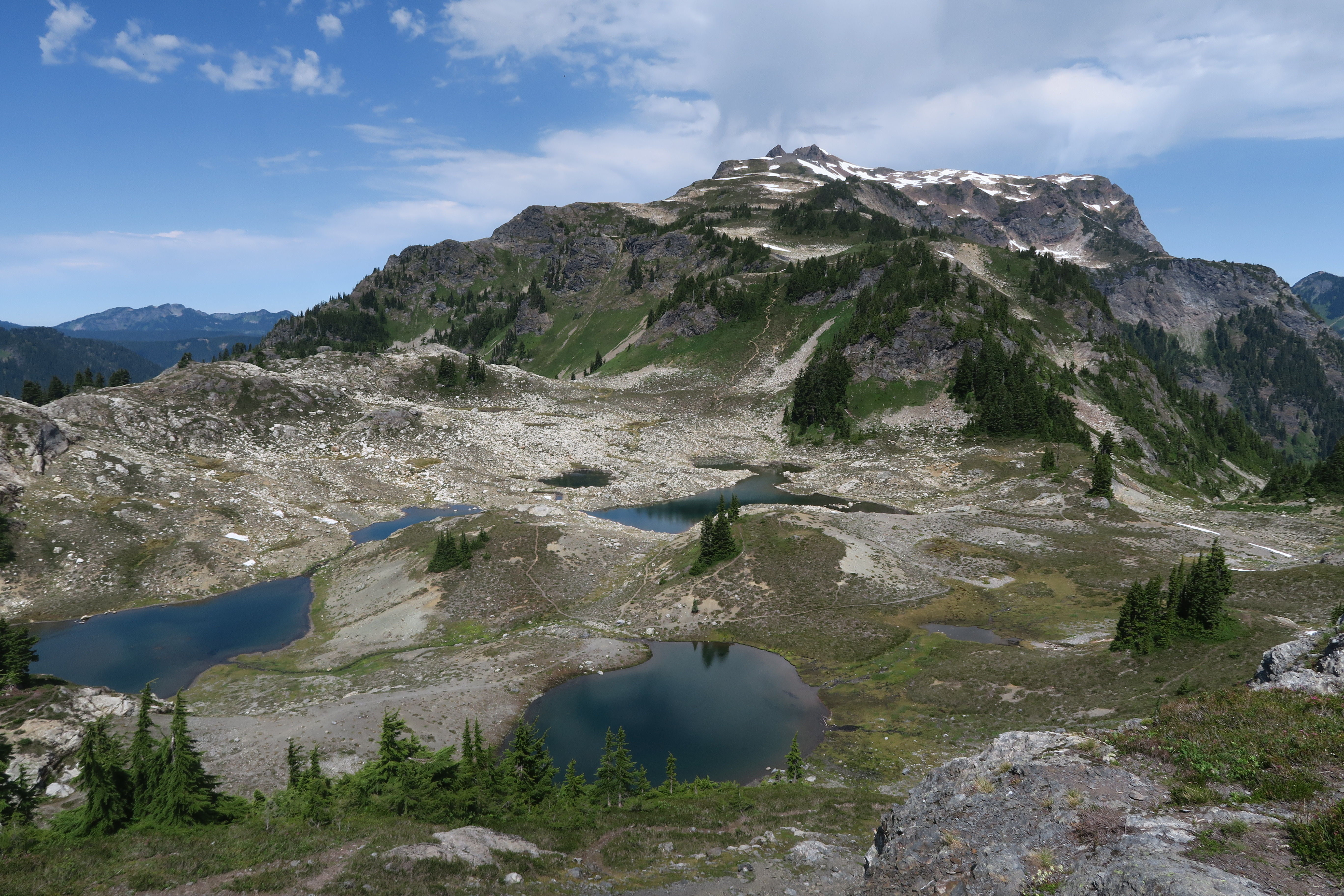
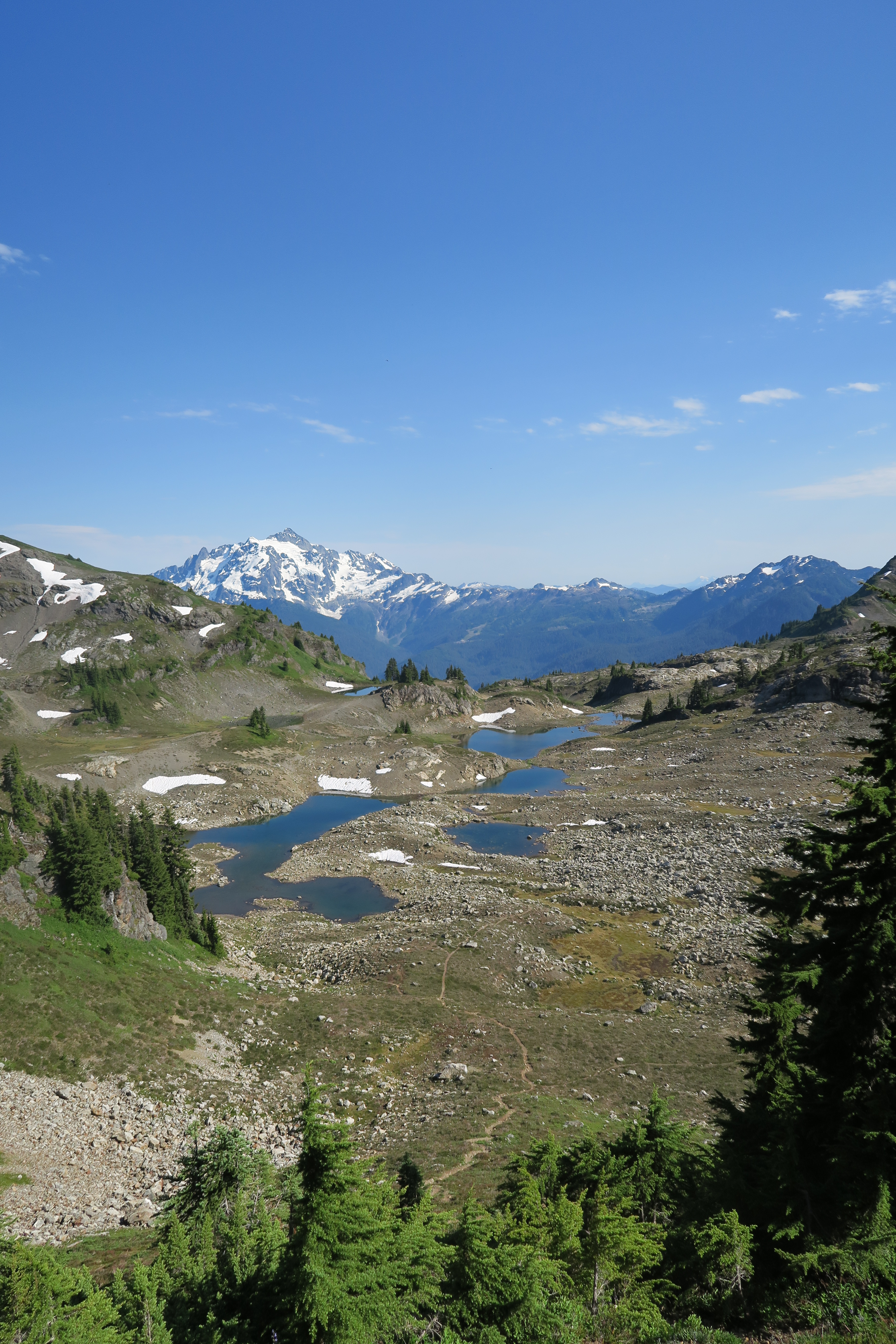
We set out from the trailhead at about 10 and the day was already terribly hot. The switchbacks up the initial slope went quick enough, although we had some confusion before the turn off to yellow aster butte. The guidebook says to “look for a trail that goes off to the left” and at one point we thought we saw a trail heading left, but it turned out to just be a minor spur to a campsite. The actual trail to yellow aster butte is very well marked with a big sign and obvious when you get there, just minutes before the trail reaches the pass at the end of the valley. From the turnoff, it was quick going on the traverse to yellow aster butte, and just as we crested the knoll where you see the route down to the tarns and the ridge leading to Tomyhoi itself, it was apparent how amazing the views on the trip were going to be.
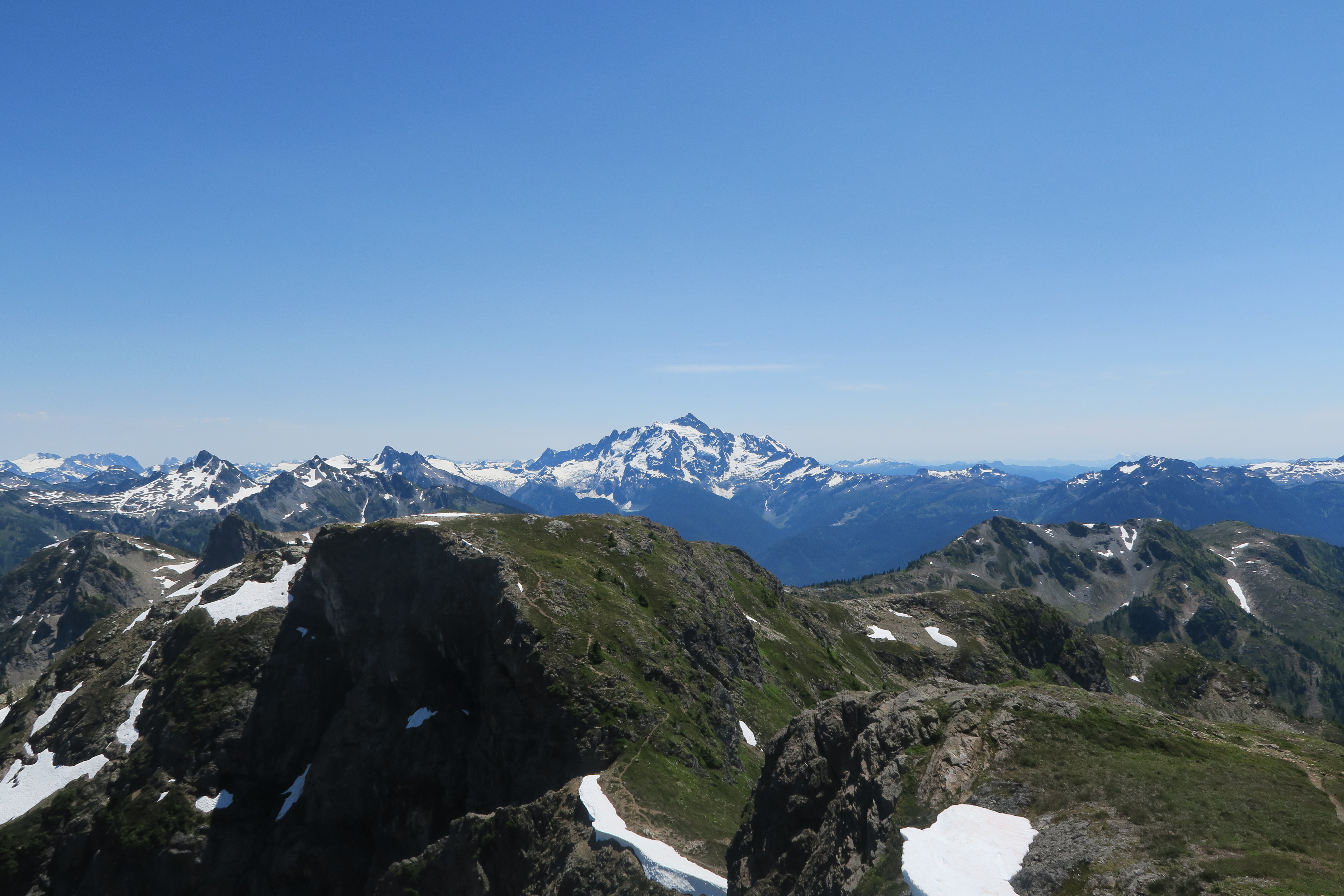
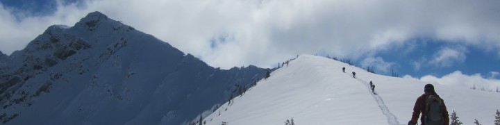
From this knoll there are amazing views of Shuksan and Baker, and the ridge from here down to the tarns and up towards Tomyhoi are extremely pleasant and varied. It took us a bit under 2 hours to the tarns where we had lunch, and from there about 2 hours to wander up the ridge (pushing the pace, really) to the subsummit (with a bit of annoying up and down along the way). The subsummit is quite nice, but from there the true summit looks very intimidating!
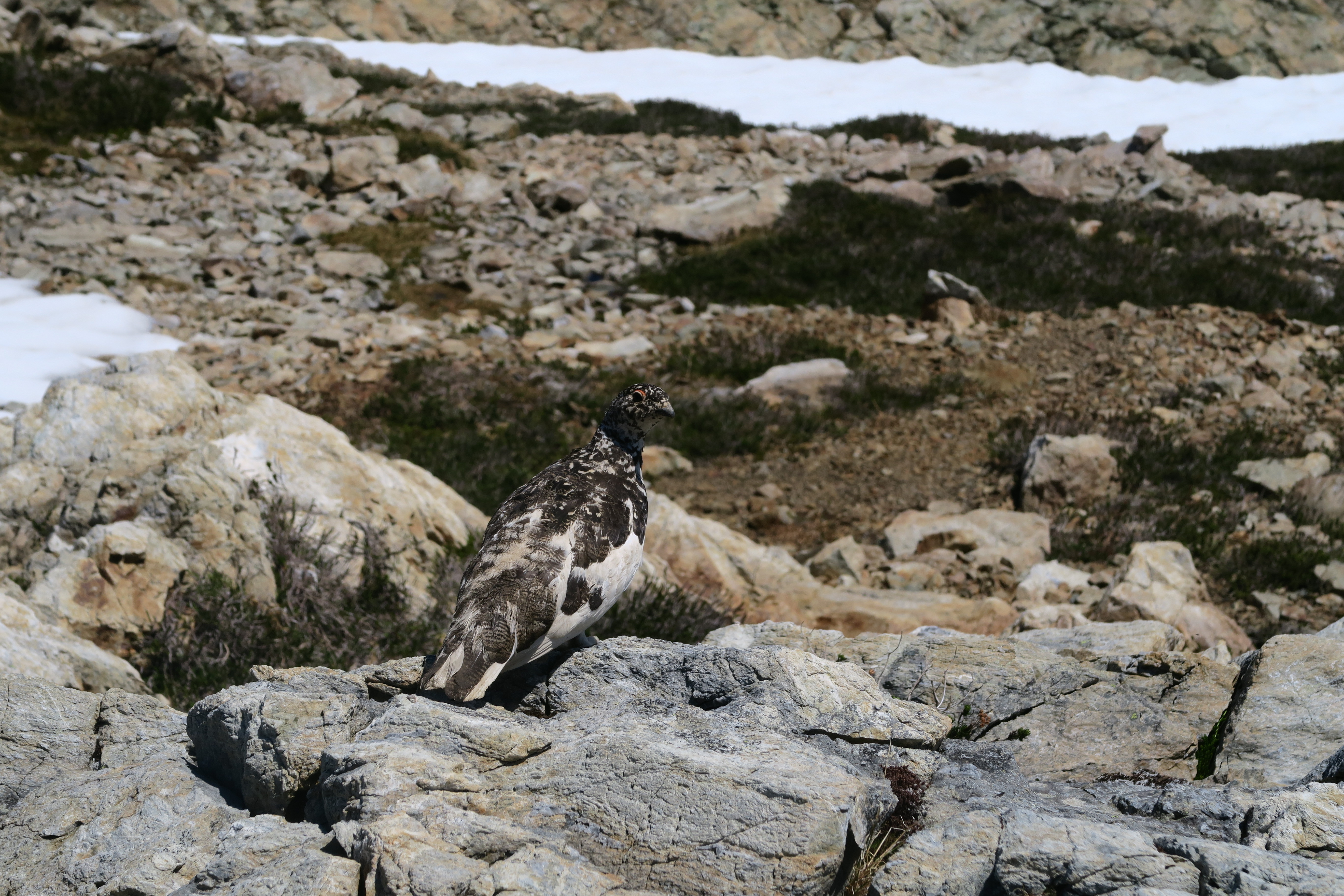
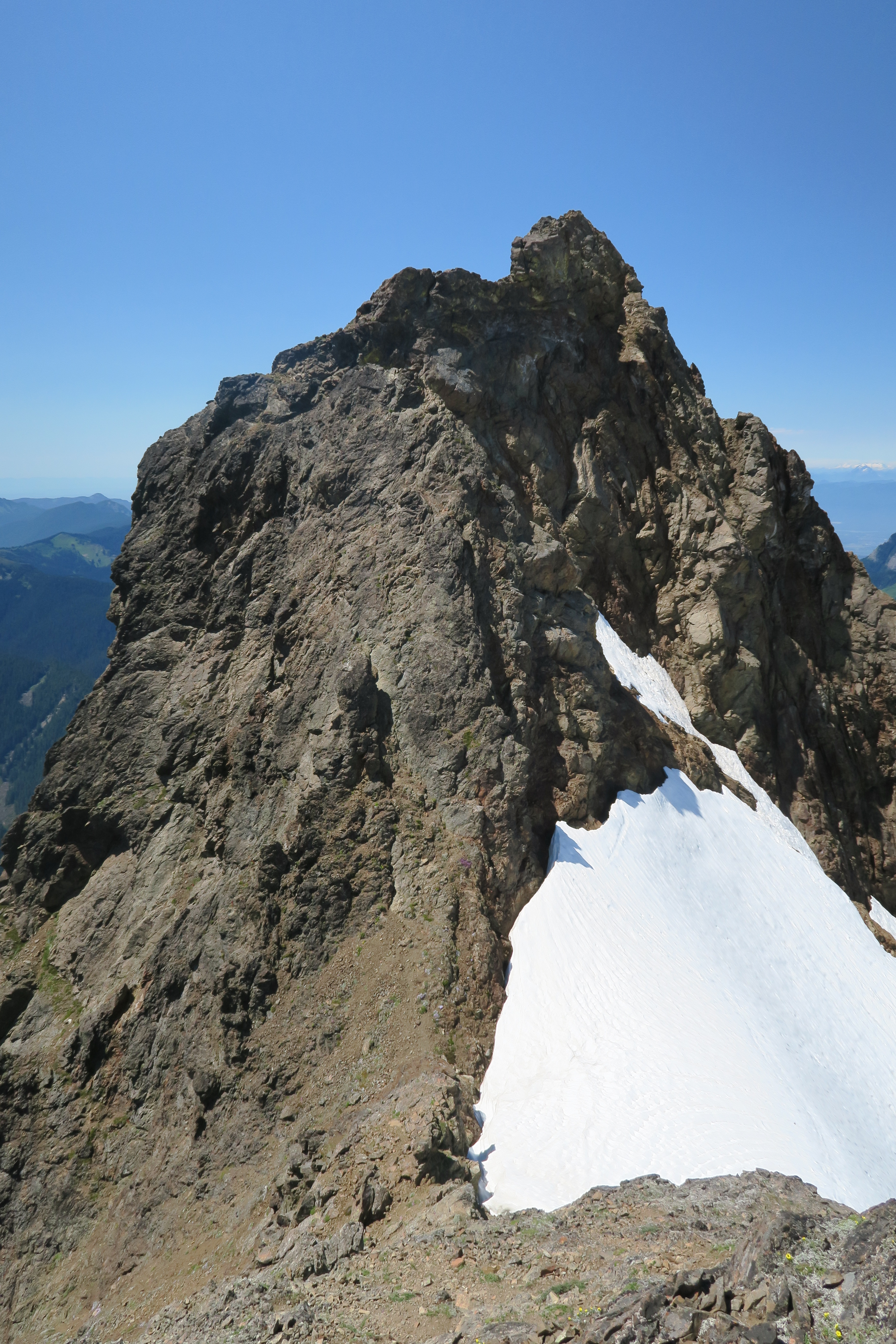
We scrambled down loose ledges to the col between the subsummit and true summit to get a look, and fortunately from the bottom it doesn’t really look so bad. There’s a groove up to the left, then one from there up to the right, and it’s only from the top of that groove to the top of the ridge (perhaps 8m total) that the going gets quite difficult with decent exposure. Luckily, this hard part is on the most solid rock of the day and neither of us had trouble ascending it. For comparison, I’d say that the route is comparable to Sky Pilot, although probably a little easier. Above this crux, the summit was easy to attain and although it’s a tiny summit, the views from the top were great, with plenty to see in both the US and Canada. Total ascent time: 4 hours, 45 minutes. Total water consumed on ascent: 3 litres.
The descent through the scrambling part was challenging for Alex as it was his first true scramble route, but with a bit of guidance and coaching he made it down safely and without too many frayed nerves. From the subsummit down to the tarns went quickly even though the temperature was still scorching, but a quick dip in the tarns cooled us down and from there it was a tedious and tiring descent back to the car for a total round trip time of about 8 hours, 30 minutes.
In all, Tomyhoi is a fantastic trip and well deserving of the 3 stars that Gunn gave it in his guidebook. You spend very little time in the trees, so almost the entire ascent is through the alpine, and the trip has plenty of variety including places requiring routefinding and a really nice scramble to top it off! Sure, I went sweated out at least 6 litres of water over the course of the day, but that just meant that we were lucky enough to be up there on a day where we could have it all to ourselves!