Date: May 28-30, 2015
Participants: Brittany Zenger, Geoff Zenger, John Minier (guide)
Difficulty: 5 (snow and glacier ice to 70 degrees)
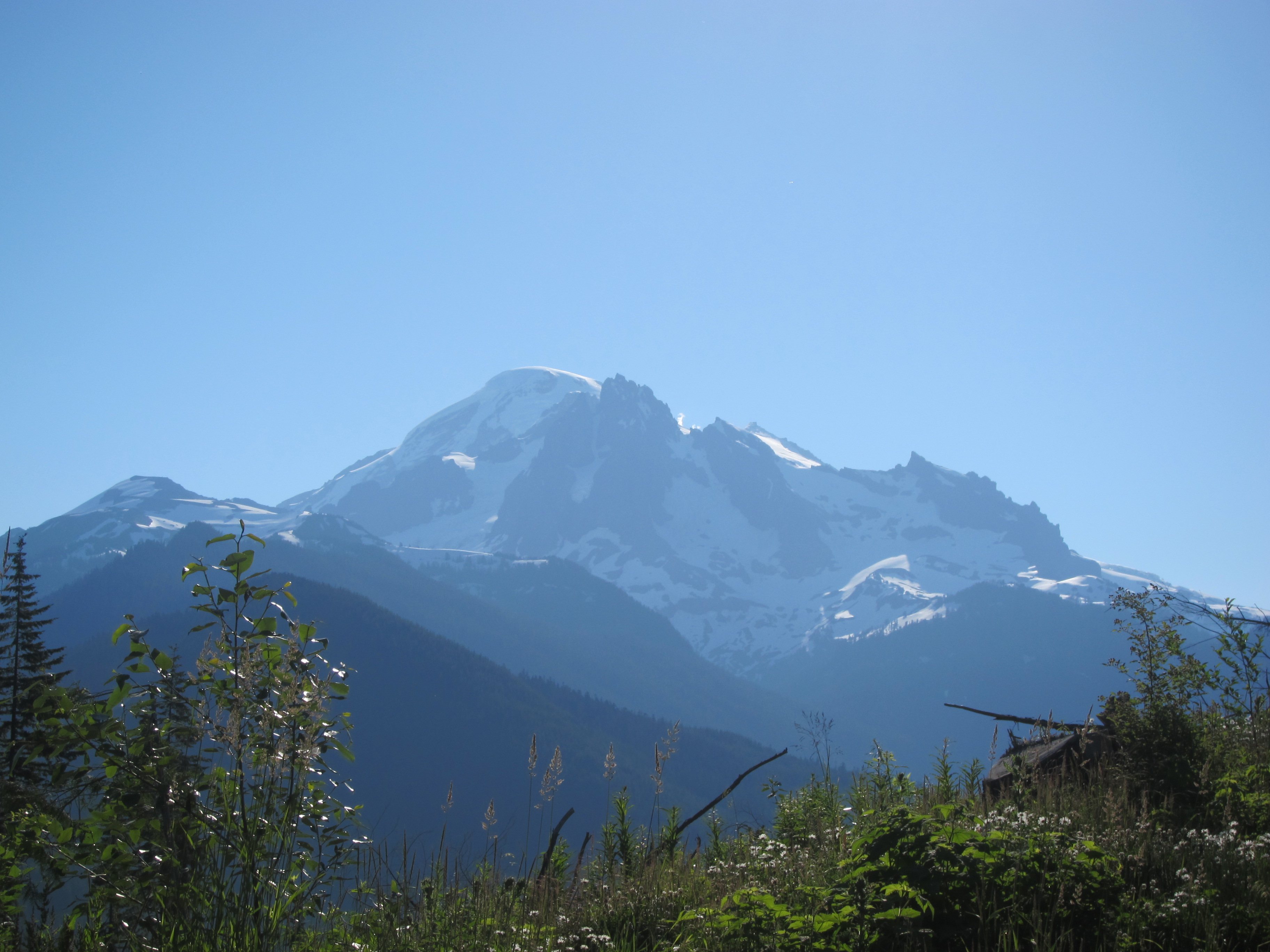
Report: As you drive along the Trans Canada Highway from Vancouver to Hope, when you’re passing through Abbotsford Mt. Baker dominates the horizon, and straight in the centre of your view is Mt. Baker’s North Ridge. This frequent view, combined with both Alpine Select and Beckey’s guide to the North Cascades calling the North Ridge a classic must-do route had led me to gaze at the route for the past few years and want to climb it and return once again to Mt. Baker.
Prior to this trip, we’d only climbed with a guide once before, but given the described difficulty of the North Ridge (extensive climbing on exposed 45+ degree snow slopes and a 30-40m 70 degree ice wall) I sought out a guide to lead us up the route. I ended up booking John Minier through Mt. Baker Mountain Guides for our wedding anniversary and we lucked out as he is a great guide! If you’re looking to climb something in the North Cascades I highly recommend checking him and his guiding service out. They were very helpful in arranging the trip, and he was a great guy to spend 3 days with (even cooked us delicious breakfasts and dinners!).
We began our trip meeting at 7:30 Thursday morning at the Glacier public service centre for a gear check and to divide up our group gear, and once that was done and we’d picked up a hot drink from one of Glacier’s coffee shops we headed up to the Heliotrope Ridge parking lot. The trudge up to Hogsback was the usual one, but the trail is in good shape, and although the upper rock was already full with a large party, we found a couple nice tent platforms not far below it on a dry rib and were able to set up camp off the snow and on dry land. Here we had a relaxed afternoon, did an hour or two of mountaineering practice (ice axe arrest, short roping technique, etc), had a tasty dinner, and headed to bed just past 7 for an early rise the next day.
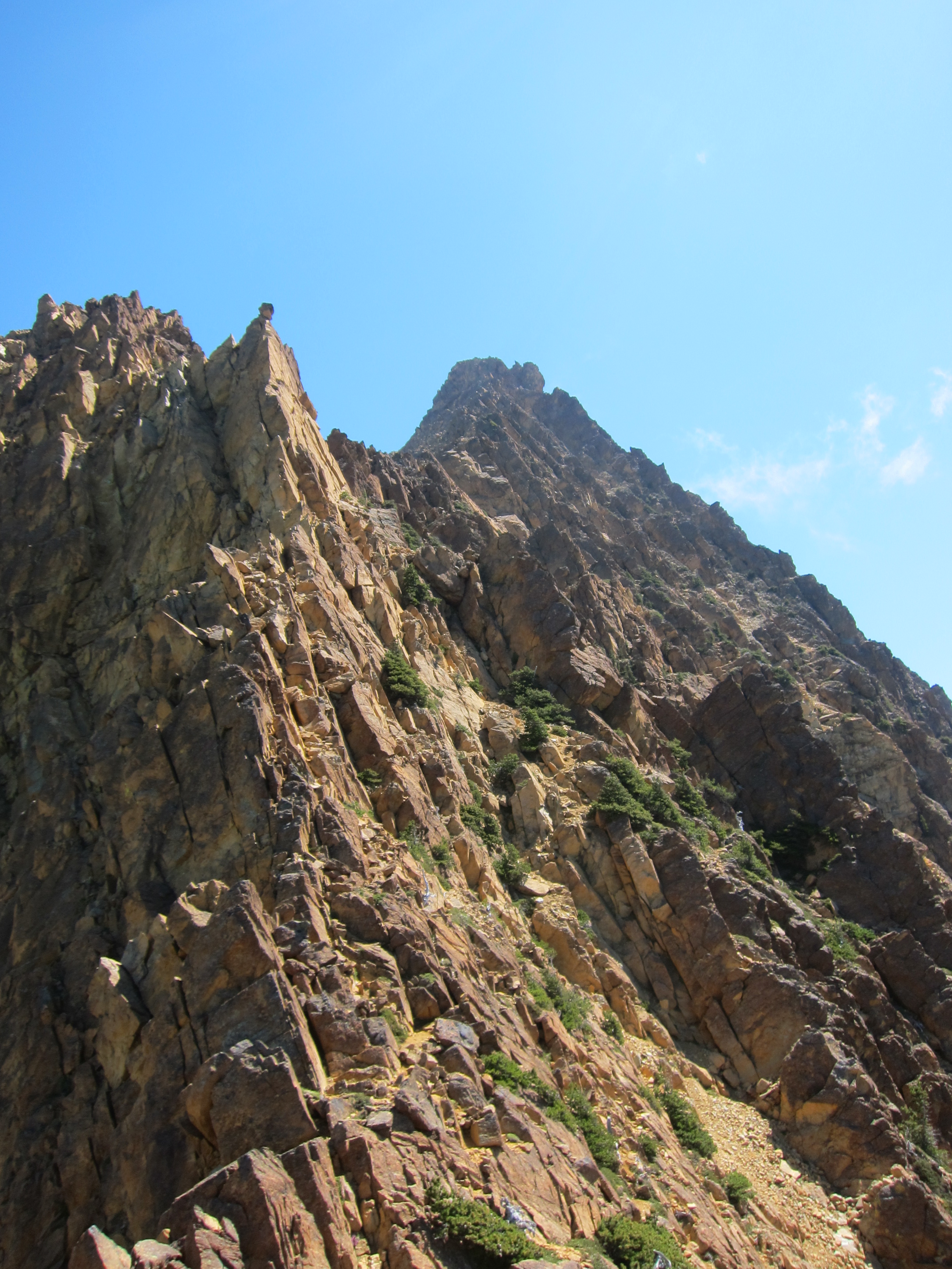
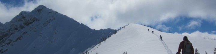
John woke us up at the unholy hour of 2am, and after choking down a few mouthfuls of oatmeal and suiting up, we were set to head out to Mt. Baker’s north ridge by 3:30am. It took us about two and a half hours to climb up to the Coleman glacier and cross it to the start of the north ridge. If you look at the route description for the north ridge in Alpine Select, you’ll notice that it suggests two routes: an easier route by going around the ridge to the Roosevelt Glacier and up to the ridge from there or a steeper route straight up through the “hourglass” from the Coleman Glacier, and we took neither. The Roosevelt Glacier is currently blocked by large crevasses, and the hourglass has a large crevasse blocking all progress. Instead, we crossed a bergschrund and ascended snowslope about 100m to the left of the hourglass and after two short pitches on steep snow, short-roped the traverse over to the top of the hourglass and from there up to the ridge proper. On the ridge itself we took a break before ascending up moderate snow slopes to the base of the infamous ice cliff, which we reached at about a quarter to 9.
Looking up at the ice cliff from just below it, I immediately knew how happy I was to have hired a guide (John) rather than attempt the route myself. Although the ice itself goes at an easy AI3, the exposure below is substantial and the ice itself is far more challenging (i.e. rotten) than anything I’ve previously experienced on weekend ice climbing trips to Lillooet. The total route length from our bottom belay to a safe belay stance atop the ice cliff is probably about 65m, and if you’re willing to stretch the rope could probably be done (just) in a single long pitch, but we did it as 3 short pitches, which took us approximately 2 hours to fully ascend.
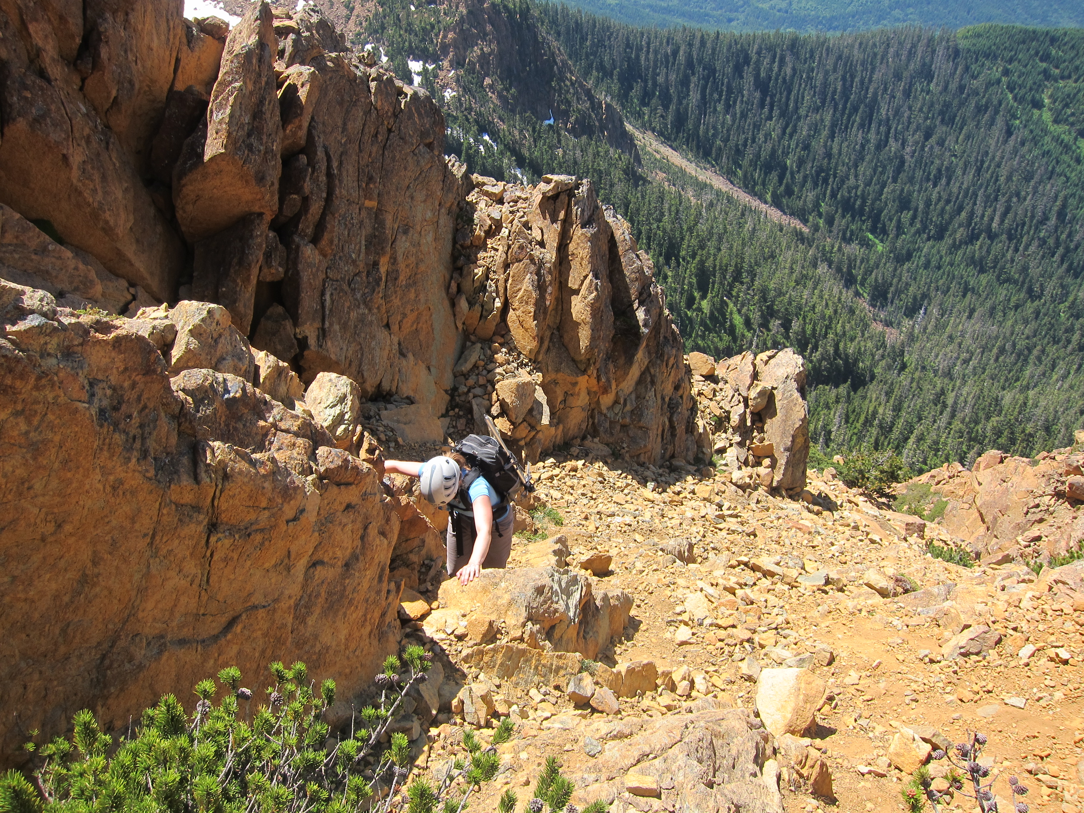
Until this point, we’d had great weather all morning, but shortly after finishing the ice cliff the weather socked in and we ended up with very limited visibility. Luckily there were some tracks to follow and we made our way up the moderate yet very exposed snowslopes to the final serac band, eventually winding our way up to an anchor station below the final seracs. Here the normal route trends left, but it turned out that it was a mess of serac to the left, and we ended up having to ascend the steep exposed snowslopes to the right of the seracs which led to the summit plateau across which we wandered, eventually reaching the main summit of Mt. Baker (Grant Peak) just past 2pm. It was an exhausting but totally exhilarating climb and I was very happy that from this point back to our camp we just had to descend the easy Coleman-Deming route that we’d already done years ago.
On the descent, the Roman Wall was a complete mess of mush. I was postholing on most steps past my knees (although one of the deeper post-holes turned out to be straight into a small crevasse high on the wall) and although it seemed like it was taking forever, we eventually reached the saddle between Mt. Baker and Colfax Peak and were greatly relieved that the snow on the Coleman Glacier was in much, much better shape for the final descent down to our camp. We finally reached our tents a bit past 5pm, totally tired, and happy that we’d decided to stay in camp one more night and not push on to the cars. In camp we settled down to relax, dry our soggy feet, and enjoy another great dinner and eventually headed to bed at a much more reasonable hour than the night before.
Saturday night we had a lazy morning in camp eating a delicious breakfast of pound cake and jam (try it!) and eventually set out for the cars at around 9:30. The hike out was uneventful except for running into a number of groups of friends heading up for a day or weekend of skiing on the glacier, and a bit past 11 we were back at the cars where we sorted out the group gear again, said goodbye to John, and left Mt. Baker once again for a big meal down at the North Fork Beer Shrine!
In all, this was a fantastic trip, one that I’ll always remember. Mt. Baker’s ridge was a much more difficult route than I expected it to be. I always knew that the ice step would be a challenge, but I didn’t realize how full on the rest of the mountaineering would be, and in the end, it stands out as the most difficult snow/ice mountaineering route that I’ve ever done by a good margin. To finish off this trip report, thank you once again to John and Mt. Baker Mountain Guides for their outstanding service. We couldn’t have done this trip without you!